- Queenstown, Maryland
Infobox Settlement
official_name = Queenstown, Maryland
settlement_type =Town
nickname =
motto =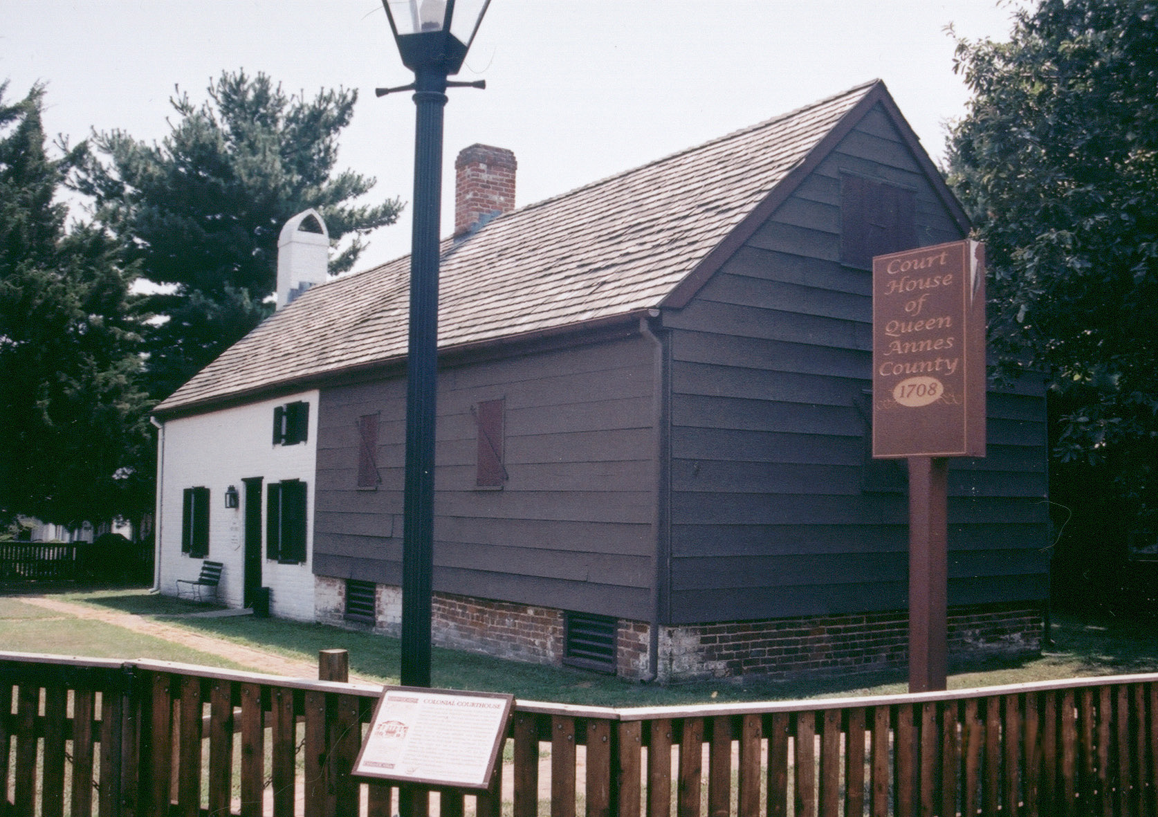
imagesize =
image_caption = Courthouse of Queen Anne's County built in 1708
image_
image_
mapsize =
map_caption =
mapsize1 =
map_caption1 =subdivision_type = Country
subdivision_name =United States
subdivision_type1 = State
subdivision_name1 =Maryland
subdivision_type2 = County
subdivision_name2 = Queen Anne's
government_footnotes =
government_type =
leader_title =
leader_name =
leader_title1 =
leader_name1 =
established_title =
established_date =unit_pref = Imperial
area_footnotes =area_magnitude =
area_total_km2 = 1.1
area_land_km2 = 1.1
area_water_km2 = 0.1
area_total_sq_mi = 0.4
area_land_sq_mi = 0.4
area_water_sq_mi = 0.0population_as_of = 2000
population_footnotes =
population_total = 617
population_density_km2 = 579.9
population_density_sq_mi = 1501.8timezone = Eastern (EST)
utc_offset = -5
timezone_DST = EDT
utc_offset_DST = -4
elevation_footnotes =
elevation_m = 6
elevation_ft = 20
latd = 38 |latm = 59 |lats = 21 |latNS = N
longd = 76 |longm = 9 |longs = 24 |longEW = Wpostal_code_type =
ZIP code
postal_code = 21658
area_code = 410
blank_name = FIPS code
blank_info = 24-64600
blank1_name = GNIS feature ID
blank1_info = 0597939
website =
footnotes =Queenstown is a town in
Queen Anne's County, Maryland ,United States . The population was 617 at the 2000 census.Geography
Queenstown is located at coor dms|38|59|21|N|76|9|24|W|city (38.989086, -76.156645)GR|1.
According to the
United States Census Bureau , the town has a total area of 0.4square mile s (1.1km² ), of which, 0.4 square miles (1.1 km²) of it is land and 0.04 square miles (0.1 km²) of it (4.65%) is water.History
Queenstown was the original seat of Queen Anne’s county, before the location changed to
Centreville, Maryland . It location was important during the 18th century, because it is near a creek that, during that time, could be navigated by tradesmen. A hub for shipping and receiving, Queenstown was attacked by English troops during the War of 1812. [Maryland: A New Guide to the Old Line State (2nd ed.)Earl Arnett, Robert J. Brugger, Edward C. PapenfuseThe Johns Hopkins University Press, Baltimore 1999]Demographics
As of the
census GR|2 of 2000, there were 617 people, 255 households, and 184 families residing in the town. Thepopulation density was 1,501.8 people per square mile (581.0/km²). There were 279 housing units at an average density of 679.1/sq mi (262.7/km²). The racial makeup of the town was 95.30% White, 3.73% African American, 0.16% Native American, 0.16% Asian, and 0.65% from two or more races. Hispanic or Latino of any race were 1.30% of the population.There were 255 households out of which 27.1% had children under the age of 18 living with them, 57.6% were married couples living together, 11.0% had a female householder with no husband present, and 27.8% were non-families. 22.0% of all households were made up of individuals and 6.3% had someone living alone who was 65 years of age or older. The average household size was 2.42 and the average family size was 2.83.
In the town the population was spread out with 20.6% under the age of 18, 8.6% from 18 to 24, 28.7% from 25 to 44, 28.4% from 45 to 64, and 13.8% who were 65 years of age or older. The median age was 41 years. For every 100 females there were 102.3 males. For every 100 females age 18 and over, there were 99.2 males.
The median income for a household in the town was $48,500, and the median income for a family was $49,500. Males had a median income of $37,321 versus $30,893 for females. The
per capita income for the town was $24,185. About 3.9% of families and 3.7% of the population were below thepoverty line , including 2.8% of those under age 18 and 13.4% of those age 65 or over.References
External links
Wikimedia Foundation. 2010.