- Maryland Route 456
-
Maryland Route 456
Del Rhodes Avenue 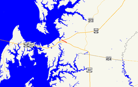
Route information Maintained by MDSHA Length: 1.20 mi[1] (1.93 km)
2 sectionsMajor junctions South end:  US 50 near Queenstown
 US 301 in Queenstown
North end:  MD 18 in Queenstown
Location Counties: Queen Anne's Highway system Maryland highway system
Interstate • US • State • Minor • Former • Turnpikes←  MD 454
MD 458  →
→Maryland Route 456 (MD 456) is a state highway in the U.S. state of Maryland. Known as Del Rhodes Avenue, the state highway runs 1.20 miles (1.93 km) from U.S. Route 50 (US 50) north to MD 18 within Queenstown. MD 456, which serves as a cut-off between US 50 and US 301 just east of the split of the two highways, is officially separated into two sections, MD 456 and MD 456A, by a superstreet intersection with US 301. The state highway was constructed in the early 1930s as a cut-off between Queenstown and MD 404, then the main east–west highway in western Queen Anne's County. MD 456 was extended south in the late 1940s when US 50 was moved to its present course.
Contents
Route description
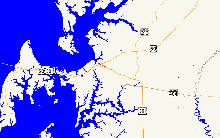
MD 456 begins at an intersection with US 50 (Ocean Gateway) just east of Queenstown. The ramp from westbound US 50 to northbound MD 456 is the original alignment and has the unsigned designated US 50QB.[1] MD 456 heads northwest along a row of residences.[2] The state highway enters the town of Queenstown after crossing the Wye River.[1] MD 656 (Friels Road) splits to the west before MD 456 officially ends at US 301 (Blue Star Memorial Highway), where the two highways meet at a superstreet intersection.[1][2] Traffic on MD 456 is required to turn right onto US 301, make a U-turn, and turn right again to continue on MD 456.[2] The roadway, now officially MD 456A, continues 0.32 miles (0.51 km) to the highway's northern terminus at MD 18 (Main Street), officially MD 18C, in the center of Queenstown.[1][3]
History
The Eastern Shore Boulevard, designated MD 404 by 1933, was completed around Queenstown by 1930.[4][5] MD 456 was constructed from the MD 656 intersection north to the center of Queenstown shortly after 1930.[6][5] When US 50 was moved to its present alignment south of Queenstown in 1949, MD 456 was extended south along the old section of MD 404 and MD 656 was designated on the section of old MD 404 between MD 456 and MD 18.[7] The MD 456–US 301 junction was transformed into a superstreet intersection in 2003, resulting in the designation of MD 456A north of the junction.[8]
Junction list
The entire route is in Queenstown in Queen Anne's County.
Mile
[1]Destinations Notes 0.00 US 50 (Ocean Gateway) – Bay Bridge, Easton, DentonSouthern terminus of MD 456 0.56  MD 656 west (Friels Road)
0.88 US 301 (Blue Star Memorial Highway) – Bay Bridge, WilmingtonSuperstreet intersection; northern terminus of MD 456; southern terminus of MD 456A 1.20 MD 18 (Main Street) – CentrevilleNorthern terminus of MD 456A; officially MD 18C 1.000 mi = 1.609 km; 1.000 km = 0.621 mi References
- ^ a b c d e f "Highway Location Reference: Queen Anne's County" (PDF). Maryland State Highway Administration. 2009. http://www.marylandroads.com/Location/2009_QUEENANNES.pdf. Retrieved 2010-09-30.
- ^ a b c Google, Inc. Google Maps – Maryland Route 456 (Map). Cartography by Google, Inc. http://maps.google.com/maps?f=d&source=s_d&saddr=US-50+W%2FOcean+Gateway&daddr=Del+Rhodes+Ave&hl=en&geocode=FdzJUgIdhjB2-w%3BFZDmUgIddgF2-w&mra=ls&sll=38.976693,-76.152935&sspn=0.030493,0.077162&ie=UTF8&t=h&z=16. Retrieved 2010-06-09.
- ^ Google, Inc. Google Maps – Maryland Route 456A (Map). Cartography by Google, Inc. http://maps.google.com/maps?f=d&source=s_d&saddr=Del+Rhodes+Ave&daddr=Queenstown,+Queen+Anne%27s,+MD&hl=en&geocode=FdznUgIdSv91-w%3BFUzzUgId4ex1-ynHJXVU9Q24iTFuF_DjPLwTaA&mra=ls&sll=38.990178,-76.15537&sspn=0.003811,0.009645&ie=UTF8&ll=38.989127,-76.155328&spn=0.003811,0.009645&t=h&z=17. Retrieved 2010-06-09.
- ^ Maryland Geological Survey. Map of Maryland Showing State Road System: State Aid Roads and Improved County Road Connections (Map) (1930 ed.).
- ^ a b Maryland Geological Survey. Map of Maryland Showing State Road System: State Aid Roads and Improved County Road Connections (Map) (1933 ed.).
- ^ Report of the State Roads Commission of Maryland. 1927-1930. Baltimore: Maryland State Roads Commission. 1930-10-01. p. 225. http://www.archive.org/details/reportofstateroa1927mary. Retrieved 2010-09-30.
- ^ Maryland State Roads Commission. Maryland: Official Highway Map (Map) (1949 ed.).
- ^ "Highway Location Reference: Queen Anne's County" (PDF). Maryland State Highway Administration. 2003. http://www.marylandroads.com/Location/2003_QUEENANNES.pdf. Retrieved 2010-09-30.
External links
Roads in Queen Anne's County, Maryland State highways 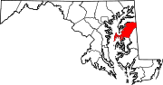
U.S. Highways Categories:- State highways in Maryland
- Roads in Queen Anne's County, Maryland


Wikimedia Foundation. 2010.