- Maryland Route 835
-
Maryland Route 835

MD 835A highlighted in redRoute information Maintained by MDSHA Location Counties: Queen Anne's Highway system Maryland highway system
Interstate • US • State • Minor • Former • Turnpikes←  MD 834
MD 837  →
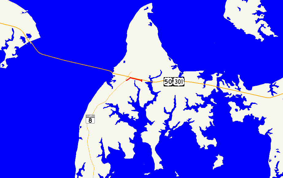
→Maryland Route 835 (MD 835) is a collection of state highways in the U.S. state of Maryland. These ten highways are service roads or old alignments in the vicinity of MD 18 and U.S. Route 50 and US 301 in western Queen Anne's County. One of the highways, MD 835A, is signed; it is the only state highway in Maryland that is signed with its letter suffix. MD 835 and MD 835G are found in Kent Narrows. MD 835A, MD 835C, and MD 835F are located in Stevensville. MD 835B and MD 835H through MD 835K are in Grasonville.
- MD 835 is the designation for Seward Marina Road, a 0.13-mile (0.21 km) connector between MD 18 and a right-in/right-out interchange (Exit 42) with eastbound US 50 and US 301 on the east side of Kent Narrows.[1][2]
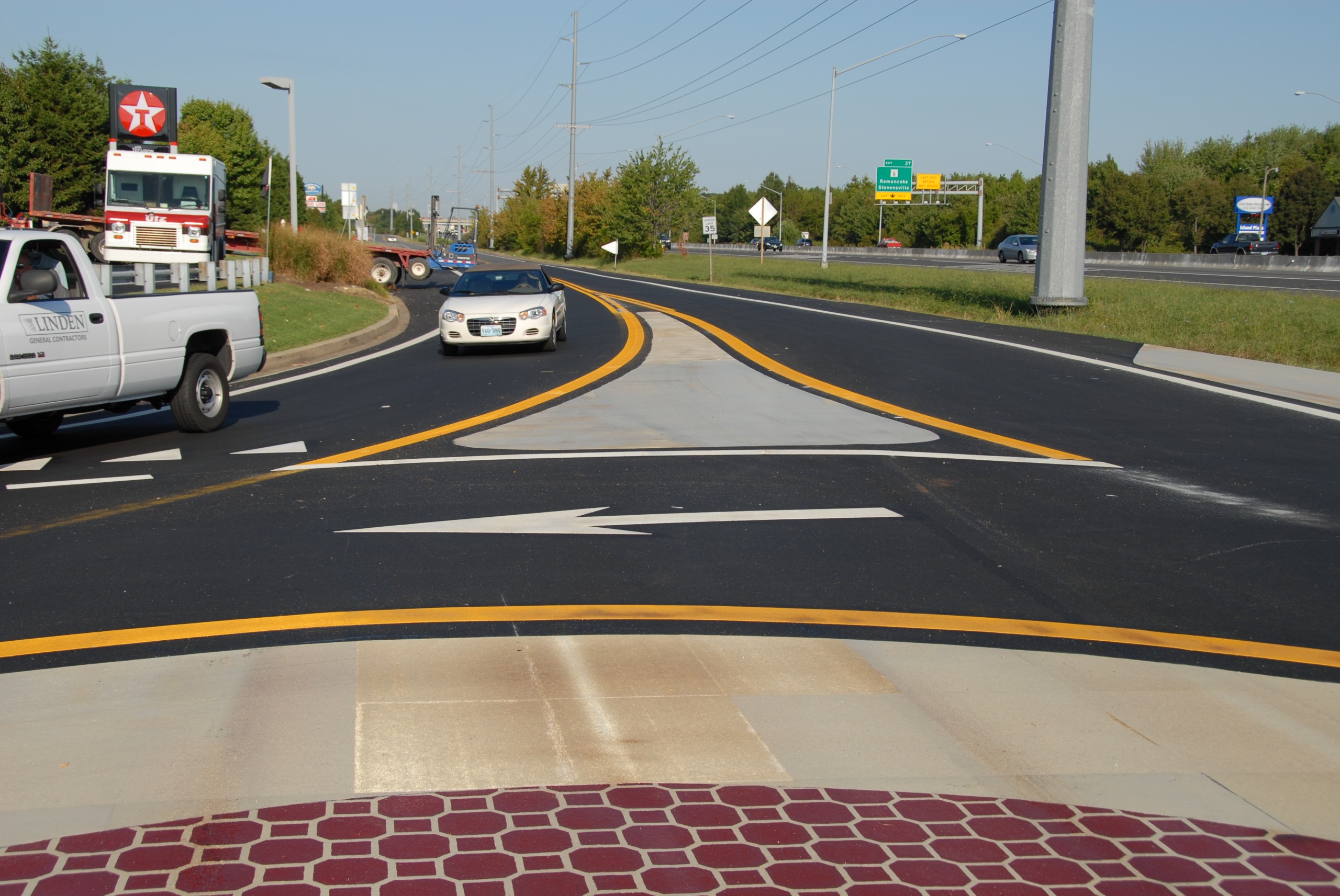
- MD 835A is the signed designation for the state-maintained portion of Pier One Road and Thompson Creek Service Road, which together run 0.77 miles (1.24 km) along the eastbound side of US 50 and US 301 in Stevensville. MD 835A is the only state highway in Maryland signed with its letter suffix. The state highway's western terminus is at the beginning of state maintenance just west of MD 8 (Romancoke Road), a short distance south of MD 8's interchange with US 50 and US 301, east of the Bay Bridge Marina, and north of Bay Bridge Airport. After the intersection with MD 8, MD 835A curves to the northeast and closely parallels the freeway, providing access to a park and ride facility and a pair of shopping centers. The state highway reaches its eastern terminus at a roundabout with Thompson Creek Road and the right-in/right-out ramps of Exit 38A of US 50 and US 301.[1][3]
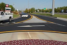 The eastern terminus of MD 835A at the Thompson Creek roundabout.
- MD 835B is the designation for Saddler Road, a 0.62-mile (1.00 km) highway that parallels the westbound side of US 50 and US 301 between Jackson Creek Road and Chester River Beach Road (unsigned MD 18V) in Grasonville.[1][4]
- MD 835C is the designation for the old alignment of MD 18 through the Stevensville Historic District. The 0.77-mile (1.24 km) highway follows Old Love Point Road and East Main Street between intersections with MD 18 in Stevensville and passes by Christ Church.[1][5]
- MD 835F is the designation for a 0.05-mile (0.080 km) section of Schooner Parkway west from MD 18 in Stevensville. The state highway provides access to an office park.[1][6]
- MD 835G is the designation for Kent Narrows Road, a 0.40-mile (0.64 km) connector between Kent Narrows Way North immediately east of Kent Narrows and a right-in/right-out interchange (Exit 42) with westbound US 50 and US 301.[1][7]
- MD 835H is the designation for a 0.74-mile (1.19 km) stretch of Winchester Creek Road that parallels the westbound side of US 50 and US 301 between VFW Avenue (MD 18W) and Hissey Road (MD 835I) in Grasonville. MD 835H features a right-in/right-out interchange (Exit 44B) with the westbound freeway.[1][8]
- MD 835I is the designation for a 0.20-mile (0.32 km) segment of Hissey Road from a right-in/right-out interchange (Exit 45A) with westbound US 50 and US 301 to just north of the highway's intersection with MD 835H in Grasonville.[1][9]
- MD 835J is the designation for a 0.77-mile (1.24 km) stretch of Winchester Creek Road and Blackbeard Road that parallels the westbound side of US 50 and US 301 between Hissey Road (MD 835I) and the end of state maintenance east of Nesbit Road (MD 835K) and the westbound ramps for Exit 45B in Grasonville.[1][10]
- MD 835K is the designation for a 0.42-mile (0.68 km) portion of Nesbit Road between MD 18 and a point just north of MD 835J in Grasonville.[1][11]
References
- ^ a b c d e f g h i j "Highway Location Reference: Queen Anne's County" (PDF). Maryland State Highway Administration. 2009. http://www.marylandroads.com/Location/2009_QUEENANNES.pdf. Retrieved 2010-08-31.
- ^ Google, Inc. Google Maps – Maryland Route 835 (Map). Google, Inc. http://maps.google.com/maps?f=d&source=s_d&saddr=Main+St&daddr=Unknown+road&hl=en&geocode=FdCUUgIduLR0-w%3BFcKaUgIdXbd0-w&mra=ls&sll=38.967042,-76.23736&sspn=0.003829,0.009645&ie=UTF8&t=h&z=18. Retrieved 2010-09-01.
- ^ Google, Inc. Google Maps – Maryland Route 835A (Map). Google, Inc. http://maps.google.com/maps?f=d&source=s_d&saddr=Marina+Club+Rd%2FPier+1+Rd&daddr=Unknown+road&hl=en&geocode=FXK9UgId2mRz-w%3BFZy5UgIdwpdz-w&mra=ls&sll=38.976885,-76.317075&sspn=0.007657,0.01929&ie=UTF8&ll=38.976893,-76.317108&spn=0.007657,0.01929&t=h&z=16. Retrieved 2010-09-01.
- ^ Google, Inc. Google Maps – Maryland Route 835B (Map). Google, Inc. http://maps.google.com/maps?f=d&source=s_d&saddr=Saddler+Rd&daddr=Saddler+Rd&hl=en&geocode=FdCPUgIdRvR0-w%3BFXqLUgIdKh91-w&mra=ls&sll=38.963997,-76.215119&sspn=0.007658,0.01929&ie=UTF8&ll=38.964564,-76.21587&spn=0.007658,0.01929&t=h&z=16. Retrieved 2010-09-01.
- ^ Google, Inc. Google Maps – Maryland Route 835C (Map). Google, Inc. http://maps.google.com/maps?f=d&source=s_d&saddr=Business+Pkwy&daddr=E+Main+St&geocode=Fe7pUgIdPpRz-w%3BFZfHUgId2Ytz-w&hl=en&mra=ls&sll=38.981597,-76.311915&sspn=0.007656,0.01929&ie=UTF8&t=h&z=15. Retrieved 2010-09-01.
- ^ Google, Inc. Google Maps – Maryland Route 835F (Map). Google, Inc. http://maps.google.com/maps?f=d&source=s_d&saddr=Schooner+Pkwy&daddr=Schooner+Pkwy&geocode=FdbeUgIdOolz-w%3BFT3hUgIdJ4hz-w&hl=en&mra=ls&sll=38.98566,-76.314283&sspn=0.000957,0.002411&ie=UTF8&ll=38.98574,-76.31445&spn=0.000957,0.002411&t=h&z=19. Retrieved 2010-09-01.
- ^ Google, Inc. Google Maps – Maryland Route 835G (Map). Google, Inc. http://maps.google.com/maps?f=d&source=s_d&saddr=Kent+Narrows+Rd&daddr=Unknown+road&geocode=FYCjUgIdkKB0-w%3BFSGdUgIdvLd0-w&hl=en&mra=ls&sll=38.967951,-76.239324&sspn=0.007658,0.01929&ie=UTF8&t=h&z=17. Retrieved 2010-09-01.
- ^ Google, Inc. Google Maps – Maryland Route 835H (Map). Google, Inc. http://maps.google.com/maps?f=d&source=s_d&saddr=Vfw+Ave&daddr=Winchester+Creek+Rd&geocode=FWiEUgIdRjV1-w%3BFXaXUgIdSVx1-w&hl=en&mra=ls&sll=38.964865,-76.200335&sspn=0.007658,0.01929&ie=UTF8&ll=38.964614,-76.199734&spn=0.007658,0.01929&t=h&z=16. Retrieved 2010-09-01.
- ^ Google, Inc. Google Maps – Maryland Route 835I (Map). Google, Inc. http://maps.google.com/maps?f=d&source=s_d&saddr=Exit+45A&daddr=Hissey+Rd&geocode=FZyRUgId5GR1-w%3BFSKYUgIdslt1-w&hl=en&mra=ls&sll=38.966717,-76.194069&sspn=0.007658,0.01929&ie=UTF8&t=h&z=18. Retrieved 2010-09-01.
- ^ Google, Inc. Google Maps – Maryland Route 835J (Map). Google, Inc. http://maps.google.com/maps?f=d&source=s_d&saddr=Hissey+Rd&daddr=Black+Beard+Rd%2FWinchester+Creek+Rd&geocode=FXKTUgIdhmN1-w%3BFc6iUgIdspF1-w&hl=en&mra=ls&sll=38.970012,-76.181527&sspn=0.003829,0.009645&ie=UTF8&t=h&z=16. Retrieved 2010-09-01.
- ^ Google, Inc. Google Maps – Maryland Route 835K (Map). Google, Inc. http://maps.google.com/maps?f=d&source=s_d&saddr=Nesbit+Rd&daddr=Nesbit+Rd&geocode=FZSPUgIdEI51-w%3BFQGgUgIduXp1-w&hl=en&mra=ls&sll=38.968944,-76.186758&sspn=0.001914,0.004823&ie=UTF8&t=h&z=16. Retrieved 2010-09-01.
External links
Roads in Queen Anne's County, Maryland State highways 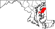
U.S. Highways Categories:- State highways in Maryland
- Roads in Queen Anne's County, Maryland


Wikimedia Foundation. 2010.