- Maryland Route 481
-
Maryland Route 481
Damsontown Road 
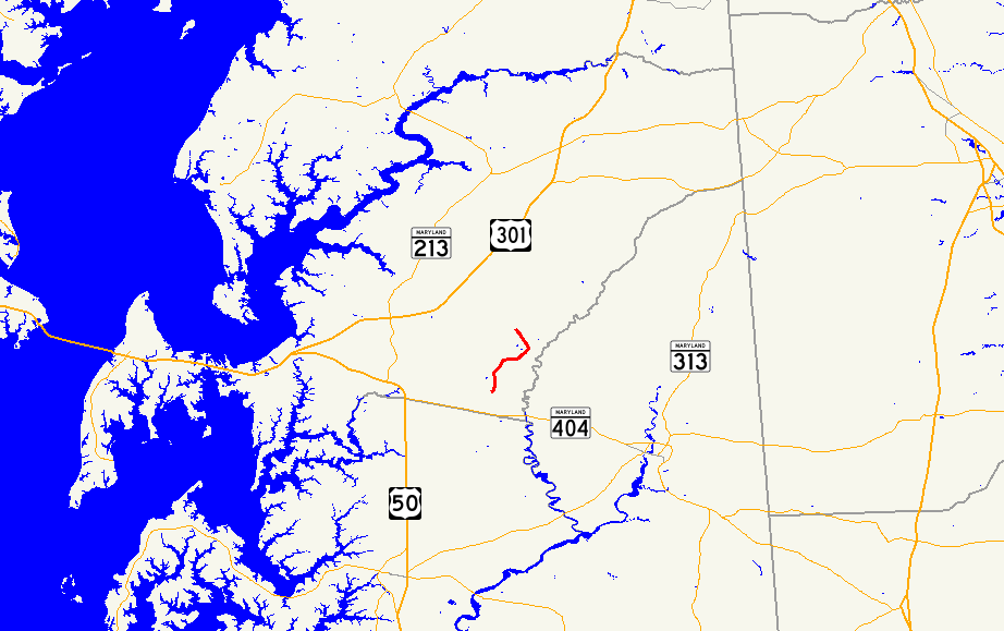
Route information Maintained by MDSHA Length: 5.13 mi[1] (8.26 km) Major junctions South end:  MD 309 near Queen Anne
North end:  MD 304 in Ruthsburg
Location Counties: Queen Anne's Highway system Maryland highway system
Interstate • US • State • Minor • Former • Turnpikes←  MD 480
MD 482  →
→Maryland Route 481 (MD 481) is a state highway in the U.S. state of Maryland. Known as Damsontown Road, the state highway runs 5.13 miles (8.26 km) from MD 309 near Queen Anne north to MD 304 in Ruthsburg. MD 481, which was constructed in the early 1930s, provides access to Tuckahoe State Park on its course through southeastern Queen Anne's County.
Contents
Route description
MD 481 begins at an intersection with MD 309 (Starr Road) north of Queen Anne. The state highway heads north through farmland, passing Crouse Mill Road, which is used to access Tuckahoe State Park from the west.[2] MD 481 curves east to cross Blockiston Branch, then veers north and meets the other end of Crouse Mill Road. The state highway reaches its northern terminus at MD 304 (Ruthsburg Road) in Ruthsburg.[1][2]
History
MD 481 was completed in 1933.[3][4] The state highway has not changed beyond minor improvements.
Junction list
The entire route is in Queen Anne's County.
Location Mile
[1]Destinations Notes Queen Anne 0.00 MD 309 (Starr Road) – CentrevilleSouthern terminus Ruthsburg 5.13 MD 304 (Ruthsburg Road) – Centreville, BridgetownNorthern terminus 1.000 mi = 1.609 km; 1.000 km = 0.621 mi References
- ^ a b c "Highway Location Reference: Queen Anne's County" (PDF). Maryland State Highway Administration. 2009. http://www.marylandroads.com/Location/2009_QUEENANNES.pdf. Retrieved 2010-09-29.
- ^ a b Google, Inc. Google Maps – Maryland Route 481 (Map). Cartography by Google, Inc. http://maps.google.com/maps?f=d&source=s_d&saddr=MD-481+N%2FDamsontown+Rd&daddr=MD-481+N%2FDamsontown+Rd&hl=en&geocode=FZ5EUgIdiJ94-w%3BFSYlUwIdVvl4-w&mra=ls&sll=38.97469,-75.964085&sspn=0.060988,0.154324&ie=UTF8&t=h&z=13. Retrieved 2010-06-09.
- ^ Maryland Geological Survey. Map of Maryland Showing State Road System: State Aid Roads and Improved County Road Connections (Map) (1933 ed.).
- ^ Report of the State Roads Commission of Maryland. 1931-1934. Baltimore: Maryland State Roads Commission. 1934-12-28. p. 350. http://www.archive.org/details/reportofstateroa1931mary. Retrieved 2010-09-29.
External links
Roads in Queen Anne's County, Maryland State highways 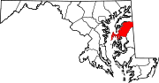
U.S. Highways Categories:- State highways in Maryland
- Roads in Queen Anne's County, Maryland


Wikimedia Foundation. 2010.