- Church Hill Grange Hall
-
Church Hill Grange Hall
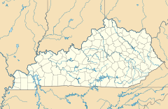

Nearest city: Hopkinsville, Kentucky Coordinates: 36°47′58″N 87°34′28″W / 36.79944°N 87.57444°WCoordinates: 36°47′58″N 87°34′28″W / 36.79944°N 87.57444°W Area: 0.7 acres (0.28 ha) Built: 1878 Governing body: Private MPS: Christian County MRA NRHP Reference#: 75000744[1] Added to NRHP: August 28, 1975 Church Hill Grange Hall, near Hopkinsville, Kentucky, was built in 1878. It served historically as a meeting hall. It was listed on the National Register of Historic Places in 1975.[1]
References
- ^ a b "National Register Information System". National Register of Historic Places. National Park Service. 2009-03-13. http://nrhp.focus.nps.gov/natreg/docs/All_Data.html.
U.S. National Register of Historic Places Topics Lists by states Alabama • Alaska • Arizona • Arkansas • California • Colorado • Connecticut • Delaware • Florida • Georgia • Hawaii • Idaho • Illinois • Indiana • Iowa • Kansas • Kentucky • Louisiana • Maine • Maryland • Massachusetts • Michigan • Minnesota • Mississippi • Missouri • Montana • Nebraska • Nevada • New Hampshire • New Jersey • New Mexico • New York • North Carolina • North Dakota • Ohio • Oklahoma • Oregon • Pennsylvania • Rhode Island • South Carolina • South Dakota • Tennessee • Texas • Utah • Vermont • Virginia • Washington • West Virginia • Wisconsin • WyomingLists by territories Lists by associated states Other Categories:- Properties of religious function on the National Register of Historic Places in Kentucky
- Buildings and structures in Christian County, Kentucky
- Grange organizations and buildings
- Clubhouses in Kentucky
- Kentucky Registered Historic Place stubs

Wikimedia Foundation. 2010.