- Church Hill
-
St. John's Church Historic District
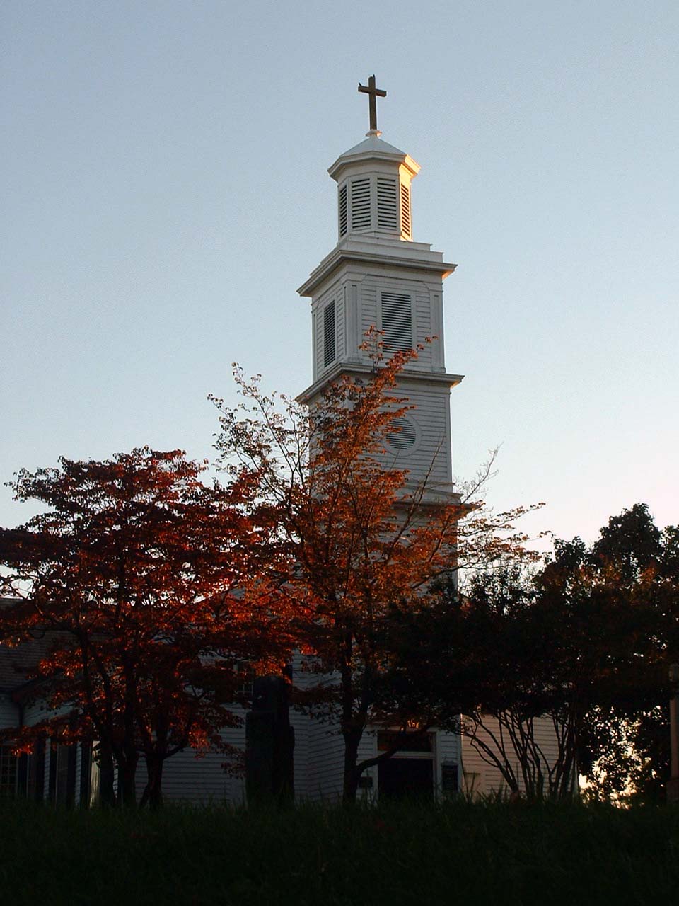
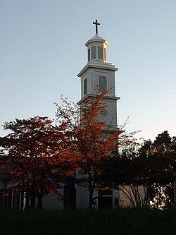 St.John's Episcopal Church, Richmond, Virginia
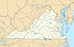

Location: Bounded roughly by 22nd, Marshall, 32nd, Main, and Franklin Sts. and Williamsburg Ave., Richmond, Virginia Coordinates: 37°31′45″N 77°25′5″W / 37.52917°N 77.41806°WCoordinates: 37°31′45″N 77°25′5″W / 37.52917°N 77.41806°W Area: 100 acres (40 ha) Architect: Byrd,William Architectural style: Greek Revival, Federal Governing body: Local NRHP Reference#: 70000884 (original)
[1] (increase)
90002097Significant dates Added to NRHP: September 15, 1970 Boundary increase: January 17, 1991 Church Hill, also known as the St. John's Church Historic District, is an Old and Historic District in Richmond, Virginia. This district encompasses the original land plat of the city of Richmond. Church Hill is the eastern terminus of Broad Street, a major east-west thoroughfare in the Richmond Metropolitan Area, and one of the longest, which carries U.S. Route 250. The name Church Hill is often used to describe both the specific historic district and the larger general area in the East End encompassing other neighborhoods such as Union Hill, Chimborazo, Fairmount, Peter Paul, Woodville, etc.
Contents
History
Church Hill is known as the site of Virginia's second revolutionary convention where Patrick Henry gave his "Give me liberty or give me death" speech in St. John's Episcopal Church, Richmond, Virginia. It is also known for Chimborazo Park, where the largest American Civil War Hospital was located.
On Friday, October 2, 1925, a 4,000-foot Chesapeake and Ohio railroad single track tunnel built during Reconstruction collapsed under Church Hill. The Church Hill Tunnel collapse occurred during refurbishment works, killing 3 or 4 and engulfing a work train in complete with a 4-4-0 engine #231 and 10 flat cars. The tunnel was closed and filled-in after the collapse. In the July 2006, a coalition of officials and historical groups made plans to remove the buried engine. If recovered, it would be displayed at the Virginia Historical Society in Richmond. Some borings were made into the tunnel from above for examination by camera. Only murky water was found, whereupon further work was delayed by city permitting issues. The bricked-in entrance of the collapsed tunnel can still be seen at the south east end of the alley just north of Marshall Street, on 18th Street.
Douglas Wilder, the first African American to have been elected governor of a U.S. state1, was born and raised in Church Hill.
Preservation Efforts
The Church Hill neighborhood experienced serious physical decline during the 1950s, owing mostly to absentee landlords. The Historic Richmond Foundation was established in 1956 out of concern for "saving and enhancing the setting for St. John's Church."[2] In 1957, encouraged in large part by Historic Richmond, City Council created a historic district ordinance while simultaneously adopting the St. John's Church Old and Historic District. The preservation of Church Hill marked the formal beginning of the preservation movement in Richmond.[3]
Notable Structures, Monuments and Parks
- Adams-Taylor House
- Adams Double House
- Chimborazo Park
- Elmira Shelton House
- Libby Hill Park
- Pohlig Brothers Building
- Richmond Hill
- Soldiers and Sailors Monument
- St. John's Mews
- Superior Warehouse
- Woodward House
- WRVA Building
Maps
References
- ^ "National Register Information System". National Register of Historic Places. National Park Service. 2009-03-13. http://nrhp.focus.nps.gov/natreg/docs/All_Data.html.
- ^ Zehmer, Jack. Church Hill: The St. John's Historic District, 1991. (p. 11)
- ^ Katie Kelley, Historic Richmond Foundation Architectural Historian
External links
- Church Hill People's News
- Church Hill on myspace.com
- Church Hill neighbors on Yahoo!Groups
- Church Hill Association
- Historicrichmond.com info about Church Hill
- St. John's Episcopal Church
- Richmond City Watch: Church Hill
- Alliance to Conserve Old Richmond Neighborhoods (ACORN): Neighborhood Maps
- Richmond, Virginia, a National Park Service Discover Our Shared Heritage Travel Itinerary
Nearby Neighborhoods in Richmond, Virginia Northwest
Shockoe ValleyNorth
Union HillWest
Shockoe BottomChurch Hill East
Chimborazo
Chimborazo ParkSouth
Tobacco RowSoutheast
Libby HillU.S. National Register of Historic Places Topics Lists by states Alabama • Alaska • Arizona • Arkansas • California • Colorado • Connecticut • Delaware • Florida • Georgia • Hawaii • Idaho • Illinois • Indiana • Iowa • Kansas • Kentucky • Louisiana • Maine • Maryland • Massachusetts • Michigan • Minnesota • Mississippi • Missouri • Montana • Nebraska • Nevada • New Hampshire • New Jersey • New Mexico • New York • North Carolina • North Dakota • Ohio • Oklahoma • Oregon • Pennsylvania • Rhode Island • South Carolina • South Dakota • Tennessee • Texas • Utah • Vermont • Virginia • Washington • West Virginia • Wisconsin • WyomingLists by territories Lists by associated states Other  Category:National Register of Historic Places •
  Portal:National Register of Historic PlacesCategories:
- Historic districts in Virginia
- Neighborhoods in Richmond, Virginia
- Hills of Richmond, Virginia

Wikimedia Foundation. 2010.