- Dundonald, Saskatoon
-
Dundonald — Neighborhood — Dundonald Streetscape
Coordinates: 52°5′49″N 106°35′40″W / 52.09694°N 106.59444°W Country  Canada
Province  Saskatchewan
City Saskatoon Suburban Development Area Confederation SDA Neighbourhood Dundonald Government - Type Municipal (Ward 4) - Administrative body Saskatoon City Council - Councillor Time zone UTC (UTC-6) City of Saskatoon Neighbourhoods Dundonald is one of many subdivisions of the city of Saskatoon, Saskatchewan which was built in the 1980s, and until recently was the farthest northwest quarter of the city of Saskatoon. The North West Development area is some of the latest land to be annexed by the city of Saskatoon, however is still zoned DAG1,2, and 3, which is agricultural land as of 2007. Dundonald surrounds a large landscaped park which hosts many soccer and baseball games. Most of the population works in sales & service, followed closely by those employed in the trades, transport, equipment operator, business, finance, and administration.[1] In comparison the neighbourhood of Dundonald with a 2001 census population of 5,285[2] is larger than the Saskatchewan city of Melville which had a population of 4,149 in 2006, and 4,453 in 2001 and Dundonald is also larger than the provincial city of Humboldt which was 4,998 in 2006, and 5,161 in 2001.[3] In Saskatchewan rural towns must maintain a population above 5,000 to apply for city status.
Contents
History
The land was annexed for Dundonald between 1975–1979, and shortly thereafter construction began.[4] The street names honour former City councillors.[5]
List of Dundonald Roads Road name City Councillor Bowman Lane, Crt, Crescent Bowman, Aden (1941–1952)
Bowman, Lillie F. (1955–1964)Carrothers Court Carrothers, W.A. (1930) Flavelle Court, Crescent Flavelle, W.T.A. (1953–54, 1961–66) George Road Alexander, George Heggie Court, Crescent Heggie, Robert A. (1954–1963) Hughes Drive Hughes, Helen (1976–1980) Hunt Road Hunt, George L. (1952–1954) Junor Avenue Junor, Donald (1968–1979) Kirkpatrick Court, Crescent Kirkpatrick, W.P. (1923–1924) Latrace Road Latrace, Harold (1964–1967) Lennon Crescent Lennon, Thomas George (1973–1976) Makaroff Road Makaroff, P.G. (1939) Manning Crescent, Lane Manning, W.G. (1947–1951, 1954–1957) McCann Way McCann, Peter (1982–85, 1991–2000) Murray Place Murray, George (1928–1929) Nesbitt Lane, Way, Crescent Nesbitt, W.G. (1948–1957) Nixon Crescent Nixon, Howard (1982–1985) O'Regan Court, Crescent O'Regan, W.B. (1931–1934) Robinson Crescent Robinson, Gladys (1965) Stacey Court, Crescent Stacey, Francis L. (1954–1956) Sumner Place, Lane, Crescent Sumner, A.J.E. (1943–1945) Ward Road, Court Ward, George (1968–1970) Wedge Road Wedge, J.B. (1961–68, 1971–72) Education
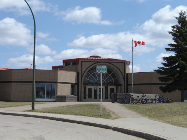
 Dundonald School
 St. Peter School
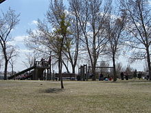 St. Peter School
Area Parks
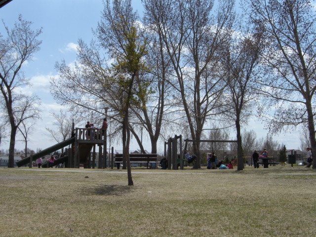
- Dundonald Park 19.31 acres (78,100 m2)
- Princess Diana Multi-District Park
Transportation
City Transit
Dundonald is serviced by the City Transit Bus Route Saskatoon Transit; Route 4 Dundonald/Confederation Terminal/Willowgrove.
Layout
33rd Street is to the south and 37th Street to the north, and whereas these two streets run parallel to each other, there are no other numbered streets throughout the neighbourhood, Originally the grid layout was going to continue before the city decided to develop with the crescents and cul-de-sac layout instead. This neighbourhood constructed in the 1980s abandoned the grid style of road layout, leaving 33rd & 37th Streets the remaining numeric ones in the neighbourhood. Junor Avenue marks the eastern boundary and Hughes Drive serves as the western boundary, while 37th Street is the northern boundary and 33rd Street serves as the southern boundary.
Shopping
- Dundonald Neighbourhood Commercial Centre (located at Wedge & George Roads)
- Confederation Park Mall
In the neighbouring subdivisions there is also these retail experiences.
- Confederation Park Suburban Centre
- 22nd Street Arterial Commercial District
- 33rd Street Arterial Commercial District
- Blairmore Suburban Centre under construction
See also
Recreation
In the neighbouring subdivision this facility is very nearby.
- Cosmo Civic Centre & Ice Arena and Carlyle King Branch Library
Life
Dundonald Community Association maintains the ice rink in Dundonald Park, as well as provides leisure activities at both schools.[12]
References
- ^ 2003 Neighbourhood Profiles URL accessed April 2, 2007
- ^ Parkridge Profile URL accessed April 9, 2007
- ^ Statistics Canada 2006 Community Profiles URL accessed April 4, 2007
- ^ Populace Spring 2006 URL accessed April 4, 2007
- ^ Dundonald Map URL accessed April 4, 2007
- ^ City of Saskatoon Archives - History of Saskatoon URL accessed April 4, 2007
- ^ Dundonald | Saskatoon Public Schools URL accessed April 3, 2007
- ^ Dundonald School URL accessed April 3, 2007
- ^ Dundonald School Newsletter URL accessed April 4, 2007
- ^ St. Peter School URL accessed April 4, 2007
- ^ St. Peters School Newsletter URL accessed April 4, 2007
- ^ City of Saskatoon · Departments · Community Services · Lots for ... URL accessed April 4, 2007
External links
- Dundonald Community Association Website
- Local Area Planning
- Saskatoon Neighbourhoods Word Search Puzzle
- City of Saskatoon · Departments · Community Services · City Planning · ZAM Maps
- Populace Spring 2006
Coordinates: 52°08′50″N 106°43′33″W / 52.147222°N 106.725833°W
North: North West Development Area | Hampton Village West: North West Development Area Dundonald East: Westview South: Confederation Park | Massey Place Categories:- Neighbourhoods in Saskatoon


Wikimedia Foundation. 2010.