- Airport Business Area, Saskatoon
Infobox Settlement
official_name = Airport Business Area
other_name =
native_name =
nickname =
settlement_type = Neighborhood
motto =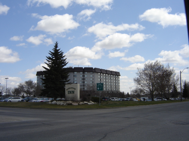
imagesize =
image_caption = Saskatoon Inn
flag_size =
image_
seal_size =
image_shield =
shield_size =
city_logo =
citylogo_size =
mapsize =
map_caption =
mapsize1 =
map_caption1 =
image_dot_
dot_mapsize =
dot_map_caption =
dot_x = |dot_y =
pushpin_
pushpin_label_position =
pushpin_map_caption =
pushpin_mapsize =
subdivision_type = Country
subdivision_name = CAN
subdivision_type1 = Province
subdivision_name1 = SK
subdivision_type2 = City
subdivision_name2 = Saskatoon
subdivision_type3 = Suburban Development Area
subdivision_name3 = North Industrial SDA
subdivision_type4 = Neighbourhood
subdivision_name4 = Airport Business Area
government_footnotes =
government_type =
leader_title = Administrative body
leader_name =Saskatoon City Council
leader_title1 = Councillor
leader_name1 =
leader_title2 =
leader_name2 =
leader_title3 =
leader_name3 =
leader_title4 =
leader_name4 =
established_title = Annexed
established_date =1965-1969
established_title2 =
established_date2 =
established_title3 =
established_date3 =
area_magnitude =
unit_pref =
area_footnotes =
area_total_km2 =
area_land_km2 =
area_water_km2 =
area_total_sq_mi =
area_land_sq_mi =
area_water_sq_mi =
area_water_percent =
area_urban_km2 =
area_urban_sq_mi =
area_metro_km2 =
area_metro_sq_mi =
population_as_of = 2006
population_footnotes =
population_note =
population_total =
population_density_km2 =
population_density_sq_mi =
population_metro =
population_density_metro_km2 =
population_density_metro_sq_mi =
population_urban =
population_density_urban_km2 =
population_density_urban_sq_mi =
population_blank1_title = Average Income
population_blank1 = $
population_density_blank1_km2 =
population_density_blank1_sq_mi =
timezone = UTC
utc_offset = -6
timezone_DST =
utc_offset_DST =
latd=52 |latm=9|lats=4|latNS=N
longd= 106|longm= 41|longs= 3|longEW=W
elevation_footnotes =
elevation_m =
elevation_ft =
postal_code_type =
postal_code =
area_code =
blank_name =
blank_info =
blank1_name =
blank1_info =
website =
footnotes = City of Saskatoon NeighborhoodsAirport Business Area is an
industrial park located in the North Industrial SDA Suburban Development Area ofSaskatoon ,Saskatchewan . Industrial parks are usually located close totransport facilities, especially where more than one transport modalities coincide. The Idylwyld Drive North, Sk Hwy 11 Louis Riel Trail, and Sk Hwy 12 concurrency are all accessed directly from the Airport Business Area. TheSaskatoon John G. Diefenbaker International Airport is north of the Airport Business Area. Circle Drive marks the southern boundary, with access to SK Hwy 14 and Sk Hwy 16, the Yellowhead Trans Canada.Geography
The land was annexed from the
rural municipality of Corman Park between 1965-1969. In 2005 land was annexed for Akzo (Marquis Industrial).cite web
last =
first =
authorlink =
coauthors =
title = Populace Spring 2006
work =
publisher =
date =
url =http://www.saskatoon.ca/org/city_planning/resources/populace_newsletter/Populace_Spring_2006.pdf
format =
doi =
accessdate = 2008-05-12] The Airport Business subdivision is several major trucking routes. The Idylwyld Drive North, Sk Hwy 11 Louis Riel Trail to Prince Albert via Warman, and Sk Hwy 12 to Blaine Lake via Martensville concurrency mark the eastern boundary. Circle Drive marks the southern boundary, with access to SK Hwy 1`4 and Sk Hwy 16, the Yellowhead Trans Canada. It is a main thoroughfare through the city connecting Regina,Saskatoon andPrince Albert, Saskatchewan . It also connects west Saskatoon with the bedroom communities of Warman and Martensville.Larkhaven Park is a park within the region which owes its name to a former naming of an industrial park previously located in this area. Larkhaven Industrial area is located in the area of the Saskatoon Inn. [ [http://www.valuation-net.com/affiliates/brunsdon/articles/office2001.pdf 2000 to 2001 Saskatoon Office Study] URL accessed January 27, 2007]
McNab Park community is a residential area located in the airport business area. This residential area uses the residences of the former RCAF base near the airport. [ [http://www.saskatoon.ca/org/development/resources/business_profile_newsletters/newsletter_summer2001.pdf BUSINESS PROFILE] URL accessed January 27, 2007]
Economy
The Airport Business Area park is a mix of commercial and industrial concerns south east of the
Saskatoon John G. Diefenbaker International Airport . Areva NC (formerly named COGEMA resources), R.C.A.F. Memorial Park, Shaw Communications, Global Televison are businesses based in the airport business park. Saskatoon Inn, Heritage Inn, Travelodge, Sandman Hotel and Country Inn and Suites are next to the airport for the travelling business person. Saskatoon Hyundai and Auto Clearing are auto dealerships which make their home base in the Airport Business Area.In the Airport Business Area subdivision are 3374 full time employees and 841 part time employees.cite web
last =
first =
authorlink =
coauthors =
title = Final Report 2005
work =
publisher =
date =
url =http://www.saskatoon.ca/org/transit/strategicplan/FinalReport2005.pdf
format =
doi =
accessdate = 2008-05-12]Future Plans
The airport business area is a part of the local area plans of the City of Saskatoon infrastructure development. Some of the upcoming plans are to structure Airport Drive as a “Gateway to Saskatoon” and phase out residential communities for example at McNab Park and re-vamp the area to light industrial and business park uses. Rename the area to Airport Business Area from Airport Industrial Area, and incorporate Hamption Industrial area within Airport Business Area. Develop the area west of Airport Drive and North west of Circle Drive. Reserve the Larkhaven Park formation as a park space. [ [http://www.city.saskatoon.sk.ca/org/city_planning/local_area_plans/plans_being_implemented/airport_industrial_presentation.pdfAirport Industrial Local Area Plan Airport Industrial Local Area Plan] URL accessed January 27, 2007] [cite web
last =
first =
authorlink =
coauthors =
title = Summary Notes_134719046
work = Local Area Plan Airport Business Area
publisher =City of Saskatoon
date =
url = http://www.city.saskatoon.sk.ca/org/city_planning/local_area_plans/plans_being_implemented/lap_recommendations/airport_industrial_implementation_summary.pdf
format =
doi =
accessdate = 2008-05-13]Location
Geographic Location (8-way)
Centre =Airport Business Area
North =Saskatoon John G. Diefenbaker International Airport
Northeast =
East =North Industrial
Southeast =
South =Mayfair
Southwest = Hudson Bay Park
West = Hampton Village
Northwest =Saskatoon John G. Diefenbaker International Airport

References
External links
* [http://www.woutersrealty.com/Neighbourhood_Profiles/page_1239111.html Neighborhood Profiles]
* [http://www.scs.sk.ca/saskatoon100/students/funstuff/wordsearches/neighbourhoods/neighbourhoods.html Saskatoon Neighborhoods Word Search Puzzle]
* [http://www.city.saskatoon.sk.ca/org/leisure/community_associations/your_association.asp?ca=37 City of Saskatoon · Departments · Community Services · Community ... ]
* [http://www.saskatoon.ca/org/city_planning/zam_maps/index.asp City of Saskatoon City of Saskatoon · Departments · Community Services · City Planning · ZAM Maps]
* [http://www.saskatoon.ca/org/city_planning/resources/populace_newsletter/Populace_Spring_2006.pdf Populace Spring 2006]
Wikimedia Foundation. 2010.