- Sutherland Industrial, Saskatoon
Infobox Settlement
official_name = Sutherland Industrial
other_name =
native_name =
nickname =
settlement_type = Neighborhood
motto =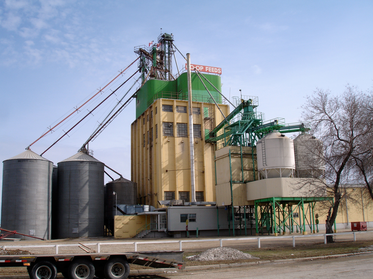
imagesize = 270px
image_caption = Co-Op Feeds plant
flag_size =
image_
seal_size =
image_shield =
shield_size =
city_logo =
citylogo_size =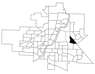
mapsize = 270px
map_caption = Sutherland Industrial location map
mapsize1 =
map_caption1 =
image_dot_
dot_mapsize =
dot_map_caption =
dot_x = |dot_y =
pushpin_
pushpin_label_position =
pushpin_map_caption =
pushpin_mapsize =
subdivision_type = Country
subdivision_name = CAN
subdivision_type1 = Province
subdivision_name1 = SK
subdivision_type2 = City
subdivision_name2 = Saskatoon
subdivision_type3 = Suburban Development Area
subdivision_name3 = University Heights
subdivision_type4 = Neighbourhood
subdivision_name4 = Sutherland Industrial
government_footnotes =
government_type = Municipal (Ward 10)
leader_title = Administrative body
leader_name =Saskatoon City Council
leader_title1 = Councillor
leader_name1 = Bev Dubois
leader_title2 =
leader_name2 =
leader_title3 =
leader_name3 =
leader_title4 =
leader_name4 =
established_title = Settled
established_date = 1908
established_title2 = Incorporated (town)
established_date2 = 1912
established_title3 = Annexed
established_date3 = 1956
area_magnitude =
unit_pref =
area_footnotes =
area_total_km2 = 2.14
area_land_km2 =
area_water_km2 =
area_total_sq_mi =
area_land_sq_mi =
area_water_sq_mi =
area_water_percent =
area_urban_km2 =
area_urban_sq_mi =
area_metro_km2 =
area_metro_sq_mi =
population_as_of = 2006
population_footnotes =
population_note =
population_total = 10
population_density_km2 =
population_density_sq_mi =
population_metro =
population_density_metro_km2 =
population_density_metro_sq_mi =
population_urban =
population_density_urban_km2 =
population_density_urban_sq_mi =
population_blank1_title =
population_blank1 =
population_density_blank1_km2 =
population_density_blank1_sq_mi =
timezone = UTC
utc_offset = -6
timezone_DST =
utc_offset_DST =
latd=52 |latm= 7|lats=50 |latNS=N
longd= 106|longm= 35|longs= 30|longEW=W
elevation_footnotes =
elevation_m =
elevation_ft =
postal_code_type =
postal_code =
area_code =
blank_name =
blank_info =
blank1_name =
blank1_info =
website =
footnotes = City of Saskatoon NeighborhoodsSutherland Industrial is an industrial subdivision located in east-central
Saskatoon ,Saskatchewan ,Canada . As of 2006, the area is home to a mere ten residents. Sutherland Industrial was originally part of Sutherland, a town outside of Saskatoon before being annexed by the city in 1956. The subdivision also contains the first urban reserve in Saskatchewan, the Muskeg Lake Cree Nation.cite web
last =
first =
authorlink =
coauthors =
title = City of Saskatoon profile - 2006
work =
publisher = City of Saskatoon
date = 2007
url = http://www.saskatoon.ca/org/city_planning/resources/neighbourhood_demographics/saskatoon_profile.pdf
format =
doi =
accessdate = 2008-04-17] cite web
last =
first =
authorlink =
coauthors =
title = Populace Spring 2006
work =
publisher = City of Saskatoon
date = 2006
url = http://www.saskatoon.ca/org/city_planning/resources/populace_newsletter/Populace_Spring_2006.pdf
format =
doi =
accessdate = 2007-10-22]History
The Sutherland Industrial area was built up when the
Canadian Pacific Railway branch line between Regina and Edmonton reached Saskatoon in 1907.cite web
last =
first =
authorlink =
coauthors =
title = Exploring the Wonder City - Driving Tour
work =
publisher = City of Saskatoon - Archives
date = 2006
url = http://www.scs.sk.ca/saskatoon100/COSdrivetour/38.htm
format =
doi =
accessdate = 2008-01-13] The CPR yards and station were constructed three miles east of Saskatoon.cite web
last = Jeff
first = O'Brien
authorlink =
coauthors =
title = A History of Saskatoon to 1914
work =
publisher = City of Saskatoon - Archives
date = July 2005
url = http://www.saskatoon100.ca/docs/SaskatoonHistoryto1914.pdf
format =
doi =
accessdate = 2008-01-13] A settlement grew adjacent to the rail yards, and was incorporated as the village of Sutherland August 30, 1909. [cite web
last = Jeff
first = O'Brien
authorlink =
coauthors =
title = Saskatoon Chronology: 1882-2005
work =
publisher = City of Saskatoon Archives
date = July 2005
url = http://www.saskatoon100.ca/docs/chronology_for_saskatoon100_website.pdf
format =
doi =
accessdate = 2008-01-13 ] It was named afterWilliam Charles Sutherland , a politician who served on Saskatoon's town council before it became a city in 1906.In 1956, the town was annexed by the growing city of Saskatoon. Sutherland became the city's easternmost neighbourhood until development in the 1970s took place even further east.cite web
last =
first =
authorlink =
coauthors =
title = Historical Resources
work =
publisher = City of Saskatoon - Archives
date =
url = http://www.saskatoon.ca/org/clerks_office/archives/history/index.asp
format =
doi =
accessdate = 2008-01-15 ] The amalgamation required some name changes to Sutherland's streets, to avoid confusion with identically-named streets already in Saskatoon (e.g. 6th Street became 110th Street). [cite book
last = O'Brien
first = Jeff
editor = Roberta Coulter
coauthors = Ruth W. Millar, William P. Delainey
title = Saskatoon: A History in Photographs
year = 2006
publisher = Coteau Books
pages = p.30
isbn = I-55050-336-7] At some point after annexation, the neighbourhood boundaries were redrawn. The mainly residential portion of the former town became the neighbourhood of Sutherland, while the rail yards and associated industrial lands were split off as the Sutherland Industrial subdivision.In 1988, the Muskeg Lake Cree Nation settled a land claim which created western Canada's first urban reserve. Title to 35 acres of land in the southeast part of Sutherland Industrial was transferred to the band. Under an agreement with the City of Saskatoon, the band does not pay civic taxes, but collects its own levy and pays the city for services. The development of the reserve is also in accordance with laws of Saskatchewan and the bylaws of Saskatoon. [cite web
last =
first =
authorlink =
coauthors =
title = Treaty Land Entitlement
work =
publisher = Muskeg Lake Cree Nation
date =
url = http://muskeglakearchives.com/TLE/tleHISTORY.htm
format =
doi =
accessdate = 2008-04-17 ]Government and politics
Sutherland exists within the federal electoral district of
Saskatoon—Humboldt . It is currently represented byBrad Trost of theConservative Party of Canada , first elected in 2004 and re-elected in 2006.Provincially, the area is within the constituency of
Saskatoon Silver Springs . It is currently represented byKen Cheveldayoff of theSaskatchewan Party , first elected in 2003 and re-elected in 2007.In Saskatoon's non-partisan municipal politics, Sutherland lies within ward 10. It is currently represented by Bev Dubois, first elected in 2003 and re-elected in 2006.
Industrial
The entirety of Sutherland Industrial is zoned for industrial uses. Heavy industrial businesses are located along the CPR tracks to the north, while light industrial businesses are concentrated in the south along College Drive. [cite web
last =
first =
authorlink =
coauthors =
title = City of Saskatoon Development Plan - Land Use Map
work =
publisher = City of Saskatoon - Community Services - City Planning
date = 2007-02-20
url = http://www.city.saskatoon.sk.ca/org/city_planning/resources/maps/dev_plan.pdf
format =
doi =
accessdate = 2008-04-17 ]Location
Sutherland Industrial is located within the University Heights Suburban Development Area. It is bounded by Gray Avenue to the north and east, College Drive to the south, and Central Avenue to the west.
Geographic Location (8-way)
Centre = Sutherland Industrial
North = Forest Grove
Northeast = Forest Grove - Arbor Creek
East = Arbor Creek
Southeast = College Park East
South = College Park - College Park East
Southwest = College Park
West = Sutherland
Northwest = U of S Lands - North Management Area

References
*Bill Barry, "Geographic Names of Saskatchewan" (Regina: People Places Publishing, 2005)
*John Duerkop, "Saskatoon's History in Street Names" (Saskatoon: Purich Publishing, 2000)External links
* [http://www.saskatoon.ca/org/city_planning/zam_maps/109.pdf Sutherland Industrial Zoning/Address Map (ZAM)]
* [http://www.saskatoon.ca/org/city_planning/zam_maps/index.asp City of Saskatoon City of Saskatoon · Departments · Community Services · City Planning · ZAM Maps]
* [http://www.saskatoon.ca/org/city_planning/resources/populace_newsletter/Populace_Spring_2006.pdf Populace Spring 2006]
* [http://www.saskatoon.ca/org/city_planning/local_area_plans/index.asp City of Saskatoon - Local Area Plans]
Wikimedia Foundation. 2010.