- Avalon, Saskatoon
Infobox Settlement
official_name = Avalon
other_name =
native_name =
nickname =
settlement_type = Neighborhood
motto =
imagesize =
image_caption = Avalon Shopping Centre
flag_size =
image_
seal_size =
image_shield =
shield_size =
city_logo =
citylogo_size =
mapsize =
map_caption =
mapsize1 =
map_caption1 =
image_dot_
dot_mapsize =
dot_map_caption =
dot_x = |dot_y =
pushpin_
pushpin_label_position =
pushpin_map_caption =
pushpin_mapsize =
subdivision_type = Country
subdivision_name = CAN
subdivision_type1 = Province
subdivision_name1 = SK
subdivision_type2 = City
subdivision_name2 = Saskatoon
subdivision_type3 = Suburban Development Area
subdivision_name3 = Nutana
subdivision_type4 = Neighbourhood
subdivision_name4 = Avalon
government_footnotes =
government_type = Municipal (Ward 7)
leader_title = Administrative body
leader_name =Saskatoon City Council
leader_title1 = Councillor
leader_name1 = Bob Pringle
leader_title2 =
leader_name2 =
leader_title3 =
leader_name3 =
leader_title4 =
leader_name4 =
established_title = Annexed
established_date =1910s
established_title2 = Construction
established_date2 = 1945-1970
established_title3 =
established_date3 =
area_magnitude =
unit_pref =
area_footnotes =
area_total_km2 =
area_land_km2 =
area_water_km2 =
area_total_sq_mi =
area_land_sq_mi =
area_water_sq_mi =
area_water_percent =
area_urban_km2 =
area_urban_sq_mi =
area_metro_km2 =
area_metro_sq_mi =
population_as_of = 2006
population_footnotes =
population_note =
population_total = 3,160
population_density_km2 =
population_density_sq_mi =
population_metro =
population_density_metro_km2 =
population_density_metro_sq_mi =
population_urban =
population_density_urban_km2 =
population_density_urban_sq_mi =
population_blank1_title = Average Income
population_blank1 = $63,694
population_density_blank1_km2 =
population_density_blank1_sq_mi =
timezone = UTC
utc_offset = -6
timezone_DST =
utc_offset_DST =52°5'42"N 106°39'30"W
latd=52 |latm= 5|lats=42 |latNS=N
longd= 106|longm= 39|longs= 30|longEW=W
elevation_footnotes =
elevation_m =
elevation_ft =
postal_code_type =
postal_code =
area_code =
blank_name =
blank_info =
blank1_name =
blank1_info =
website = [http://www.city.saskatoon.sk.ca/org/leisure/community_associations/your_association.asp?ca=14 Exhibition Community Association]
footnotes = City of Saskatoon NeighborhoodsAvalon is one of the east side neighborhoods ofSaskatoon which will be benefited from the construction of Circle Drive Bridge south. [ [http://www.borealisoutdoor.com/content/news/20050210_SaskatoonSouthBridge.htm Circle Drive South Bridge] URL accessed March 21, 2007] Avalon is part of the Nutana, but was not originally a part of the early Temperance Colony area on the east side of theSouth Saskatchewan River , developing later after Saskatoon became a city in 1906. The subdivision was one of the early neighborhoods which departed from grid patterns for road infrastructure layout, adopting crescents to replace streets and avenues.Demographics
The Avalon subdivision has a population of 3,160 residents and an average family size of 2.4. The Average home selling price is $124,183 in 2005 and homeownership is 75.5%. The average family income is $63,694. [ [http://www.city.saskatoon.sk.ca/org/city_planning/resources/neighbourhood_demographics/avalon.pdf Profiles] ]
History
The Avalon community was first laid out in maps dating back to the early 1910s, but construction did not begin until after
World War II . It, along with another post-war community, Grosvenor Park, received coverage in the local newspaper, "Saskatoon Star-Phoenix " due to city planners deciding to move away from thegrid system of street layout design, adopting the use of curved streets and crescents (although some grid patterns were retained). Part of the decision to adopt the then non-standard layout format was due to the city's upcoming plans to develop the Idylwyld and Circle Drive freeway system, which runs along Avalon's western and southern boundary.Development of Avalon was effectively complete by the end of the 1970s, although a small addition, making use of buffer land between Avalon and the freeway, was added in the 1990s. In 2006, the city commenced construction of a long-awaited interchange at Clarence Avenue and Circle Drive, in Avalon's southeast corner, which will allow improved access to the freeway and to newly-developed shopping centres to the south.
Public services
Saskatoon Light and Power provides electrical utilities to all Saskatoon neighborhoods which existed prior to 1958.cite web
last =
first =
authorlink =
coauthors =
title = Saskatoon Light & Power
work =
publisher = City of Saskatoon
date =
url = http://www.saskatoon.ca/org/electrical/index.asp
format =
doi =
accessdate = 2008-05-11] Water is treated and supplied by the City of Saskatoon Water and Wastewater Treatment Branch.cite web
last =
first =
authorlink =
coauthors =
title = City of Saskatoon Departments Utility Services Water Treatment
work =
publisher =
date =
url = http://www.saskatoon.ca/org/water_treatment/index.asp
format =
doi =
accessdate = 2008-05-11] The Avalon neighborhood is a part of the east division of the Saskatoon Police Services patrol system. This division services east of theSouth Saskatchewan River which encompasses the thirty one neighbourhoods, two industrial areas. [cite web
last =
first =
authorlink =
coauthors =
title = Saskatoon Police Service
work =
publisher =
date =
url = http://www.police.saskatoon.sk.ca/index.php?page_id=3&loc=divisions/central.php
format =
doi =
accessdate =2008-05-11 ] The Avalon neighborhood is served by the City of Saskatoon Saskatoon Fire & Protective Services.cite web
last =
first =
authorlink =
coauthors =
title = Fire and Protective Services
work =
publisher = City of Saskatoon
date =
url = http://www.city.saskatoon.sk.ca/dpt/fire_protective/index.asp
format =
doi =
accessdate =2008-05-11 ]Governance
Avalon exists within the federal electoral district of
Blackstrap . It is currently represented by Member of ParliamentLynne Yelich of theConservative Party of Canada , first elected in 2000 and re-elected in 2004 and 2006.cite web
title = CBC - Canada Votes 2006 - Candidates and Ridings
work =
publisher =
date =
url = http://www.cbc.ca/canadavotes/riding/229/
format =
doi =
accessdate = 2008-05-11]Provincially, the area is within the constituency of
Saskatoon Eastview . It is currently represented byMember of the Legislative Assembly Judy Junor of theSaskatchewan New Democratic Party , first elected in a 1998 by-election.In Saskatoon's non-partisan municipal politics, the avalon neighborhood lies within ward 7. It is currently represented by Councillor
Bob Pringle .cite web
title = City of Saskatoon · City Hall · Ward Councillors
work =
publisher = City of Saskatoon
date =
url = http://www.city.saskatoon.sk.ca/org/ward_councillors/index.asp
format =
doi =
accessdate = 2008-05-11]The Avalon Community Association is formed of volunteers in the community and may petition the councillor, MLA or MP regarding infrastructure or public services for the neighborhood.
Layout
Ruth Street is the road which is the north of this community.
Idylwyld Drive merging withCircle Drive demarks the south and western boundary edge. Clarence Avenue delimits the eastern boundary.As a result of the increased traffic south of Circle Drive, a new Clarence Avenue and Circle Drive interchange was constructed providing an arterial roadway overpass of Clarence Ave over Circle Drive. Construction began in 2006 was completed by the end of 2007. [cite web
last =
first =
authorlink =
coauthors =
title =City of Saskatoon · Departments · Infrastructure Services ...
work =
publisher =
date =
url =http://www.saskatoon.ca/org/municipal_engineering/construction/Clarence_Circle/index.asp
format =
doi =
accessdate = 2007-10-28 ]The community was developed between 1946 to c1956, the roadways follow naming patterns after Mayors from the City's inception in 1903 until the Right Honourable J.D. McAskill 1954–1958.
A unique flavour to the community is Vernon Avenue. This street shows on maps as a one block street between Ruth and Bute Streets. Although signage is posted at both corners, access to the road is restricted, as traffic in both directions of Ruth Street can't access southbound Vernon Avenue to eastbound Bute Street. Motorists however can go west on Bute and travel northbound on Vernon by merging with the oncoming traffic exiting the freeway. Despite housing on the street, Vernon is considered an exit ramp that connects motorists from the Idylwyld Freeway to the Ruth Street/Lorne Avenue (Highway 219) intersection.
Area Parks
* Avalon Park
* C.P. Seeley Park
* John Lake ParkTransportation
City Transit
Saskatoon Transit .Education
* John Lake School is a public elementary school constructed in 1958. [Citation
last = Blashill
first = Lorraine
author-link =
last2 =
first2 =
author2-link =
title = from a little stone school...History of Saskatoon Public Schools.
place = Saskatoon, SK
publisher = Modern press Ltd.
year = 1982
volume =
edition =
pages=100
url =
doi =
id =
isbn = ]
* George Vanier School is a separate elementary school.Infobox School
name = John Lake School
native_name =
latin_name =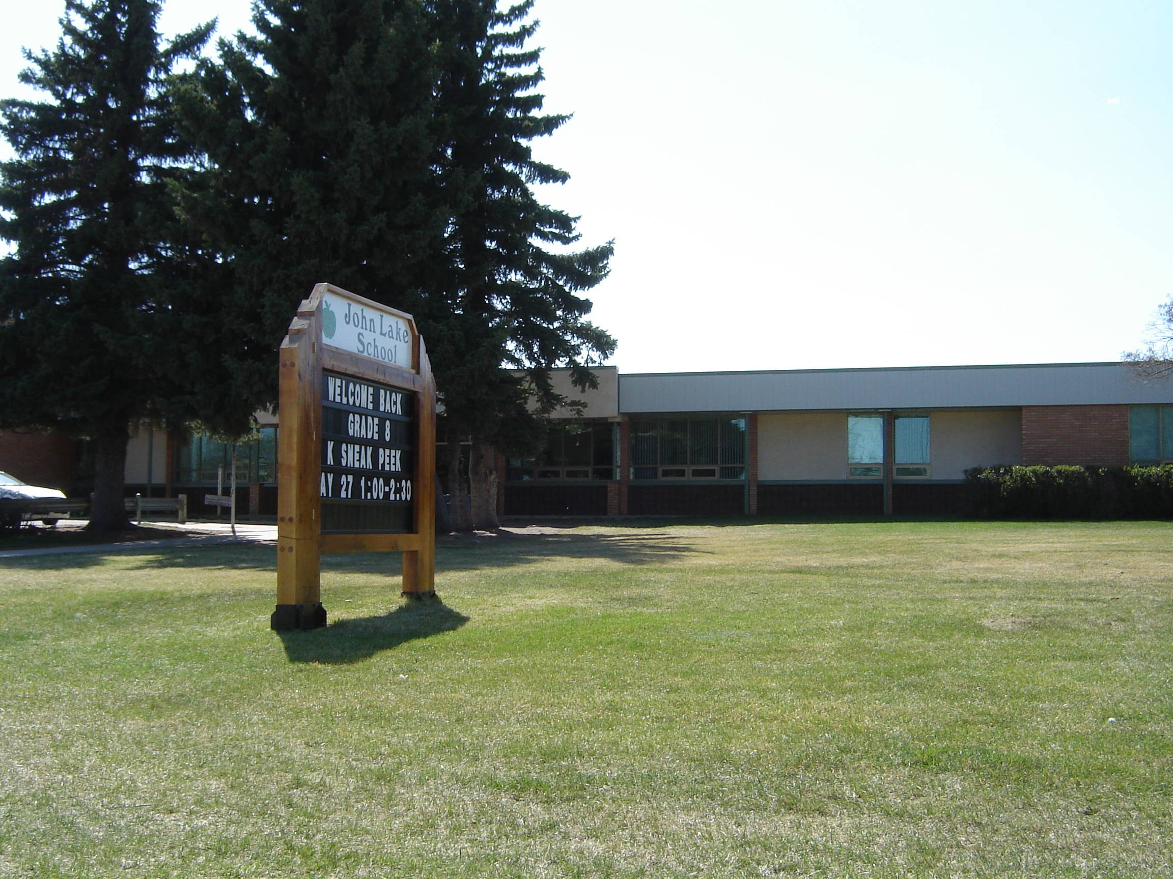
imagesize =
caption = John Lake School
location = Avalon subdivision
streetaddress = 2606 Broadway
region = Nutana SDA
city =Saskatoon
province =Saskatchewan
county =Canada
postalcode = S7J 0Z6
coordinates =
schoolnumber =
schoolboard =
district =Saskatoon Public School Division
authority =
religion =
denomination =
oversight =
affiliation =
superintendent =
trustee =
founder =
specialist =
president =
head of school =
headteacher =
head_label =
head =
chairperson =
principal = Loretta Metzger
viceprincipal = David Crowell
dean =
administrator =
rector =
chaplain =
director =
custodian = Mr. Gordon Arnott
Mr. Raymond Fritsch
staff =
ranking =
bar pass rate =
faculty =
teaching_staff =
roll =
MOE =
ceeb =
school code =
LEA =
ofsted =
testaverage =
testname =
national_ranking =
classes = elementary
classes offered = Kindergarden to Grade 8
avg_class_size =
ratio =
SAT =
ACT =
graduates =
year =
gender =
lower_age =
upper_age =
houses =
schooltype = public
fundingtype =
type = elementary
system =
fees =
tuition =
revenue =
endowment =
budget =
enrolment =
products =
grades =
age range =
medium =
language =
classrooms =
campus =
campus size =
campus type =
Hours_in_Day =
athletics =
conference =
slogan =
song =
fightsong =
motto =
accreditation =
rival =
mascot =
mascot
sports =
patron =
team_name =
nickname =
school_colours =
school_colors =
yearbook =
publication =
newspaper =
opened =
established =
founded =
status =
closed =
students =
sixth_form_students =
pupils =
alumni =
nobel_laureates =
enrollment =
gradeK =
grade1 =
grade2 =
grade3 =
grade4 =
grade5 =
grade6 =
grade7 =
grade8 =
grade9 =
grade10 =
grade11 =
grade12 =
grade13 =
other_grade_label =
other =
communities =
feeders =
free_label =
free_text =
free_label1 =
free_text1 =
free_label2 =
free_text2 =
free_label3 =
free_text3 =
free_label4 =
free_text4 =
free_label5 =
free_text5 =
footnotes =
picture =
homepage = [http://www.spsd.sk.ca/index.aspx?section=schools&page=JLS John Lake School]Lifestyle
The Avalon community association puts together a wide variety of programs for its residents varying from seasonal sports and activities, through to adult and toddler group activities. [ [http://www.city.saskatoon.sk.ca/org/leisure/community_associations/your_association.asp?ca=2 City of Saskatoon · Departments · Community Services · Community ...] URL accessed March 21, 2007]
References
Location
Coordinates: 52°5'42"N 106°39'30"W
[ [http://www.city.saskatoon.sk.ca/org/city_planning/resources/publications/Future_Growth_and_Development_of_Saskatoon.pdf Selling an Idea or a Product] URL accessed January 27, 2007]North: Queen Elizabeth West: Exhibition Avalon East: Adelaide/Churchill South: CN Industrial External links
* [http://www.saskatoon.ca/org/city_planning/zam_maps/index.asp City of Saskatoon City of Saskatoon · Departments · Community Services · City Planning · ZAM Maps]
* [http://www.saskatoon.ca/org/city_planning/resources/populace_newsletter/Populace_Spring_2006.pdf Populace Spring 2006]
Wikimedia Foundation. 2010.