- C.N. Industrial, Saskatoon
Infobox Settlement
official_name = C.N. Industrial Area
other_name =
native_name =
nickname =
settlement_type = Neighborhood
motto =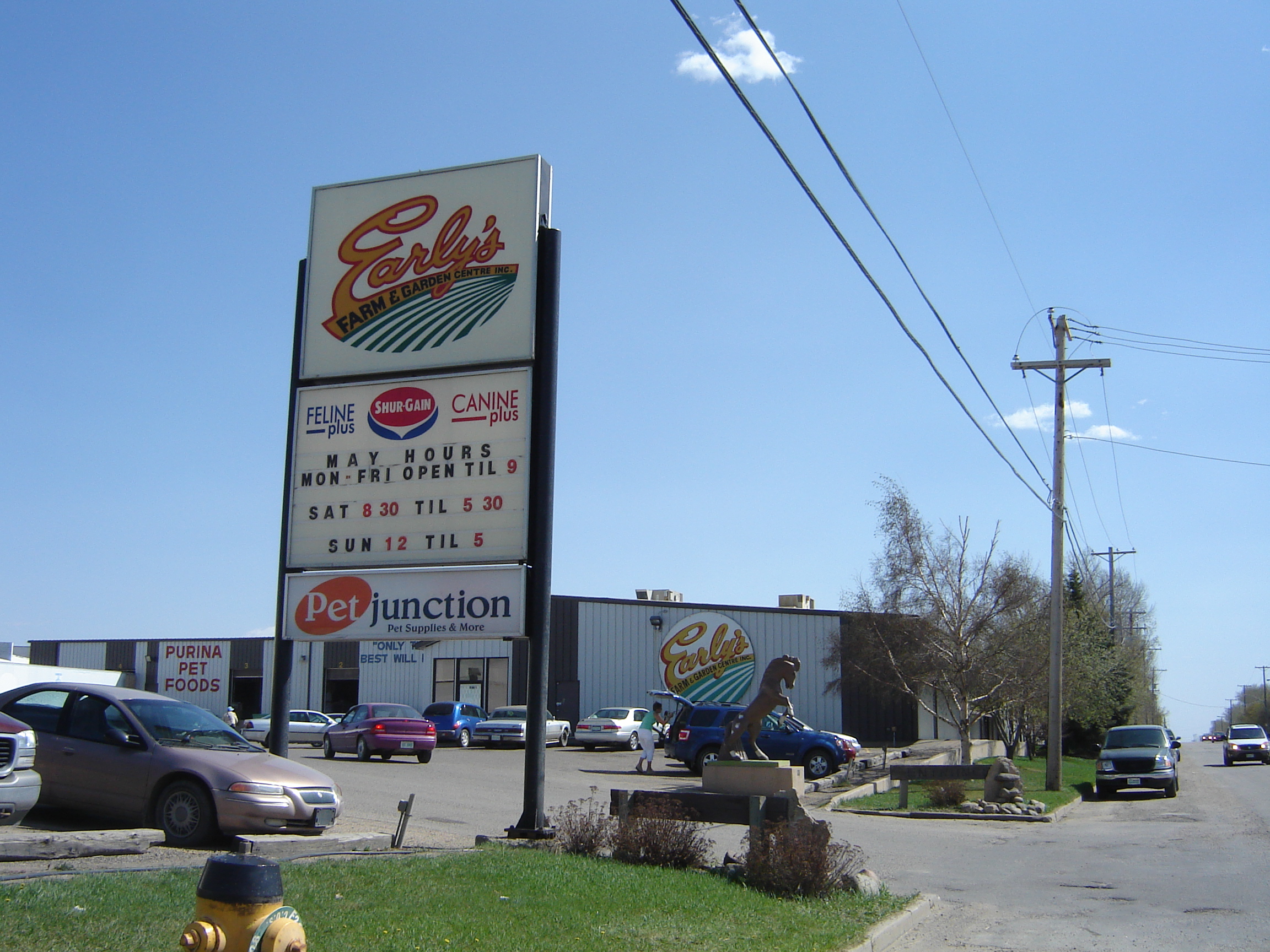
imagesize =
image_caption = Early's Seed and Feed
flag_size =
image_
seal_size =
image_shield =
shield_size =
city_logo =
citylogo_size =
mapsize =
map_caption =
mapsize1 =
map_caption1 =
image_dot_
dot_mapsize =
dot_map_caption =
dot_x = |dot_y =
pushpin_
pushpin_label_position =
pushpin_map_caption =
pushpin_mapsize =
subdivision_type = Country
subdivision_name = CAN
subdivision_type1 = Province
subdivision_name1 = SK
subdivision_type2 = City
subdivision_name2 = Saskatoon
subdivision_type3 = Suburban Development Area
subdivision_name3 = Nutana
subdivision_type4 = Neighbourhood
subdivision_name4 = C.N. Industrial Area
government_footnotes =
government_type = Municipal (Ward 6)
leader_title = Administrative body
leader_name =Saskatoon City Council
leader_title1 = Councillor
leader_name1 = Charlie Clark
leader_title2 =
leader_name2 =
leader_title3 =
leader_name3 =
leader_title4 =
leader_name4 =
established_title = Annexed
established_date = 1960-1964
established_title2 = CN Industrial 2 Annexed
established_date2 = 1965-1969
established_title3 =
established_date3 =
area_magnitude =
unit_pref =
area_footnotes =
area_total_km2 =
area_land_km2 =
area_water_km2 =
area_total_sq_mi =
area_land_sq_mi =
area_water_sq_mi =
area_water_percent =
area_urban_km2 =
area_urban_sq_mi =
area_metro_km2 =
area_metro_sq_mi =
population_as_of = 2006
population_footnotes =
population_note =
population_total =
population_density_km2 =
population_density_sq_mi =
population_metro =
population_density_metro_km2 =
population_density_metro_sq_mi =
population_urban =
population_density_urban_km2 =
population_density_urban_sq_mi =
population_blank1_title = Average Income
population_blank1 = $
population_density_blank1_km2 =
population_density_blank1_sq_mi =
timezone = UTC
utc_offset = -6
timezone_DST =
utc_offset_DST =
latd=52 |latm= 5|lats=21|latNS=N
longd= 106|longm= 39|longs= 49|longEW=W
elevation_footnotes =
elevation_m =
elevation_ft =
postal_code_type =
postal_code =
area_code =
blank_name =
blank_info =
blank1_name =
blank1_info =
website =
footnotes = City of Saskatoon NeighborhoodsThe CN industrial Area is the industrial park located in southernSaskatoon . It is a part of the Nutana Suburban Development Area. A new auto mall has been constructed to the east in Stonebridge. This industrial park was established with the Grand Trunk Pacific Railway crossing theSouth Saskatchewan River . Idylwyld Drive provides a concurrency for TransCanada Highway and Sk Hwy 5 next to this park providing a perimeter route around the city of Saskatoon and access to major trucking routes.Geography
The CN Industrial is bordered to the south by
The Willows, Saskatoon , on the north by Idylwyld Drive and Avalon. Stonbridge is to the east, and Sk Hwy 219 to the west. Diefenbaker management area and the South Saskatchewan River are west of the CN Industrial area. The auto mall is a newer part of the CN Industrial area east of Portage Avenue to Clarence Avenue. There is a new interchange at Clarence Avenue and Idylwyld Drive to provide easier access to the area.The
Grand Trunk Bridge (Saskatoon) or CN Bridge crosses theSouth Saskatchewan River between the Queen Elizabeth Power Station on the upstream (west) side and Diefenbaker Park on the downstream (east) side. The train bridge commenced construction work in 1906 with rail line service beginning onSeptember 21 ,1908 . [cite web
last =
first =
authorlink =
coauthors =
title = The Wonder City
work =
publisher =
date =
url = http://olc.spsd.sk.ca/de/stoon100pics/photogallery/bridges.htm
format =
doi =
accessdate =2008-05-12 ] The proposed south vehicular bridge will travel from Clarence Avenue to an area near 11th Street on the west side of Saskatoon. The south bridge is planned to span north and parallel to the Brand Trunk Bridge.cite web
last =
first =
authorlink =
coauthors =
title = City of Saskatoon · Departments · Infrastructure Services ...
work =
publisher =
date =
url = http://www.city.saskatoon.sk.ca/org/municipal_engineering/river_crossings/index.asp
format =
doi =
accessdate = 2008-05-12]Economy
The major employers in this area are Westfair Foods, Early Seed and Feed, Roadex Services, Ltd., N. Yanke Transfer, Ltd., and Speedway Moving & Storage. The Saskatoon Auto Mall includes Saturn, Mini, Sherwood, Chevrolet, BMW auto dealers which have relocated from 8th Street and Circle Drive to the auto mall. [cite web
last =
first =
authorlink =
coauthors =
title = Saskatoon Auto Mall - Used and New Cars, Trucks and RVs in Saskatoon, SK Canada
work =
publisher =
date =
url = http://www.saskatoonautomall.com/
format =
doi =
accessdate =2008-05-12 ]Future Plans
Future plans include the completion of Circle Drive with a south bridge. Infrastructure preparations will include a major interchanges at the C.N. Industrial Park north perimeter along Circle Drive.
As a result of the increased traffic south of Circle Drive, a new Clarence Avenue and Circle Drive interchange was constructed providing an arterial roadway overpass of Clarence Ave over Circle Drive. Construction began in 2006 was completed by the end of 2007. [cite web
last =
first =
authorlink =
coauthors =
title =City of Saskatoon · Departments · Infrastructure Services ...
work =
publisher =
date =
url =http://www.saskatoon.ca/org/municipal_engineering/construction/Clarence_Circle/index.asp
format =
doi =
accessdate = 2007-10-28 ]Location
Geographic Location (8-way)
Centre =C.N. Industrial
North = Avalon
Northeast =
East = Stonebridge
Southeast =
South = The Willows
Southwest = Hamlet of Furdale
West = Saskatoon Golf and Country Club
Northwest =Diefenbaker Management Area

References
External links
* [http://www.woutersrealty.com/Neighbourhood_Profiles/page_1239111.html Neighborhood Profiles]
* [http://www.scs.sk.ca/saskatoon100/students/funstuff/wordsearches/neighbourhoods/neighbourhoods.html Saskatoon Neighborhoods Word Search Puzzle]
* [http://www.city.saskatoon.sk.ca/org/leisure/community_associations/your_association.asp?ca=37 City of Saskatoon · Departments · Community Services · Community ... ]
* [http://www.saskatoon.ca/org/city_planning/zam_maps/index.asp City of Saskatoon City of Saskatoon · Departments · Community Services · City Planning · ZAM Maps]
* [http://www.saskatoon.ca/org/city_planning/resources/populace_newsletter/Populace_Spring_2006.pdf Populace Spring 2006]
Wikimedia Foundation. 2010.