- The Willows, Saskatoon
Infobox Settlement
official_name = The Willows
other_name =
native_name =
nickname =
settlement_type = Subdivision or Neighborhood
motto =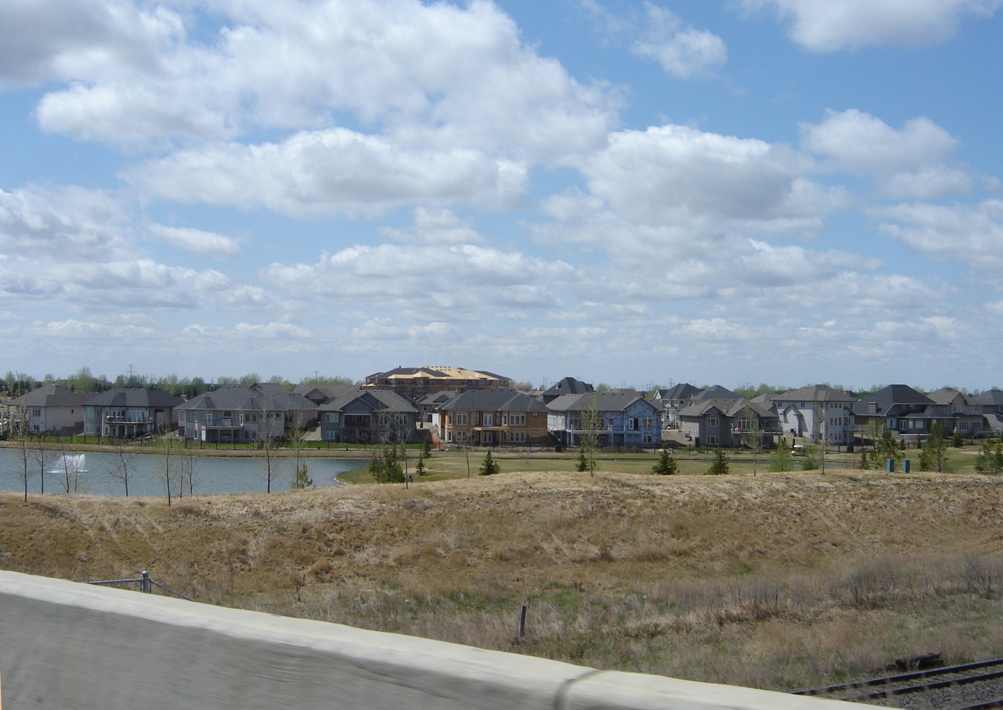
imagesize =
image_caption = The Willows skyline
flag_size =
image_
seal_size =
image_shield =
shield_size =
city_logo =
citylogo_size =
mapsize =
map_caption =
mapsize1 =
map_caption1 =
image_dot_
dot_mapsize =
dot_map_caption =
dot_x = |dot_y =
pushpin_
pushpin_label_position =
pushpin_map_caption =
pushpin_mapsize =
subdivision_type = Country
subdivision_name = Canada
subdivision_type1 = Province
subdivision_name1 =Saskatchewan
subdivision_type2 = City
subdivision_name2 =Saskatoon
subdivision_type3 = Suburban Development Area
subdivision_name3 = Nutana
subdivision_type4 = Residential Neighbourhood
subdivision_name4 = The Willows
government_footnotes = Neighborhood Association
government_type = Municipal Ward
leader_title = Alderman or councillor
leader_name =
leader_title1 =
leader_name1 =
leader_title2 =
leader_name2 =
leader_title3 =
leader_name3 =
leader_title4 =
leader_name4 =
established_title = Annexed
established_date =200-2004cite web
last =City Planning Branch, Community Services Department
first =City of Saskatoon
authorlink =
coauthors =
title = Populace Spring 2006
work =
publisher =
date =Volume 8, Issue 1 • Spring 2006
url =http://www.saskatoon.ca/org/city_planning/resources/populace_newsletter/Populace_Spring_2006.pdf
format =
doi =
accessdate = 2007-05-22 ]
established_title2 = Construction
established_date2 = 2004
established_title3 =
established_date3 =
area_magnitude =
unit_pref =
area_footnotes =
area_total_km2 =
area_land_km2 =
area_water_km2 =
area_total_sq_mi =
area_land_sq_mi =
area_water_sq_mi =
area_water_percent =
area_urban_km2 =
area_urban_sq_mi =
area_metro_km2 =
area_metro_sq_mi =
population_as_of = 2006
population_footnotes =
population_note =
population_total =
population_density_km2 =
population_density_sq_mi =
population_metro =
population_density_metro_km2 =
population_density_metro_sq_mi =
population_urban =
population_density_urban_km2 =
population_density_urban_sq_mi =
population_blank1_title =
population_blank1 =
population_density_blank1_km2 =
population_density_blank1_sq_mi =
timezone = UTC
utc_offset = -6
timezone_DST =
utc_offset_DST =
latd=52 |latm= 4|lats=39 |latNS=N
longd= 106|longm= 39|longs= 30|longEW=W
elevation_footnotes =
elevation_m =
elevation_ft =
postal_code_type =
postal_code =
area_code =
blank_name =
blank_info =
blank1_name =
blank1_info =
website =
footnotes = City of Saskatoon NeighborhoodsThe Willows Residential Community and Golf Club, is a residential community in the Nutana Suburban Development Area in the city of
Saskatoon ,Saskatchewan . The Willows is south of the Circle Drive which is concurrent withSaskatchewan Highway 16 . Its northern boundary is the CN Rail line and the former Cartwright Street right-of-way (the street was subsequently rerouted through the community as part of its development); to the east is Clarence Avenue and to the west is Lorne Avenue. The 36-hole Willows Golf & Country Club winds its way around the subdivision which when construction of homes began in 2004 became the city's first golf course community. [cite web
last =
first =
authorlink =
coauthors =
title =Selling an Idea or a Product
work =
publisher =
date =
url =http://www.city.saskatoon.sk.ca/org/city_planning/resources/publications/Future_Growth_and_Development_of_Saskatoon.pdf
format =
doi =
accessdate= 2007-10-28 ] Home construction began almost immediately after the land for the subdivision and the golf course was annexed from therural municipality ofCorman Park No. 344, Saskatchewan . The golf course, however, had been in operation for more than a decade before residential development began.Transportation
Access to The Willows is via Cartwright Street from Lorne or Clarence avenues. An overpass over the CN rail line was built on Clarence in the mid-2000s to facilitate access, and access to the area was further enhanced with the construction of the Clarence Avenue and Circle Drive interchange which was completed in 2007. [cite web
last =
first =
authorlink =
coauthors =
title =City of Saskatoon · Departments · Infrastructure Services ...
work =
publisher =
date =
url =http://www.saskatoon.ca/org/municipal_engineering/construction/Clarence_Circle/index.asp
format =
doi =
accessdate = 2007-10-28 ]Government and politics
The Willows exists within the federal electoral district of Blackstrap. It is currently represented by
Lynne Yelich . [cite web
last =
first =
authorlink =
coauthors =
title =Voter Information Service -
work = Elections Canada
publisher =
date =
url = http://www.elections.ca/scripts/pss/InfovoteMain_ne.aspx?L=e&ED=47011&EV=99&EV_TYPE=6&PC=S7K6N9&Prov=&ProvID=&MapID=&QID=-1&PageID=21&TPageID=
format =
doi =
accessdate = 2008-08-261]Provincially, the area is within the constituency of
Saskatoon Southeast . It is currently represented by the HonourableDon Morgan . [cite web
last =
first =
authorlink =
coauthors =
title =Provincial Constituency Boundaries: City of Saskatoon
work = Elections Saskatchewan
publisher =
date =
url = http://www.elections.sk.ca/constituency.php?cID=48&page=mla-1&PageID=21&TPageID=
format =
doi =
accessdate = 2008-08-261] [cite web
last =
first =
authorlink =
coauthors =
title =CTI
work =
publisher =
date =
url = http://www.textiles.ca/eng/IssPolContacts/7601.cfm
format =
doi =
accessdate = 2008-08-261]In Saskatoon's non-partisan municipal politics, The Willows lies within ward 7. It is currently represented by Bob Pringle. [cite web
last =
first =
authorlink =
coauthors =
title =City of Saskatoon · City Council · Ward Councillors · Ward 7 - Councillor Bob Pringle
work =
publisher =
date =
url = http://www.briarwoodca.com/
format =
doi =
accessdate = 2008-08-261] Due to population rise since the 2006 census, the city wards are being remapped. Quotation|She's asking the province to allow Saskatoon to use other population estimates in drawing ward boundaries to capture residential development thats happened since 2006, particularly in Stonebridge, the Willows, and Hampton Village.|Janice Mann City clerk, and municipal wards commission. [Citation
last = Nickel
first = Rod
author-link =
last2 =
first2 =
author2-link =
title = City wards being remapped East-side neighborhoods show population growth - Man asking province to allow city to use other estimates
newspaper =The StarPhoenix
pages = Front Page
year = 2008
date = Tuesday, August 26, 2008
url = http://www.canada.com/saskatoonstarphoenix/]Layout
The roads are laid out in a court system styling. As of April 2008 only Cartwright Street and Cartwright Terrace had been assigned names. Future plans for the community show a further residential development on the west side of the golf course, accessed only from Lorne Avenue. [cite web
last =
first =
authorlink =
coauthors =
title =City of Saskatoon City of Saskatoon · Departments · Community Services · City Planning · ZAM Maps
work =
publisher =
date =
url =http://www.saskatoon.ca/org/city_planning/zam_maps/031.pdf
format =
doi =
accessdate = 2007-10-28 ]hopping
The nearest shopping to The Willows is the Stonegate Shopping Centre with Wal-Mart as an anchor to the north east of The Willows subdivision.
Recreation facilities
The golf course itself is the major recreation facility in The Willows. The area also has the German Canadian Club Concordia, a convention and banquet faclity at the corner of Cartwright Street and Lorne Avenue, although the land owned by the club was not annexed by the city and remains in the Corman Park municipality. The Willows is also the closest Saskatoon community to the Dakota Dunes Casino a few miles south of Saskatoon on Lorne Avenue.
chools
The community's layout does not allow for the construction of schools.
Location
Coordinates: 52°4'39"N 106°39'30"W
[ [http://www.city.saskatoon.sk.ca/org/city_planning/resources/publications/Future_Growth_and_Development_of_Saskatoon.pdf Selling an Idea or a Product] URL accessed January 27, 2007]North: CN Industrial West: Corman Park No. 344, Saskatchewan The Willows East: Corman Park No. 344, Saskatchewan South: Corman Park No. 344, Saskatchewan References
External links
* [http://www.saskatoon.ca/org/city_planning/zam_maps/index.asp City of Saskatoon City of Saskatoon · Departments · Community Services · City Planning · ZAM Maps]
* [http://www.saskatoon.ca/org/city_planning/resources/populace_newsletter/Populace_Spring_2006.pdf Populace Spring 2006]
Wikimedia Foundation. 2010.