- U of S Lands South Management Area, Saskatoon
Infobox Settlement
official_name = U of S Lands South Management Area
other_name =
native_name =
nickname =
settlement_type = Neighborhood
motto =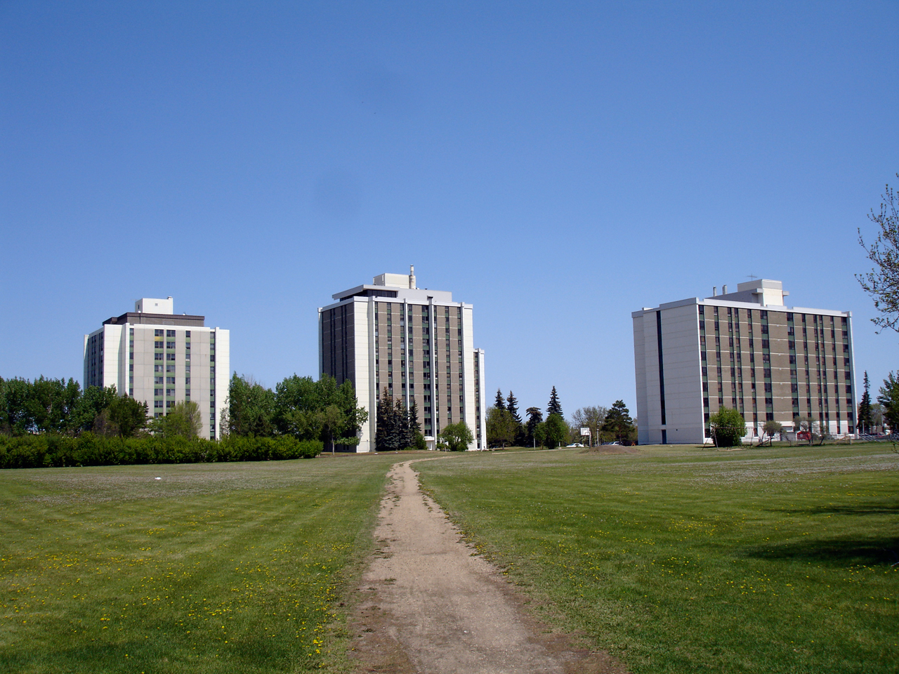
imagesize =
image_caption = McEwon Park residence buildings
flag_size =
image_
seal_size =
image_shield =
shield_size =
city_logo =
citylogo_size =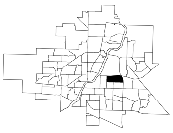
mapsize = 270px
map_caption = U of S Lands South Management Area location map
mapsize1 =
map_caption1 =
image_dot_
dot_mapsize =
dot_map_caption =
dot_x = |dot_y =
pushpin_
pushpin_label_position =
pushpin_map_caption =
pushpin_mapsize =
subdivision_type = Country
subdivision_name = CAN
subdivision_type1 = Province
subdivision_name1 = SK
subdivision_type2 = City
subdivision_name2 = Saskatoon
subdivision_type3 = Suburban Development Area
subdivision_name3 = Nutana
subdivision_type4 = Neighbourhood
subdivision_name4 = U of S Lands South Management Area
government_footnotes =
government_type = Municipal (Ward 8)
leader_title = Administrative body
leader_name =Saskatoon City Council
leader_title1 = Councillor
leader_name1 = Glen Penner
leader_title2 =
leader_name2 =
leader_title3 =
leader_name3 =
leader_title4 =
leader_name4 =
established_title = Annexed
established_date = 1955-1959
established_title2 = Construction
established_date2 = 1055-1959
established_title3 =
established_date3 =
area_magnitude =
unit_pref =
area_footnotes =
area_total_km2 = 1.67
area_land_km2 =
area_water_km2 =
area_total_sq_mi =
area_land_sq_mi =
area_water_sq_mi =
area_water_percent =
area_urban_km2 =
area_urban_sq_mi =
area_metro_km2 =
area_metro_sq_mi =
population_as_of = 2006
population_footnotes =
population_note =
population_total = 1,103
population_density_km2 =
population_density_sq_mi =
population_metro =
population_density_metro_km2 =
population_density_metro_sq_mi =
population_urban =
population_density_urban_km2 =
population_density_urban_sq_mi =
population_blank1_title = Average Income
population_blank1 = $36,760
population_density_blank1_km2 =
population_density_blank1_sq_mi =
timezone = UTC
utc_offset = -6
timezone_DST =
utc_offset_DST =
latd=52 |latm= 7|lats=30 |latNS=N
longd= 106|longm= 37|longs= 22|longEW=W
elevation_footnotes =
elevation_m =
elevation_ft =
postal_code_type =
postal_code =
area_code =
blank_name =
blank_info =
blank1_name =
blank1_info =
website =
footnotes = City of Saskatoon NeighborhoodsU of S Lands South Management Area is an area of and located in east-central
Saskatoon ,Saskatchewan ,Canada . It is a categorized as a management area, as it lacks the residential, industrial or future development characteristics present in most neighbourhoods. The area is home to 1,103 residents living in residences belonging to theUniversity of Saskatchewan . The neighbourhood is considered a lower-income area, with an average family income of $36,760, an average dwelling value of $221,222 and a home ownership rate of 0.2%.cite web
last =
first =
authorlink =
coauthors =
title = U of S Lands South Management Area neighbourhood profile - 2006
work =
publisher = City of Saskatoon - City Planning Branch
date = 2006
url = http://www.saskatoon.ca//org/city_planning/resources/neighbourhood_demographics/neighbourhood_demographics/U%20of%20S%20Lands%20South%20MA.pdf
format =
doi =
accessdate = 2008-05-14 ]History
The land for the U of S Lands South Management Area was set aside for the
University of Saskatchewan upon its creation in 1907.cite web
last =
first =
authorlink =
coauthors =
title = Populace Spring 2006
work =
publisher = City of Saskatoon - City Planning Branch
date = 2006
url = http://www.saskatoon.ca/org/city_planning/resources/populace_newsletter/Populace_Spring_2006.pdf
format =
doi =
accessdate = October 15, 2007] In 1931, the provincially-funded School for the Deaf was opened. The building was renamed the R.J.D. Williams Buidling in 1982, after the school's longtime Dean of Residence. When deaf children were integrated into the regular school system in 1990, the School for the Deaf closed and the building was sold to the university. [cite web
last =
first =
authorlink =
title = R.J. Williams Building
work =
publisher = University of Saskatchewan
date =
url = http://scaa.usask.ca/gallery/uofs_buildings/home_williams.htm
format =
doi =
accessdate = 2008-05-18 ]Griffiths Stadium is a football stadium belonging to the University of Saskatchewan. The original stadium was located on the corner of Cumberland Avenue and College Drive, and opened in 1936. The desire for a new stadium and the widening of College Drive led to the construction of the current stadium a few hundred metres east of the original site. It opened on June 23, 1967. Improvements were made to the stadium prior to the 1989Jeux Canada Games , and again in 2006 prior to hosting theVanier Cup . [cite web
last =
first =
authorlink =
title = Griffiths Stadium
work =
publisher = University of Saskatchewan
date =
url = http://scaa.usask.ca/gallery/uofs_buildings/home_griffiths.htm
format =
doi =
accessdate = 2008-05-18 ]The McEwon Park residence complex was opened on October 2, 1970. Three high-rise buildings were initially built: 14-storey Seager Wheeler Hall housed single students living in small groups; 11-storey Assiniboine Hall housed married students without children and single students with shared accommodation; and 9-storey Souris Hall housed married students with children. A fourth tower, Wollaston Hall, was added in 1976. [cite web
last =
first =
authorlink =
title = McEwon Park Residence Complex
work =
publisher = University of Saskatchewan
date =
url = http://scaa.usask.ca/gallery/uofs_buildings/home_mceown.htm
format =
doi =
accessdate = 2008-05-18 ]The Saskatoon Field House, a city-operated athletic facility, was officially opened on December 28, 1981. [cite web
last =
first =
authorlink =
title = City of Saskatoon - Municipal Manual 2007
work =
publisher = City of Saskatoon - City Clerk's Office
date = 2007
url = http://www.city.saskatoon.sk.ca/org/clerks_office/municipal_manual.pdf
format =
doi =
accessdate = 2008-05-18 ]Stadium Parkade was build overtop of the former "Z lot" parking area to relieve parking pressure at the university campus. It was completed in 2004. [cite web
last = Kerr
first = Don
authorlink =
title = A Building Boom
work = Green and White
publisher = University of Saskatchewan
date = Winter 2007
url = http://www.usask.ca/alumni/alumnisite/publications/green_white/issues/spring2007/feature02.php
format =
doi =
accessdate = 2008-05-18 ]Government and politics
The U of S Lands South Management Area exists within the federal electoral district of
Saskatoon-Humboldt . It is currently represented byBrad Trost of theConservative Party of Canada , first elected in 2004 and re-elected in 2006.Provincially, the U of S Lands South Management Area lies within the constituency of
Saskatoon Sutherland . It is currently represented by Joceline Schriemer of theSaskatchewan Party , first elected in 2007.In Saskatoon's non-partisan municipal politics, the U of S Lands South Management Area lies within ward 6. It is currently represented by Councillor Charlie Clark, first elected in 2006.
Institutions
Education
The University of Saskatchewan's Centre for Continuing and Distance Education (formerly the Extension Division) is located in the R.J.D. Williams Building. [cite web
last =
first =
authorlink =
title = Centre for Continuing & Distance Education
work =
publisher = University of Saskatchewan
date =
url = http://www.extension.usask.ca/
format =
doi =
accessdate = 2008-05-18 ]Parks and recreation
There are no city-administered parks within the U of S Lands South MA. However, much of the west section surrounding the McEwon Park residences and Griffiths Stadium is green space and is therefore utilized in the same manner as a park.
The Saskatoon Field House is a multi-use sports facility. It features an indoor track; indoor courts for tennis, badminton, soccer and basketball; a weight room; fitness/dance studios; and multipurpose rooms for meetings. [cite web
last =
first =
authorlink =
title = Saskatoon Field House
work =
publisher = City of Saskatoon - Leisure Services and Community Development
date =
url = http://www.saskatoon.ca/org/leisure/facilities/sfh.asp
format =
doi =
accessdate = 2008-05-18 ]Griffiths Stadium is home to the University of Saskatchewan's football team, the Huskies.
Commercial
There is no commercial development in this area. The closest businesses are in the northwest corner of the adjacent Varsity View neighbourhood. However, there are 3 home-based businesses. [cite web
last =
first =
authorlink =
title = Business Profile 2007
work =
publisher = City of Saskatoon - Community Services Department - Development Services Branch
date = 2007
url = http://www.saskatoon.ca/org/development/resources/business_profile_newsletters/newsletter_year2007.pdf
format =
doi =
accessdate = 2008-06-04 ]Location
U of S Lands South Management Area is located within the University Heights Suburban Development Area. It is bounded by College Drive to the north, 14th Street to the south,
Circle Drive to the east, and Cumberland Avenue to the west. The only other road of note is Preston Avenue, which roughly bisects the area.Geographic Location (8-way)
Centre = U of S Lands South Management Area
North = University of Saskatchewan MA
Northeast = Sutherland
East = College Park
Southeast = College Park
South = Grosvenor Park - Greystone Heights
Southwest = Varsity View
West = Varsity View
Northwest = University of Saskatchewan MA

References
External links
* [http://www.saskatoon.ca//org/city_planning/resources/neighbourhood_demographics/neighbourhood_demographics/U%20of%20S%20Lands%20South%20MA.pdf U of S Lands South Management Area neighbourhood profile - 2006]
* [http://www.saskatoon.ca/org/city_planning/zam_maps/index.asp City of Saskatoon City of Saskatoon · Departments · Community Services · City Planning · ZAM Maps]
* [http://www.saskatoon.ca/org/city_planning/resources/populace_newsletter/Populace_Spring_2006.pdf Populace Spring 2006]
Wikimedia Foundation. 2010.