- Directional drilling
-
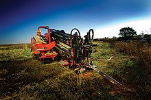 A horizontal directional drill in operation
Directional drilling (or slant drilling) is the practice of drilling non-vertical wells. It can be broken down into three main groups: Oilfield Directional Drilling, Utility Installation Directional Drilling (or H.D.D. or Horizontal Directional Drilling) Directional boring, and in-seam directional drilling to extract coal bed methane.
Contents
History
Many prerequisites enabled this suite of technologies to become productive. Probably, the first requirement was the realization that oil wells, or water wells, are not necessarily vertical. This realization was quite slow, and did not really grasp the attention of the oil industry until the late 1920s when there were several lawsuits alleging that wells drilled from a rig on one property had crossed the boundary and were penetrating a reservoir on an adjacent property. Initially, proxy evidence such as production changes in other wells was accepted, but such cases fueled the development of small diameter tools capable of surveying wells during drilling.
Measuring the inclination of a wellbore (its deviation from the vertical) is comparatively simple, requiring only a pendulum. Measuring the azimuth (direction with respect to the geographic grid in which the wellbore is running from the vertical), however, was more difficult. In certain circumstances, magnetic fields could be used, but could be influenced by metalwork used inside wellbores, as well as the metalwork used in drilling equipment. The next advance was in the modification of small gyroscopic compasses by the Sperry Corporation, which was making similar compasses for aeronautical navigation. Sperry did this under contract to Sun Oil (which was involved in a lawsuit as described above), and a spin-off company "Sperry Sun" was formed, which brand continues to this day, absorbed into Halliburton. Three components are measured at any given point in a wellbore in order to determine its position: the depth of the point along the course of the borehole (measured depth), the inclination at the point, and the magnetic azimuth at the point. These three components combined are referred to as a "survey". A series of consecutive surveys are needed to track the progress and location of a wellbore. Many of the earliest innovations such as photographic single shot technology and crow's feet baffle plates for landing survey tools were developed by Robert Richardson, an independent directional driller who first drilled in the 1940s and was still working in 2008.[1]
Prior experience with rotary drilling had established several principles for the configuration of drilling equipment down hole ("Bottom Hole Assembly" or "BHA") that would be prone to "drilling crooked hole" (i.e., initial accidental deviations from the vertical would be increased). Counter-experience had also given early directional drillers ("DD's") principles of BHA design and drilling practice that would help bring a crooked hole nearer the vertical.
In 1934, H. John Eastman of Long Beach, California, became a pioneer in directional drilling when he and George Failing of Enid, Oklahoma, saved the Conroe, Texas, oil field. Failing had recently patented a portable drilling truck. He had started his company in 1931 when he mated a drilling rig to a truck and a power take-off assembly. The innovation allowed rapid drilling of a series of slanted wells. This capacity to quickly drill multiple relief wells and relieve the enormous gas pressure was critical to extinguishing the Conroe fire. (E&P, "Making a hole was hard work," Kris Wells, American Oil & Gas Historical Society Contributing Editor, Nov. 1, 2006 and "Technology and the Conroe Crater"). In a May, 1934, Popular Science Monthly article, it was stated that "Only a handfull of men in the world have the strange power to make a bit rotating a mile below ground at the end of a steel drill pipe, snake its way in a curve or around a dog leg angle, to reach a desired object." Eastman Whipstock, Inc., would become the world's largest directional company in 1973.
Combined, these survey tools and BHA designs made directional drilling possible, but it was perceived as arcane. The next major advance was in the 1970s, when downhole drilling motors (aka mud motors, driven by the hydraulic power of drilling mud circulated down the drill string) became common. These allowed the bit to be rotated on the bottom of the hole, while most of the drill pipe was held stationary. A piece of bent pipe (a "bent sub") between the stationary drill pipe and the top of the motor allowed the direction of the wellbore to be changed without needing to pull all the drill pipe out and place another whipstock. Coupled with the development of Measurement While Drilling tools (using mud pulse telemetry or EM telemetry, which allows tools down hole to send directional data back to the surface without disturbing drilling operations), directional drilling became easier. Certain profiles could not be drilled without the drill string rotating at all times.
Benefits
Wells are drilled directionally for several purposes:
- Increasing the exposed section length through the reservoir by drilling through the reservoir at an angle
- Drilling into the reservoir where vertical access is difficult or not possible. For instance an oilfield under a town, under a lake, or underneath a difficult to drill formation
- Allowing more wellheads to be grouped together on one surface location can allow fewer rig moves, less surface area disturbance, and make it easier and cheaper to complete and produce the wells. For instance, on an oil platform or jacket offshore, 40 or more wells can be grouped together. The wells will fan out from the platform into the reservoir(s) below. This concept is being applied to land wells, allowing multiple subsurface locations to be reached from one pad, reducing costs.
- Drilling along the underside of a reservoir-constraining fault allows multiple productive sands to be completed at the highest stratigraphic points.
- Drilling a "relief well" to relieve the pressure of a well producing without restraint (a "blow out"). In this scenario, another well could be drilled starting at a safe distance away from the blow out, but intersecting the troubled wellbore. Then, heavy fluid (kill fluid) is pumped into the relief wellbore to suppress the high pressure in the original wellbore causing the blowout.
Most directional drillers are given a well path to follow that is predetermined by engineers and geologists before the drilling commences. When the directional driller starts the drilling process, periodic surveys are taken with a downhole instrument to provide survey data (inclination and azimuth) of the well bore.[2] These pictures are typically taken at intervals between 30–500 feet, with 90 feet common during active changes of angle or direction, and distances of 200–300 feet being typical while "drilling ahead" (not making active changes to angle and direction). During critical angle and direction changes, especially while using a downhole motor, an MWD (Measurement while drilling) tool will be added to the drill string to provide continuously updated measurements that may be used for (near) real-time adjustments.
These data indicate if the well is following the planned path and whether the orientation of the drilling assembly is causing the well to deviate as planned. Corrections are regularly made by techniques as simple as adjusting rotation speed or the drill string weight (weight on bottom) and stiffness, as well as more complicated and time consuming methods, such as introducing a downhole motor. Such pictures, or surveys, are plotted and maintained as an engineering and legal record describing the path of the well bore. The survey pictures taken while drilling are typically confirmed by a later survey in full of the borehole, typically using a "multi-shot camera" device.
The multi-shot camera advances the film at time intervals so that by dropping the camera instrument in a sealed tubular housing inside the drilling string (down to just above the drilling bit) and then withdrawing the drill string at time intervals, the well may be fully surveyed at regular depth intervals (approximately every 90 feet being common, the typical length of 2 or 3 joints of drill pipe, known as a stand, since most drilling rigs "stand back" the pipe withdrawn from the hole at such increments, known as "stands").
Drilling to targets far laterally from the surface location requires careful planning and design. The current record holders manage wells over 10 km (6.2 mi) away from the surface location at a true vertical depth (TVD) of only 1,600–2,600 m (5,200–8,500 ft).[3]
Disadvantages
Until the arrival of modern downhole motors and better tools to measure inclination and azimuth of the hole, directional drilling and horizontal drilling was much slower than vertical drilling due to the need to stop regularly and take time consuming surveys, and due to slower progress in drilling itself (lower rate of penetration). These disadvantages have shrunk over time as downhole motors became more efficient and semi-continuous surveying became possible.
What remains is a difference in operating costs: for wells with an inclination of less than 40 degrees, tools to carry out adjustments or repair work can be lowered by gravity on cable into the hole. For higher inclinations, more expensive equipment has to be mobilized to push tools down the hole.
Another disadvantage of wells with a high inclination was that prevention of sand influx into the well was less reliable and needed higher effort. Again, this disadvantage has diminished such that, provided sand control is adequately planned, it is possible to carry it out reliably.
Stealing oil
In 1990, Iraq accused Kuwait of stealing Iraq's oil through slant drilling.[citation needed] The United Nations redrew the border after the 1991 Gulf war that liberated Kuwait from a seven-month Iraqi occupation under former leader Saddam Hussein. It placed 11 oil wells, some farms and an old naval base that used to be in Iraq on the Kuwaiti side.[4]
In the mid-twentieth century, a slant-drilling scandal occurred in the huge East Texas Oil Field.[5]
See also
- Geosteering
- Mudlogger
- Measurement while drilling
- Logging while drilling
- Directional boring
- Mud motor
- Rotary steerable system
- Devico AS
References
- ^ JPT, vol 17, issue 4, p.32
- ^ "Glossary of geo-steering terms". http://chinookconsulting.ca/News/Directional-drilling-glossary.html. Retrieved 2010-09-05.
- ^ Gulf Times Website article "Maersk drills longest well at Al Shaheen"
- ^ AP News at ABC Inc., WABC-TV/DT New York News website article Iraq to Reopen Embassy in Kuwait published September 04, 2005
- ^ "East Texas Oilfield," Handbook of Texas Online
External links
- "Slanted Oil Wells, Work New Marvels" Popular Science, May 1934, early article on the drilling technology
- "Technology and the Conroe Crater" American Oil & Gas Historical Society
- Short video from American Petroleum Institute explaining horizontal drilling for gas extraction from oil shale.
- A video depicting horizontal shale drilling can be seen here.
Shale gas · Shale gas by country Geological formations Alum · Antrim · Barnett · Conasauga · Haynesville · Horn River · Marcellus · Montney · Muskwa · New Albany · UticaTechnology Geosteering · Directional drilling · Hydraulic fracturing · Logging while drilling · Measurement while drillingCategories:- Drilling technology
- Petroleum
- Engineering vehicles

Wikimedia Foundation. 2010.