- Shire of Chinchilla
-
Shire of Chinchilla
Queensland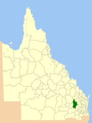
Location within QueenslandPopulation: 5,942(2006 census)[1] Established: 1912 Area: 8700.3 km² (3,359.2 sq mi) Council Seat: Chinchilla Region: Darling Downs 
LGAs around Shire of Chinchilla: Taroom Eidsvold Mundubbera Murilla Shire of Chinchilla Wondai, Kingaroy Tara Tara Wambo The Shire of Chinchilla was a Local Government Area located in the Darling Downs region of Queensland, Australia. The shire, administered from the town of Chinchilla, covered an area of 8,700.3 square kilometres (3,359.2 sq mi), and existed as a local government entity from 1912 until 2008, when it amalgamated with the Town of Dalby and the Shires of Murilla, Tara and Wambo and the southern part of Taroom to form the Western Downs Region.
The economy of the area is largely reliant on primary production. Agriculture is the mainstay of the community, with beef and pork production, wool growing, and horticulture traditionally underwriting the local economy.
Contents
History
The Shire of Chinchilla was established on 12 January 1912 by severance from the Shire of Wambo.
On 15 March 2008, under the Local Government (Reform Implementation) Act 2007 passed by the Parliament of Queensland on 10 August 2007, the Shire of Chinchilla merged with the Town of Dalby and the Shires of Murilla, Tara and Wambo and the southern part of Taroom to form the Western Downs Region.
Towns and localities
- Chinchilla
- Boonarga
- Brigalow
- Canaga
- Goombi
- Kogan
- Rywung
- Wychie
Population
Year Population 1921 3,103 1933 3,936 1947 5,203 1954 6,021 1961 6,063 1966 6,093 1971 5,524 1976 5,319 1981 5,387 1986 5,534 1991 5,406 1996 5,590 2001 5,609 2006 5,942 References
- ^ Australian Bureau of Statistics (25 October 2007). "Chinchilla (S) (Local Government Area)". 2006 Census QuickStats. http://www.censusdata.abs.gov.au/ABSNavigation/prenav/LocationSearch?collection=Census&period=2006&areacode=LGA32350&producttype=QuickStats&breadcrumb=PL&action=401. Retrieved 15 June 2011.
External links
Coordinates: 26°44′33.5″S 150°37′24″E / 26.742639°S 150.62333°E
Categories:- Populated places established in 1912
- 1912 establishments in Australia
- Former Local Government Areas of Queensland
- Darling Downs
- Queensland geography stubs

Wikimedia Foundation. 2010.