- Shire of Gayndah
Infobox Australian Place | type = lga
name = Shire of Gayndah
state = qld
imagesize= 135
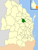
caption = Location withinQueensland
pop = 2,911
pop_footnotes = (2006 census) [Census 2006 AUS | id = LGA33300 | name = Gayndah (S) (Local Government Area) | accessdate=2008-03-18|quick = on]
area = 2709.3
est = 1866
seat = Gayndah
region =Wide Bay-Burnett
logosize = 200
url = http://www.gayndah.qld.gov.au/
near-nw = Eisdvold
near-n = Perry
near-ne = Biggenden
near-w = Mundubbera
near-e = Biggenden
near-sw = Wondai
near-s = Kilkivan
near-se = BiggendenThe Shire of Gayndah was a Local Government Area located in the northern catchment of the
Burnett River ,Queensland ,Australia . The shire covered an area of convert|2709.3|km2|sqmi|1, and existed as a local government entity from 1866 until 2008, when it amalgamated with several other councils in the region to become theNorth Burnett Regional Council .Major activities in the shire included citrus production, beef and timber.
History
The first local government in the area was the Gayndah Municipal Council, serving the town of Gayndah, which was created on 28 November 1866 under the "Municipal Corporations Act 1864". Under the "Divisional Boards Act 1879", the Rawbelle Division was created on 11 November 1879 to serve the surrounding rural area.
On 31 March 1903, following the enactment of the "Local Authorities Act 1902", Gayndah became a Town and Rawbelle a Shire. The Shire was renamed Gayndah on 17 March 1923, and on 24 May 1924 the Town Council was amalgamated into the Shire.
On 15 March 2008, under the "Local Government (Reform Implementation) Act 2007" passed by the
Parliament of Queensland on 10 August 2007, the Shire of Biggenden merged with the Shires of Eidsvold, Biggenden, Monto, Mundubbera and Perry to form theNorth Burnett Regional Council .Towns and Localities
* Gayndah
* Ban Ban Springs
* Binjour
* Byrnestown
* Gooroolba
* Ideraway
* WetheronPopulation
References
Wikimedia Foundation. 2010.