- Shire of Murilla
-
Shire of Murilla
Queensland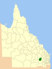
Location within QueenslandPopulation: 2,687(2006 census)[1] Established: 1879 Area: 6075.8 km² (2,345.9 sq mi) Council Seat: Miles Region: Darling Downs 
LGAs around Shire of Murilla: Bendemere Taroom Chinchilla Bendemere Shire of Murilla Chinchilla Warroo Tara Tara The Shire of Murilla was a Local Government Area located in the Darling Downs region of Queensland, Australia. The shire, administered from the town of Miles, covered an area of 6,075.8 square kilometres (2,345.9 sq mi), and existed as a local government entity from 1879 until 2008, when it amalgamated with the Town of Dalby and the Shires of Chinchilla, Tara and Wambo and the southern part of Taroom to form the Western Downs Region.
Contents
History
Murilla Division was created on 11 November 1879 as one of 74 divisions around Queensland under the Divisional Boards Act 1879. With the passage of the Local Authorities Act 1902, it became a shire on 31 March 1903.
On 15 March 2008, under the Local Government (Reform Implementation) Act 2007 passed by the Parliament of Queensland on 10 August 2007, the Shire of Murilla merged with the Town of Dalby and the Shires of Chinchilla, Tara and Wambo and the southern part of Taroom to form the Western Downs Region.
Towns and localities
- Barramornie
- Bogandilla
- Drillham South
- Glenaubyn
- Hookswood
- Myall Park
- Moraby
- Nangram
- Pine Hills
- Sunnyside
- Yulabilla
Population
Year Population 1933 2,217 1947 2,493 1954 3,090 1961 3,599 1966 3,494 1971 3,239 1976 3,137 1981 3,007 1986 3,212 1991 2,919 1996 2,775 2001 2,687 2006 2,740 References
- ^ Australian Bureau of Statistics (25 October 2007). "Murilla (S) (Local Government Area)". 2006 Census QuickStats. http://www.censusdata.abs.gov.au/ABSNavigation/prenav/LocationSearch?collection=Census&period=2006&areacode=LGA35550&producttype=QuickStats&breadcrumb=PL&action=401. Retrieved 15 June 2011.
External links
Coordinates: 26°39′27.25″S 150°11′03.54″E / 26.6575694°S 150.1843167°E
Murilla Category:Darling Downs
Categories:- Populated places established in 1879
- 1879 establishments in Australia
- Queensland geography stubs

Wikimedia Foundation. 2010.