- City of Redcliffe
-
City of Redcliffe
Queensland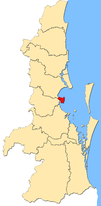
Map of Redcliffe City in South East QueenslandPopulation: 51,174 (2006 Census) • Density: 1343.1/km² (3,478.6/sq mi) Established: 1824 Postcode: 4019, 4020, 4021, 4022 Area: 38.1 km² (14.7 sq mi) Mayor: Cr Allan Sutherland Location: 23 km (14 mi) from Brisbane CBD State District: Redcliffe, Murrumba Federal Division: Petrie 
LGAs around City of Redcliffe: Caboolture Deception Bay Moreton Bay Pine Rivers City of Redcliffe Moreton Bay Brisbane Bramble Bay Moreton Bay City of Redcliffe is a defunct Local Government Area in South East Queensland, Australia. It is in the northern part of the County of Stanley. The council covers the suburbs of Clontarf, Kippa-Ring, Margate, Redcliffe, Rothwell, Scarborough and Woody Point – a total area of 38.1 km² with a population of 51,174.[1]
For more details on this topic, see Redcliffe City, Queensland.Contents
Council structure
Elected representatives
The Redcliffe City Council consisted of one Mayor and seven Councillors. Not based on Divisions, the Mayor and Councillors represented the entire city, elected every four years by popular vote.
Council services
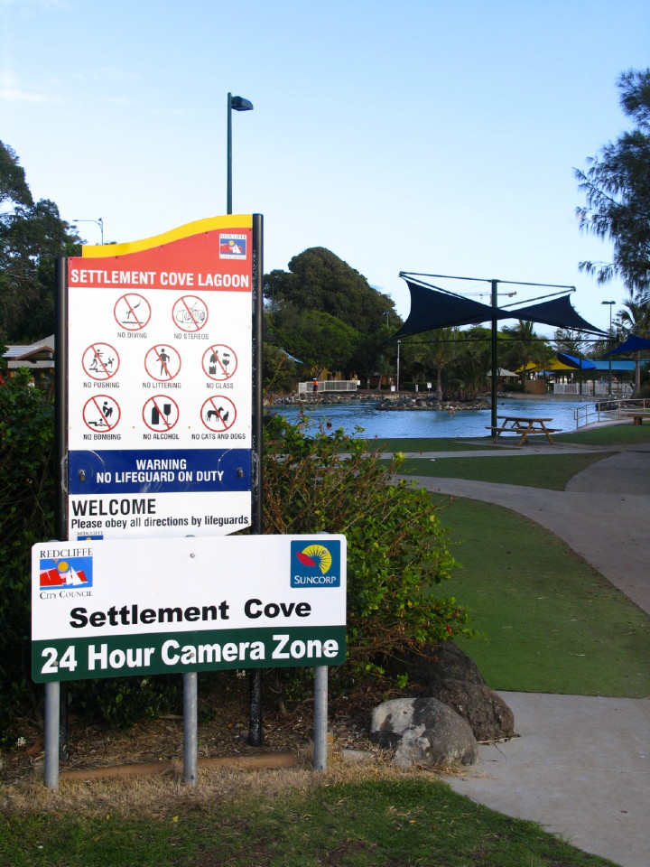
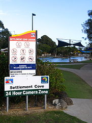 Settlement Cove in Redcliffe is provided by Redcliffe City Council
The Council had an annual budget of approximately $65 million (2005/06)[2] with works involving such areas as road maintenance and construction, community, cultural and youth activities, town planning and development, water and sewerage, waste management and recycling, maintenance of parks and public areas, library services, public health and animal control, and business and tourism support.
History of the council
Edmund MacDonnell was appointed as the initial chairman of the Redcliffe Divisional Board in 1888. The Redcliffe Shire Council replaced this board in 1902, then known as the Redcliffe Town Council in 1921. Finally, the Redcliffe City Council was established in 1959.
Future
On 27 June 2007 the Queensland Government's Local Government Reform Commission recommended the City of Redcliffe merge with neighbouring Pine Rivers and Shire of Caboolture, to become the Moreton Bay Regional Council.
Sister cities
Redcliffe City Council, on behalf of the City of Redcliffe, has two Sister City arrangements:[3]
 Japan – Sanyō-Onoda, Yamaguchi*
 Australia – Winton, Queensland*
- Sister City arrangements in doubt under Moreton Bay Regional Council.
Surrounding local governments
Redcliffe is immediately north of Brisbane's area, connected from Clontarf to Brighton via the historic Hornibrook Bridge and Houghton Highway. Shire of Pine Rivers is to the south-west of the peninsula, and Shire of Caboolture to the north-west.
References
- ^ Australian Bureau of Statistics (25 October 2007). "Redcliffe (C) (Local Government Area)". 2006 Census QuickStats. http://www.censusdata.abs.gov.au/ABSNavigation/prenav/LocationSearch?collection=Census&period=2006&areacode=LGA36200&producttype=QuickStats&breadcrumb=PL&action=401. Retrieved 2007-08-03.
- ^ Redcliffe City Council (2006) (PDF). Redcliffe City Council Annual Report 2005/2006. http://www.redcliffe.qld.gov.au/Annual%20Report%202005%202006.pdf. Retrieved 2007-08-03.
- ^ "Council A-Z Services" (HTML). Redcliffe City Council. 2006. http://www.redcliffe.qld.gov.au/services.htm#S. Retrieved 2007-01-04.
External links
Local Government Areas in South East Queensland Brisbane · Gold Coast · Ipswich · Logan · Lockyer Valley · Moreton Bay · Redland · Scenic Rim · Somerset · Sunshine CoastLocal Government Areas of Queensland South East Brisbane · Gold Coast · Ipswich · Lockyer Valley · Logan · Moreton Bay · Redland · Scenic Rim · Somerset · Sunshine CoastWide Bay-Burnett Darling Downs Central Central Highlands · Gladstone · Isaac · Mackay · Rockhampton · WoorabindaNorth Far North Aurukun · Cairns · Cassowary Coast · Cook · Hopevale · Kowanyama · Lockhart River · Mapoon · Napranum · Northern Peninsula Area · Pormpuraaw · Tablelands · Torres · Torres Strait Islands · Weipa · Wujal Wujal · YarrabahNorth West Central West South West Coordinates: 27°13′47.06″S 153°06′29.71″E / 27.2297389°S 153.1082528°E
Categories:- Populated places established in 1824
- 1824 establishments in Australia
- Former Local Government Areas of Queensland


Wikimedia Foundation. 2010.