- Nauset Light
-
Nauset Beach Light 
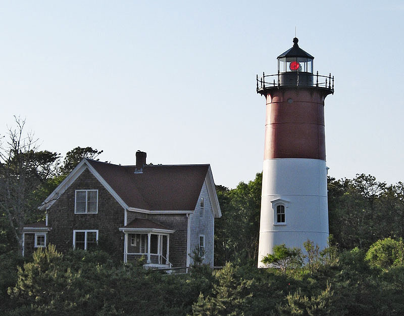
Nauset Light and lightkeeper's house Location Eastham, Massachusetts Year first constructed 1838 Year first lit 1877 (current tower in Chatham)
1923 (current tower here)Automated 1955 Deactivated 1996-97
now a Private AidFoundation Concrete Construction Cast iron with brick lining Tower shape Conical Markings / pattern Upper red, lower white with black lantern Height 48 feet (15 m) Focal height 120 feet (37 m) Original lens 4th order Fresnel lens Current lens Carlisle & Finch DB-224 Range White 24 nm, Red 20 nm Characteristic Alt white and red 10s Fog signal none Admiralty number J0396 ARLHS number USA-529 USCG number 1-510.1 Nauset Beach Light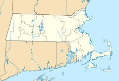

Location: Nauset Beach, Eastham, Massachusetts Coordinates: 41°51′36.5″N 69°57′10.6″W / 41.860139°N 69.952944°WCoordinates: 41°51′36.5″N 69°57′10.6″W / 41.860139°N 69.952944°W Area: 1 acre (0.40 ha) Built: 1875 Architectural style: Gothic Revival Governing body: U.S. Coast Guard MPS: Lighthouses of Massachusetts TR NRHP Reference#: 87001484
[4]Added to NRHP: June 15, 1987 Nauset Light, officially Nauset Beach Light,[1] is a lighthouse in Eastham, Massachusetts. It is a cast iron plate shell lined with brick and stands 48 feet (15 m) high.
History
Nauset Light was constructed in 1877 and was originally one of two lights in Chatham. It was moved to Eastham in 1923 to replace the Three Sisters of Nauset, three small wood lighthouses that had been decommissioned. They have since been relocated to a small field about 1,000 feet (300 m) west of the Nauset Light.[2]
The light was automated and the keeper's house was sold in 1955. Due to coastal erosion, by the early 1990s Nauset Light was less than 50 feet (15 m) from the edge of the 70-foot (21 m) cliff on which it stood. In 1993, the Coast Guard proposed decommissioning the light. There was a great public outcry. The non-profit Nauset Light Preservation Society was formed and funded and, in 1995, leased the lighthouse from the Coast Guard. It arranged the light's relocation in November 1996 to a location 336 feet (102 m) west of the original one. The move was accomplished successfully by International Chimney Corporation, which had previously moved the larger Highland Light a similar distance.[5]
In 1998, Mary Daubenspeck, who had owned the keeper's house since 1955, agreed to donate it to the National Park Service with the right to live in it for 25 years. It was agreed that the house would be moved from its original location, then only 23 feet from the edge of the cliff, to a new location near the relocated tower. This was accomplished in October, 1998.[5] At about the same time, the Coast Guard gave the tower to the National Park Service and the Nauset Light Preservation Society agreed to maintain it as a private aid to navigation.
The lighthouse is the logo for Cape Cod Potato Chips. It was added to the National Register of Historic Places in 1987 as Nauset Beach Light.[4]
References
- ^ a b (PDF) Light List, Volume I, Atlantic Coast, St. Croix River, Maine to Shrewsbury River, New Jersey. Light List. United States Coast Guard. 2009. p. 7. http://www.navcen.uscg.gov/pdf/lightLists/LightList%20V1.pdf.
- ^ a b "Historic Light Station Information and Photography: Massachusetts". United States Coast Guard Historian's Office. http://www.uscg.mil/history/weblighthouses/LHMA.asp.
- ^ Rowlett, Russ (2010-02-11). "Lighthouses of the United States: Southeast Massachusetts". The Lighthouse Directory. University of North Carolina at Chapel Hill. http://www.unc.edu/~rowlett/lighthouse/ma2.htm.
- ^ a b "National Register Information System". National Register of Historic Places. National Park Service. 2009-03-13. http://nrhp.focus.nps.gov/natreg/docs/All_Data.html.
- ^ a b "Nauset Light". The Nauset Light Preservation Society. http://www.nausetlight.org/index.htm. Retrieved 12 February 2010.
U.S. National Register of Historic Places Topics Lists by states Alabama • Alaska • Arizona • Arkansas • California • Colorado • Connecticut • Delaware • Florida • Georgia • Hawaii • Idaho • Illinois • Indiana • Iowa • Kansas • Kentucky • Louisiana • Maine • Maryland • Massachusetts • Michigan • Minnesota • Mississippi • Missouri • Montana • Nebraska • Nevada • New Hampshire • New Jersey • New Mexico • New York • North Carolina • North Dakota • Ohio • Oklahoma • Oregon • Pennsylvania • Rhode Island • South Carolina • South Dakota • Tennessee • Texas • Utah • Vermont • Virginia • Washington • West Virginia • Wisconsin • WyomingLists by territories Lists by associated states Other  Category:National Register of Historic Places •
  Portal:National Register of Historic PlacesCategories:
- Gothic Revival architecture in Massachusetts
- Buildings and structures completed in 1877
- Lighthouses on the National Register of Historic Places in Massachusetts
- Lighthouses in Barnstable County, Massachusetts
- Eastham, Massachusetts

Wikimedia Foundation. 2010.