Dumpling Rocks Light

Dumpling Rocks Light
Dumpling Rock Light
Dumpling Rock Light 1889 MA.JPG
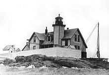
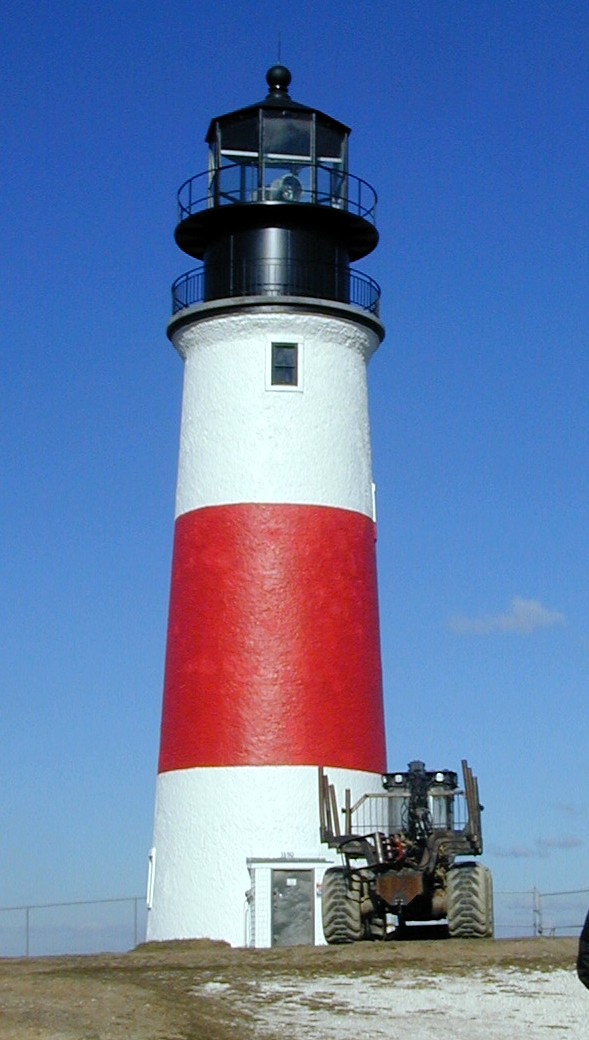
US Coast Guard photo of the 1889 structure
Location Dumpling Rock, Buzzards Bay, Massachusetts
Coordinates 41°32′17.8″N 70°55′17.1″W / 41.538278°N 70.921417°W / 41.538278; -70.921417Coordinates: 41°32′17.8″N 70°55′17.1″W / 41.538278°N 70.921417°W / 41.538278; -70.921417
Year first constructed 1829 (first tower)
Year first lit 1889 (last tower)
Automated 1942
Deactivated 1942 replaced by skeleton tower (below)
Tower shape Square wood tower attached to house
Markings / pattern Black lantern on white tower and house
Original lens Fourth and fifth order Fresnel lens
Characteristic F W with R sector
Fog signal Second class Daboli trumpet, 1 every 15s

[1]

Dumpling Rocks Light 7
Location Dumpling Rock, Buzzards Bay, Massachusetts
Coordinates 41°32′17.8″N 70°55′17.1″W / 41.538278°N 70.921417°W / 41.538278; -70.921417
Year first constructed 1942
Automated 1942
Construction Skeleton tower
Markings / pattern Square Green Daymark
Focal height 52ft (16m)
Range 8nm
Characteristic Fl G 6s
Fog signal none
USCG number 1-16040

[2]

Dumpling Rocks Light is a light on a skeleton tower on Dumpling Rock, Buzzards Bay, Massachusetts. It replaced the wooden Dumpling Rock Light, built 1889, which in turn replaced the original stone lighthouse established in 1829.

References

  1. ^ "Historic Light Station Information and Photography: Massachusetts". United States Coast Guard Historian's Office. 2009-09-01. http://www.uscg.mil/history/weblighthouses/LHMA.asp. 
  2. ^ United States Coast Guard (2009). Light List, Volume I, Atlantic Coast, St. Croix River, Maine to Shrewsbury River, New Jersey. p. 143. 


Wikimedia Foundation. 2010.

Игры ⚽ Поможем написать курсовую

Look at other dictionaries:

  • Minot's Ledge Light — Minots Ledge Light Minots Light in a storm Location Offshore Cohasset, Massachusetts Year first constructed 1850 (first tower) Year first lit 1860 (current tower) Automated 1947 Deactivated 1851 1860 Foundation …   Wikipedia

  • Chatham Light — Chatham Lighthouse and Coast Guard Station Location Chatham, Massachusetts Year first constructed 1808 Year first lit 1877 (current structure) Automated 1982 Foundation Concrete Construction …   Wikipedia

  • Duxbury Pier Light — Duxbury Pier lighthouse in Plymouth Harbor Location Plymouth Harbor, Plymouth, Massachusetts Coordinates …   Wikipedia

  • Old Scituate Light — in Scituate Location Cedar Point, Scituate Harbor Year first lit 1811 Deactivated 1860–1994 Foundation Natural/emplaced Construction Granite/Brick …   Wikipedia

  • Nauset Light — Nauset Beach Light Nauset Light and lightkeeper s house Location Eastham, Massachusetts Year first constructed 1838 Year first lit 1877 (current tower in Chatham) 1923 (current tower here) Automated 1955 Deactivated 1996 97 …   Wikipedia

  • Marblehead Light (Massachusetts) — For the lighthouse in Ohio, see Marblehead Light (Ohio). Marblehead Light Marblehead Light Location Marblehead Neck, Massachusetts Coordinates …   Wikipedia

  • Mayo Beach Light — the second Mayo Beach Light (USCG) Location Mayo Beach on Cape Cod Coordinates …   Wikipedia

  • Derby Wharf Light — US Coast Guard photo Location Salem, Massachusetts Coordinates …   Wikipedia

  • Newburyport Harbor Light — The current tower, built in 1898. U.S. Coast Guard photo Location Newburyport, Massachusetts Coordinates …   Wikipedia

  • Deer Island Light — The original 1890 light, replaced in 1982. Location Boston Harbor Coordinates …   Wikipedia

Share the article and excerpts

Direct link
Do a right-click on the link above
and select “Copy Link”