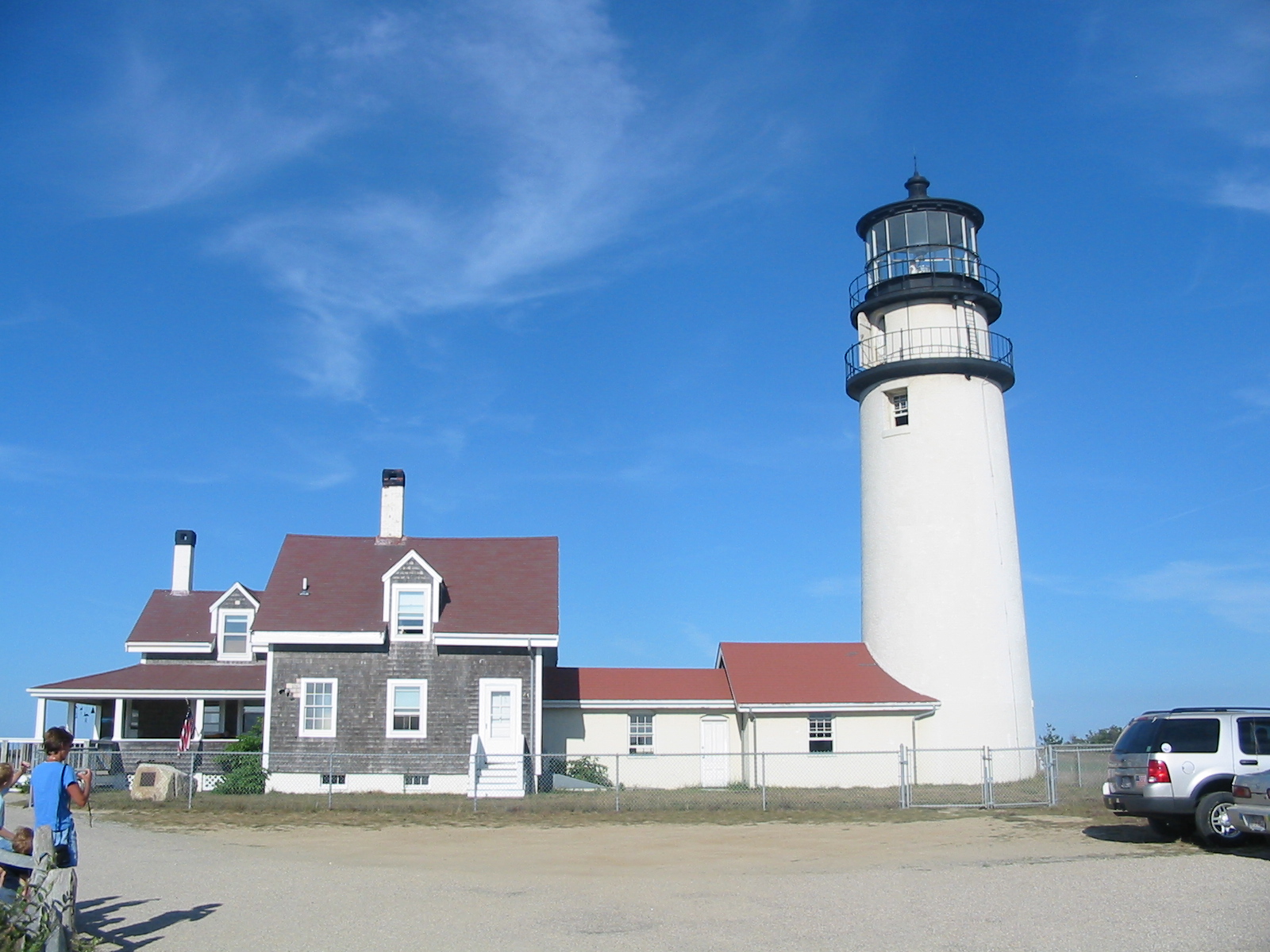
- Cape Cod Highland Light
caption = Cape Cod Highland Lighthouse
location = Near Truro, Massachusetts
coordinates = 42.02 –70.03
yearbuilt = 1857
yearlit = 1857
automated = 1986
yeardeactivated =
foundation =
construction = Brick
shape = Round tower
marking = White
height = 66 feet (20m)
elevation = 183 feet (55m) above sea level
lens =
currentlens = VRB - 25
intensity =
range = 45 miles (70km)
characteristic = Flashes white every 5 secondsThe Cape Cod Highland Lighthouse is situated on the
Cape Cod National Seashore near the town of Truro, Massachusetts. It is a working lighthouse situated on the Highland Golf Course. The grounds are open all year round whilst the light is open to the public from May until late October, with guided tours available if required.. It is owned by the National Park Service and cared for by the Highland Museum and Lighthouse Inc., [ [http://trurohistorical.org/ Highland Museum and Lighthouse Inc.] ] on behalf of theUnited States Coast Guard who run the actual light.History
In 1797, a station authorised by
George Washington was established at this point on the Cape, with a light to warn shipping about the dangerous coastline betweenCape Ann andNantucket . In 1857 the lighthouse was declared dangerous and demolished and a new one constructed. [ [http://www.rudyalicelighthouse.net/MassLgts/Highland/Highland.htm Cape Cod Highland Lighthouse] ] . Along with the lighthouse, there were a keepers’ building and a generator shed, both of which can still be seen today.The new lighthouse was fitted with a first order
Fresnel lens which was in turn replaced by a larger first order lens in 1901. In 1932 a the lamp was upgraded to a 1000 watt lamp. Later upgrades saw the lamp being replaced by two areobeacons, each containing a 1000 watt lamp and a back-up lamp, then in 1998 the areobeacons were replaced by 110 watt beacons.The lighthouse today, is not located where it was built, in 1990 it was in danger of falling down the cliff due to erosion so it was decided to move the whole structure 570 feet (175m) back from the cliff edge. The move was carried out by International Chimney Corp. of Buffalo NY and Expert House Movers of Maryland over a period of 18 days in July 1996. [ [http://www.rudyalicelighthouse.net/MassLgts/Highland/Highland.htm Massachusetts Lights] ]References
External links
* [http://lighthouse.cc/highland/index.html New England Lighthouses: A Virtual Guide]
* [http://trurohistorical.org/ Highland House Museum Cape Cod Highland Lighthouse]
* [http://www.rudyalicelighthouse.net/MassLgts/Highland/Highland.htm Massachusetts Lighthouses]
* [http://www.nps.gov/ National Parks Service]
* [http://www.experthousemovers.com/ Expert House Movers of Maryland]
* [http://www.internationalchimney.com/ International Chimney Corp. of Buffalo NY]
Wikimedia Foundation. 2010.

