- List of crossings of the River Thames
-
 London Bridge, in central London
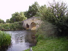
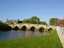 Newbridge, in rural Oxfordshire
This is a list of crossings of the River Thames including bridges, tunnels and ferries. There are 214 bridges, over 20 tunnels, six public ferries and one ford.[citation needed]
Contents
Barrier and boundary
Until sufficient crossings were established, the river provided a formidable barrier, with Belgic tribes and Anglo-Saxon kingdoms being defined by which side of the river they were on. When English counties were established their boundaries were partly determined by the Thames. On the northern bank were the historic counties of Gloucestershire, Oxfordshire, Buckinghamshire, Middlesex and Essex. On the southern bank were the counties of Wiltshire, Berkshire, Surrey, and Kent. However the permanent crossings that have been built to date have changed the dynamics and made cross-river development and shared responsibilities more practicable. In 1965, upon the creation of Greater London, the London Borough of Richmond upon Thames incorporated areas that had been part of both Middlesex and Surrey; and changes in 1974 moved some of the boundaries away from the river. For example, some areas that had been part of Berkshire became part of Oxfordshire, what had been Buckinghamshire became part of Berkshire, and what had been Middlesex became part of Surrey. On occasion – for example in rowing – the banks are still referred to by their traditional county names.
History of crossings
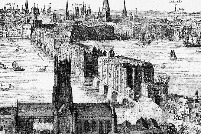
 An engraving by Claes Van Visscher showing Old London Bridge in 1616.
Many of the present road bridges on the river are on the site of earlier fords, ferries and wooden structures. The earliest known major crossings of the Thames by the Romans were at London Bridge and Staines Bridge. At Folly Bridge in Oxford the remains of an original Saxon structure can be seen, and mediaeval stone structures such as Newbridge and Abingdon Bridge are still in use. Kingston’s growth is believed to stem from its having the only crossing between London Bridge and Staines until the beginning of the 18th century. Proposals to build bridges across the Thames at Lambeth and Putney in around 1670 were prevented by the Rulers of the Company of Watermen, since it would mean ruin for the 60,000 rivermen who provided a pool of naval reserve.[1] During the 18th century, many stone and brick road bridges were built from new or to replace existing structures both in London and along the length of the river. These included Putney Bridge, Westminster Bridge, Datchet Bridge, Windsor Bridge and Sonning Bridge. Several central London road bridges were built in the 19th century, most conspicuously Tower Bridge, the only Bascule bridge on the river, designed to allow ocean going ships to pass beneath it. The most recent road bridges are the bypasses at Isis Bridge and Marlow By-pass Bridge and the Motorway bridges, most notably the two on the M25 route Queen Elizabeth Bridge and M25 Runnymede Bridge.
The development of the railway resulted in a spate of bridge building in the 19th century including Blackfriars Railway Bridge and Charing Cross (Hungerford) Railway Bridge in central London, and the spectacular railway bridges by Isambard Kingdom Brunel at Maidenhead Railway Bridge, Gatehampton Railway Bridge and Moulsford Railway Bridge.
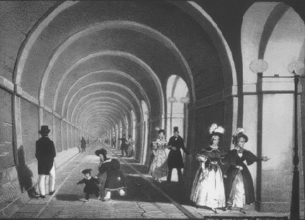
The world’s first underwater tunnel was the Thames Tunnel by Marc Brunel built in 1843 and used to carry the East London Line. The Tower Subway was the first railway under the Thames, which was followed by all the deep-level tube lines. Road tunnels were built in East London at the end of the 19th century, being the Blackwall Tunnel and the Rotherhithe Tunnel, and the latest tunnel was the Dartford Crossing.
Many foot crossings were established across the weirs that were built on the non-tidal river, and some of these remained when the locks were built – for example at Benson Lock. Others were replaced by a footbridge when the weir was removed as at Hart's Weir Footbridge. Around the year 2000 AD, several footbridges were added along the Thames, either as part of the Thames Path or in commemoration of the Millennium. These include Temple Footbridge, Bloomers Hole Footbridge, the Hungerford Footbridges and the Millennium Bridge, all of which have distinctive design characteristics.
Some ferries still operate on the river. The Woolwich Ferry carries cars and passengers across the river in the Thames Gateway and links the North Circular and South Circular roads. Upstream are smaller pedestrian ferries, for example Hampton Ferry and Shepperton to Weybridge Ferry the last being the only non-permanent crossing that remains on the Thames Path.
Note on the listing
The list starts at the downstream (Estuary) end and follows the river upstream towards the source. A few of the crossings listed are public pedestrian crossings utilising walkways across lock gates and bridges above or adjacent to the adjoining weirs. Most of the other locks on the River Thames also have walkways across their lock gates and weirs, but these either do not completely cross the river, or are restricted to authorised personnel only, and are therefore not listed. Besides the ferry crossings listed, there are commuter boat services operating along the river in London, and tourist boat services operating both in London and upstream. Whilst the principal purpose of these services is not to carry people across the river, it may be possible to use them to do so.
North Sea to London
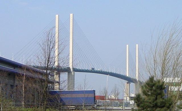
 The Queen Elizabeth II Bridge
- proposed Lower Thames Crossing at or east of Dartford Crossing – three options announced in April 2009
- Gravesend - Tilbury Ferry, a passenger ferry.
- High Speed 1 rail tunnels from Swanscombe in Kent to West Thurrock in Essex. (Two 2.5 km tunnels, 7.15 m internal diameter.)
- Dartford Crossing including two Dartford Tunnels (1963 and 1980) and the cable-stayed Queen Elizabeth II Bridge (1991)
- Dartford Cable Tunnel (2003; tunnel carrying electrical cable; accessible by authorised personnel only)
- 380kV Thames Crossing (power line crossing at West Thurrock)
East London
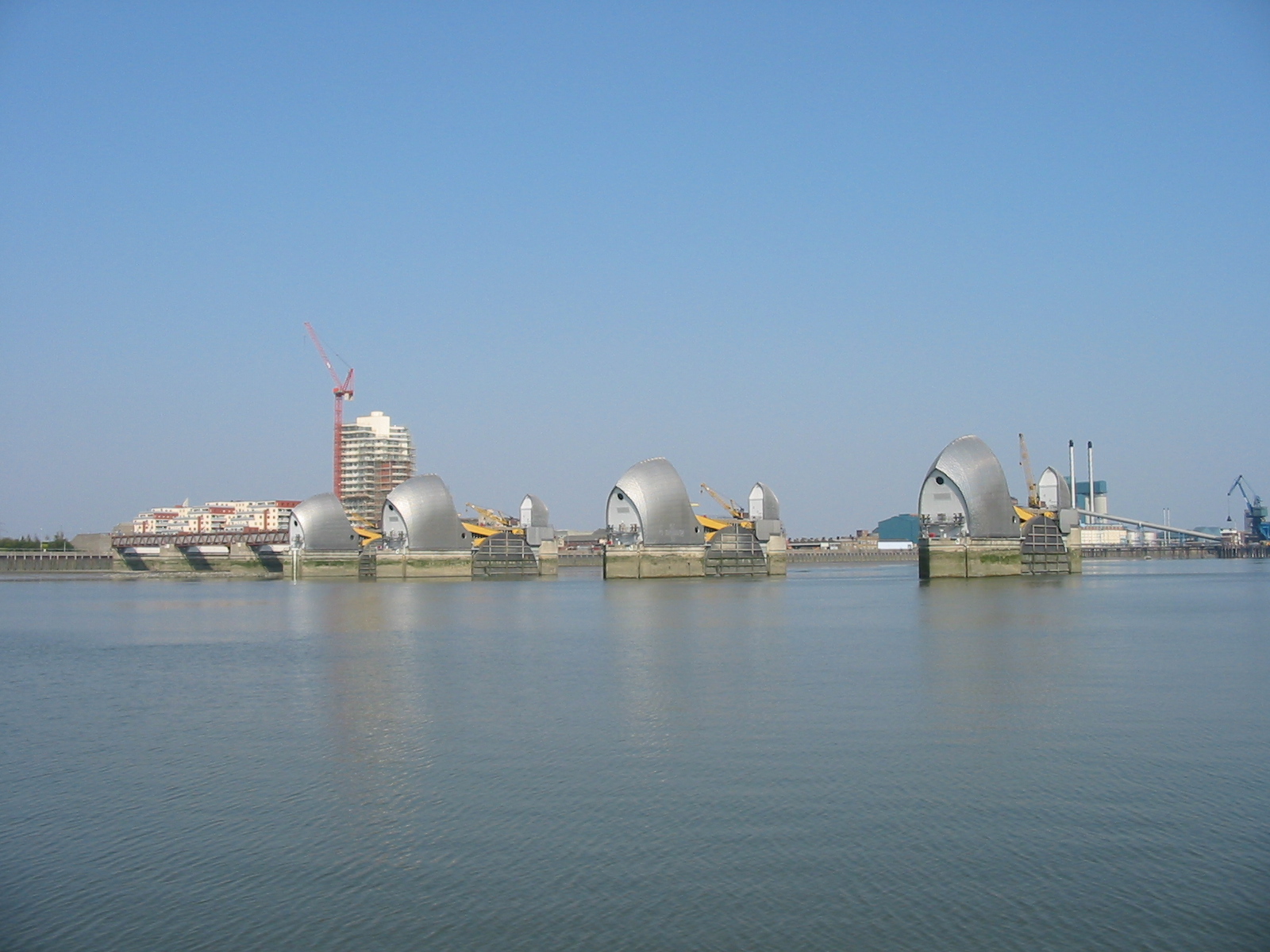
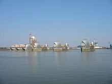 Thames Barrier
 Thames Tunnel in the mid-19th century
- proposed Thames Gateway Bridge, bridge between Beckton with Thamesmead, cancelled in November 2008.
- Docklands Light Railway tunnel (between King George V and Woolwich Arsenal stations)
- Woolwich foot tunnel (1912)
- Woolwich Ferry
- Crossrail tunnel (construction started 15 May 2009)
- Millennium Dome electricity cable tunnel
- Thames Barrier (includes service tunnel accessible by authorised personnel only)
- proposed Silvertown Link (bridge or tunnel to relieve the Blackwall Tunnels)
- Jubilee Line tunnels (between North Greenwich and Canning Town; 1999)
- Blackwall Tunnels (Alexander Binnie, 1897; second bore 1967)
- Jubilee Line tunnels (between Canary Wharf and North Greenwich; 1999)
- Docklands Light Railway tunnel (between Island Gardens and Cutty Sark; 1999)
- Greenwich foot tunnel (Alexander Binnie, 1902)
- Jubilee Line tunnels (between Canada Water and Canary Wharf; 1999)
- Canary Wharf - Rotherhithe Ferry
- Rotherhithe Tunnel (Maurice Fitzmaurice, 1908)
- Thames Tunnel (Wapping to Rotherhithe Tunnel) (Marc Brunel, 1843; the world's first underwater tunnel, now part of the East London Line)
Central London
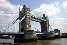 Tower Bridge
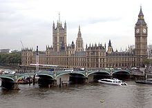 Westminster Bridge
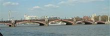 Lambeth Bridge
- Tower Bridge (1894)
- Tower Subway (Peter W. Barlow and James Henry Greathead; 1870. The world's first underground tube railway, cable hauled - now used for water mains and telephone cables and not accessible)
- Northern Line (City branch) tunnels (between London Bridge and Bank; 1900)
- London Bridge (1973)
- City & South London Railway tunnels (This railway's original crossing of the river between Borough and King William Street; 1890. Abandoned in 1900 when the Northern Line City branch tunnels were opened on a new alignment)
- Cannon Street Railway Bridge (1982)
- Southwark Bridge (1921)
- Millennium Bridge (footbridge, 2002)
- Blackfriars Railway Bridge (1886)
- Blackfriars Bridge (1869)
- Waterloo & City Line tunnels (between Waterloo and Bank; 1898)
- Waterloo Bridge (1945) (the "women's bridge")
- Northern Line (Charing Cross branch) tunnels (between Waterloo and Embankment; 1926)
- Hungerford Footbridges (Golden Jubilee Bridges) (2002)
- Charing Cross (Hungerford) Bridge (Railway, 1864)
- Bakerloo Line tunnels (between Waterloo and Embankment; 1906)
- Jubilee Line tunnels (between Waterloo and Westminster; 1999)
- Westminster Bridge (1862)
- Lambeth Bridge (1932)
- Vauxhall Bridge (1906)
- Victoria Line tunnels (between Vauxhall and Pimlico; 1971)
- Grosvenor Bridge (Victoria Railway Bridge) (1859)
South west London
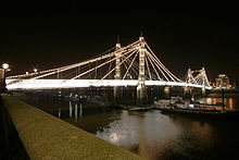 Albert Bridge
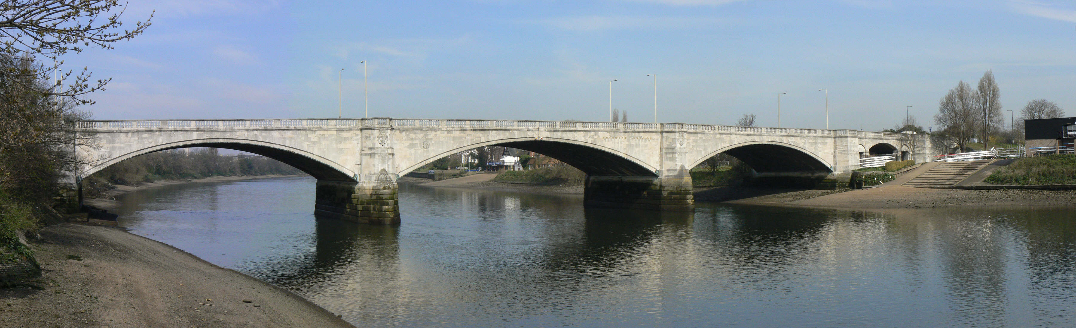
 Chiswick Bridge
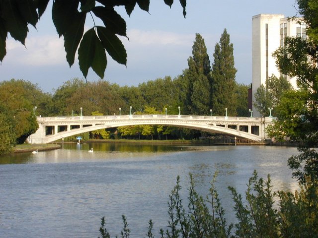
 Richmond Bridge
- Chelsea Bridge (1937)
- Albert Bridge (1873)
- Battersea Bridge (Sir Joseph Bazalgette, 1890) (Henry Holland, 1771)
- Battersea Railway Bridge (1863)
- Wandsworth Bridge (1938)
- Fulham Railway Bridge and Footbridge (1889)
- Putney Bridge (Sir Joseph Bazalgette, 1886) (Phillips & Ackworth, 1729)
- Hammersmith Bridge (Sir Joseph Bazalgette, 1887)
- Barnes Railway Bridge and Footbridge (1849)
- Chiswick Bridge (1933)
- Kew Railway Bridge (1869)
- Kew Bridge (John Wolfe-Barry, 1903)
- Richmond Lock and Footbridge (1894)
- Twickenham Bridge (1933)
- Richmond Railway Bridge (1848)
- Richmond Bridge (1777)
- Hammerton's Ferry (F) (Marble Hill Twickenham to Ham House)
- Teddington Lock Footbridge (1889)
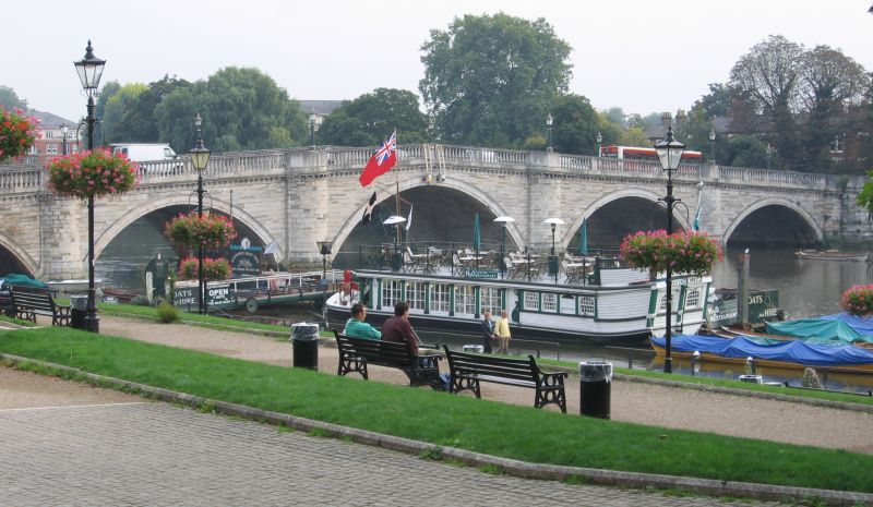
- Kingston Railway Bridge (1863)
- Kingston Bridge (1828)
- Hampton Court Bridge (1933)
- Hampton Ferry (F) (to Hurst Park, East Molesey, 1519)
London to Windsor
 Chertsey Bridge
- Walton Bridge (1953 and 1999)
- Shepperton to Weybridge Ferry (F)
- Chertsey Bridge (1785)
- M3 Motorway Bridge (1971)
- Staines Railway Bridge (1856)
- Staines Bridge (1832)
- M25 Runnymede Bridge (Edwin Lutyens, 1961; widened 1983 and 2005)
- Albert Bridge (1928)
- Datchet Bridge (1836-demolished 1848; the only Thames crossing to suffer this fate)
- Victoria Bridge (1967)
- Black Potts Railway Bridge (1892)
- Windsor Bridge (1824)
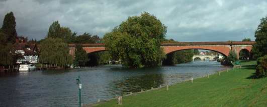
- Windsor Railway Bridge (Isambard Kingdom Brunel, 1849)
- Queen Elizabeth Bridge (1966)
Windsor to Reading
 Maidenhead Railway Bridge
 Reading Bridge
- Summerleaze Footbridge (1992)
- M4 Bridge (incorporates footbridge) (1961)
- Maidenhead Railway Bridge (Isambard Kingdom Brunel, 1838)
- Maidenhead Bridge (1777)
- Cookham Bridge (1867)
- Bourne End Railway Bridge (1895; incorporates footbridge)
- Marlow By-pass Bridge (1972)
- Marlow Bridge (William Tierney Clark, 1832)
- Temple Footbridge (1989)
- Hambleden Lock (incorporates public footbridge)
- Henley Bridge (1786)
- Shiplake Railway Bridge (1897)
- Sonning Bridge (c.1775) & Sonning Backwater Bridges (1986)
- Caversham Lock (incorporates public footbridge)
- Reading Bridge (1923)
- Caversham Bridge (1926)
Reading to Oxford
 Wallingford Bridge
 Shillingford Bridge
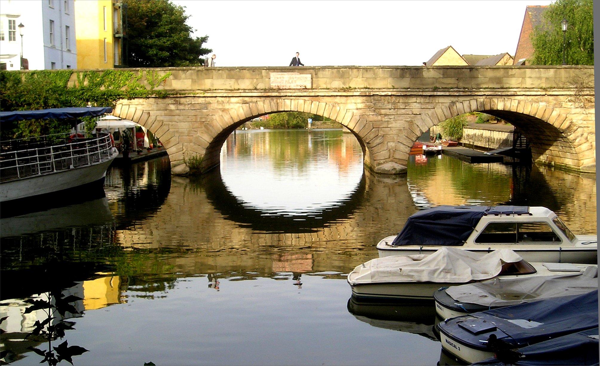
 Folly Bridge, Oxford
- Reading Festival Bridge (2008, a temporary footbridge on permanent footings for the Reading Festival)
- Whitchurch Bridge (1902, a toll bridge from Whitchurch-on-Thames to Pangbourne)
- Gatehampton Railway Bridge (Isambard Kingdom Brunel, 1838)
- Goring and Streatley Bridge (1923)
- Moulsford Railway Bridge (Isambard Kingdom Brunel, 1838)
- Winterbrook Bridge (1993)
- Wallingford Bridge (1809)
- Benson Lock (incorporates public footbridge)
- Shillingford Bridge (1827)
- Little Wittenham Bridge
- Day's Lock (incorporates public footbridge)
- Clifton Hampden Bridge (George Gilbert Scott,1867)
- Appleford Railway Bridge (1929)
- Sutton Bridge (1807)
- Culham Bridge (across Swift Ditch, a backwater and former main course of the river near Abingdon) (1790)
- Abingdon Bridge (1416)
- Abingdon Lock (incorporates public footbridge)
- Nuneham Railway Bridge (1929)
- Kennington Railway Bridge (1923)
- Isis Bridge (1962)
- Donnington Bridge (1962)
- Folly Bridge (1827)
- Grandpont Bridge (1930s)
- Gasworks Bridge (1882)
- Osney Rail Bridge
- Osney Bridge (1885)
Oxford to Cricklade
 Radcot Bridge
 St. John's Bridge, Lechlade.
- Medley Footbridge (1865)
- Godstow Bridge (1792)
- A34 Road Bridge (1961)
- Swinford Toll Bridge (1777)
- Pinkhill Lock (Incorporates public footbridge)
- Hart's Weir Footbridge (1879)
- Newbridge (13th century)
- Tenfoot Bridge (1869)
- Shifford Cut Footbridge and Duxford Ford
- Tadpole Bridge (1784)
- Old Man's Bridge (1868)
- Radcot Bridge (1787)
- Eaton Footbridge (1936)
- Bloomers Hole Footbridge (2000)
- St. John's Bridge (1886)
- Halfpenny Bridge (James Hollingworth, 1792) - the start of the navigable Thames
- Hannington Bridge (1841)
- Castle Eaton Bridge (1893)
- Water Eaton House Bridge
- Eysey Footbridge
- A419 Road Bridge (1988)
- Cricklade Town Bridge (1852)
Beyond Cricklade
- Waterhay Bridge
- High Bridge, Ashton Keynes
- Three Bridges, Ashton Keynes
- unnamed road bridge at grid reference 020946
- Neigh Bridge
- unnamed road bridge at grid reference 004972
- Parker's Bridge, Ewen
- A429 Road Bridge
- A433 Road Bridge
See also
- Datchet Bridge
- Islands in the River Thames
- Locks and weirs on the River Thames
- List of Bridges in London
- London River Services
- Thames Path
- Tunnels underneath the River Thames
References
Categories:- Crossings of the River Thames
- Bridges across the River Thames
- Lists of bridges
- Crossings by river
- Tunnels underneath the River Thames


Wikimedia Foundation. 2010.