- Hampton Court Bridge
Infobox_Bridge
bridge_name=Hampton Court Bridge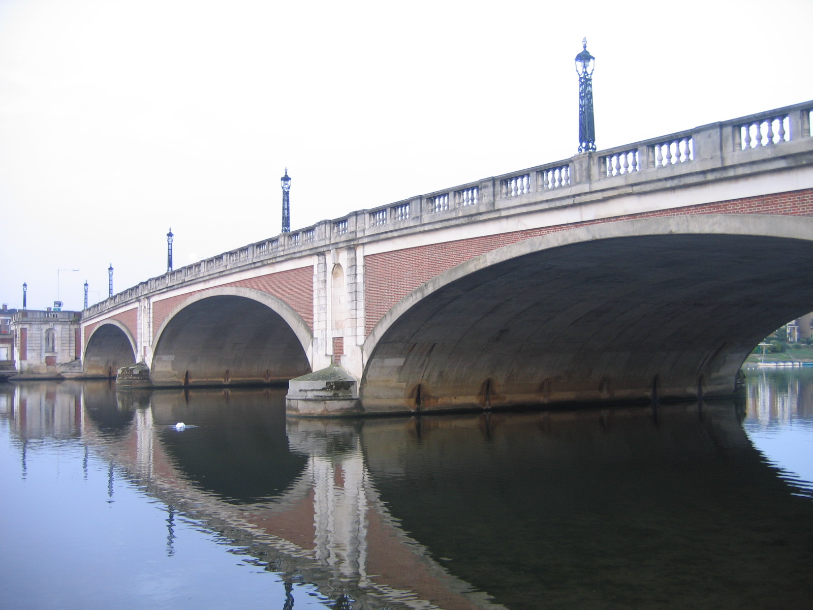
caption=Hampton Court bridge in 2006
official_name=
carries=
crosses=River Thames
locale=East Molesey
Hampton Court Palace
maint=
id=
designer = W. P. Robinson
Sir Edward Lutyens
design= Arch
material = Concrete with a brick finish
spans = 3
pierswater = 2
mainspan=
length=
width=
height= 19ft 5in (5.91m)
clearance=
below=
traffic=
open=3 July 1933
closed=
toll=
map_cue=
map_
map_text=
map_width=
coordinates= coord|51|24|14|N|0|20|33|W|region:GB_type:landmark
lat=
long=Hampton Court Bridge crosses the
River Thames in England in a north to south direction betweenEast Molesey ,Surrey andHampton Court Palace ,Greater London . It is on the reach aboveTeddington Lock and about hundred yards upstream of the bridge isMolesey Lock .On the north bank is
Hampton Court Palace ,Hampton Court Park andBushy Park . On the south bank isHampton Court railway station , Molesey Lock and the mouth of the River Mole.Historic crossings
The location of the bridge had been a ferry crossing point since at least the
Tudor period . The first bridge was built 1752–53, after a 1750 parliamentary bill enabled the construction of a privately owned bridge by James Clarke. It had seven wooden arches, and was built in theChinoiserie design of the Willow pattern that was popular at the time.It was subsequently replaced by a more sturdy wooden bridge in 1778. In 1840 this bridge had become dilapidated and the owner appealed to the
City of London Corporation to support reconstruction. Among their arguments were that since the bridge was built, the City had created Molesey Lock and Weir and as a consequence navigation through the bridge was dangerous. The bridge was described about this time as "crazy, hog-backed, inconvenient and obstructive of the navigation". [Fred. S. Thacker "The Thames Highway: Volume II Locks and Weirs" 1920 - republished 1968 David & Charles]In 1864–66, a new bridge was built, designed by E. T. Murray. It consisted of
wrought iron lattice girders resting on fourcast iron columns. The approach was betweenbattlement ed brick walls. One of these approach walls still remain on the south bank.The modern bridge
The modern bridge is the fourth to be located on the site. It was designed by W. P. Robinson and Sir
Edwin Lutyens to reflect the style of portions ofHampton Court Palace designed bySir Christopher Wren . The bridge has 3 arches, and is designed to carry road traffic.Construction of the present bridge began in 1930. The work included demolition of a hotel (the Old Castle), diverting the flow of the River Mole into the
River Ember , and constructing a new road. Today this road is known as Hampton Court Way and connects theA308 with the A307 (Portsmouth road). The bridge is constructed ofreinforced concrete and faced with red bricks.The bridge was opened by Edward VIII, then
Prince of Wales on3 July 1933 on the same day as the opening ofChiswick Bridge andTwickenham Bridge , which carry the A316 (the stretch then called the Richmond bypass).ee also
*
Crossings of the River Thames References
*
Elmbridge Borough Council - Information plaque at the BridgeExternal links
* [http://www.marketingreinforcements.pwp.blueyonder.co.uk/index_hamptoncourtbridge.html The Thames from Hampton Court to Sunbury Lock]
River item line
upstream=Hampton Ferry (pedestrian)|downstream=Kingston Bridge (road)River item line
upstream = southern bankShepperton to Weybridge Ferry
downstream = northern bank
Kingston Bridge
Wikimedia Foundation. 2010.