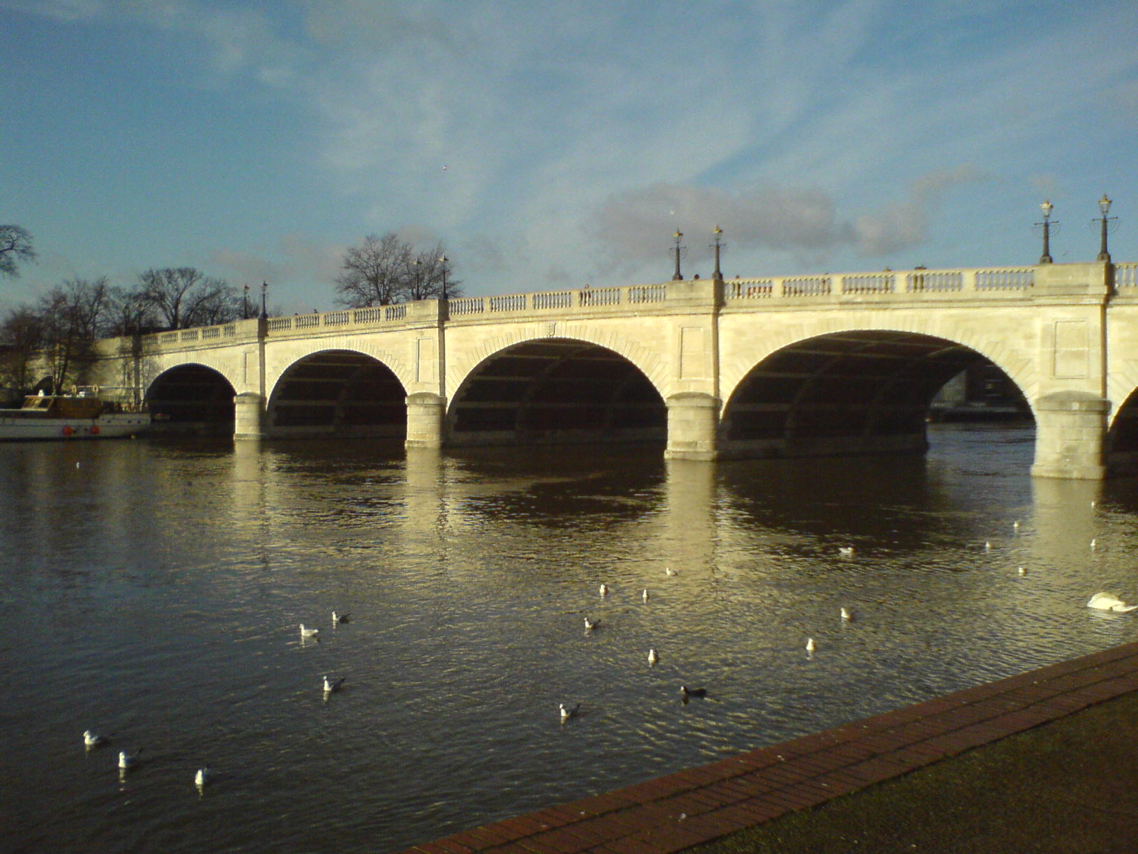
- Kingston Bridge, London
Infobox_Bridge
bridge_name=Kingston Bridge
caption=Kingston Bridge from upstream at Kingston
official_name=
carries=A308 road
crosses=River Thames
locale=Kingston upon Thames
maint=
id=
designer = Lapidge
design= Arch
material = Stone
spans = 5
pierswater = 4
mainspan= convert|60|ft|0|in|m
length= convert|382|ft|0|in|m
width=
height= convert|23|ft|11|in|m [River Thames Alliance. [http://www.visitthames.co.uk/text.asp?PageId=320 Bridge heights on the River Thames.] ]
clearance=
below=
traffic= 50,000 vehicles
open= 17 July 1828
closed=
toll= Abolished 1870
map_cue=
map_
map_text=
map_width=
coordinates= coord|51|24|40|N|0|18|32|W|region:GB_type:landmark
lat=
long=Kingston Bridge is a road bridge at
Kingston upon Thames inLondon , England, carrying the A308 across theRiver Thames . It joins the town centre of Kingston in theRoyal Borough of Kingston upon Thames , toHampton Court Park ,Bushy Park , and the village ofHampton Wick in theLondon Borough of Richmond upon Thames .As of 2005 , it carries approximately 50,000 vehicles per day with up to 2,000 vehicles per hour in each direction during peak times.Kingston Bridge is on the reach above
Teddington Lock and close to and downstream of the mouth of theHogsmill River, a minor tributary of the Thames. It is on the route of theThames Path .History
Kingston Bridge was the only crossing of the river between
London Bridge andStaines Bridge untilPutney Bridge was opened in 1729. This contributed greatly to Kingston's success as amedieval market town . According toJohn Leland , writing in under the Tudors there was a bridge in Saxon times. He wrote "And yn the old tyme the commune saying ys that the bridge where the commun passage was over the Tamise was lower on the ryver then it is now. And when men began the new town in the Saxons tymes they toke from the very clive of Comeparke (cliff of Coombe Park) side to build on the Tamise side; and sette a new bridge hard by the same." [ [http://www.british-history.ac.uk/report.aspx?compid=45379 "Kingston upon Thames", The Environs of London: volume 1: County of Surrey (1792), pp. 212-256.Date accessed: 30 September 2008] ] Leland refers to a contemporary bridge and there is evidence that a wooden bridge had existed at Kingston since the13th century . This was downstream of the present bridge where Old Bridge Street atHampton Wick was matched by an Old Bridge Street on the Kingston side - the former Saxon bridge being further downstream. [Fred. S. Thacker "The Thames Highway: Volume II Locks and Weirs" 1920 - republished 1968 David & Charles]As a crucial link between Surrey and Middlesex, the mediaeval timber bridge was susceptible to destruction during civil conflict as happened during the
Wars of the Roses andWyatt's rebellion . There are records of tolls being granted for a number of years to pay for repairs to the bridge, but in 1567, Robert Hamond made it a free bridge for ever. [http://www.british-history.ac.uk/report.aspx?compid=45379 "Kingston upon Thames", The Environs of London: volume 1: County of Surrey (1792), pp. 212-256. Date accessed: 30 September 2008] ] However in spite of his endowments it appears by the 18th century some tolls had been reimposed. The bridge was described in 1710 "The great Wooden Bridge hath 20 interstices: two in the middle wide enough for barges...it had 22 pierres pf Wood and had in the middle two fair Seates for Passengers to avoid Carts and to sit and enjoy the delightfull Prospect". [Fred. S. Thacker "The Thames Highway: Volume II Locks and Weirs" 1920 - republished 1968 David & Charles]In 1825 Kingston Corporation notified the
City of London Corporation Navigation Committee that it intended to build a new bridge. Thismasonry bridge was completed in 1828. It was built ofPortland stone , and consisted of five elliptical arches, the centre arch being a 60 feet span by 19 in height, and the side arches 56 and 52 feet spans respectively. Theabutment s were terminated by towers orbastion s, and the whole surmounted by acornice andbalustrade , with galleries projecting over the pier; which gave a bold relief to the general elevation. The length of the bridge was 382 feet by 27 feet in width. It was of chaste Grecian architecture, from the design of Mr. Lapidge. The building contract was undertaken by Mr. Herbert for £26,800. and the extra work has not exceeded £100, a very rare, if not an unprecedented occurrence in either public or private undertakings of this description. The first stone was laid by the Earl of Liverpool, November 7, 1825, and the bridge was opened in due form by her royal highness the Duchess of Clarence, on July 17, 1828.Th bridge became free from tolls in 1870, and celebrations including a fireworks show were followed a few days later with the burning of the toll-gates on Hampton Green. It was widened between 1912 and 1914 with the carriageway increased from 25 feet to 55 feet. A new facade of Portland stone was designed to replicate the features of the original. The bridge was widened again in 2000 to also include two bicycle lanes, larger pavements and a bus lane.
ee also
*
Crossings of the River Thames References
*Kingston New Bridge, in "The Mirror of Literature, Amusement, and Instruction" Volume XII., No. 324, July 26, 1828
*River bridge line
upstream=Hampton Court Bridge (road)|downstream=Kingston Railway Bridge (rail)
location = TQ177693River item line
upstream = northern bankHampton Court Bridge
downstream = southern bankTeddington Lock Footbridge
Wikimedia Foundation. 2010.
