- Osney Bridge
-
Osney Bridge 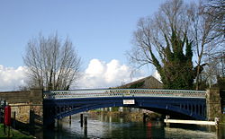
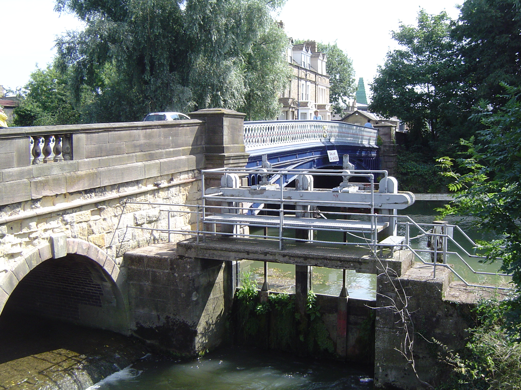
Osney Bridge looking north from Osney IslandCarries A420 road Crosses River Thames Locale Oxford Maintained by Oxfordshire County Council Design arch Material iron Height 7 feet 6 inches (2.29 m)[1] Number of spans 1 Opened 1889 Coordinates 51°45′10″N 1°16′23″W / 51.752694°N 1.273093°WCoordinates: 51°45′10″N 1°16′23″W / 51.752694°N 1.273093°W Osney Bridge is a road bridge across the River Thames in Oxford, England, built in 1889 to replace a stone bridge which collapsed in 1885[2]. It carries the Botley Road (A420) from Botley into Oxford. The Thames Path crosses the river on this bridge, just above Osney Lock.
The original bridge was probably built by the monks of Osney Abbey, to carry the main road across the millstream of Osney Mill west from the island then known as Osney.[3] By the early 17th century it was a three arch stone construction. In 1790 the millstream became the main navigation channel of the river, and the bridge became a serious obstruction to navigation by the mid 19th century. In 1885 the central arch collapsed leaving massive piers[4]
Osney Bridge has the lowest headroom of any across the navigable Thames.
See also
- Crossings of the River Thames
References
- ^ "Bridge heights on the River Thames" (in English). River Thames Alliance.. http://www.visitthames.co.uk/text.asp?PageId=320. Retrieved 2009-05-14.
- ^ Eade, John (2005). "Where Thames Smooth Waters Glide" (in English). http://thames.me.uk/s01770.htm. Retrieved 2009-05-14.
- ^ Crossley, Alan; Elrington, C.R. (eds.); Chance, Eleanor; Colvin, Christina; Cooper, Janet; Day, C.J.; Hassall, T.G.; Selwyn, Nesta (1979). A History of the County of Oxford, Volume 4: Communications. Victoria County History. http://www.british-history.ac.uk/report.aspx?compid=22808#s3.
- ^ Thacker, Fred. S. (1920 - republished 1968) (in English). The Thames Highway: Volume II a history of the locks and weirs. 2. Newton Abbot: David & Charles. pp. 525 p. Bibcode 978153. ISBN 0715342320.
 View of bridge with mini-weir from the western side
Next crossing upstream River Thames Next crossing downstream Medley Footbridge (pedestrian) Osney Bridge Osney Rail Bridge (railway) Next crossing upstream Thames Path Next crossing downstream northern bank
Medley FootbridgeOsney Bridge southern bank
Abingdon LockCategories:- Bridges across the River Thames
- Bridges in Oxford
- Bridges completed in 1889
- Thames Path

Wikimedia Foundation. 2010.