- North West Leicestershire
-
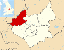
North West Leicestershire District — District — Shown within Leicestershire Sovereign state United Kingdom Constituent country England Region East Midlands Administrative county Leicestershire Founded Admin. HQ Coalville Government – Type North West Leicestershire District Council – Leadership: Leader & Cabinet – Executive: Conservative – MP: Andrew Bridgen (Con) Area – Total 107.8 sq mi (279.3 km2) Area rank 146th Population (2010 est.) – Total 90,800 – Rank Ranked 254th – Density 842/sq mi (325.1/km2) Time zone Greenwich Mean Time (UTC+0) – Summer (DST) British Summer Time (UTC+1) Postcode ISO 3166-2 ONS code 31UH OS grid reference NUTS 3 Ethnicity 98.8% White Website nwleics.gov.uk North West Leicestershire is a local government district in Leicestershire, England. Its main towns are Ashby-de-la-Zouch and Coalville.
The district contains East Midlands Airport, which operates flights to the rest of Britain and to various places in Europe. It is also notable as the location of Castle Donington and Donington Park, a grand-prix circuit and a major venue for music festivals.
The district is represented in the UK Parliament by the constituency of the same name.
The area has a long history of mineral extraction, with coal, brick clay, gravel and granite amongst the products. All the deep coal mines in the area have closed, but opencast mining still continues.
The district was formed in 1974 by a merger of Ashby de la Zouch Urban District, Ashby Woulds Urban District, Coalville Urban District, Ashby de la Zouch Rural District, Castle Donington Rural District and Ibstock from the Market Bosworth Rural District.
Contents
Politics
Like many other shire districts, authority over North West Leicestershire is shared between the district council and the county council. Areas of responsibility of the district council include local planning, building control, council housing, refuse collection, recycling, and some leisure services and parks.
The district council is currently controlled by 38 councillors who are elected every four years; the last election took place in May 2011[1] and saw the Conservatives hold onto control after previously winning it for the first time since its creation in 1973. The current political make-up of the council is as follows[2]:
Political party Current members Conservative Labour Liberal Democrat The council has a six-member executive known as the Cabinet[3] which is made up of councillors who have special responsibilities and power. As the Conservatives won overall control of the council in 2007, they hold all of the seats on the cabinet.
Position Councillor Respective Ward Leader of the Council Cllr Richard Blunt Appleby Corporate Portfolio Holder Cllr Nicholas Rushton Breedon Portfolio Holder for Housing Cllr Roger Bayliss Ashby Holywell Portfolio Holder for Community Cllr Trevor Pendleton Kegworth & Whatton Portfolio Holder for Environment Cllr Alison Smith Kegworth & Whatton Portfolio Holder for Transforming Services Cllr Annette Bridges Moira Parishes[4]
- Appleby Magna, Ashby Woulds, Ashby-de-la-Zouch,
- Bardon, Belton, Breedon on the Hill
- Castle Donington, Charley, Chilcote, Coleorton
- Ellistown and Battleflat
- Heather
- Ibstock
- Isley cum Langley
- Kegworth
- Lockington cum Hemington, Long Whatton
- Measham
- Normanton le Heath
- Oakthorpe and Donisthorpe, Osgathorpe
- Packington
- Ravenstone with Snibston
- Snarestone, Staunton Harold, Stretton en le Field, Swannington, Swepstone
- Worthington
- Whitwick
Economy
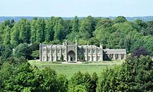
BMI (British Midland), an airline, is headquartered in Donington Hall, Castle Donington.[5] Prior to its disestablishment, Excalibur Airways had its head office on the grounds of East Midlands Airport in Castle Donington.[6] Prior to its disestablishment, Orion Airways had its head office on the grounds of East Midlands Airport.[7]
References
- ^ North West Leicestershire District Council election, 2011 results, North West Leicestershire District Council website
- ^ Council makeup, North West Leicestershire District Council website
- ^ Cabinet makeup, North West Leicestershire District Council website
- ^ "Parish Map of North West Leicestershire". Leicestershire County Council. http://www.leics.gov.uk/index/leicestershire_map/parishmaps.htm?district=NWLeics. Retrieved 2008-12-10.
- ^ "Contact us." BMI. Accessed September 23, 2008.
- ^ "World Airline Directory." Flight International. 24-30 March 1993. "91.
- ^ "World Airline Directory." Flight International. 29 March 1986. 114.
External links
Unitary authorities Boroughs or districts - Blaby
- Charnwood
- Harborough
- Hinckley and Bosworth
- Melton
- North West Leicestershire
- Oadby and Wigston
Major settlements Topics - Birds
- Museums
- Parliamentary constituencies
- Places
- SSSIs
Derbyshire Amber Valley • Bolsover • Chesterfield • Derby • Derbyshire Dales • Erewash • High Peak • North East Derbyshire • South Derbyshire

Leicestershire Blaby • Charnwood • Harborough • Hinckley and Bosworth • Leicester • Melton • North West Leicestershire • Oadby and Wigston
Lincolnshire Nottinghamshire Ashfield • Bassetlaw • Broxtowe • Gedling • Mansfield • Newark and Sherwood • Nottingham • Rushcliffe
Northamptonshire Rutland Categories:- Leicestershire geography stubs
- Local government in Leicestershire
- Non-metropolitan districts of Leicestershire
- Local government districts of the East Midlands
Wikimedia Foundation. 2010.


