- Mani Peninsula
-
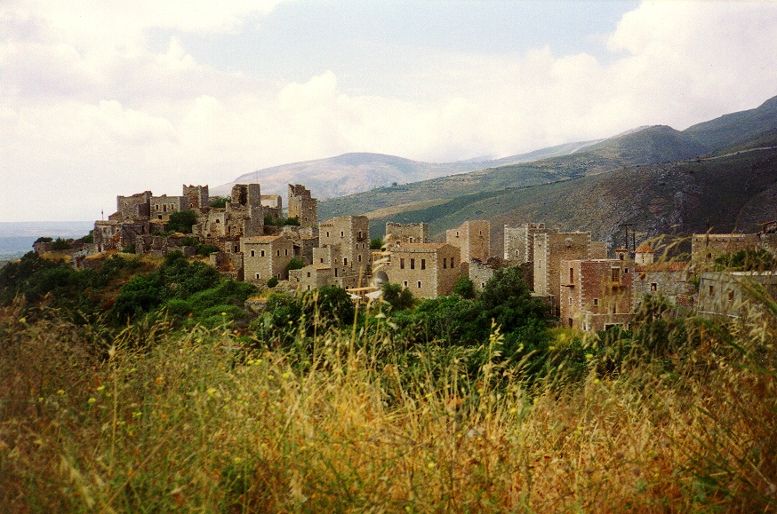
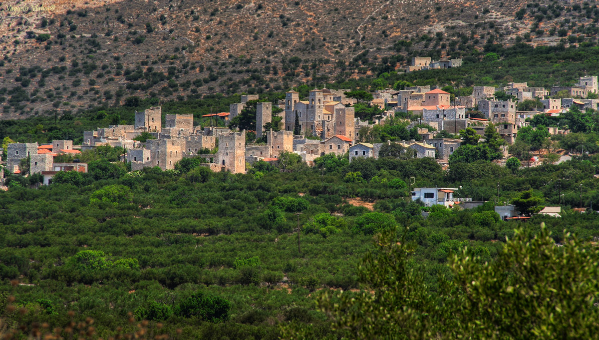
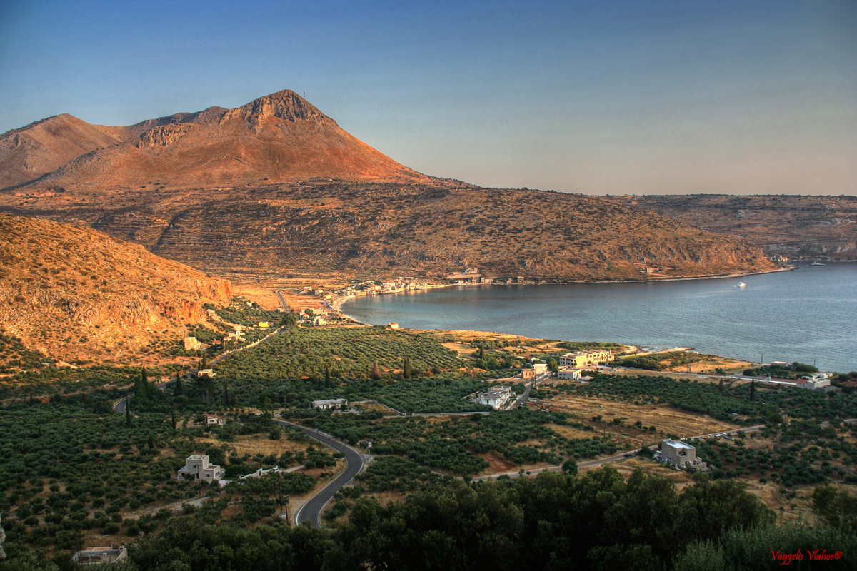
 View from mani
The Mani Peninsula (Μάνη in Greek), also long known as Maina or Maïna, is a geographical and cultural region in Greece. Mani is the central peninsula of the three which extend southwards from the Peloponnese in southern Greece. To the east is the Laconian Gulf, to the west the Messenian Gulf. The peninsula forms a continuation of the Taygetos mountain range, the western spine of the Peloponnese. A place so wild, that even the Sicilians and Calabrese of Italy were reluctant to step foot.
Mani is home of the Maniots.
Contents
Geography
 Map of Greece highlighting the Peloponnese. Mani is the middle peninsula at the south of the Peloponnese.
The terrain is mountainous and inaccessible. The name "Mani" is thought to have originally meant "dry" or "treeless." Until recent years many Mani villages could be reached only by sea. Today a narrow and winding road extends down the west coast from Kalamata to Areopoli, then south to Akrotainaro (the pointy cape which is the most southward soil of continental Greece and continental Europe) before it turns north until Gytheio.
Mani has been traditionally divided into three regions:
- Exo Mani (Έξω Μάνη) or Outer Mani to the northwest,
- Kato Mani (Κάτω Μάνη) or Lower Mani to the east,
- Mesa Mani (Μέσα Μάνη) or Inner Mani to the southwest.
A fourth region named Vardounia (Βαρδούνια) to the north is also sometimes included.
Administratively, Mani is now divided between the prefectures of Laconia (Kato Mani, Mesa Mani) and Messenia (Exo Mani), in the periphery of Peloponnesos, but in ancient times it lay entirely within Laconia, the district dominated by Sparta. The Messenian Mani (also called aposkiaderi, local expression meaning "shady") receives somewhat more rainfall than the Laconian (called prosiliaki, local expression meaning "sunny"), and is consequently more fertile. Maniots from what is now Messenian Mani have surnames that uniformly end in -eas, whereas Maniots from what is now Laconian Mani have surnames that end in -akos, additionally there is the "-oggonas" ending.
History
 The flag of Mani.
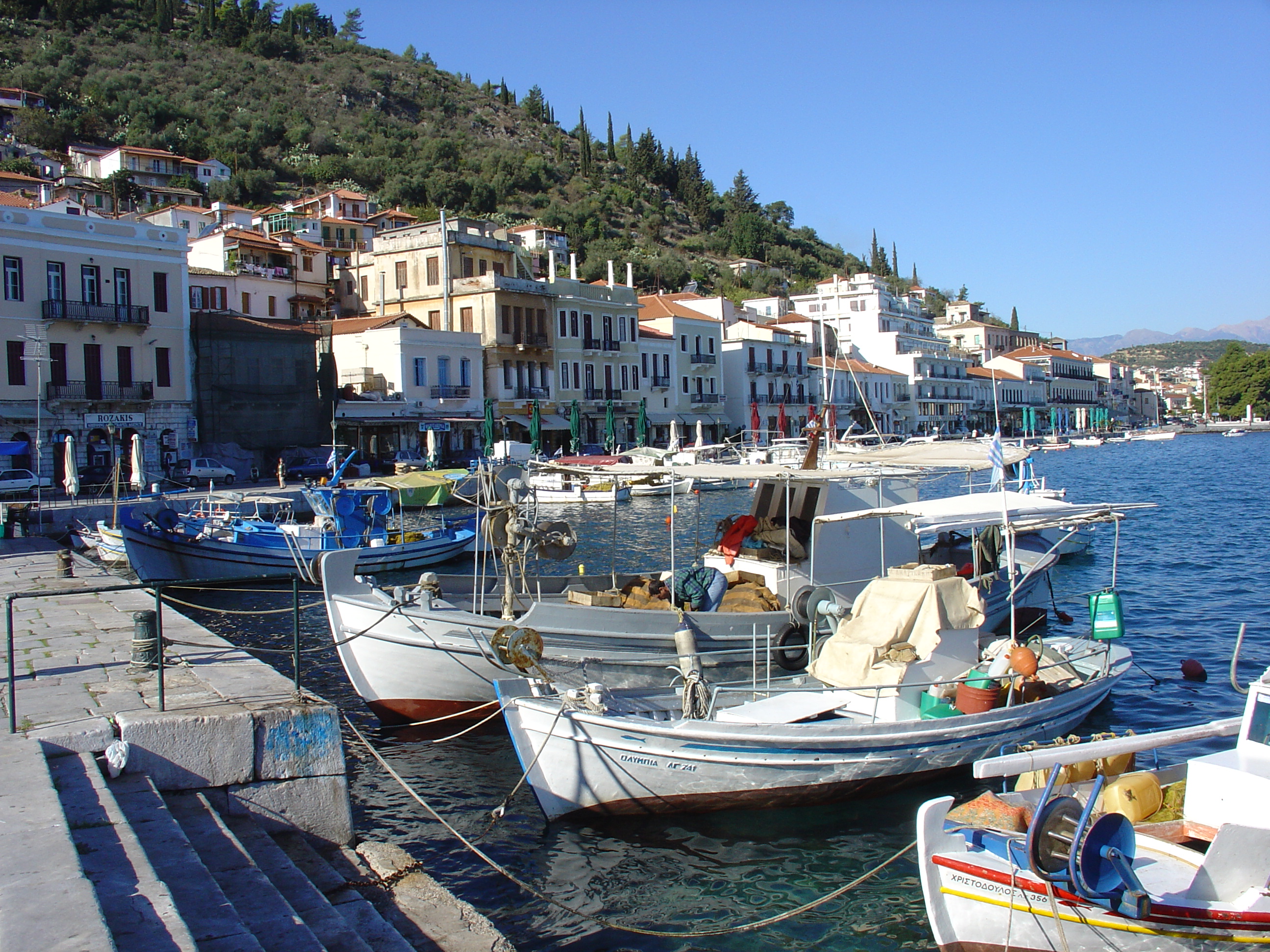
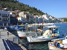 The port of the city of Gythio.
Neolithic remains have been found in many caves along the Mani coasts. Homer refers to a number of towns in the Mani region, and some artifacts from the Mycenaean period have been found. The area was occupied by the Dorians in about 1200 BC, and became a dependency of Sparta. When Spartan power was destroyed in the 3rd century BC, Mani was self-governing for a time before being absorbed into the Roman Empire in the 2nd century BC.
As the power of the Byzantine Empire declined, the peninsula drifted out of the Empire's control. The fortress of Maini in the south became the area's centre. Over the subsequent centuries, the peninsula was fought over by the Byzantines, the Franks, and the Saracens.
After the Fourth Crusade in 1204, Italian and French knights (known collectively by the Greeks as Franks) occupied the Peloponnese and created the Principality of Achaea. They made Mani into one of the twelve baronies of the Principality of Morea and built the fortresses of Mystras, Passavas, Gustema (Beaufort), and Great Maina. The area fell under Byzantine rule after 1262, forming part of the Despotate of the Morea.
In 1460, after the fall of Constantinople, the Despotate fell to the Ottomans. Mani was not subdued and retained its internal self-government in exchange for an annual tribute. Local chieftains or beys governed Mani on behalf of the Ottomans. As Ottoman power declined, the mountains of the Mani became a stronghold of the klephts, bandits who also fought against the Ottomans. There is evidence of a sizeable Maniot emigration to Corsica sometime during the Ottoman years.
The last bey of Mani, Petros Mavromichalis, was among the leaders of the Greek War of Independence. He proclaimed the revolution at Areopoli on March 17, 1821. The Maniots contributed greatly to the struggle, but once Greek independence was won, they wanted to retain local autonomy. During the reign of Ioannis Kapodistrias, they violently resisted outside interference to the point of killing Kapodistrias.
The Mani's local autonomy was abolished in 1870, and the area gradually became a backwater as the inhabitants abandoned the land through emigration. It was not until the 1970s, when new roads led to the growth of the tourist industry, that the Mani began to regain population and become prosperous. Maniots are known for their obstinate character, wild nature, conservative views, sometimes extreme frugality, and their zealous safeguarding of the family property.
Despite the region's aridity, Mani is known for its unique culinary products such as glina or syglino (pork or pork sausage smoked with aromatic herbs such as thyme, oregano, mint, etc. and stored in lard along with orange peel). Mani is also known for the world's best extra-virgin olive oil, soft-pressed from partially ripened olives of the Koroneiki variety, which are organically grown on mountain terraces. The local honey is also of superior quality.
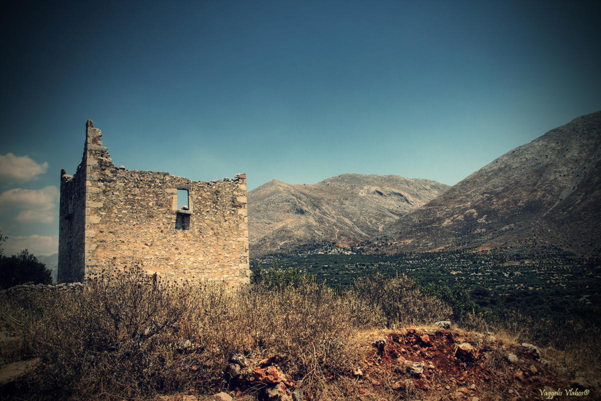
Today the Mani's coastal villages are full of cafés and souvenir shops. The peninsula attracts visitors for its Byzantine churches, Frankish castles, secluded sandy beaches and stunning scenery. Some popular beaches during the summer are Kalogria and the beaches by Stoupa harbor, while Kardamyli and Agios Nikolaos have nice pebble and sand beaches too. The ancient tower houses of Mani (pyrgospita) are significant tourist attractions, and some offer accommodations for visitors. The Diros stalactite and stalagmite caves, near Oitylo, are also popular tourist destination. As they are partly underwater, visitors tour them in gondola-like boats.
Gytheio, Areopoli, Kardamyli, and Stoupa are filled with tourists during the summer months, but the region is generally quiet during the winter months. Many inhabitants work as olive farmers, and devote the winter months to the olive harvest and processing. Some of the villages in the mountains are less tourist oriented and often have very few inhabitants. One of the most traditional and conservative regions of Greece, Mani is a stronghold of the right-wing New Democracy party.
There were wild fires in Mani in the summer of 2007.
Gallery
See also
Further reading
- Patrick Leigh Fermor, (1958). Mani, Travels in the Southern Peloponnese. London: John Murray. Reissued in paperback 2004, ISBN 0-7195-6691-6.
Coordinates: 36°34′05″N 22°25′43″E / 36.56811°N 22.42859°E
Categories:- Peninsulas of Greece
- Mani


Wikimedia Foundation. 2010.