- National Highway (Australia)
-
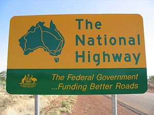 Road sign of the National Highway.
 Australia's National Highway
The file File:NationalHighways.png has an uncertain copyright status and may be deleted. You can comment on its removal. The National Highway Shield in NSW, QLD, WA, NT & TAS.
 The National Highway Shield in VIC, QLD & SA.
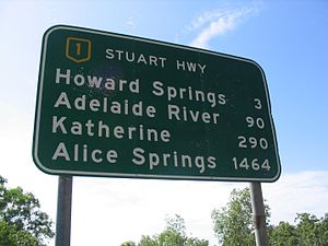 Actual National Highway Sign located on the Stuart Highway - Listing distances to key locations on this highway.
The National Highway (now part of the AusLink National Network) is a system of roads connecting all the States and Territories of Australia, and is the major network of highways connecting Australia's largest and most important cities.
The National Highway was established by the National Highway Act 1974 when Gough Whitlam was Prime Minister of Australia. Before then, while the Federal Government helped to fund major roads, it did not assume direct responsibility for their construction or upkeep. The National Highway was financed entirely by the Federal Government, though State and Territory Governments are responsible for the actual construction and maintenance of the roads that form part of the National Highway.
Under AusLink, established in July 2004, the AusLink National Network has additional links, both road and rail. The Federal Government encourages funding from state, territory and local governments and public-private partnerships to upgrade the network and requires state government funding contributions on parts of the network, especially for new links. For example, the Pacific Highway and the Calder Highway are now part of the National Network, but new projects are being funded 50/50 by Federal and State Governments. State contributions (generally 20%) are required on some sections of the old network near major cities.
Various superseded Acts (most recently, the Australian Land Transport Development Act, 1988) specified which roads were eligible to become part of the National Highway. To qualify, a road or a series of connected roads had to be a direct connection between two State or Territory capital cities. The city of Cairns in the far northern part of the State of Queensland was also included in former Acts.
The National Highway also includes a small (by comparison) 320 km segment in Tasmania - from the northern port cities of Burnie, Devonport, to Launceston and ending in the southern capital Hobart. The Melbourne-Devonport ferry route is sometimes described colloquially as the 'sea highway', providing a link from Tasmania to the rest of the country by road.
Some of the well-known highways that are part of the National Highway include the Hume Highway, the Bruce Highway, the Eyre Highway and the New England Highway.
National Highways are denoted by a route marker in the shape of the highway route number shields found around Australia. The word "NATIONAL" is printed in the upper portion of the shield above the highway's number. The shield, text and number are coloured yellow while the background is dark green - Australia's national colours.
National Highway numbering originates from the earlier National Route network. Many of the routes that are now National Highways with the signature green and gold shields, continue beyond the official National Highway as the black and white shielded National Routes. Certain stretches of the National Highways have "A" and "M" tag on their shields; particularly those in Victoria and South Australia. They have completely revised their route numbering, basing it on the British M, A, B, C classifications. These states have retained the original National Highway numbering and shield decal, having added the appropriate M and A classification.
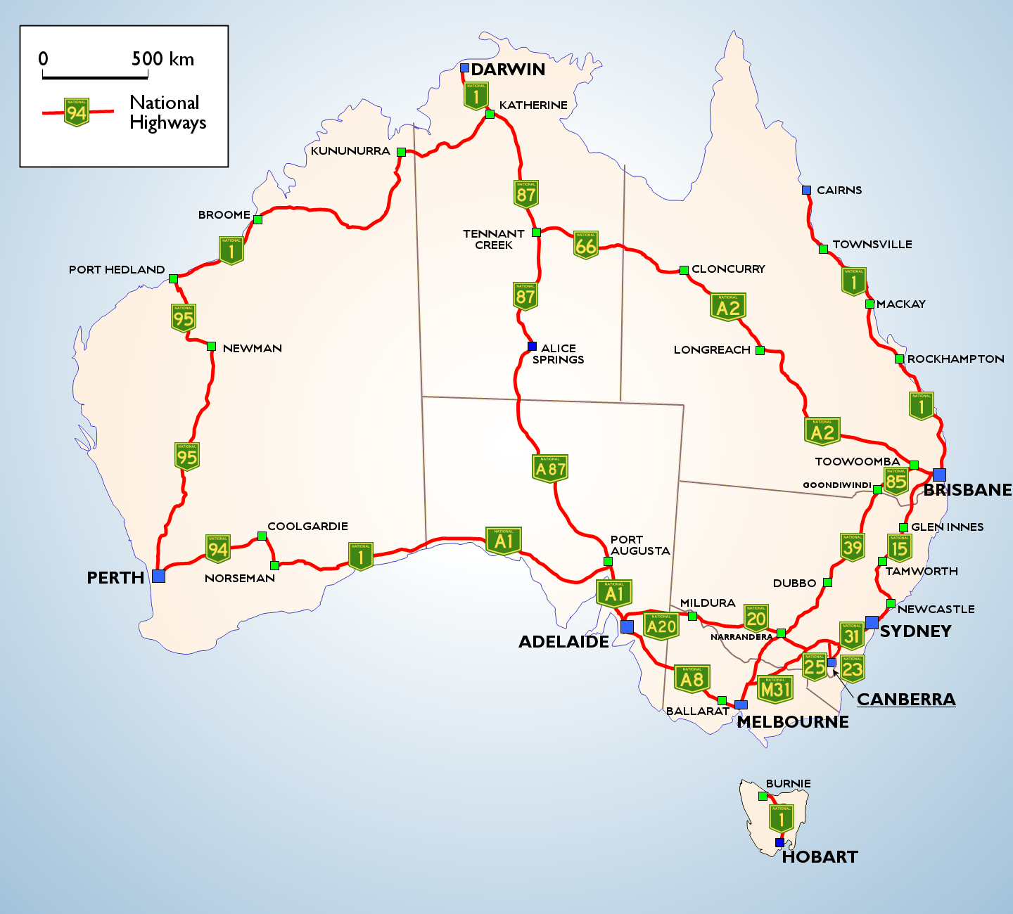
List of roads on the AusLink National Network
- Sydney to Melbourne - Hume Highway and Hume Freeway
- Sydney to Brisbane - the Sydney-Newcastle Freeway, New England and Cunningham Highways route and the Pacific Highway route
- Brisbane to Cairns - Bruce Highway
- Brisbane to Darwin - Warrego, Landsborough, Barkly and Stuart Highways
- Brisbane to Melbourne - Warrego, Gore, Newell and Goulburn Valley Highways and Hume Freeway
- Melbourne to Adelaide - Western Freeway, Western Highway, Dukes Highway, South Eastern Freeway and Adelaide-Crafers Highway
- Adelaide to Darwin - Port Wakefield Road and Stuart Highway
- Adelaide to Sydney - Sturt and Hume Highways
- Adelaide to Perth - Port Wakefield Road, Eyre, Coolgardie-Esperance and Great Eastern Highways
- Perth to Darwin - Great Northern, Victoria and Stuart Highways
- Sydney to Canberra - Hume and Federal Highways
- Melbourne to Canberra - Hume Freeway, Hume and Barton Highways
- Hobart to Burnie including the link from Launceston to Bell Bay - Brooker, Midlands and the Bass Highway
- Townsville to Mount Isa - Flinders Highway
- Melbourne to Sale - Princes Highway
- Perth to Bunbury - South Western Highway
- Melbourne to Mildura - Calder Highway
- Sydney to Dubbo - Great Western and Mitchell Highways
- Sydney to Wollongong - Southern Freeway and Princes Highway
- Melbourne to Geelong - Princes Highway
- some urban links in Sydney, Melbourne, Brisbane, Perth and Adelaide, connecting the long distance links to each other and to ports and airports.
See also
External links
Categories:- Australian highways


Wikimedia Foundation. 2010.