- Midland Highway (Tasmania)
-
Midland Highway
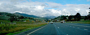
Midland Highway, at DysartRoute information Length: 176 km (109 mi) History: Formerly  [1]
[1]Major junctions South end:  Brooker Highway Granton, Hobart
 Boyer Road
 East Derwent Highway
 Esk Highway
 Lake Highway
 Illawarra Main Road
North end: Bass Highway Launceston, TasmaniaLocation Primary
destinations:Perth, Epping Forest, Campbell Town, Ross, Oatlands, Bagdad, Brighton, Bridgewater Highway system Highways in Australia
National Highway • Freeways in AustraliaThe Midland Highway (also known as the Midlands Highway) is one of Tasmania's major inter-city highways, running for 176 kilometres (109 mi) between Hobart and Launceston. It is part of the AusLink National Network and is a vital link for road freight to transport goods to and from the two cities. It represents a major north-south transportation corridor in Tasmania and has the route 1 designation as part of the National Highway. The highway consists of various traffic lane arrangements, the most common being two lanes – one in each direction, with overtaking options and at-grade intersections. At both the Launcestion and Hobart sections of the highway there are small portions of grade-separated dual carriageway.
Contents
History
Surveyor Grimes marked out the track from Hobart to Launceston in 1807, and Governor Macquarie followed the route in 1811 when he visited the colony accompanied by his wife. The party took five and a half days to complete the journey.
Macquarie again visited the colony in 1821, when the road was fit for a carriage, but his journal records many different sections, and it was not until 1831 that the first regular coach service was operated by J. E. Cox.
The first mailman, Robert Taylor, was appointed in 1816, he walked, leaving Hobart and Launceston on alternate Sundays and carrying the mail in a pack.
The first record of movement between the two centres was in 1821 when then Governor Lachlan Macquarie selected sites for towns on the highway.
It was known as the 'Main Road' or 'Hobart Road' for most of its history. In the 1930s it became known as the Midland Highway, and in the 2000s - it also had 'The Heritage Highway' label applied to it.
The route of the highway originally ran between Hobart and Launceston, and passed through the localities which are now known as: Bridgewater, Brighton, Pontville, Mangalore, Bagdad, Dysart, Kempton, Melton Mowbray, Jericho, Oatlands, Antill Ponds, Woodbury, Tunbridge, Ross, Campbell Town, Conara Junction, Cleveland, Epping Forest, Perth, Breadalbane and Kings Meadows.
As part of the National Highway, there have been many on-going changes to the highway since the 1980s.
The southern outlet in Launceston was built, bypassing many Launceston suburbs, allowing motorists to travel from the Breadalbane roundabout, almost directly to the city centre, at full highway speed. Around the same time, the towns of Ross, Oatlands and Kempton were bypassed.
In 2002, a railway line underpass was constructed near Symmons Plains, south of Perth, to create a grade separated rail crossing on the highway itself. Significant numbers of overtaking lanes have also been extended or created.
Future
As part of the Southern Transport Investment Program there is currently a 9.5 km bypass under construction on the southern section of the Highway. There has been mounting pressure for the Highway to be upgraded to a four lane carriageway for 20 years to fall in line with the Auslink network of highways such as the Hume and Pacific as it is Tasmania's most heavily travelled stretch of long Highway. Plans for Perth and Campbell Town to also be bypassed have also been proposed, but they is unlikely to occur in the near future.
The State and federal Liberal Parties have pledged $400 million to the funding of a dual carriageway highway between Hobart and Launceston.[2] The Liberal Party's claim is that when taking into account the Brighton Bypass, the Southern Outlet and the 34 km of overtaking lanes, there is 120 km of single carriageway road on the Midland Highway.[2] The Australian Labor Party stated that the $400 million dollar budget is grossly underfunded,[3] and could not possibly be constructed for that price.
The Liberal Party defended the accusations that the 3 million/km budget[2] is too low by stating that they are not planning any new road alignments or bypasses, just adding new lanes to the existing alignment. They have not stated if they plan to include grade separation or T-junctions and roundabouts. Should both the federal and state Liberal Parties win the next elections, they plan to upgrade this remaining stretch of road from 2014 progessively.[4]
See also
- Highways in Australia
- List of highways in Tasmania
- Southern Transport Investment Program
- Brighton Transport Hub
Notes
- ^ Former State Route Numbering System in Tasmania, Ozroads: the Australian Roads Website. Retrieved on 30 January 2008.
- ^ a b c http://tasliberal.com.au/policy/four-lane-midland-highway
- ^ http://www.themercury.com.au/article/2010/02/19/128891_tasmania-news.html
- ^ http://www.liberal.org.au/news.php?Id=4831
References
- Alexander, Alison (2005) The Midland Highway in Alexander, A. Ed. The Companion to Tasmanian History. Hobart. Centre for Tasmanian Historical Studies. ISBN 186295223X
Categories:- Australian highways
- Highways in Tasmania
- Highways in Hobart
- Midlands (Tasmania)


Wikimedia Foundation. 2010.