- Mcgees Bridge
-
Mcgees Bridge 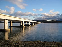
Carries  Tasman Highway
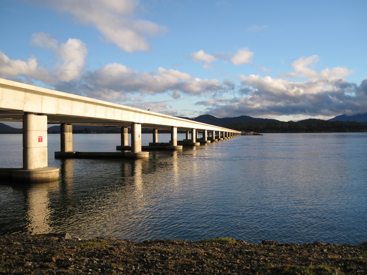
Crosses Pitt Water Locale Hobart, Tasmania Maintained by Department of Infrastructure, Energy and Resources Design post-tensioned trough-girder bridge Total length 1000 meters (causeway)
460 meters (main bridge)Width 15 meters Opened December 2002 Coordinates 42°48′23″S 147°31′33″E / 42.80639°S 147.52583°ECoordinates: 42°48′23″S 147°31′33″E / 42.80639°S 147.52583°E Mcgees Bridge and causeway crosses Pitt Water within the greater area of Hobart, Tasmania. The bridge provides a vital link between Hobart and two of Tasmania's principal tourist attractions - Port Arthur Historic Site on the Tasman Peninsula and the picturesque East Coast via the Tasman Highway.
History
The state government decided in the mid 19th century that if a crossing at Pitt Water could be made, it would considerably reduce the time to reach Sorell. It was decided to build a causeway for two-thirds of the length of Pitt water and have a bridge complete the rest of the crossing. Australia's first Post-tensioned beam and slab bridge was completed in 1957.[1] A feature of the bridge is that the voids for the tendons were created using inflated rubber tubes which were withdrawn after the concrete had set. The bridge was given a 50 year life span. In 2001 it became apparent that the ingress of chlorides had caused the bridge to deteriorate seriously. The State government awarded John Holland P/L a design/build contract to replace the ageing bridge.
The new Bridge (designed by GHD) is thought to be the first match-cast precast-segmental channel-type road bridge outside France and the USA[1]. The $20 million McGees Bridge was the largest single infrastructure project funded by the State Government for more than 15 years.[2].
The new bridge was named as a tribute to Dr Rodney William McGee, ESM, who died after a long battle with cancer on February 1, 2002, aged 47. At the time of his death he was a senior engineer with the Department of Infrastructure, Energy and Resources and was recognised interstate and internationally for his expertise in bridge engineering.[2]
The project was marked by extensive community involvement and particular attention to safeguarding the local environment, as the bridge is in an internationally recognised wetlands site and designated heritage area.[2]
The Premier of Tasmania, Jim Bacon was present at the successful official opening ceremony which was also attended by the Minister for Infrastructure, Jim Cox, the Mayor of Sorell, Carmel Torenius, and members of Rod McGee's family.[2]
References
- ^ a b "CIAconference". John Holland P/L. 2003. http://www.ghd.com.au/aptrixpublishing.nsf/AttachmentsByTitle/PP+SorellCauseway+PDF/$FILE/CIAconference.pdf. Retrieved 2007-04-15.
- ^ a b c d "Secretary's Overview". Department of Infrastructure, Energy and Resources. 2003. http://www.dier.tas.gov.au/annual_reports/2003_annual_report/secretarys_overview. Retrieved 2007-04-11.
 Road Infrastructure in greater Hobart
Highways 
Major Roads Bridges Bowen Bridge · Bridgewater Bridge · Jordan River Bridge · Mcgees Bridge · Sorell Causeway · Tasman BridgeUnder construction Proposals Bagdad Bypass · Eastern Ring Road · Hobart Area Transportation Study · Hobart Bypass · Rokeby Bypass · Sorell Bypass · Southern Transport Investment ProgramCategories:- Bridges in Hobart
- Bridges completed in 2002
Wikimedia Foundation. 2010.