- Brooker Highway
-
Brooker Highway 
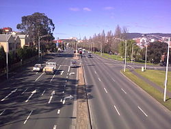
![The Brooker Highway at ClaremontFormerly [1]](/pictures/enwiki/50/200px-Brooker_Hwy10.JPG)
The Brooker Highway at Claremont
Formerly [1]
[1]Length 17 km (11 mi) Direction South-North From  Tasman Highway /
 Davey Street /
Macquarie Street Hobart, Tasmaniavia Glebe, Lutana, Goodwood, Glenorchy, Montrose, Rosetta, Berriedale, Claremont, Austins Ferry To  Midland Highway, Granton, Hobart
Established 1961 Allocation Highway 1 Major junctions  Domain Highway
 Goodwood Road
 Lyell Highway
for full list see Exits
The Brooker Highway is a highway in the State of Tasmania, Australia. Also known as the Northern Outlet, the highway is the major arterial route through Hobart's northern suburbs and is Hobart's major road connection to the cities and towns of Northern Tasmania. It is a part of the National Highway Network and is one of Tasmania's busiest highways.
The Brooker Highway runs approximately 17 km north from the CBD, through the northern suburbs of Hobart, and through the City of Glenorchy, bypassing commercial and industrial centres along the original Main Road. It is a four lane (dual-carriageway) highway, and apart from the Domain Highway junction, only the northern sections of the highway have grade separated junctions. The major at-grade junctions are controlled by traffic light and roundabout intersections.
Contents
History

The original Brooker Avenue was constructed in 1961 as a 2 lane road from the end of Liverpool Street to Elwick Road. In 1965, the Hobart Area Transportation Study was released and entailed large development plans for the Brooker Highway. By 1968 the road had been duplicated and works reached Berriedale. In 1977 the highway was further extended, taking the road to the Claremont Link Road. By 1983 the highway that stands today was complete through to Granton and the Bridgewater bridge.[2] The Brooker Highway was built as a replacement to the original Midland Highway route between Hobart city and Granton, which passed along Elizabeth Street, New Town Road and Main Road, through the built up areas of New Town, Moonah, Glenorchy, Rosetta, Montrose, Claremont and Berriedale.[2] This was the first major highway construction in the Hobart City region, and was named the Brooker Highway, after the Minister for Transport at the time of the conception of the project, Edward Brooker (between Davey Street and Cleary's Gates at the top of the ridge, the highway is also known as "Brooker Avenue").
Route description
The highway starts in the Hobart CBD at the junction with
 Eastern Outlet (Tasman Highway),
  Davey Street and Macquarie Street. The Tasman Highway heads east over the Tasman Bridge, past the Airport and eventually leads to the east coast of the state, while Davey Street leads towards the Southern Outlet, which in turn heads south towards Kingston and Huonville (Davey and Macquarie are one-way streets - Davey Street flows south-west, and Macquarie Street flows north-east through the CBD).
Apart from the connection to Davey and Macquarie Streets, the major intersection with streets in the CBD is the three-lane roundabout at the north-east end of Liverpool Street. Because it was built in close proximity to the main railway station at the time, the roundabout was, and continues to be, called the "Railway Roundabout". The sunken garden in the centre of the roundabout functions as a pedestrian thoroughfare, with under-road tunnels connecting to the two sides of Liverpool Street, the original site of the railway station to the north-east, and to the Domain and the suburb of The Glebe to the north-west. The roundabout was originally just an un-controlled intersection, but with the gradual increase in traffic, particularly from the eastern shore of the Derwent, it was often in grid-lock at peak travel times. Traffic lights were introduced and alleviated the situation, and later construction of the direct links from the Tasman Bridge to Davey and Macquarie Streets further relieved the pressure. Other streets from the CBD provide access to the highway, but for much of its length to the city boundary at Risdon Road it is limited access road.
Through the City of Glenorchy the highway has large multi-lane intersections, at Risdon Road, Elwick Road and Derwent Park Road. The highway is in a reasonable condition for its age, and experiences congestion for only a few hours a day.
Trees line the middle nature strip for several kilometres, and fencing prevents pedestrian access at various points. The Highway makes its way past The Domain, Cornelian Bay Hockey Grounds, Rugby Park, The Royal Hobart Showgrounds, Tattersalls Park and the Derwent Entertainment Centre. At the northern end (at Granton) it connects to the
 Midland Highway (which heads north towards Launceston) and the
  Lyell Highway (which takes motorists towards the west coast).
Recent history
In April 2007, the Department of Infrastructure, Energy and Resources announced plans to replace the sub-standard rusted light poles between Risdon Road and Clearys Gates Road.[3] These are over 40 years old and were the first lights on the Highway, which sparked some concern from the Hobart City Council. They argue that the light poles are in good condition and are a significant feature of the Brooker Highway entrance to Hobart. While the Hobart City Council supports the replacement, they have written to Infrastructure Minister Jim Cox asking him to consider retaining the ornate arms on modern pole bases.[3]
The Department of Infrastructure, Energy and Resources proposes to re-align the Elwick Road and Goodwood Road exits, reducing confusion and the number of traffic lights. The nearby Goodwood roundabout will also be replaced with traffic lights.[4] The Tasmanian Government has also revealed they are currently planning to upgrade the interchange at the Domain Highway to improve access and travel flows for passenger and freight. This includes a capacity expansion to 6 lanes from the Domain Highway to Risdon Road.[5]
Recently the government came under pressure from the community to improve pedestrian access over the highway at Goodwood and eliminate the stairs primarily for the benefit of the elderly and handicapped.
2010 Emergency Landing Incident
On 4 April 2010 18 year old pilot Patrick Humphries made world headlines [6] by using the normally busy highway as an emergency landing strip after experiencing aircraft problems.[7] Humpries was unhurt from the accident and no vehicles where involved in the incident.[8]
Exits
Brooker Highway Southbound interchanges Distance from
Tasman Highway
(km)Distance from
Lyell Highway
(km)Northbound interchanges End Brooker Highway 
continues as Davey Street
to Hobart0 18.5 Start Brooker Highway
from Macquarie StreetBellerive, Sorell
Tasman Highway

Bellerive, Sorell
Tasman Highway No Access 0.2-0.3 18.3-18.2 Hobart
Collins Street, Sackville Street
Hobart
Liverpool Street (west) (exit only)0.4 18.1 Hobart
Liverpool Street (west) (exit only)Bellerive
Liverpool Street (east)Hobart
Bathurst Street (entry only)Hobart
Bathurst Street (entry only)Bellerive
Liverpool Street (east)Glebe
Edward Street0.6 17.9 No Access Hobart
Brisbane Street (exit only)0.7 17.8 Hobart
Brisbane StreetGlebe
Scott Street, Lillie Street,
Davenport Street0.8-1.0 17.7-17.5 No Access North Hobart
Warwick Street1.1 17.4 North Hobart
Warwick StreetGlebe
Shoobridge Street1.3 17.2 North Hobart
Burnett StreetNorth Hobart
Burnett StreetNo Access 1.7 16.8 North Hobart
Federal StreetQueens Domain
Clearys Gates Road2.4 16.1 No Access New Town
Park Street (exit only)2.6 15.9 New Town
Park StreetBellerive, Hobart
Domain Highway
3.2 15.3 Bellerive, Hobart
Domain HighwayNew Town
Risdon Road4.1 14.4 New Town
Risdon RoadMoonah
Bowen Road4.9 13.6 Moonah
Bowen RoadLutana
Ashbolt CrescentLutana
Ashbolt CrescentLutana
Bowen Road5 13.5 No Access Derwent Park, Lutana
Derwent Park Road5.6 12.9 Derwent Park, Lutana
Derwent Park RoadGoodwood
Lampton Avenue (east)6.3 12.2 Derwent Park
Lampton Avenue (west)Derwent Park
Lampton Avenue (west)Derwent Park
Howard Road
7.1 11.4 Derwent Park
Howard RoadGoodwood
Renfrew CourtGoodwood
Renfrew CourtDowsing Point, Bowen Bridge
Goodwood Road
7.5 11 Dowsing Point, Bowen Bridge
Goodwood Road Glenorchy
Elwick Road7.6 10.9 Glenorchy
Elwick RoadDerwent Entertainment Centre
Loyd Road8 10.5 Derwent Entertainment Centre
Loyd RoadMontrose
Duncan Street
9.1 9.4 Montrose
Duncan StreetForeshore Road (No Through Road) Foreshore Road (No Through Road) Dodson Street (No Through Road) 9.6 8.9 Dodson Street (No Through Road) Berriedale, Rosetta
Main Road10 8.5 Berriedale, Rosetta
Main RoadBerriedale, Collinsvale
Berriedale Road (On ramp only)
10.6 7.9 Berriedale, Collinsvale
Berriedale RoadChigwell, Claremont
Claremont Link Road12.4 6.1 Chigwell, Claremont
Claremont Link RoadClaremont
Abbotsfield Road13.7 4.8 Claremont
Abbotsfield RoadClaremont
Hilton Road15 3.5 Claremont
Upper Hilton RoadStart Dual Carriageway 17.2 1.3 End Dual Carriageway Granton
Black Snake Road (On ramp only)17.9 0.6 Granton
Black Snake RoadGranton
Main Road (Off ramp only)18.3 0.2 No Access New Norfolk, Queenstown
Lyell Highway
18.5 0 New Norfolk, Queenstown
Lyell Highway Start Brooker Highway
continues from Midland HighwayEnd Brooker Highway
continues as Midland Highway
to Bridgewater, LauncestonSee also
References
- ^ Former State Route Numbering System in Tasmania, Ozroads: the Australian Roads Website. Retrieved on 30 January 2008.
- ^ a b "Tasmanian Expressways". ozroads.com.au. 2003. http://www.ozroads.com.au/TAS/expressways/expressways.htm. Retrieved 30 April 2007.
- ^ a b "Council poles apart on Brooker lights switch". The Mercury.
- ^ "Lights to end the roundabout blues". The Mercury. 11 February 2008. http://www.news.com.au/mercury/story/0,22884,23192532-3462,00.html. Retrieved 14 February 2008.[dead link]
- ^ "Infrastructure Australia Priorities Welcomed". Tasmanian Government. 19 December 2008. http://www.media.tas.gov.au/release.php?id=25620. Retrieved 24 December 2008.
- ^ http://www.mirror.co.uk/news/top-stories/2010/04/05/teenage-pilot-escapes-unhurt-after-crash-landing-on-motorway-115875-22162919/
- ^ http://www.abc.net.au/news/stories/2010/04/05/2864256.htm
- ^ "Plane crashes on city highway". The Sydney Morning Herald. 4 April 2010. http://www.smh.com.au/national/plane-crashes-on-city-highway-20100404-rlb1.html.
External links
Categories:- 1961 establishments in Australia
- Australian highways
- Highways in Hobart

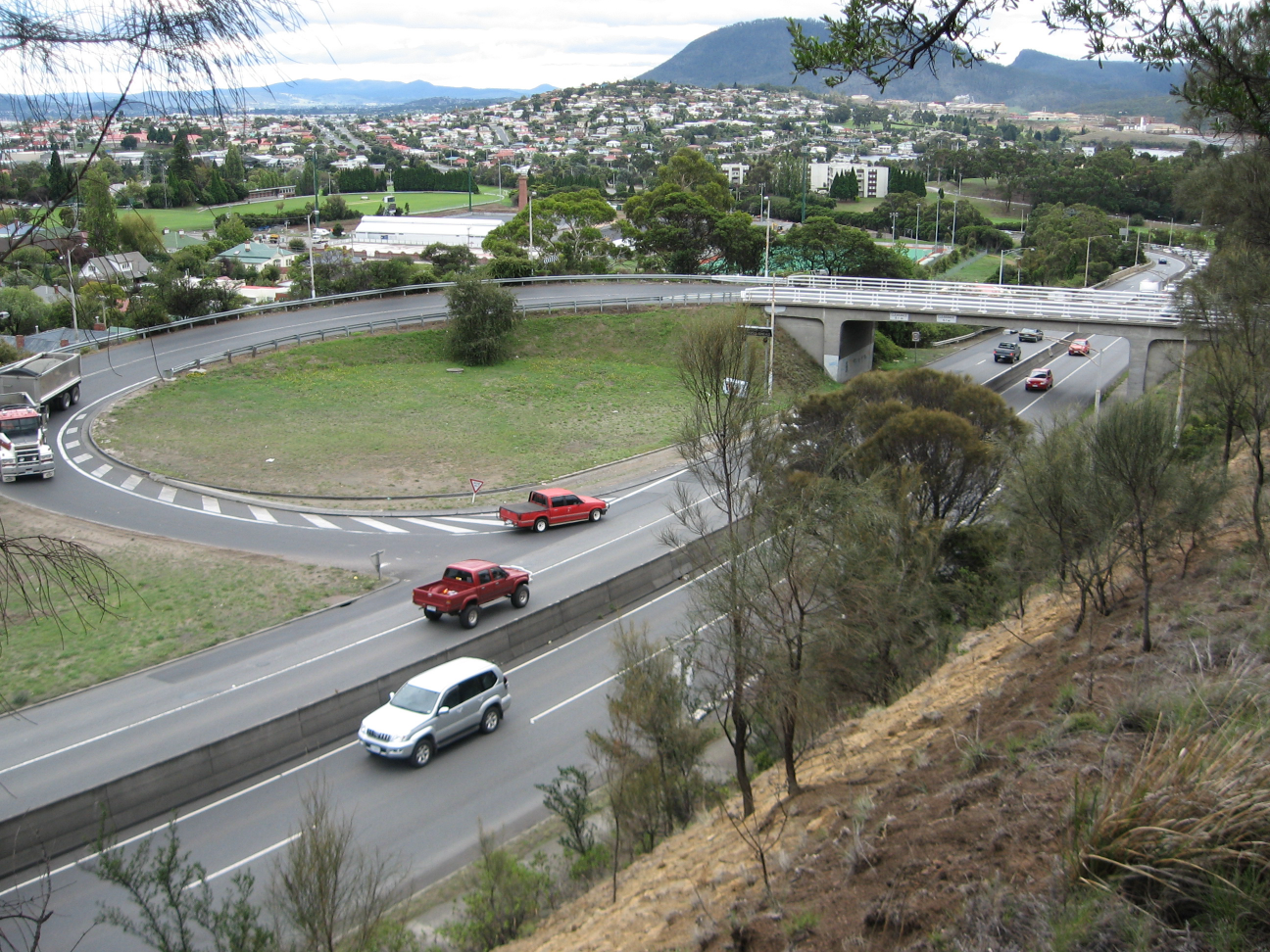
![The Brooker Highway at ClaremontFormerly [1]](/pictures/enwiki/66/Brooker_Hwy10.JPG)

Wikimedia Foundation. 2010.