- Cunningham Highway
-
Cunningham Highway 

Under conversion to 
Length 338 km (210 mi) Direction West-East From  Newell Highway /

 Leichhardt Highway /
 Barwon Highway, Goondiwindi, Queensland NSW/Qld Border
via Yelarbon, Inglewood, Warwick To  Ipswich Motorway /
 Warrego Highway, Ipswich, Queensland
Allocation Goondiwindi - Warwick: Warwick - Ipswich:
Major junctions  New England Highway
 New England Highway
 Boonah-Fassifern Road
The Cunningham Highway is a National Highway in Queensland, Australia. It is named after the explorer and botanist Allan Cunningham who followed a route close to where the modern day highway runs.
Contents
Route
South-west of Ipswich, the highway passes through the Main Range National Park and over the mountain pass of Cunninghams Gap. In 1828 after discovering the route Cunningham sent a report to Governor Ralph Darling emphasising the economic benefits that a link between the coast and pastoral lands to the west would provide.[1]
 Cunningham Highway at Cunningham's Gap
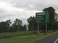
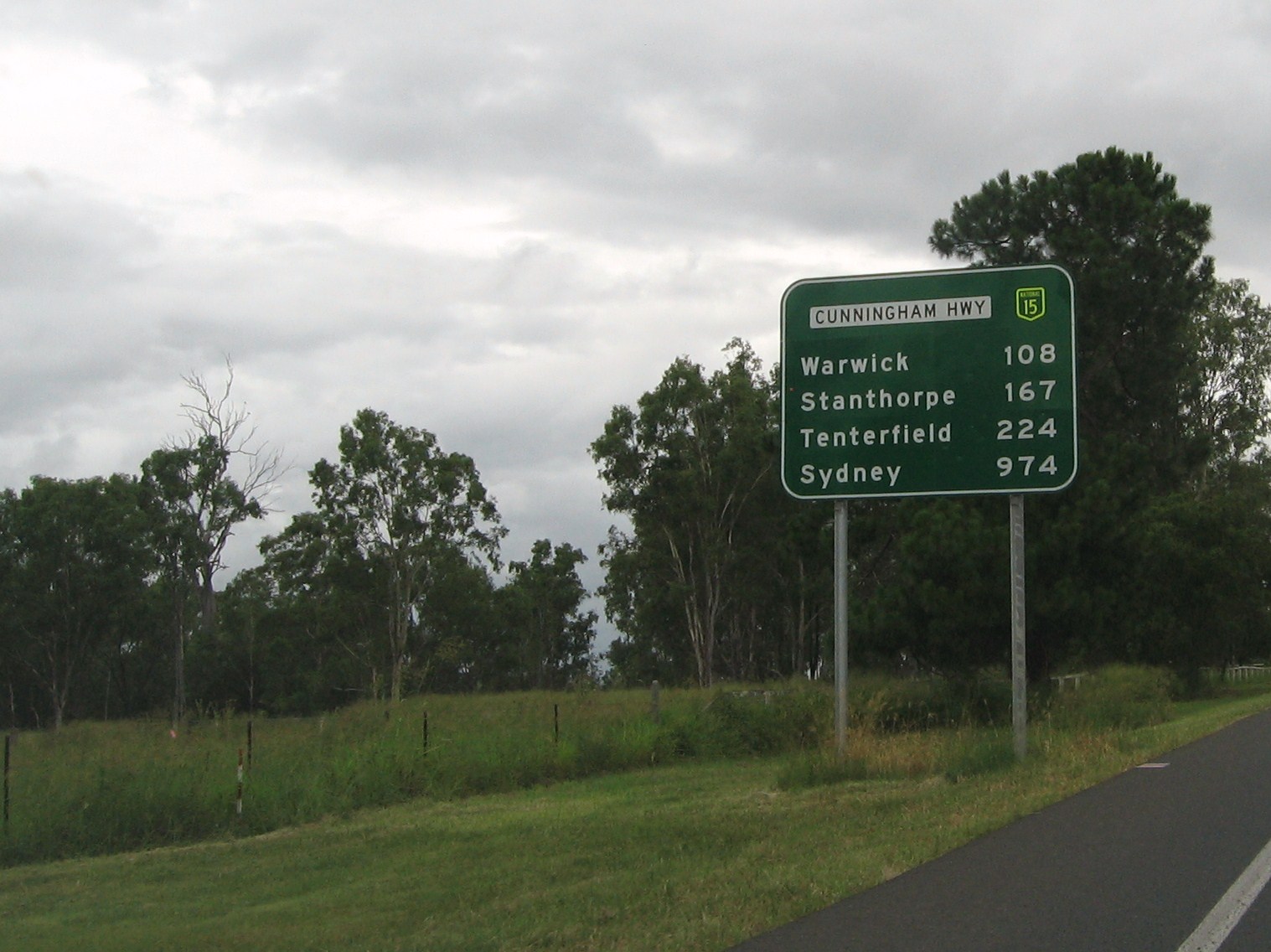
The highway begins in Brisbane where it is known as Ipswich Road, which turns into the M2 Ipswich Motorway. After the Warrego Highway turnoff, it is then known as the Cunningham Highway. It runs south-west from Brisbane for approximately 330 km (210 mi) until it terminates at Goondiwindi. It is route number 15 until Warwick where it then becomes route 42.
The highway is periodically closed for short periods after landslides deposit dirt and rocks on the road, especially around the steep sections near Cunninghams Gap.
The M5 Centenary Motorway extension from Springfield joins the Cunningham Highway at Yamanto. It is also expected to have additional space for expansion and a possible rail loop link to Ipswich-Springfield.
List of towns along the Cunningham Highway
Motorway Section Exits and Interchanges
Cunningham Highway 
Northbound exits Distance to
Brisbane
(km)Distance to
Sydney
(km)Southbound exits End Cunningham Highway 
continues as Ipswich Motorway
to Brisbane / Gold Coast / Sunshine Coast
30 959 Start Cunningham Highway
continues from Ipswich Motorwayno exit 30.5 958.5 Dinmore, Ipswich
Brisbane RoadDinmore
Aberdare Street31 958 no exit Ipswich, Redbank Plains
Mary Street / Redbank Plains Road
34 955 Redbank Plains, Ipswich
Redbank Plains Road / Mary StreetQUEENSLAND PIONEER STEAM RAILWAY 36 953 QUEENSLAND PIONEER STEAM RAILWAY Raceview, Swanbank
South Station Road37 952 Swanbank, Raceview
Swanbank RoadRaceview, Ripley
Ripley Road39 950 Ripley, Raceview
Ripley RoadEND SINGLE CARRIAGEWAY SECTION 40 949 START SINGLE CARRIAGEWAY SECTION Ipswich, Yamanto, Boonah
Warwick Street / Ipswich-Boonah Road
43 946 Boonah, Yamanto
Ipswich-Boonah Road / Warwick StreetVehicle Inspection Centre 44 945 Service Station START MOTORWAY SECTION 45 944 continues as Cunningham Highway
to Warwick / Tenterfield / SydneySee also
References
 Road infrastructure in Queensland
Motorways 
National Highways Barkly Highway • Bruce Highway • Cunningham Highway • Gore Highway • Landsborough Highway • Leichhardt Highway • New England Highway • Warrego HighwayHighways Balonne Highway • Barwon Highway • Brisbane Valley Highway • Burnett Highway • Bunya Highway • Capricorn Highway • Captain Cook Highway • Carnarvon Highway • Castlereagh Highway • Centenary Highway • D'Aguilar Highway • Dawson Highway • Donohue Highway • Flinders Highway • Gold Coast Highway • Gregory Highway • Isis Highway • Kennedy Highway • Leichhardt Highway • Mary Valley Highway • Mitchell Highway • Moonie Highway • Mount Lindesay Highway • Mulligan Highway • Outback Highway • Palmerston Highway • Peak Downs Highway • Wide Bay HighwayDevelopmental Roads /
Outback TracksBirdsville Track • Burke Developmental Road • Gregory Developmental Road • Gulf Developmental Road • Kennedy Developmental Road • Savannah WayProposals Categories:- Highways in Queensland
- Australia road stubs


Wikimedia Foundation. 2010.