- D'Aguilar Highway
-
D'Aguilar Highway 


Length 163 km (101 mi) Direction West-East From  Bunya Highway,
Kingaroy, Queenslandvia Nanango, Yarraman, Kilcoy, Woodford To  Bruce Highway,
Caboolture, QueenslandAllocation Kingaroy - Nanango: Nanango - Yarraman: Formerly
Yarraman - Harlin:Harlin - Caboolture:

Major junctions  Burnett Highway
New England Highway
 Brisbane Valley Highway
 Beerburrum Road
The D'Aguilar Highway is a two-lane highway linking the Bruce Highway near Caboolture with Kingaroy in the state of Queensland, Australia. Major towns along the route include Woodford, Kilcoy, Yarraman, Nanango and Kingaroy. The highway is approximately 163 kilometres (101 mi) in length.
The highway now bypasses Caboolture to the north, with the last section of the bypass opening for traffic on 13 December 2007.
Contents
Route
Major Intersections
Intersections are listed from west to east.
Location Route Distance from Kingaroy Roads Intersected Notes Kingaroy 
0 kilometres (0 mi) Bunya HighwayNanango 
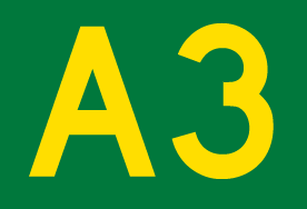
24.3 kilometres (15.1 mi) Burnett HighwayRoute 96 ends, becomes Route A3 Yarraman 
45.3 kilometres (28.1 mi) _  New England Highway
Route A3 continues southwest along New England Highway Blackbutt 59.3 kilometres (36.8 mi) Blackbutt-Crows Nest Road Moore 81.0 kilometres (50.3 mi) Linville Road Harlin 90.3 kilometres (56.1 mi) Brisbane Valley HighwayRoute 17 and 85 continue south along Brisbane Valley Highway Kilcoy 113 kilometres (70 mi) Kilcoy-Murgon Road Dual-signed as Hope Street and William Street within Kilcoy Town Woodford 134 kilometres (83 mi)  Kilcoy-Beerwah Road
D'Aguilar 142 kilometres (88 mi)  Mount Mee Road
Caboolture 161 kilometres (100 mi) Beerburrum RoadCaboolture 163 kilometres (101 mi)  Bruce Highway
Terminus. Route 85 continues east along Caboolture-Bribie Island Road Proposed Kilcoy bypass
In January 2009, the Department of Transport and Main Roads’ Roads published details of the preferred design for a bypass of the Kilcoy township.[1] The proposed route follows an abandoned rail corridor, and would have minimal impact on existing infrastructure.[2]
References
- ^ "D'Aguilar Highway upgrade - Kilcoy Bypass". Queensland Government. 23 October 2009. http://www.mainroads.qld.gov.au/en/Projects/A-Z-Search/A-E/DAguilar-Highway-upgrade-Kilcoy-Bypass.aspx. Retrieved 25 March 2010.
- ^ "Kilcoy Bypass Preliminary Design". Queensland Government. October 2009. http://www.mainroads.qld.gov.au/~/media/files/projects/a-e/daguilar-highway-upgrade-kilcoy-bypass/kilcoybypasslayout.pdf. Retrieved 25 March 2010.
See also
- Highways in Australia
- List of highways in Queensland
- Bridges over the Brisbane River
 Road infrastructure in Queensland
Motorways 
National Highways Highways Balonne Highway • Barwon Highway • Brisbane Valley Highway • Burnett Highway • Bunya Highway • Capricorn Highway • Captain Cook Highway • Carnarvon Highway • Castlereagh Highway • Centenary Highway • D'Aguilar Highway • Dawson Highway • Donohue Highway • Flinders Highway • Gold Coast Highway • Gregory Highway • Isis Highway • Kennedy Highway • Leichhardt Highway • Mary Valley Highway • Mitchell Highway • Moonie Highway • Mount Lindesay Highway • Mulligan Highway • Outback Highway • Palmerston Highway • Peak Downs Highway • Wide Bay HighwayDevelopmental Roads /
Outback TracksBirdsville Track • Burke Developmental Road • Gregory Developmental Road • Gulf Developmental Road • Kennedy Developmental Road • Savannah WayProposals Categories:- Highways in Queensland
- Australia road stubs


Wikimedia Foundation. 2010.