- Nanango, Queensland
-
Nanango
Queensland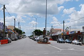
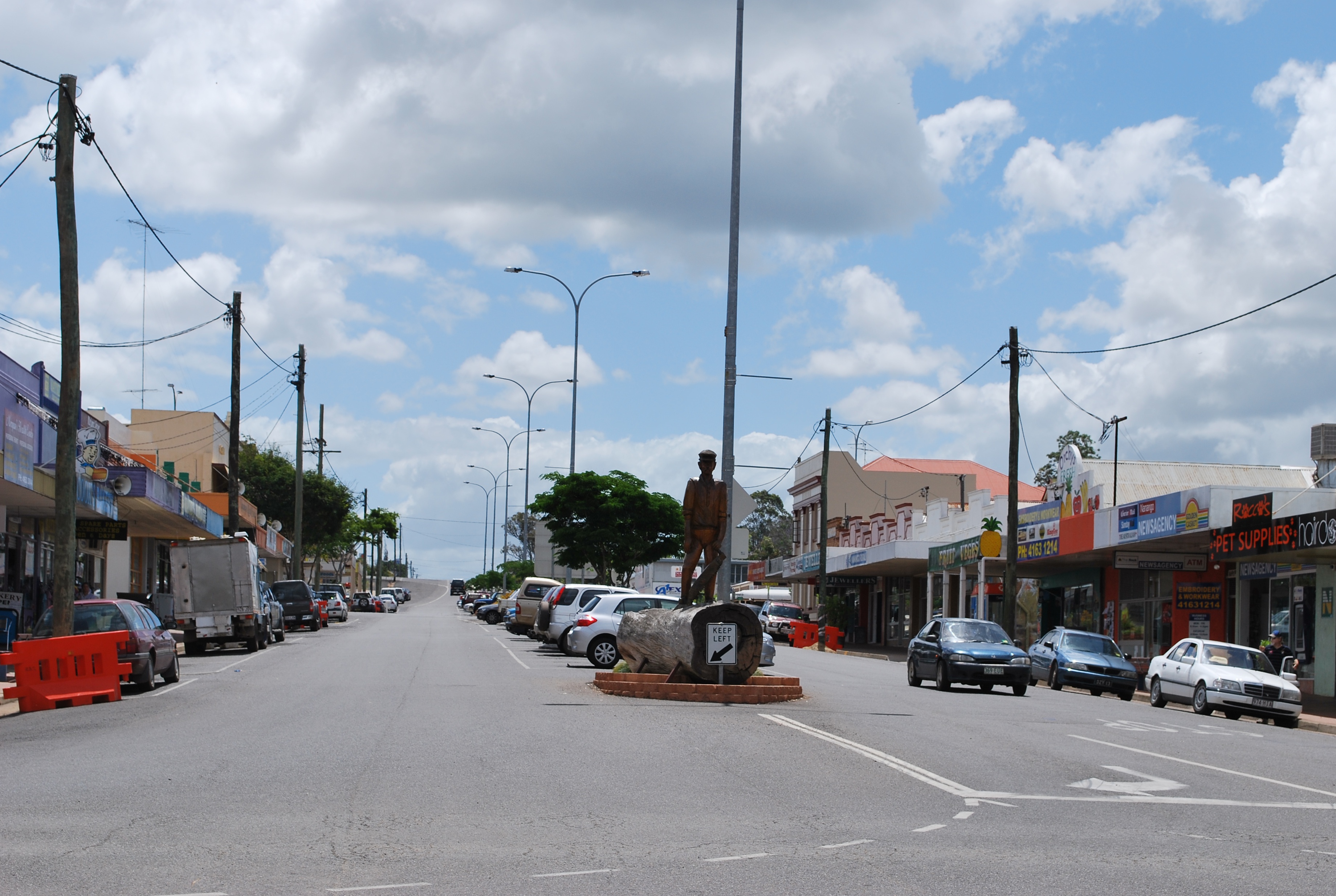
Drayton St, the main street of Nanango
 Nanango
Population: 3,083[1] Postcode: 4615 Coordinates: 26°40′S 152°00′E / 26.667°S 152°ECoordinates: 26°40′S 152°00′E / 26.667°S 152°E Elevation: 355.0 m (1,165 ft) Location: LGA: South Burnett Region State District: Nanango Federal Division: Blair Mean max temp Mean min temp Annual rainfall 25.2 °C
77 °F10.0 °C
50 °F788.7 mm
31.1 inNanango (
 /nəˈnæŋɡoʊ/)[2] is a town in the South Burnett region of Queensland, Australia. It is the fourth oldest town in Queensland.[citation needed] At the 2006 census, Nanango had a population of 3,083.[1] It is situated 210 kilometres (130 mi) north-west of the state capital, Brisbane. Nanango sits at the junction of the D'Aguilar and Burnett Highways.
Contents
History
The original inhabitants of the area were the indigenous people belonging to the Wakka Wakka (or Waka Waka) people. The area was used as a gateway to the bunya nut festivals, where Aboriginal people would travel from far as far away as the Clarence River in northern New South Wales and the Maranoa River to feast on bunya nuts from the bunya trees.
The area around Nanango was first settled by Europeans in 1847 by John Borthwick and William Oliver from Ipswich taking up pastures for sheep farming. Oliver selected an area of more than 500 km² that comprised four blocks - Coolabunia, Booie, Broadwater and Nanango.
The first commercial establishment at the present site of Nanango township was Goode's Inn, founded by prospector Jacob Goode. The inn served travellers journeying from Brisbane and Limestone (now known as Ipswich) and became the meeting place for early residents of Taromeo, Tarong and Nanango stations. The town of Nanango quickly developed around it. Goode was officially licensed to sell "fermentous liquor" in 1851, probably three years after he commenced to do so in 1848.
The name Nanango has evolved from the Wakka Wakka word "Nunangi". There is dispute over the origins of the name Nanango- the word means "large watering hole" or but was also the name of a local aboriginal leader at the time of settlement. The original settlement was called "Noogoonida" by the aboriginies, meaning "place where the waters gather together".
Beef, dairy and timber (in particular the valuable red cedar) were the primary early industries in the area. The discovery of gold at the Seven Mile Diggings near Nanango in 1867 precipitated a gold rush, and consequently a local population boom, however the gold deposits were found to be meagre. At one time the population included 700 miners, many of whom were Chinese. A second population boom occurred when the Brisbane Valley railway line was extended to Yarraman in 1911[3]. Nanango became the terminus of a branch off the South Burnett railway line at Kingaroy on 13 November, 1911[4]. The 22.5km (14 mile) missing rail link between Nanango and Yarraman, although planned was never built. After World War I, however, growth levelled off until the early 1970s when the development of the Tarong Power Station led to a third population explosion. McCauley Weir was used as the town's water supply until three additional bores were drilled at the confluence of Barkers Creek and Meandu Creek.
Economy
Today Nanango's principal industries are power generation and coal mining, agriculture, beef and pork production, dairying and milk processing, timber growing and milling, small crops, natural medicine, art and craftwork and tourism.
Education
Nanango has two primary schools being Nanango State Primary situated near Barkers creek and a Catholic school called St. Patricks. It is also fortunate to hold a high school, Nanango State High School which was established in 1982 and is set over 35 acres of land. It has over 500 students and includes a special needs unit
Culture
Nanango also has a vigorous cultural and sporting life and is host to several potteries and many craft outlets. The town also has many clubs and a range of sporting facilities including an RSL, bike, darts, golf, lawn bowling and archery clubs. There are 13 well-maintained parklands in the Shire which naturalists believe are home to 250 different bird species.
Tourism
Located approximately 200km away from Brisbane, Nanango attracts day and weekend trippers from South East Queensland. Tourists also travel through the town on their way between Rockhampton in the north and Sydney/Melbourne in the south. The CBD features chainsaw sculptures and murals which reflect the town's historical connections with timber-felling, farming and mining.
A great deal of Nanango's colourful history is preserved in its buildings - especially Ringsfield House, a restored circa 1908 Queenslander developed by architect Robin Dods and now the headquarters of the Nanango Historical Society. Unfortunately a number of fires throughout history have ravaged the CBD of the town, especially the fire of 1940 which destroyed all of the shops on the southern side of Drayton Street from Fitzroy to Henry Street. This has led the CBD to have a "1950's feel" to it due to the architecture of the time. One building that escaped the ravages of fire was "Nobby's Corner", an example of an old-fashioned corner store with wide verandahs.
Nanango serves as a gateway for exploration of nearby towns. Day trips from the town include the Grapes and Gourmets Drive,[5] Bunya Mountains, Coomba Falls and fossicking at Seven Mile Diggings. The "Great Bunya Drive" was created in 2006 and passes through the township and other regional attractions.
Events
Nanango has a number of live entertainment venues which regularly host performances by local theatre and musical groups. The Lee Park race track - not far south of the CBD - hosts around 8 meetings each year.
Major annual events include the international Criterium Bike Race (held in Nanango's CBD in February); the Nanango Show (held at the Nanango Showgrounds in April); the Nanango Arts Festival (held over a week in June); the Nanango Country Music Muster (held at the Showgrounds in September); the week-long Pioneer Festival, previously known as the Mardis Gras, until locals were worried it may be mistaken for a similarly named festival in New South Wales (in October) and the Christmas Carnival (in December).
External links
- University of Queensland: Queensland Places:Nanango
- ABC Regional Article 29 August 2002
- Historical timeline of the South Burnett
References
- ^ a b Australian Bureau of Statistics (25 October 2007). "Nanango (Urban Centre/Locality)". 2006 Census QuickStats. http://www.censusdata.abs.gov.au/ABSNavigation/prenav/LocationSearch?collection=Census&period=2006&areacode=UCL343400&producttype=QuickStats&breadcrumb=PL&action=401. Retrieved 2008-03-27.
- ^ Macquarie Dictionary, Fourth Edition (2005). Melbourne, The Macquarie Library Pty Ltd. ISBN 1-876429-14-3
- ^ Whistlestop wines
- ^ Rails to Nanango Milne, Rod Australian Railway Historical Society Bulletin, May, 1993 pp116-131
- ^ South Burnett Holidays
Towns and communities in the South Burnett Region | Wide Bay-Burnett | Queensland Categories:- Towns in Queensland

Wikimedia Foundation. 2010.