- Memerambi, Queensland
-
Memerambi
Queensland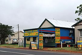
The "Stop Shop" at Memerambi
 Memerambi
Population: 541[1] Postcode: 4610 Coordinates: 26°27′S 151°49′E / 26.45°S 151.817°ECoordinates: 26°27′S 151°49′E / 26.45°S 151.817°E Location: LGA: South Burnett Region State District: Nanango Federal Division: Maranoa Memerambi is a town in the South Burnett region of Queensland, Australia. The name 'Memerambi' is an Aboriginal word for Sugargum tree. The town is located in the South Burnett Region Local government area and on the Bunya Highway, 239 kilometres (149 mi) north west of the state capital, Brisbane. At the 2006 census, Memerambi and the surrounding area had a population of 541.[1] Memerambi was once a bustling centre with a hotel, two general stores, saddlery, butcher, bank, mobile sawmill and cheese factory. Today businesses in Memerambi include 'Stop Shop' general store; clock repairs; large machinery & engineering works; pharmaceutical manufacturing; stock feed store; graziers; concreting & pool construction.[2]
Notable residents
- Mr Kingston and his wife with their four children. Mr and Mrs Kingston were the first storekeepers in Memerambi[3]
- Arthur Benjamin Postle, a professional sprinter known as "The Crimson Flash", was acclaimed "the fastest man in the world" in 1906. He moved to Memerambi in 1913 and operated his own auctioning business there.[4]
- Ben and Harry Young, of Memerambi, pioneers of the South Burnett peanut industry, planted the first commercial crop of peanuts in the South Burnett in 1919. These brothers were sons of a Chinese immigrant, Ah Young. Harry Young later designed the first peanut thresher in Queensland and Ben became a director of the Peanut Marketing Board.[5]
References
- ^ a b Australian Bureau of Statistics (25 October 2007). "Memerambi (Kingaroy Shire)". 2006 Census QuickStats. http://www.censusdata.abs.gov.au/ABSNavigation/prenav/LocationSearch?collection=Census&period=2006&areacode=SSC36677&producttype=QuickStats&breadcrumb=PL&action=401. Retrieved 2009-04-02.
- ^ Locafy: Local Area Marketing, accessed on 2011-11-13.
- ^ Bonzle Digital Atlas of Australia, Image sourced from Picture Queensland, State Library of Queensland This image is free of copyright restrictions.
- ^ Australian Dictionary of Biography, accessed on 2011-11-13.
- ^ "History of the Australian Peanut Industry". Peanut Company of Australia. http://www.pca.com.au/history.php?subaction=showfull&id=1206929287&archive=&start_from=&ucat=27&. Retrieved 2009-10-17.
Towns and communities in the South Burnett Region | Wide Bay-Burnett | Queensland Categories:- Towns in Queensland
- Queensland geography stubs


Wikimedia Foundation. 2010.