- Carnarvon Highway
Infobox Australian Road
road_name = Carnarvon Highway
""'Carnarvon Developmental Road"
route_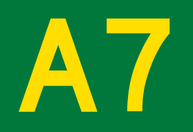
route_
route_
photo =
caption = Formerly
length = 696
direction = North-South
start = "'
finish =
est =
through = Injune, Roma, Surat, St George, Mungindi
route = "Rolleston - St George:"
exits =The Carnarvon Highway [ [http://www.hotkey.net.au/~krool/photos/qld/carnarvon.html Carnarvon Highway] , "Ozroads: the Australian Roads Website". Retrieved on
July 26 2008 .] is a statehighway ofQueensland , linking Moree south of the NSW/QLD border, via the town of St George, eventually to the township of Rolleston. North of Roma it is known as the Carnarvon Developmental Road. National Route 46 runs from Moree to St George. The A7 then continues north from St George to Rolleston, which continues along theDawson Highway andGregory Highway to Emerald and Charters Towers.It is the main access road to the
Carnarvon National Park .Route Numbering
National Route 55 (NR55) [ [http://www.ozroads.com.au/NSW/RouteNumbering/National%20Routes/55/nr55.htm National Route 55] , "Ozroads: the Australian Roads Website". Retrieved on
July 26 2008 .] was a former north-south route through central northernNew South Wales and centralQueensland , connecting theNewell Highway at Gilgandra with Walgett, St George, Roma, Emerald and Charters Towers. The highway was a strategic route to take B-doubles and other large vehicles (which cannot use theBruce Highway ) to the Queensland ports north of Rockhampton.Today, NR55 only covers 340km of the
Castlereagh Highway , having been replaced by the alpha-numeric designation A55 within Queensland during 2004. A7 has now replaced the NR55 route of the Carnarvon Highway between Rolleston and St George. National Route 46, newly signposted, now extends from St George to Moree.NR55 signs were first erected in
New South Wales between Gilgandra and Walgett. It had then been extended from Walgett to the Queensland border at Hebel, in the late 1970s - where it originally terminated.NR55 first appeared in
Queensland on the Gregory and Dawson Highways, between Emerald and Rolleston, during the early 1980s.This is where for many years there was an oddity between the
Queensland andNew South Wales interpretation of the path that NR55 would take. It created the situation where the southern end of route NR55 (Carnarvon Highway) was located over 100 kilometres west from the northern end of route NR55 (Castlereagh Highway ).Eventually, NR55 was taken as an extension of the
Castlereagh Highway between the Queenland/New South Wales border and St George. With the change in alphanumeric route numbering in the mid 2000s, NR55 was completly decomissioned along the entire stretch of the Carnarvon Highway and was replaced with National Route 46 between St George and Moree, and the A7 between St George and Rolleston.List of towns on the Carnarvon Highway
*
Moree
*Ashley
*Garah
*Mungindi
*St George
*Surat
*Roma
*Injune
*RollestonSee also
*
Highways in Australia
*List of highways in Queensland
*List of highways in New South Wales References

Wikimedia Foundation. 2010.