- Fort Atkinson (Nebraska)
-
Fort Atkinson State Historical Park 
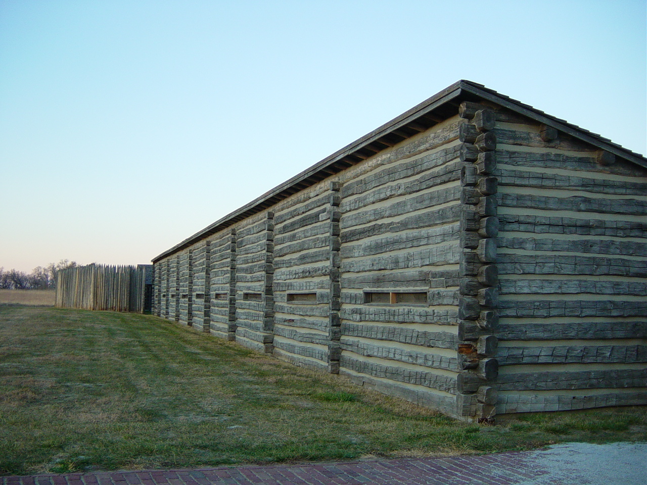
West ramparts of (reconstructed) Fort AtkinsonLocation Washington County, Nebraska, USA Nearest city Fort Calhoun, NE Coordinates 41°27′08″N 96°00′45″W / 41.45222°N 96.0125°WCoordinates: 41°27′08″N 96°00′45″W / 41.45222°N 96.0125°W Established 1971 Governing body Nebraska Game and Parks Commission Fort AtkinsonBuilt: 1819 Architect: Unknown Governing body: State NRHP Reference#: 66000454
[1]Significant dates Added to NRHP: October 15, 1966 Designated NHL: July 4, 1961[2] (See also, Fort Atkinson, Wisconsin)
Fort Atkinson was the first United States Army post to be established west of the Missouri River in the unorganized region of the Louisiana Purchase of the United States. Located just east of present-day Fort Calhoun, Nebraska, the fort was erected in 1819 and abandoned in 1827. The site is now known as Fort Atkinson State Historical Park and is a National Historic Landmark. A replica fort was constructed by the state at the site during the 1980s-1990s.
The post, which included soldiers, traders, trappers, and other frontier people, has been credited by the Nebraska State Legislature as the first town in Nebraska. Founded almost 30 years before the creation of the Nebraska Territory, Fort Atkinson had more than 1,000 residents. It included a brickyard, lime kiln, stone quarry, grist mill, saw mill, and cooper shop.[3]
Contents
Lewis and Clark
The site that would become Fort Atkinson was the Council Bluff (not to be confused with Council Bluffs, Iowa, 20 miles to the south) used for an 1804 council between the Lewis and Clark Expedition and members of the Oto and Missouria Native American tribes. William Clark recommended the high bluff overlooking the Missouri River to the United States government as a suitable location to build a fort.
Council Bluff: frontier post
Fifteen years later, in 1819, President James Monroe dispatched a military expedition (the Yellowstone Expedition, led by Colonel Henry Atkinson) to establish a series of forts along the Missouri. These forts were to support the American fur trade and counteract British influence on the northern plains. The 6th US Infantry and 1st Rifle Regiments made up the military portion of the expedition, which arrived at the Council Bluff site on September 19. It was located near Fort Lisa and Cabanne's Trading Post, private fur trading establishments operated by major traders who were based in St. Louis, Missouri.[4]
The expedition stopped to build Cantonment Missouri, a winter camp along the river bottom below the bluffs. Abandoning plans to establish more forts upstream, the soldiers settled in for winter. The winter of 1819-20 was very harsh; a shortfall of government contractors left the garrison without sufficient supplies. The soldiers suffered widespread scurvy (due to poor nutrition and lack of vitamin C), which claimed the lives of over 200 of the 1,120 men that first winter. Estimates of the civilian deaths is possibly as high as double the military dead; no records were kept of their losses.[4]
In the spring of 1820, the Missouri River flooded Cantonment Missouri. The soldiers built a permanent camp atop Council Bluff, and renamed it Fort Atkinson. Originally, the fort was to be named "Fort Calhoun" in honor of the Secretary of War, John C. Calhoun, but its first commander was honored.[4] During the 1820s, soldiers took meteorological observations as research for the government.
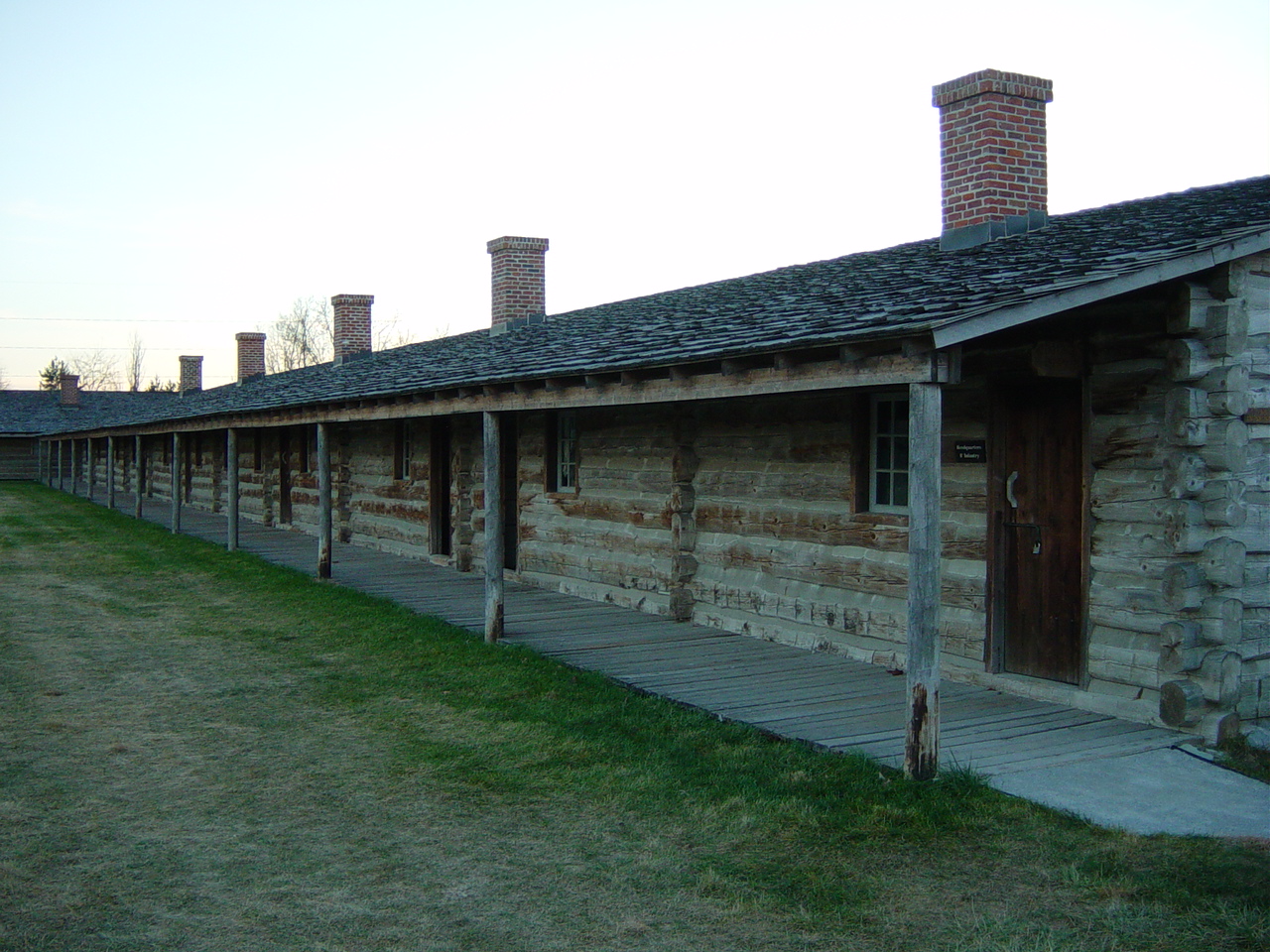
 Detail of (reconstructed) west rampart barracks
The garrison was involved in combat only in 1823. Members of the Arikara tribe attacked a trading post along the Missouri River in present-day South Dakota. Soldiers from the fort retaliated by attacking an Arikara village. Although no American soldiers died in the brief skirmish, seven soldiers drowned on the way upriver when their keelboat struck a log. They were counted as the first United States' casualties in the Indian Wars on the Great Plains.
In 1827, the Army abandoned the fort at Council Bluff and reassigned its personnel to other locations.
Re-activation of Fort Atkinson
When the Mormons established Cutler's Park in the North Omaha area in 1846, some of their food for the harsh winter was provided from old provisions they found at the fort. By the 1850s, when widespread European-American settlement began in the area, little remained of the fort.
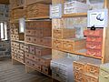
In the 1950s, Nebraska State Historical Society archeological crews determined the locations of buildings at the Fort Atkinson site. The Nebraska Game and Parks Commission gained title to the site in 1971. During the 1980s and 1990s, it reconstructed the fort. Today, Fort Atkinson is a Nebraska state historical park, which includes a military museum. It was designated a National Historic Landmark.
Living history demonstrations take place on the first weekend of each month from May to October. In addition to people demonstrating craft work and the duties of the Indian agent, military re-enactors interpret the activities of the Sixth Regiment of United States Infantry and First Regiment of United States Riflemen.
Image gallery
-

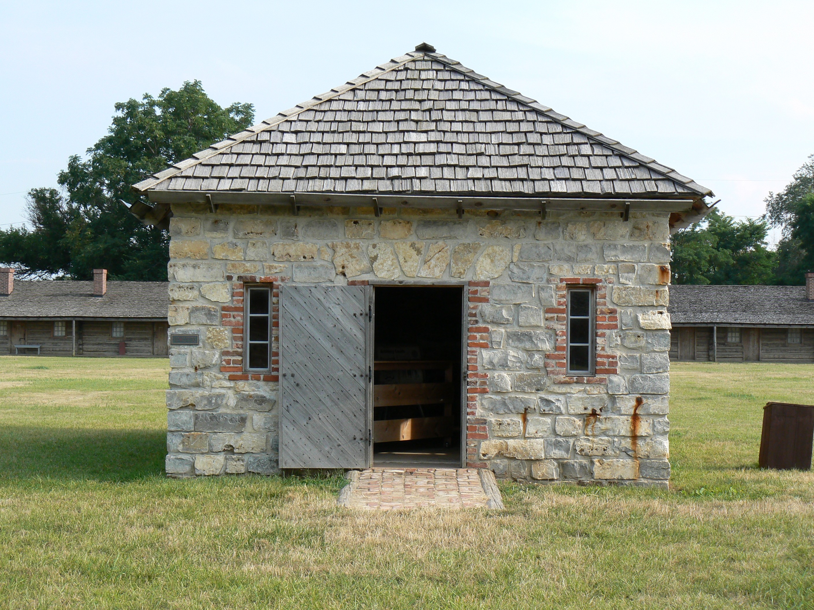
Outside of the (reconstructed) powder magazine at Fort Atkinson.
-
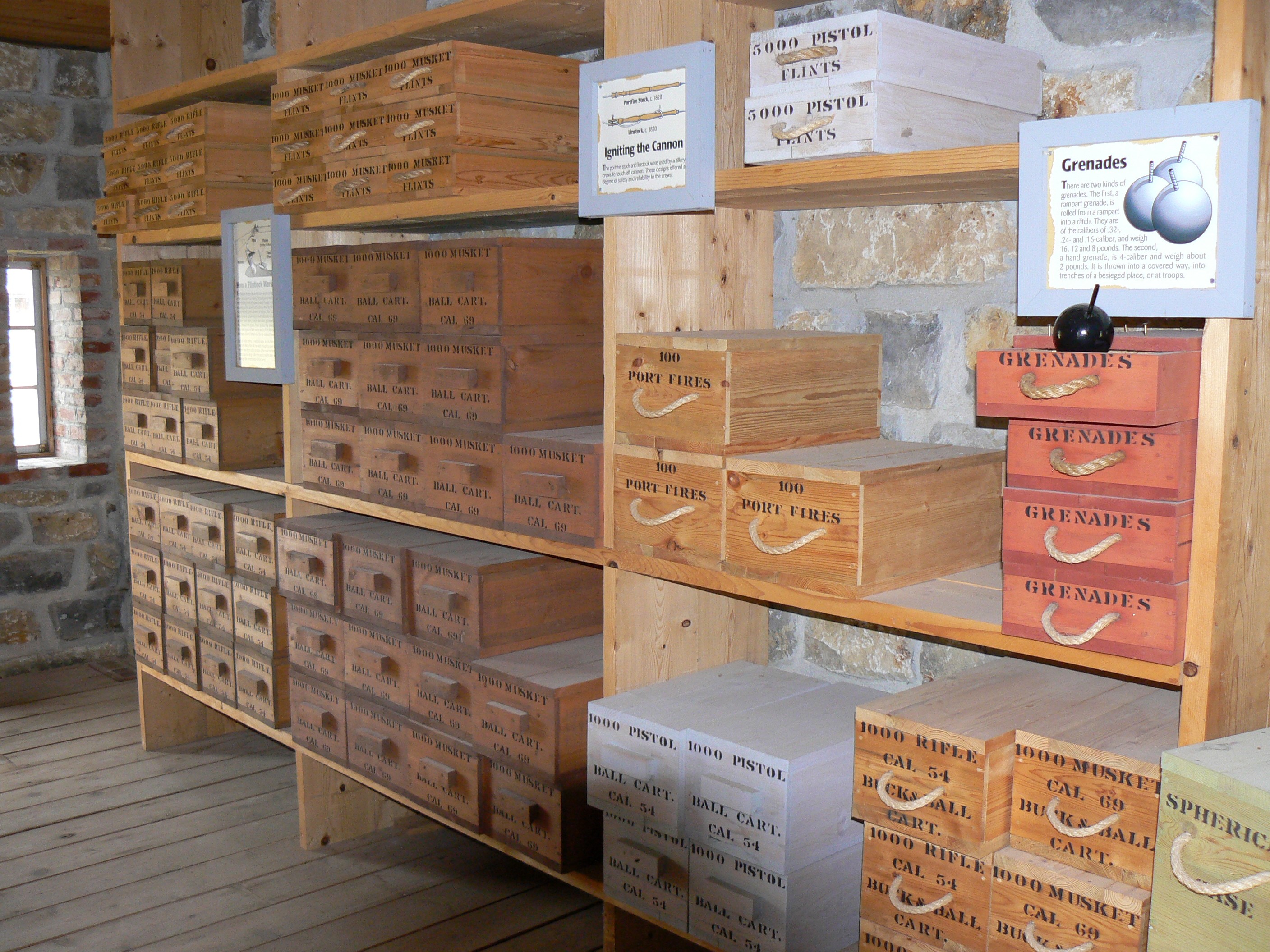
Inside of (reconstructed) powder magazine at Fort Atkinson.
See also
- Washington County Historical Association
- National Register of Historic Places listings in Washington County, Nebraska
References
- ^ "National Register Information System". National Register of Historic Places. National Park Service. 2008-04-15. http://nrhp.focus.nps.gov/natreg/docs/All_Data.html.
- ^ "Fort Atkinson". National Historic Landmark summary listing. National Park Service. http://tps.cr.nps.gov/nhl/detail.cfm?ResourceId=318&ResourceType=Site. Retrieved 2008-06-27.
- ^ (1912) Bulletin. Issues 2. Nebraska State Legislature. p. 7.
- ^ a b c "Fort Calhoun -- Washington County". Nebraska...Our Towns. University of Nebraska-Lincoln. http://www.casde.unl.edu/history/counties/washington/fortcalhoun/. Retrieved 2009-10-19.
External links
- Fort Atkinson State Historical Park
- Friends of Fort Atkinson
- History of Fort Atkinson
- Nebraska State Historical Society - Fort Atkinson
- Fort Atkinson records, Nebraska State Historical Society
U.S. National Register of Historic Places Topics Lists by states Alabama • Alaska • Arizona • Arkansas • California • Colorado • Connecticut • Delaware • Florida • Georgia • Hawaii • Idaho • Illinois • Indiana • Iowa • Kansas • Kentucky • Louisiana • Maine • Maryland • Massachusetts • Michigan • Minnesota • Mississippi • Missouri • Montana • Nebraska • Nevada • New Hampshire • New Jersey • New Mexico • New York • North Carolina • North Dakota • Ohio • Oklahoma • Oregon • Pennsylvania • Rhode Island • South Carolina • South Dakota • Tennessee • Texas • Utah • Vermont • Virginia • Washington • West Virginia • Wisconsin • WyomingLists by territories Lists by associated states Other  Category:National Register of Historic Places •
  Portal:National Register of Historic Places
Federal National MonumentsNational Historic TrailsNational Recreation AreasNational Wildlife RefugesState State ParksChadron · Eugene T. Mahoney · Fort Robinson · Indian Cave · Niobrara · Platte River · Ponca · Smith Falls
State Historical ParksAshfall Fossil Beds · Ash Hollow · Arbor Lodge · Bowring Ranch · Buffalo Bill Ranch · Champion Mills · Fort Atkinson · Fort Hartsuff · Fort Kearny · Rock Creek Station
State Recreation AreasAlexandria · Arnold · Atkinson Lake · Blue River · Bluestem · Bowman Lake · Box Butte Reservoir · Branched Oak · Bridgeport · Brownville · Calamus · Champion Lake · Cheyenne · Conestoga · Cottonmill · Crystal Lake · Dead Timber · DLD · Enders Reservoir · Fort Kearny · Fremont Lakes · Gallagher Canyon · Johnson Lake · Keller Park · Lake Maloney · Lake McConaughy · Lake Minatare · Lake Ogallala · Lewis and Clark · Long Lake · Long Pine · Louisville · Medicine Creek · Memphis · Merritt Reservoir · Mormon Island · North Loup · Olive Creek · Oliver Reservoir · Pawnee Lake · Pelican Point · Pibel Lake · Pioneer · Red Willow Reservoir · Riverview Marina · Rock Creek Lake · Rock Creek Station · Rockford · Sandy Channel · Schramm Park · Sherman Reservoir · Stagecoach · Summit Lake · Sutherland Reservoir · Swanson Reservoir · Two Rivers · Union Pacific · Verdon · Victoria Springs · Wagon Train · Walgren Lake · War Axe · Wildcat Hills · Willow Creek · Windmill
State Recreation TrailsNebraska Game and Parks Commission (web) History of the Fur Trade in Nebraska Fur trading posts Cabanne's Trading Post · Fort Lisa · Pilcher's Post · Bordeaux Trading Post · Fort Charles · Post of the Otos · Robidoux Pass Trading PostFur traders Peter A. Sarpy · Manuel Lisa · Jean-Pierre Cabanné · Lucien Fontenelle · Joshua Pilcher · Joseph La Flesche · Logan FontenelleFur trading tribes Fur trading companies Other Steamboat Bertrand · Fort Atkinson · Museum of the Fur Trade · Platte River · Missouri River · Elkhorn RiverCategories:- Archaeological sites in Nebraska
- Forts in Nebraska
- Nebraska state parks
- National Historic Landmarks in Nebraska
- 1819 establishments
- Military and war museums in Nebraska
- Museums in Washington County, Nebraska
- Pre-state history of Nebraska
- Protected areas of Washington County, Nebraska
-
Wikimedia Foundation. 2010.