- DeSoto National Wildlife Refuge
-
Desoto National Wildlife Refuge IUCN Category IV (Habitat/Species Management Area)

Location Harrison and Pottawattamie counties in Iowa and Washington County in Nebraska, USA Nearest city Blair, NE Coordinates 41°31′25.2″N 96°1′4.6″W / 41.523667°N 96.017944°WCoordinates: 41°31′25.2″N 96°1′4.6″W / 41.523667°N 96.017944°W Area 8,362 acres (33.83 km2) Established March 12, 1958 Governing body U.S. Fish and Wildlife Service |
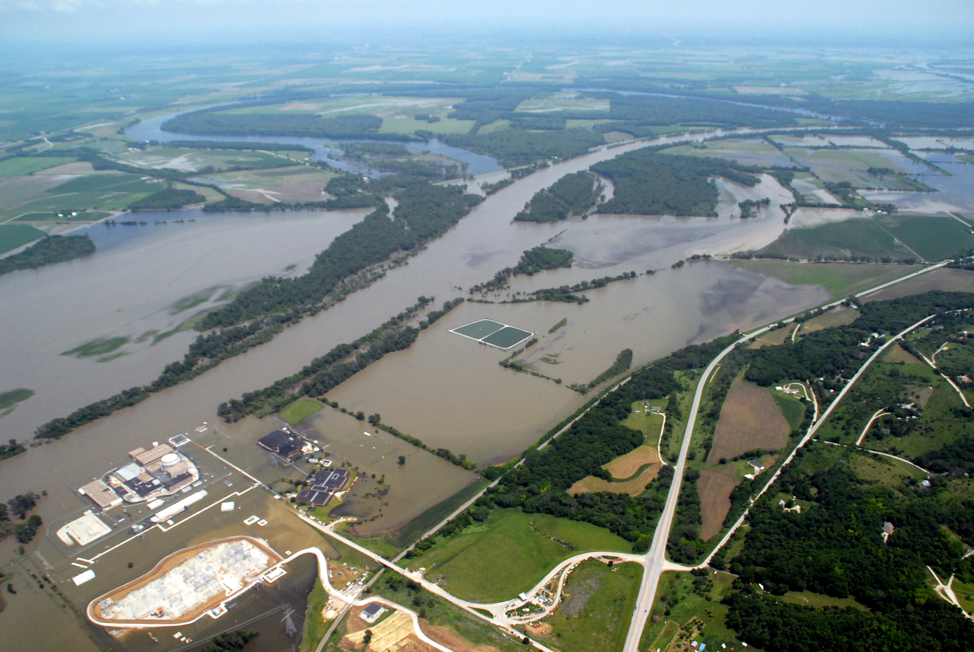
 The refuge on June 20, 2011, during the 2011 Missouri River flood. The oxbow lake is in the upper left. A levee breach on June 25, 2011 resulted in the refuge closing after being nearly be totally inundated. The Fort Calhoun Nuclear Generating Station is in the foreground.
DeSoto National Wildlife Refuge, created in 1958, is located along the banks of the Missouri River in the U.S. states of Iowa and Nebraska. The 8,362-acre (33.83 km2) refuge (46% in Iowa, 54% in Nebraska) preserves an area that would had been otherwise lost to cultivation. In 1960, an Army Corps of Engineers channelization project on the Missouri River moved the main river channel in the area to the west. The former river channel became DeSoto Lake, a seven-mile long oxbow lake. As a result, part of the Nebraska portion of the refuge lies on the east side of the Missouri River.
Today, the refuge is home to around 30 mammal species, including white-tailed deer, beavers, opossums, raccoons, fox squirrels, muskrats and coyotes. Many bird species also inhabit the refuge, such as bald eagles, great blue herons, egrets, pelicans, turkeys and cardinals. The refuge is also a major stopover on the Central Flyway bird migration route; the population of migratory birds increases substantially in the spring and fall months. The numbers of snow-geese used to frequently be in the hundreds of thousands, but for unknown reasons has substantially dropped for only a few thousand a year (not at once). The population of Canadian geese that stopped at the lake before it was channelized is once again rising.
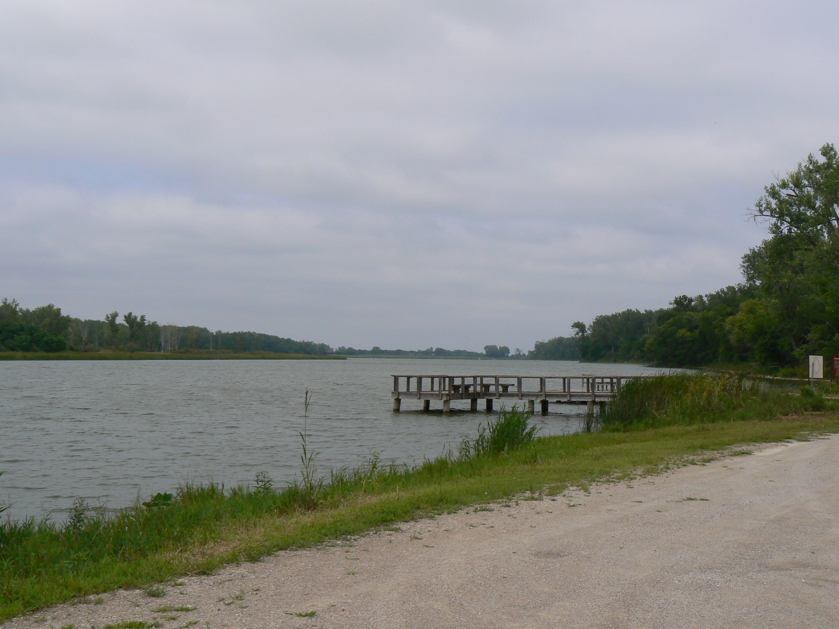
Several miles of nature trails provide access to the varied landscapes of the refuge. Hunting is allowed in season (for deer, turkey, and pheasant) with a permit and there are several fishing piers along the lake, which are open outside of the bird migration seasons. No pets are allowed in the refuge.
The refuge also documents the area's human history. In 1865, the sternwheel Steamboat Bertrand, bound for Montana Territory, sank in the Missouri River. The boat and its cargo rested on the river bottom until 1968, when the wreck was rediscovered. Over 500,000 items were excavated from the wreck; many in excellent condition. Catalogue numbers are now in the upper 5000's, each number sometimes only having one related object, or in the case of nails, tens of thousands. A visitor's center in the refuge displays many of these items. The Bertrand site is listed on the National Register of Historic Places.
DeSoto National Wildlife Refuge is located 5 miles (8 km) east of Blair, Nebraska. Access to the refuge is on U.S. Route 30 between Blair and Interstate 29.
 DeSoto Lake was once part of the Missouri River, but rechannelization projects cut a large bend out of the river, forming the lake at Desoto NWR
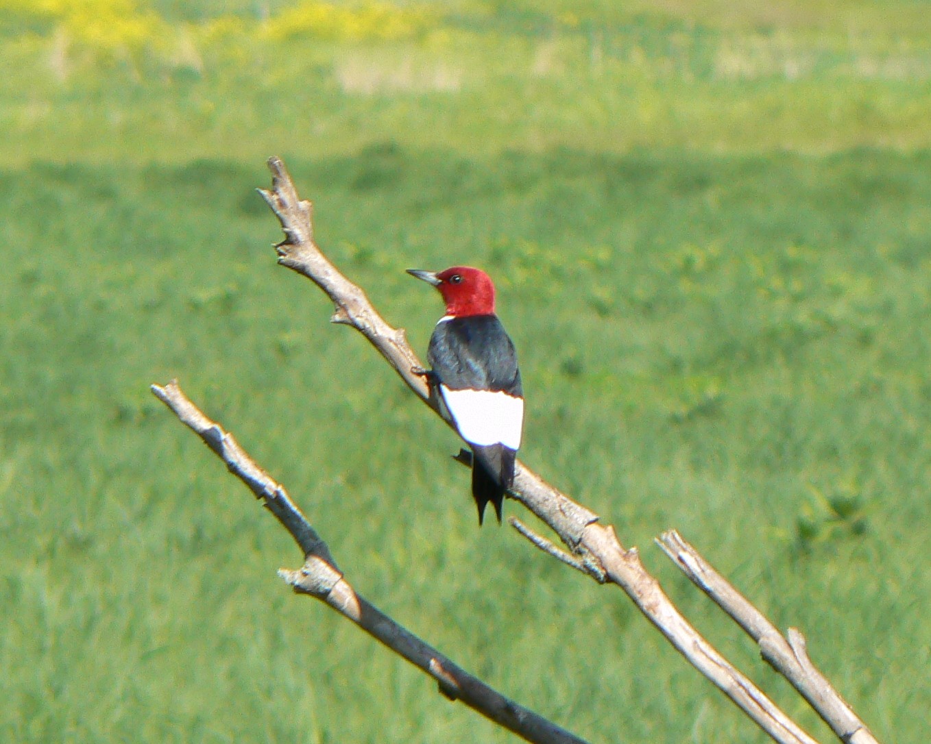
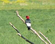 Red-headed woodpecker at DeSoto NWR.
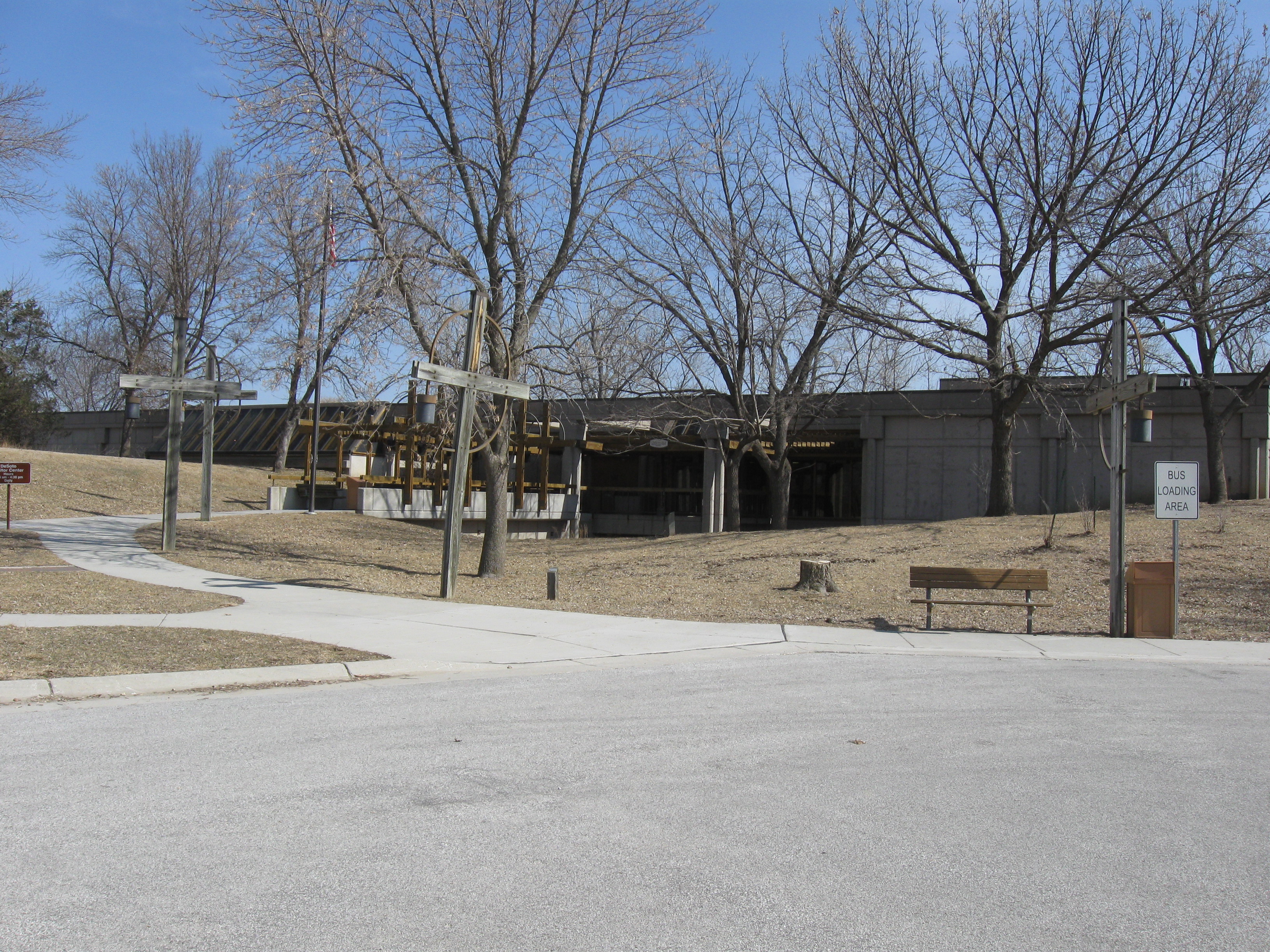
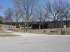 DeSoto NWR center, housing the Steamboat Bertrand exhibit.
See also
External links
- DeSoto NWR website
- DeSoto NWR on Recreation.gov
- Friends of Boyer Chute and DeSoto National Wildlife Refuges
Federal National MonumentsNational Historic TrailsNational Recreation AreasNational Wildlife RefugesBoyer Chute · Crescent Lake · DeSoto · Fort Niobrara · John and Louise Seier · Karl E. Mundt · North Platte · Rainwater Basin · Valentine
State State ParksChadron · Eugene T. Mahoney · Fort Robinson · Indian Cave · Niobrara · Platte River · Ponca · Smith Falls
State Historical ParksAshfall Fossil Beds · Ash Hollow · Arbor Lodge · Bowring Ranch · Buffalo Bill Ranch · Champion Mills · Fort Atkinson · Fort Hartsuff · Fort Kearny · Rock Creek Station
State Recreation AreasAlexandria · Arnold · Atkinson Lake · Blue River · Bluestem · Bowman Lake · Box Butte Reservoir · Branched Oak · Bridgeport · Brownville · Calamus · Champion Lake · Cheyenne · Conestoga · Cottonmill · Crystal Lake · Dead Timber · DLD · Enders Reservoir · Fort Kearny · Fremont Lakes · Gallagher Canyon · Johnson Lake · Keller Park · Lake Maloney · Lake McConaughy · Lake Minatare · Lake Ogallala · Lewis and Clark · Long Lake · Long Pine · Louisville · Medicine Creek · Memphis · Merritt Reservoir · Mormon Island · North Loup · Olive Creek · Oliver Reservoir · Pawnee Lake · Pelican Point · Pibel Lake · Pioneer · Red Willow Reservoir · Riverview Marina · Rock Creek Lake · Rock Creek Station · Rockford · Sandy Channel · Schramm Park · Sherman Reservoir · Stagecoach · Summit Lake · Sutherland Reservoir · Swanson Reservoir · Two Rivers · Union Pacific · Verdon · Victoria Springs · Wagon Train · Walgren Lake · War Axe · Wildcat Hills · Willow Creek · Windmill
State Recreation TrailsNebraska Game and Parks Commission (web) Protected Areas of Iowa Federal DeSoto • Driftless Area • Neal Smith • Northern Tallgrass Prairie • Port Louisa • Union Slough • Upper Mississippi River
State Ambrose A. Call • Backbone • Badger Creek • Banner Lakes at Summerset • Beed's Lake • Bellevue • Big Creek • Black Hawk • Brushy Creek • Cedar Rock • Clear Lake • Dolliver Memorial • Elk Rock • Elinor Bedell • Emerson Bay • Fairport • Fort Defiance • Geode • George Wyth Memorial • Green Valley • Gull Point • Honey Creek • Lacey-Keosauqua • Lake Ahquabi • Lake Anita • Lake Darling • Lake Keomah • Lake MacBride • Lake Manawa • Lake of Three Fires • Lake Wapello • Ledges • Lewis and Clark • Maquoketa Caves • Marble Beach • McIntosh Woods • Mines of Spain & E.B. Lyons • Mini-Wakan • Nine Eagles • Okamanpedan • Palisades-Kepler • Pikes Peak • Pikes Point • Pilot Knob • Pine Lake • Pleasant Creek • Prairie Rose • Preparation Canyon • Red Haw • Rice Lake • Rock Creek • Springbrook • Stone • Templar • Trapper's Bay • Twin Lakes • Union Grove • Viking Lake • Volga River • Walnut Woods • Wapsipinicon • Waubonsie • Wildcat Den • Wilson Island
Backbone • Barkley • Gifford • Holst • Loess Hills • Pilot Mound • Shimek • Stephens • White Pine Hollow • Yellow River
A.F. Miller • Ames High Prairie • Anderson Prairie • Behrens Pond and Woodlands • Berry Woods • Bird Hill • Bixby • Bluffton Fir Stand • Brush Creek Canyon • Brushy Creek • Cameron Woods • Casey's Paha • Catfish Creek • Cayler Prairie • Cedar Bluffs • Cedar Hills Sand Prairie • Cheever Lake • Clay Prairie • Claybanks Forest • Cold Water Spring • Crossman Prairie • Decorah Ice Cave • Dinesen Prairie • Doolittle Prairie • Fallen Rock • Fish Farm Mounds • Five Ridge Prairie • Fleming Woods • Fort Atkinson • Freda Haffner Kettlehole • Gitchie Manitou • Hanging Bog • Hardin City Woodland • Hartley Fort • Hayden Prairie • Hoffman Prairie • Indian Bluffs Primitive Area • Indian Fish Trap • Iowa's State Preserves System • Kalsow • Kish-Ke-Kosh Prairie • Lamson Woods • Liska-Stanek Prairie • Little Maquoketa • Malanaphy Springs • Malchow Mounds • Manikowski Prairie • Mann Wilderness Area • Marietta Sand Prairie • Mericle Woods • Merrill A. Stainbrook • Merritt Forest • Montauk • Mossy Glen • Mount Pisgah Cemetery • Mount Talbot • Nestor Stiles Prairie • Ocheyedan Mound • Old State Quarry • Palisades-Downs • Pecan Grove • Pellett Woods • Pilot Grove • Pilot Knob • Retz Woods • Roberts Creek • Rock Creek Island • Rock Island • Roggman Boreal Slopes • Rolling Thunder Prairie • Saint James Lutheran Church • Savage Woods • Searryl's Cave • Sheeder Prairie • Silver Lake Fen • Silvers-Smith Woods • Slinde Mounds • Starr's Cave • Steele Prairie • Stinson Prairie • Strasser Woods • Sylvan Runkel • Toolesboro Mounds • Turin Loess Hills • Turkey River Mounds • White Pine Hollow • Williams Prairie • Wittrock Indian Village • Woodland Mounds • Woodman Hollow • Woodthrush •
County State Parks
(Leased)Bobwhite • Cold Springs • Crystal Lake • Eagle Lake • Echo Valley • Frank A. Gotch • Heery Woods • Lake Cornelia • Lake Icaria • Kearny • Margo Frankel • Mill Creek • Oak Grove • Oakland Mills • Pammel • Sharon Bluffs • Spring Lake • Swan Lake • Three Mile Lake
Iowa Department of Natural Resources Categories:- IUCN Category IV
- National Wildlife Refuges in Iowa
- National Wildlife Refuges in Nebraska
- Missouri River
- National Register of Historic Places in Nebraska
- Border irregularities of the United States
- Protected areas of Harrison County, Iowa
- Protected areas of Pottawattamie County, Iowa
- Protected areas of Washington County, Nebraska

Wikimedia Foundation. 2010.