- Dead Timber State Recreation Area
-
Dead Timber State Recreation Area Nebraska State Park named for: dead timbers left after a wildfire Country United States State Nebraska County Dodge County Elevation 1,266 ft (386 m) [1] Coordinates 41°43′00″N 96°41′31″W / 41.7166667°N 96.69194°W Area 200 acres (81 ha) 
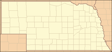
 Location of Dead Timber State Recreation Area in Nebraska
Website: Dead Timber State Recreation Area Dead Timber State Recreation Area is a Nebraska state park in Dodge County, Nebraska in the United States. The park is 200 acres (81 ha) and sits at an elevation of 1,266 feet (386 m).[1] The park is open for year-round recreation including fishing, camping, and non-powered boating.[2] Dead Timber State Recreation Area is north of Scribner on U.S. Route 275.[3]
Dead Timber State Recreation Area was the site of a seasonal Indian encampment. Local legend holds that the area acquired its name after an Indian campfire got out of control and burned much of the standing timber in the area, hence the name Dead Timber.[3] The park is located between the Elkhorn River and an oxbow lake that was once part of the nearby meandering river.
The natives camped near the river in the summer months before retreating behind the river bluffs and settling on the oxbow.[3] An oxbow lake is formed when a river creates a meander due to the river eroding the banks through hydraulic action and abrasion/corrasion. After a long period of time this meander becomes very curved, and eventually the neck of the meander will touch the opposite side and the river will cut through the neck, cutting off the meander to form the oxbow lake.
The park lies within Dodge County which was settled by European Americans in 1856. The whites displaced the Pawnee among other Native American tribes. The winter of 1856 was an especially hard winter. The newly arrived whites felt threatened by their Indian neighbors who camped near their settlements. The Pawnee sent a party to the town of Fremont to threaten war. The conflict was resolved when the whites agreed to provide food for the natives. The Pawnee were removed to a reservation by 1859.[4]
Dead Timber State Recreation Area is a small and largely undeveloped state park. Recreation is limited to camping, fishing, boating and pinicking. All boats must be human-powered as all motorized boats are not permitted in the park.[2] Primitive restroom facilities are located within the park. There are 17 camping pads with electricity and 25 pads without electricity. Fishing is permitted in the oxbow lake.[2]
Budget cuts brought on my the nationwide recession has caused the state of Nebraska to dramatically limit the services it provides at Dead Timbers State Recreation Area and many other Nebraska state parks.[2][5] Local citizens have seen the need to help care for the parks themselves and they have been volunteering to carry on chores normally handled by the state such as mowing grass, serving as camp hosts, and pulling other maintenance on the park's facilities.[5]
References
- ^ a b "Dead Timber State Recreation Area". Geographic Names Information System. United States Geological Survey. March 9, 1979. http://geonames.usgs.gov/pls/gnispublic/f?p=gnispq:3:::NO::P3_FID:828622. Retrieved September 23, 2010.
- ^ a b c d "Dead Timber State Recreation Area". Nebraska Game and Parks. http://outdoornebraska.ne.gov/parks/guides/parksearch/showpark.asp?Area_No=59#attract. Retrieved September 23, 2010.
- ^ a b c "Scriber, NE Tourism and Recreation". Scribner, NE 2010. http://www.scribnernebraska.com/tourism.cfm. Retrieved September 23, 2010.
- ^ "The Andreas History of the State of Nebraska: Dodge County". KanColl Books. http://www.kancoll.org/books/andreas_ne/dodge/dodge-p1.html#early. Retrieved September 23, 2010.
- ^ a b Rooney, Phil (September 10, 2003). "Volunteers helping state parks weather budget cuts". McCook Daily Gazette. p. 7. http://news.google.com/newspapers?id=2qggAAAAIBAJ&sjid=ZmkFAAAAIBAJ&pg=2269,2278049&dq=dead-timber-state-recreation-area&hl=en. Retrieved September 23, 2010.
Federal National MonumentsNational Historic TrailsNational Recreation AreasNational Wildlife RefugesState State ParksChadron · Eugene T. Mahoney · Fort Robinson · Indian Cave · Niobrara · Platte River · Ponca · Smith Falls
State Historical ParksAshfall Fossil Beds · Ash Hollow · Arbor Lodge · Bowring Ranch · Buffalo Bill Ranch · Champion Mills · Fort Atkinson · Fort Hartsuff · Fort Kearny · Rock Creek Station
State Recreation AreasAlexandria · Arnold · Atkinson Lake · Blue River · Bluestem · Bowman Lake · Box Butte Reservoir · Branched Oak · Bridgeport · Brownville · Calamus · Champion Lake · Cheyenne · Conestoga · Cottonmill · Crystal Lake · Dead Timber · DLD · Enders Reservoir · Fort Kearny · Fremont Lakes · Gallagher Canyon · Johnson Lake · Keller Park · Lake Maloney · Lake McConaughy · Lake Minatare · Lake Ogallala · Lewis and Clark · Long Lake · Long Pine · Louisville · Medicine Creek · Memphis · Merritt Reservoir · Mormon Island · North Loup · Olive Creek · Oliver Reservoir · Pawnee Lake · Pelican Point · Pibel Lake · Pioneer · Red Willow Reservoir · Riverview Marina · Rock Creek Lake · Rock Creek Station · Rockford · Sandy Channel · Schramm Park · Sherman Reservoir · Stagecoach · Summit Lake · Sutherland Reservoir · Swanson Reservoir · Two Rivers · Union Pacific · Verdon · Victoria Springs · Wagon Train · Walgren Lake · War Axe · Wildcat Hills · Willow Creek · Windmill
State Recreation TrailsNebraska Game and Parks Commission (web) Categories:- Protected areas of Dodge County, Nebraska
- Nebraska state parks
Wikimedia Foundation. 2010.