- Natrona, Pennsylvania
-
For other uses, see Natrona (disambiguation).
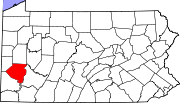
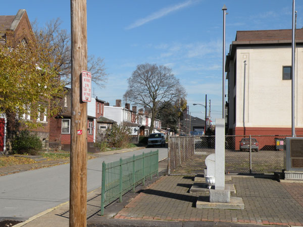
Natrona — Unincorporated community — Harrison Township The Pennsalt Historic District, founded circa 1850, in Natrona, Pennsylvania Location within the state of Pennsylvania
 Natrona
Coordinates: 40°36′52″N 79°43′21″W / 40.61444°N 79.7225°WCoordinates: 40°36′52″N 79°43′21″W / 40.61444°N 79.7225°W Country United States State Pennsylvania County Allegheny Elevation[1] 758 ft (231 m) Time zone Eastern (EST) (UTC-5) – Summer (DST) EDT (UTC-4) ZIP codes 15065 Area code(s) 724, 878 FIPS code GNIS feature ID 1182182 Website http://harrisontwp.com/ Natrona is an unincorporated community in Harrison Township, Allegheny County in the U.S. state of Pennsylvania.[1] It is located in Western Pennsylvania within the Pittsburgh Metropolitan Statistical Area, approximately 24 miles (39 km) northeast of Downtown Pittsburgh. Natrona is situated along the Allegheny River at Lock and Dam Four, Pools Three and Four between Brackenridge, Natrona Heights, Karns, Allegheny Township, and Lower Burrell.[2]
Contents
History
See also: List of company townsFurther information: History of PittsburghThe original village of Natrona – then known as East Tarentum – was built as a company town by the Pennsylvania Salt Manufacturing Company in the 1850s.[3][4][5][6][7]
Canal
Main articles: Main Line of Public Works and Pennsylvania CanalThe Pennsylvania Canal once passed through Natrona and nearby communities in the early- to mid-19th century.
Railroads
Main articles: Rail transport and Conemaugh LineThe Pennsylvania Railroad had a train station in Natrona at Vine and Federal streets; its rail line began running through the town in the mid-19th century.[8] Later, the Pennsylvania Railroad merged with rival New York Central Railroad in 1968 to form the Penn Central Transportation Company. The Interstate Commerce Commission required that the ailing New York, New Haven and Hartford Railroad be added in 1969. The Consolidated Rail Corporation replaced the Penn Central Transportation Company and operated freight service through Natrona from 1976 until 1999 when it was divided between two companies. The Norfolk Southern Railway then operated trains through the town. Amtrak has detoured passenger service through Natrona on occasion; its nearest station is Penn Station in Downtown Pittsburgh.
The West Penn Railways provided electric street car service to Natrona from 1906 until 1937.
Local factories, beginning with the Pennsylvania Salt Manufacturing Company's Natrona Works, also operated trains through Natrona. As of 2011, Allegheny Technologies uses a track to transport materials between departments at its Allegheny Ludlum Brackenridge Works.[9][10]
Mining
The Pennsylvania Salt Manufacturing Company operated its Natrona No. 1 and Natrona No. 2 bituminous coal mines at Natrona.[11]
Geography
Natrona is situated on an alluvial floodplain along the Allegheny River.
Education
The community is located within the Highlands School District. Highlands High School and Highlands Middle School are located in Natrona Heights. Air pollution levels (particularly chromium) measured in Natrona area schools are among the worst in the United States.[12]
Usage in popular culture
Knightriders
The film Knightriders (1981) by George A. Romero starring Ed Harris used scenes shot on Garfield Street in Natrona (1980) for the movie. Most of the film was shot in nearby Fawn Township.
Striking Distance
 The Lock and Dam Number Four spans the Allegheny River between Natrona in Harrison Township and Lower Burrell.
Also, the film Striking Distance (1993) starring Bruce Willis and Sarah Jessica Parker uses a sequence where boats jump over the dam at Natrona;[13] the Tarentum Bridge can be seen just above the dam over Jacks Island, although the structure was added there later through editing. The bridge is officially named the George D. Stuart Bridge (part of Pennsylvania Route 366) and actually located about 2.5 miles (4.0 km) downstream spanning the river between Tarentum and New Kensington.
See also
- Environmentalism – Natrona has a United States Environmental Protection Agency Superfund site
- Samuel Kier operated salt and oil wells in the 1800s at Natrona.
- National Register of Historic Places listings in Allegheny County, Pennsylvania
- Natrona Bottling Company – a local manufacturer of soft drink beverages
- Rachel Carson lived in nearby Springdale during her youth.
References
- ^ a b "Natrona". Geographic Names Information System. 2009. http://geonames.usgs.gov/pls/gnispublic/f?p=gnispq:3:::NO::P3_FID:1182182. Retrieved 2009-12-02.
- ^ "Lock and Dam 4". http://www.lrp.usace.army.mil/nav/l4ar.htm. Retrieved 2009-01-02.
- ^ Hexamer, Ernest (1873-10-30). "Map Collection, Free Library of Philadelphia". Hexamer General Surveys, Volume 8; Plate(s): 738-739-740. E. Hexamer & Son. http://www.philageohistory.org/rdic-images/view-image.cfm/HGSv8.0738-739-740. Retrieved 2009-01-03.
- ^ Hexamer, Ernest (1886-10-26). "Map Collection, Free Library of Philadelphia". Hexamer General Surveys, Volume 21; Plate(s): 2041-2042. E. Hexamer & Son. http://www.philageohistory.org/rdic-images/view-image.cfm/HGSv21.2041-2042. Retrieved 2009-01-03.
- ^ Hexamer, Ernest (1886-10-26). "Map Collection, Free Library of Philadelphia". Hexamer General Surveys, Volume 21; Plate(s): 2043. E. Hexamer & Son. http://www.philageohistory.org/rdic-images/view-image.cfm/HGSv21.2043. Retrieved 2009-01-03.
- ^ Hexamer, Ernest (1893-08-26). "Map Collection, Free Library of Philadelphia". Hexamer General Surveys, Volume 28; Plate(s): 2693-2694. E. Hexamer & Son. http://www.philageohistory.org/rdic-images/view-image.cfm/HGSv28.2693-2694. Retrieved 2009-01-02.
- ^ Hexamer, Ernest (1893-08-26). "Map Collection, Free Library of Philadelphia". Hexamer General Surveys, Volume 28; Plate(s): 2695. E. Hexamer & Son. http://www.philageohistory.org/rdic-images/view-image.cfm/HGSv28.2695. Retrieved 2009-01-02.
- ^ Sipes, William B. (1875). The Pennsylvania Railroad: Its Origin, Construction, Condition, and Connections; Embracing Historical, Descriptive, and Statistical Notices of Cities, Towns, Villages, Stations, Industries, and Objects of Interest on Its Various Lines in Pennsylvania and New Jersey. Pennsylvania Railroad Company. p. 218. http://books.google.com/?id=Un0FAAAAQAAJ&pg=PA218&lpg=PA218&dq=%22Pennsylvania+Railroad%22+natrona. Retrieved 2009-01-05.
- ^ "Process and Plant Capabilities—Brackenridge, PA". http://www.alleghenyludlum.com/ludlum/pages/facilities/Brackenridge.asp?qdirections=. Retrieved 2009-02-18.
- ^ "Process and Plant Capabilities—Natrona, PA". http://www.alleghenyludlum.com/pages/facilities/natrona.asp. Retrieved 2009-02-18.
- ^ Roderick, James E. (1914-04-01). "Report of the Department of Mines of Pennsylvania Part II---Bituminous 1913". Report of the Department of Mines of Pennsylvania. Wm. Stanley Ray, State Printer. pp. 583. http://books.google.com/books?id=qAkWAAAAYAAJ&pg=PA583&dq=Natrona#PPA583,M1. Retrieved 2009-02-18.
- ^ Yerace, Tom (2008-12-10). "Pollution around Highlands schools among worst in nation". Valley News Dispatch (Tribune-Review Publishing Company). http://www.pittsburghlive.com/x/pittsburghtrib/news/mostread/s_602375.html. Retrieved 2009-01-02.
- ^ Krift, F.A. (2008-04-28). "Boaters survive Allegheny River dam jump". Tribune-Review (Tribune-Review Publishing Company). http://www.pittsburghlive.com/x/pittsburghtrib/news/s_564650.html. Retrieved 2009-01-05.
External links
Municipalities and communities of Allegheny County, Pennsylvania Cities Clairton | Duquesne | McKeesport | Pittsburgh
Boroughs Aspinwall | Avalon | Baldwin | Bell Acres | Bellevue | Ben Avon | Ben Avon Heights | Bethel Park | Blawnox | Brackenridge | Braddock | Braddock Hills | Bradford Woods | Brentwood | Bridgeville | Carnegie | Castle Shannon | Chalfant | Cheswick | Churchill | Coraopolis | Crafton | Dormont | Dravosburg | East McKeesport | East Pittsburgh | Edgewood | Edgeworth | Elizabeth | Emsworth | Etna | Forest Hills | Fox Chapel | Franklin Park | Glassport | Glen Osborne | Glenfield | Green Tree | Haysville | Heidelberg | Homestead | Ingram | Jefferson Hills | Leetsdale | Liberty | Lincoln | McDonald‡ | McKees Rocks | Millvale | Monroeville | Mount Oliver | Munhall | North Braddock | Oakdale | Oakmont | Pennsbury Village | Pitcairn | Pleasant Hills | Plum | Port Vue | Rankin | Rosslyn Farms | Sewickley | Sewickley Heights | Sewickley Hills | Sharpsburg | Springdale | Swissvale | Tarentum | Thornburg | Trafford‡ | Turtle Creek | Verona | Versailles | Wall | West Elizabeth | West Homestead | West Mifflin | West View | Whitaker | White Oak | Whitehall | Wilkinsburg | Wilmerding
Townships Aleppo | Baldwin | Collier | Crescent | East Deer | Elizabeth | Fawn | Findlay | Forward | Frazer | Hampton | Harmar | Harrison | Indiana | Kennedy | Kilbuck | Leet | Marshall | McCandless | Moon | Mt. Lebanon | Neville | North Fayette | North Versailles | O'Hara | Ohio | Penn Hills | Pine | Reserve | Richland | Robinson | Ross | Scott | Shaler | South Fayette | South Park | South Versailles | Springdale | Stowe | Upper St. Clair | West Deer | Wilkins
CDPs Allison Park | Bairdford | Bakerstown | Carnot-Moon | Clinton | Curtisville | Enlow | Gibsonia | Glenshaw | Harwick | Imperial | Noblestown | Rennerdale | Russellton | Sturgeon
Unincorporated
communitiesAcmetonia | Blackridge | Blanchard | Broughton | Bruceton | Buena Vista | Creighton | Dorseyville | Elfinwild | Harmarville | Hickory Heights | Karns | Keown Station | Natrona | Natrona Heights | Warrendale | Wexford | Wildwood
Footnotes ‡This populated place also has portions in an adjacent county or counties
Categories:- Pittsburgh metropolitan area
- Company towns in Pennsylvania
- Unincorporated communities in Allegheny County, Pennsylvania


Wikimedia Foundation. 2010.