- Crafton, Pennsylvania
-
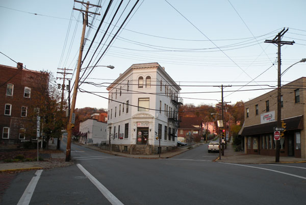
Crafton, Pennsylvania Borough 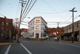 intersection of East Crafton, Noble and Dinsmore Avenues in Crafton, PA.
Country United States State Pennsylvania County Allegheny Coordinates 40°26′1.93″N 80°4′5.33″W / 40.4338694°N 80.0681472°W Population 5,951 (2010) Timezone EST (UTC-5) - summer (DST) EDT (UTC-4) ZIP code 15205 Area code 412 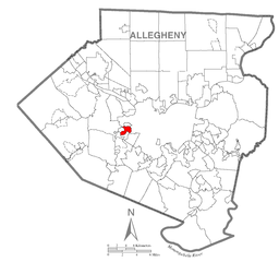 Location of Crafton in Allegheny County
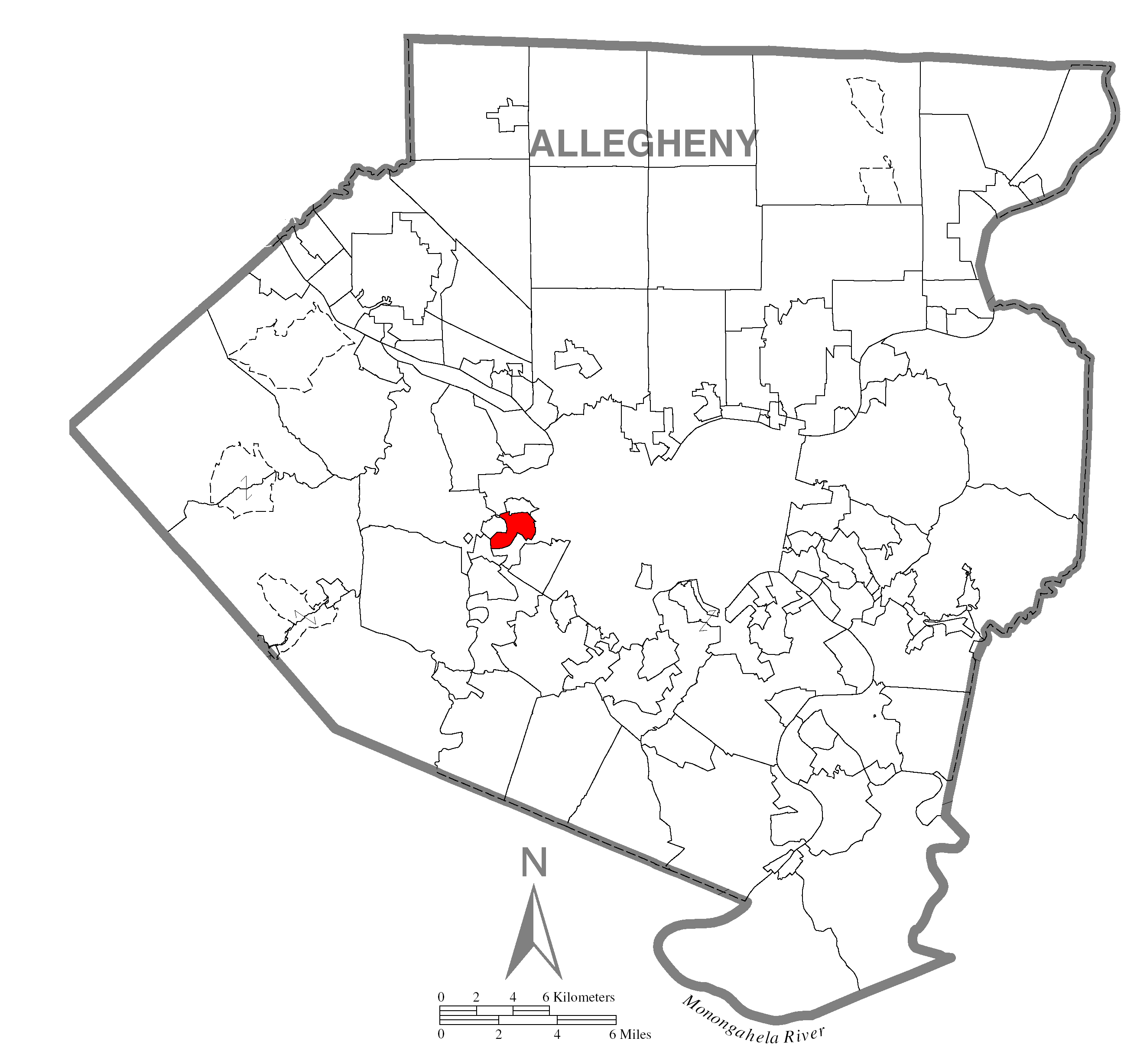
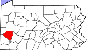
 Location of Allegheny County in Pennsylvania
Website: Crafton Borough Crafton is a borough in Allegheny County, Pennsylvania, United States, west of downtown Pittsburgh. The population grew from 1,927 in 1900 to 4,583 in 1910 and to 7,163 in 1940. The population was 5,951 at the 2010 census.[1]
Contents
History
Crafton is named after James S. Craft, a frontier attorney who was granted land near the "forks of the Ohio" in present-day Oakland.[2] The sale of this land part financed purchases of land in the Chartiers valley. Charles Craft, son of James, divided the land into lots on the death of his father and submitted it to the Allegheny County Courthouse as Crafton. Following a period of building, the borough was incorporated in 1882, with Charles as the first burgess.
Crafton was linked to downtown Pittsburgh by trolley in 1896. The service ended when the Fort Pitt Bridge was built without trolley tracks.
Crafton was rated as being the best place to raise children in Pennsylvania, according to Bloomberg Businessweek's "Best Places to Raise Your Kids 2011".[3]
Geography
Crafton is located at 40°26′2″N 80°4′5″W / 40.43389°N 80.06806°W (40.433869, -80.068146).[4]
According to the United States Census Bureau, the borough has a total area of 1.1 square miles (2.8 km2), all of it land.
Surrounding communities
- North – Ingram (an Allegheny county borough)
- North east – Crafton Heights (a Pittsburgh neighborhood)
- East – Westwood (a Pittsburgh neighborhood)
- South – Oakwood and East Carnegie (Pittsburgh neighborhoods)
- West –Thornburg (an Allegheny county borough)
- North west – Fairywood (a Pittsburgh neighborhood)
Demographics
As of the census[5] of 2000, there were 6,706 people, 3,079 households, and 1,613 families residing in the borough. The population density was 5,916.0 people per square mile (2,291.3/km²). There were 3,344 housing units at an average density of 2,950.1 per square mile (1,142.6/km²). The racial makeup of the borough was 95.50% White, 2.74% African American, 0.10% Native American, 0.60% Asian, 0.07% Pacific Islander, 0.15% from other races, and 0.84% from two or more races. Hispanic or Latino of any race were 0.57% of the population.
There were 3,080 households out of which 24.9% had children under the age of 18 living with them, 38.2% were married couples living together, 10.6% had a female householder with no husband present, and 47.6% were non-families. 40.2% of all households were made up of individuals and 14.3% had someone living alone who was 65 years of age or older. The average household size was 2.17 and the average family size was 3.01.
In the borough the population was spread out with 21.6% under the age of 18, 8.6% from 18 to 24, 32.5% from 25 to 44, 22.6% from 45 to 64, and 14.8% who were 65 years of age or older. The median age was 38 years. For every 100 females there were 90.1 males. For every 100 females age 18 and over, there were 86.9 males.
The median income for a household in the borough was $38,323, and the median income for a family was $52,386. Males had a median income of $38,292 versus $24,497 for females. The per capita income for the borough was $21,441. About 3.4% of families and 6.9% of the population were below the poverty line, including 6.5% of those under age 18 and 6.2% of those age 65 or over.
Notable people
Former Pittsburgh Steelers head coach Bill Cowher is a native of Crafton and attended Carlynton High School.
Gallery
-
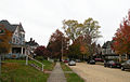
Creighton Avenue, platted in 1895
-

St. Philip Roman Catholic Church, built in 1906, located at 50 West Crafton Avenue
-

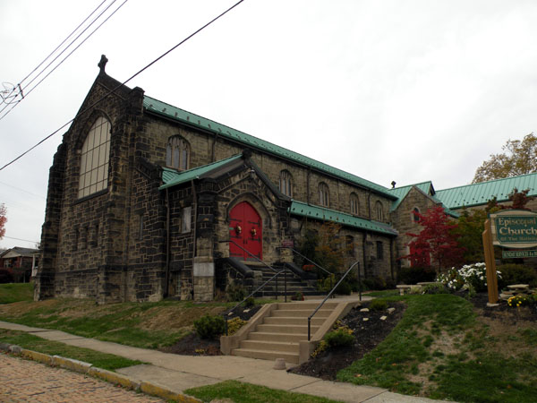
Episcopal Church of the Nativity, built in 1908, located at 33 Alice Street
-
The Campbell Building, circa 1910, located at 3 Crafton Square
-
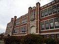
Crafton Elementary School, built in 1913, located at 1874 Crafton Boulevard
-

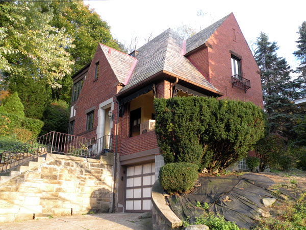
The George Leber House, built in 1938, located at 132 East Crafton Avenue
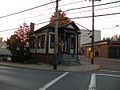
-
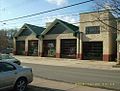
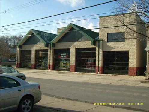
Crafton Volunteer Fire Hall, located at Noble and Bradford avenues
References
- ^ "Race, Hispanic or Latino, Age, and Housing Occupancy: 2010 Census Redistricting Data (Public Law 94-171) Summary File (QT-PL), Crafton borough, Pennsylvania". U.S. Census Bureau, American FactFinder 2. http://factfinder2.census.gov. Retrieved September 19, 2011.
- ^ "Crafton Historical Society". http://www.craftonhistoricalsociety.org/walking_tour.htm. Retrieved July 8, 2010.
- ^ "The Best Places to Raise Your Kids 2011". http://images.businessweek.com/slideshows/20101214/the-best-places-to-raise-your-kids-2011/slides/39. Retrieved December 16, 2010.
- ^ "US Gazetteer files: 2010, 2000, and 1990". United States Census Bureau. 2011-02-12. http://www.census.gov/geo/www/gazetteer/gazette.html. Retrieved 2011-04-23.
- ^ "American FactFinder". United States Census Bureau. http://factfinder.census.gov. Retrieved 2008-01-31.
External links
Municipalities and communities of Allegheny County, Pennsylvania Cities Clairton | Duquesne | McKeesport | Pittsburgh
Boroughs Aspinwall | Avalon | Baldwin | Bell Acres | Bellevue | Ben Avon | Ben Avon Heights | Bethel Park | Blawnox | Brackenridge | Braddock | Braddock Hills | Bradford Woods | Brentwood | Bridgeville | Carnegie | Castle Shannon | Chalfant | Cheswick | Churchill | Coraopolis | Crafton | Dormont | Dravosburg | East McKeesport | East Pittsburgh | Edgewood | Edgeworth | Elizabeth | Emsworth | Etna | Forest Hills | Fox Chapel | Franklin Park | Glassport | Glen Osborne | Glenfield | Green Tree | Haysville | Heidelberg | Homestead | Ingram | Jefferson Hills | Leetsdale | Liberty | Lincoln | McDonald‡ | McKees Rocks | Millvale | Monroeville | Mount Oliver | Munhall | North Braddock | Oakdale | Oakmont | Pennsbury Village | Pitcairn | Pleasant Hills | Plum | Port Vue | Rankin | Rosslyn Farms | Sewickley | Sewickley Heights | Sewickley Hills | Sharpsburg | Springdale | Swissvale | Tarentum | Thornburg | Trafford‡ | Turtle Creek | Verona | Versailles | Wall | West Elizabeth | West Homestead | West Mifflin | West View | Whitaker | White Oak | Whitehall | Wilkinsburg | Wilmerding
Townships Aleppo | Baldwin | Collier | Crescent | East Deer | Elizabeth | Fawn | Findlay | Forward | Frazer | Hampton | Harmar | Harrison | Indiana | Kennedy | Kilbuck | Leet | Marshall | McCandless | Moon | Mt. Lebanon | Neville | North Fayette | North Versailles | O'Hara | Ohio | Penn Hills | Pine | Reserve | Richland | Robinson | Ross | Scott | Shaler | South Fayette | South Park | South Versailles | Springdale | Stowe | Upper St. Clair | West Deer | Wilkins
CDPs Allison Park | Bairdford | Bakerstown | Carnot-Moon | Clinton | Curtisville | Enlow | Gibsonia | Glenshaw | Harwick | Imperial | Noblestown | Rennerdale | Russellton | Sturgeon
Unincorporated
communitiesAcmetonia | Blackridge | Blanchard | Broughton | Bruceton | Buena Vista | Creighton | Dorseyville | Elfinwild | Harmarville | Hickory Heights | Karns | Keown Station | Natrona | Natrona Heights | Warrendale | Wexford | Wildwood
Footnotes ‡This populated place also has portions in an adjacent county or counties
Categories:- Populated places established in 1872
- Pittsburgh metropolitan area
- Boroughs in Allegheny County, Pennsylvania


Wikimedia Foundation. 2010.