Creighton Avenue

Creighton Avenue
Creighton Avenue
Pittsburgh History and Landmarks Foundation Historic Landmark
Creighton Avenue is located in Pennsylvania
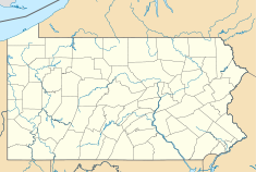
Location of Creighton Avenue in Allegheny County, Pennsylvania
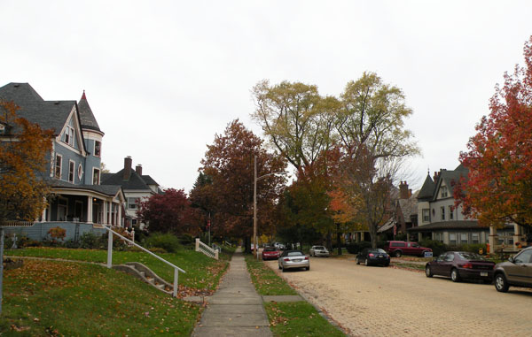
Location: Creighton Avenue in Crafton, Pennsylvania, USA
Coordinates: 40°25′53.56″N 80°3′57.8″W / 40.4315444°N 80.066056°W / 40.4315444; -80.066056Coordinates: 40°25′53.56″N 80°3′57.8″W / 40.4315444°N 80.066056°W / 40.4315444; -80.066056
Built/Founded: 1895
PHLF designated: 1990[1]

Creighton Avenue in Crafton, Pennsylvania, was platted in 1895. The avenue contains many houses that were built in the late 1800s and early 1900s. It was added to the List of Pittsburgh History and Landmarks Foundation Historic Landmarks in 1990.[1]

References

  1. ^ a b Historic Landmark Plaques 1968-2009. Pittsburgh, PA: Pittsburgh History & Landmarks Foundation. 2010. http://www.phlf.org/wp-content/uploads/2007/09/Historic-Plaques-2010b.pdf. Retrieved 2011-08-18. 

Wikimedia Foundation. 2010.

Игры ⚽ Поможем написать реферат

Look at other dictionaries:

  • Creighton Preparatory School — Creighton Prep Address 7400 Western Avenue Omaha, Nebraska, (Douglas County), 68114 1878 …   Wikipedia

  • Creighton, Nebraska —   City   Downtown Creighton: north side of Main Street looking west from Chase Avenue …   Wikipedia

  • John A. Creighton Boulevard — Infobox road highway name = John A. Creighton Boulevard marker alternate name = length = direction = South North starting terminus = Hamilton Avenue ending terminus = Bedford Street cities = Omaha established = 1912 system = John A. Creighton… …   Wikipedia

  • Fortismere School — Established 1983 (William Grimshaw in 1902) Type Foundation school Headteacher Ms Helen Anthony …   Wikipedia

  • Fortis Green — is a ward of the London Borough of Haringey, North London. It is also the name of the road that runs between Muswell Hill and East Finchley which forms part of the A504.The ward lies between Colney Hatch to the north, Muswell Hill to the east,… …   Wikipedia

  • Crafton, Pennsylvania — Coordinates: 40°26′1.93″N 80°4′5.33″W / 40.4338694°N 80.0681472°W / 40.4338694; 80.0681472 …   Wikipedia

  • Williams-Woodland Park Historic District — The Williams Woodland Park Local Historic District was established in 1985 and was placed on the United States National Register of Historic Places in 1991.Williams Woodland Park is a neighborhood in the near South Side of Fort Wayne, Indiana. It …   Wikipedia

  • Coldfall Wood — is an ancient wood in Muswell Hill, North London. It covers an area of approximately 14 hectares and is surrounded by the St. Pancras and Islington Cemetery, the East Finchley public allotments, and the residential roads Creighton Avenue and… …   Wikipedia

  • Olly Croft — Oliver Croft, also known as Olly OBE Born Oliver Albert Croft November 17, 1929 (1929 11 17) (age 82) Occupation Retired Years active 1973 2011 Spouse …   Wikipedia

  • North Omaha, Nebraska — The southwest corner of 24th Lake Streets in North Omaha. North Omaha is a community area in Omaha, Nebraska, USA. It is bordered by Cuming and Dodge Streets on the south, Interstate 680 on the north, North 72nd Street on the west and the… …   Wikipedia

Share the article and excerpts

Direct link
Do a right-click on the link above
and select “Copy Link”