- McCandless, Pennsylvania
-
McCandless Township,
Allegheny County,
Pennsylvania— Home Rule Municipality — Map of Allegheny County, Pennsylvania highlighting McCandless Township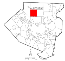 Map of Allegheny County, Pennsylvania
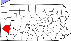
Coordinates: 40°34′35″N 80°01′45″W / 40.57651°N 80.029292°WCoordinates: 40°34′35″N 80°01′45″W / 40.57651°N 80.029292°W Country United States State Pennsylvania County Allegheny Settled 1796 Incorporated 1851 Government – Type Town Council – Town Manager Tobias M. Cordek Area – Total 16.6 sq mi (43.1 km2) – Land 16.5 sq mi (42.8 km2) – Water 0.1 sq mi (0.3 km2) Elevation 1,024 ft (312 m) Population (2010) – Total 28,457 – Density 1,754.4/sq mi (677.5/km2) Time zone Eastern (EST) (UTC-5) – Summer (DST) EDT (UTC-4) ZIP code 15090 Area code(s) 724 Website McCandless official website McCandless is a municipality in Allegheny County, Pennsylvania, United States. The population was 28,457 at the 2010 census.[1] It was originally incorporated as a township; however, on January 1, 1975, McCandless Township adopted a new charter designating it a Home Rule Charter Municipality with the name Town of McCandless.[2] Despite the name, state government publications continue to recognize McCandless as a township of the first class[3][4][5][6] rather than as a town. (Bloomsburg, in Columbia County, was incorporated as a town in 1870, and is recognized by these same publications as "the only incorporated town" in Pennsylvania.) Still, like all home rule municipalities in Pennsylvania, the Town of McCandless is not governed under the provisions of Pennsylvania's Township Code.
McCandless is part of the North Allegheny School District and participates in the multi-municipality Northland Public Library.
Contents
Geography
According to the United States Census Bureau, the township has a total area of 16.6 square miles (43 km2), of which 16.5 square miles (43 km2) is land and 0.1 square miles (0.26 km2), or 0.66%, is water.
The municipality lies on the Allegheny Plateau and is characterized by generally hilly terrain. A floodplain lies in the area of Pine Creek, which cuts a deep valley through the central portion of the township.
McCandless is bordered by Pine Township to the north and Hampton Township to the east. The southern border is Ross Township and the western border is Franklin Park borough.
History
Native American artifacts, primarily Iroquois Nation, have been found in areas of the township. Early written history includes a visit by George Washington in 1753.
The first settler in McCandless was James Duff, who had purchased 400 acres (1.6 km2) in 1796. Farming increased in the area, and in 1849, meetings were held, presided over by Daniel Vogel, for the purpose of forming a local government. The township was originally founded in 1851 and called Taylor. The area was incorporated in 1857 as a Second Class Township and renamed McCandless in honor of District Judge Wilson McCandless. The published population was 1,482 persons.
During the 1800s McCandless was primarily a farming community. During the War of 1812, an important supply route for the transportation of war materials from Pittsburgh to Commodore Perry's forces on Lake Erie passed through the area.
In 1908 an interurban commuter railroad, the Harmony Line, allowed area residents to easily commute to Pittsburgh. A concurrent oil boom resulted in rapid early development, centered around the rail stations in the Highland and Ingomar areas.
By 1931, the Harmony Line had been replaced by the popularity of the automobile.
Allegheny County Commissioner E. V. Babcock initiated the establishment of Allegheny County's North Park. He purchased the land and later sold it to the county at cost. North Park was founded in 1927 by Allegheny County. Approximately 1,600 acres (6.5 km2) of the park, 2.5 square miles (6.5 km2), are located in McCandless. This area represents approximately 15.2% of the town.
Between 1930-1950, the town more than doubled its population (from 2,653 to 6,488). By 1960, the population had redoubled (14,582) and has since doubled again. At the 2000 census, the number of households in the town was 11,159.
Expanding population and traffic brought more diversified development into the area. McKnight Road was built in the mid 1950s and became the primary access into the north suburban areas. Retail and office uses occupy some of the McCandless segment of the McKnight corridor.
Demographics
As of the census[7] of 2000, there were 29,022 people, 11,159 households, and 7,922 families residing in the township. The population density was 1,754.4 people per square mile (677.5/km²). There were 11,697 housing units at an average density of 707.1 per square mile (273.0/km²). The racial makeup of the township was 94.58% White, 1.29% African American, 0.05% Native American, 3.19% Asian, 0.01% Pacific Islander, 0.14% from other races, and 0.74% from two or more races. Hispanics or Latinos of any race were 0.70% of the population.
There were 11,159 households out of which 32.2% had children under the age of 18 living with them, 62.8% were married couples living together, 6.1% had a female householder with no husband present, and 29.0% were non-families. 25.0% of all households were made up of individuals and 8.9% had someone living alone who was 65 years of age or older. The average household size was 2.49 and the average family size was 3.02.
The age distribution was 23.6% under the age of 18, 6.8% from 18 to 24, 27.8% from 25 to 44, 25.8% from 45 to 64, and 16.1% who were 65 years of age or older. The median age was 40 years. For every 100 females there were 90.7 males. For every 100 females age 18 and over, there were 86.9 males.
The median income for a household in the township was $62,159, and the median income for a family was $73,482. Males had a median income of $57,415 versus $33,319 for females. The per capita income for the township was $31,792. About 2.2% of families and 4.0% of the population were below the poverty line, including 3.2% of those under age 18 and 9.1% of those age 65 or over.
Notable people
Further information: Category:People from McCandless, PennsylvaniaReferences
- ^ "Race, Hispanic or Latino, Age, and Housing Occupancy: 2010 Census Redistricting Data (Public Law 94-171) Summary File (QT-PL), McCandless township, Allegheny County, Pennsylvania". U.S. Census Bureau, American FactFinder 2. http://factfinder2.census.gov. Retrieved September 29, 2011.
- ^ McCandless
- ^ The Pennsylvania Manual 117
- ^ Pennsylvania Local Government Fact Sheet, 2005
- ^ "Local Government Entities in Pennsylvania" and "Municipal Statistics" in Legislator’s Municipal Deskbook for Pennsylvania
- ^ PENNDOT Type 10 highway map of Allegheny County
- ^ "American FactFinder". United States Census Bureau. http://factfinder.census.gov. Retrieved 2008-01-31.
External links
- McCandless official website
- Pennsylvania Code, Title 302, Chapter 23 — the McCandless home rule charter
Municipalities and communities of Allegheny County, Pennsylvania Cities Clairton | Duquesne | McKeesport | Pittsburgh

Boroughs Aspinwall | Avalon | Baldwin | Bell Acres | Bellevue | Ben Avon | Ben Avon Heights | Bethel Park | Blawnox | Brackenridge | Braddock | Braddock Hills | Bradford Woods | Brentwood | Bridgeville | Carnegie | Castle Shannon | Chalfant | Cheswick | Churchill | Coraopolis | Crafton | Dormont | Dravosburg | East McKeesport | East Pittsburgh | Edgewood | Edgeworth | Elizabeth | Emsworth | Etna | Forest Hills | Fox Chapel | Franklin Park | Glassport | Glen Osborne | Glenfield | Green Tree | Haysville | Heidelberg | Homestead | Ingram | Jefferson Hills | Leetsdale | Liberty | Lincoln | McDonald‡ | McKees Rocks | Millvale | Monroeville | Mount Oliver | Munhall | North Braddock | Oakdale | Oakmont | Pennsbury Village | Pitcairn | Pleasant Hills | Plum | Port Vue | Rankin | Rosslyn Farms | Sewickley | Sewickley Heights | Sewickley Hills | Sharpsburg | Springdale | Swissvale | Tarentum | Thornburg | Trafford‡ | Turtle Creek | Verona | Versailles | Wall | West Elizabeth | West Homestead | West Mifflin | West View | Whitaker | White Oak | Whitehall | Wilkinsburg | Wilmerding
Townships Aleppo | Baldwin | Collier | Crescent | East Deer | Elizabeth | Fawn | Findlay | Forward | Frazer | Hampton | Harmar | Harrison | Indiana | Kennedy | Kilbuck | Leet | Marshall | McCandless | Moon | Mt. Lebanon | Neville | North Fayette | North Versailles | O'Hara | Ohio | Penn Hills | Pine | Reserve | Richland | Robinson | Ross | Scott | Shaler | South Fayette | South Park | South Versailles | Springdale | Stowe | Upper St. Clair | West Deer | Wilkins
CDPs Allison Park | Bairdford | Bakerstown | Carnot-Moon | Clinton | Curtisville | Enlow | Gibsonia | Glenshaw | Harwick | Imperial | Noblestown | Rennerdale | Russellton | Sturgeon
Unincorporated
communitiesAcmetonia | Blackridge | Blanchard | Broughton | Bruceton | Buena Vista | Creighton | Dorseyville | Elfinwild | Harmarville | Hickory Heights | Karns | Keown Station | Natrona | Natrona Heights | Warrendale | Wexford | Wildwood
Footnotes ‡This populated place also has portions in an adjacent county or counties
Categories:- Home Rule Municipalities in Pennsylvania
- Pittsburgh metropolitan area


Wikimedia Foundation. 2010.