- Turtle Creek, Pennsylvania
Geobox Borough
name = Borough of Turtle Creek
native_name =
other_name =
other_name1 =
category =
image_size =
image_caption =
flag_size =
symbol =
symbol_size =
etymology_type = Named for
etymology =Iroquois Turtle Clan
nickname =
motto =
country = United States
state = Pennsylvania
region = Allegheny
region_type = County
district =
district_type =
area_imperial = 1.0
area_land_imperial = 1.0
area_water_imperial = 0.0
area_water_percentage = auto
area_percentage_round = 2
area_round = 1
location =
lat_d = 40
lat_m = 24
lat_s = 29
lat_NS = N
long_d = 79
long_m = 49
long_s = 18
long_EW = W
elevation_imperial = 833
elevation_round = 0
population_as_of = 2000
population = 6076
population_density_imperial = 6205.2
population_density_round = 1
established_type =
established =
mayor = Adam Forgie
timezone = EST
utc_offset = -5
timezone_DST = EDT
utc_offset_DST = -4
postal_code = 15145
postal_code_type = ZIP code
area_code = 412
area_code_type =
code2_type =
code2 =
free_type =
free =
free1_type = School District
free1 = Woodland Hills
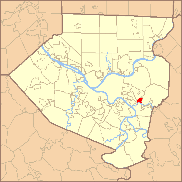
map_caption = Location of Turtle Creek in Allegheny County
map1 = Pennsylvania Locator Map.png
map1_locator = Pennsylvania
map2 = Map of USA PA.svg
map2_caption = Location of Pennsylvania in the United States
website =Turtle Creek is a borough in Allegheny County,
Pennsylvania , 12 miles (19 km ) southeast of Pittsburgh. In 1900, 3,262 people lived here; in 1910, 4,995 people lived here, and in 1940, 9,805 people lived in Turtle Creek. The population was 6,076 at the 2000 census.George Westinghouse gave life to the place by constructing a manufacturing plant nearby. Turtle Creek takes its name from a small stream that flows into theMonongahela River . Before white settlers arrived, there was a small village of Native Americans living there from the Turtle Clan of theIroquois Nation. (See:East Pittsburgh andWilmerding .)Geography
Turtle Creek is located at coor dms|40|24|29|N|79|49|18|W|city (40.408018, -79.821802)GR|1.
According to the
United States Census Bureau , the borough has a total area of 1.0square mile s (2.5km² ), all of it land.urrounding and adjacent neighborhoods
Chalfant ,East Pittsburgh ,Monroeville ,Wilkins Township ,Wilmerding ,North Versailles Demographics
As of the
census GR|2 of 2000, there were 6,076 people, 2,717 households, and 1,516 families residing in the borough. Thepopulation density was 6,205.2 people per square mile (2,393.8/km²). There were 2,969 housing units at an average density of 3,032.1/sq mi (1,169.7/km²). The racial makeup of the borough was 92.71% White, 5.17% African American, 0.08% Native American, 0.61% Asian, 0.15% from other races, and 1.28% from two or more races. Hispanic or Latino of any race were 0.61% of the population.There were 2,717 households out of which 23.4% had children under the age of 18 living with them, 37.7% were married couples living together, 14.5% had a female householder with no husband present, and 44.2% were non-families. 39.2% of all households were made up of individuals and 17.4% had someone living alone who was 65 years of age or older. The average household size was 2.16 and the average family size was 2.91.
In the borough the population was spread out with 20.1% under the age of 18, 8.1% from 18 to 24, 28.1% from 25 to 44, 21.8% from 45 to 64, and 21.9% who were 65 years of age or older. The median age was 40 years. For every 100 females there were 81.4 males. For every 100 females age 18 and over, there were 78.8 males.
The median income for a household in the borough was $30,057, and the median income for a family was $43,975. Males had a median income of $28,859 versus $23,581 for females. The
per capita income for the borough was $17,552. About 10.5% of families and 11.3% of the population were below thepoverty line , including 15.0% of those under age 18 and 12.5% of those age 65 or over.References
Wikimedia Foundation. 2010.