- Castle Shannon, Pennsylvania
Geobox|Settlement
name = Castle Shannon
native_name =
other_name =
other_name1 =
category = Borough
etymology_type = Named for
etymology = Local farm named "Castle Shanahan"
official_name =
motto =
nickname =
image_size =
image_caption =
flag_size =
symbol =
symbol_size =
country = United States
country_
state = Pennsylvania
state_
region = Allegheny
region_type = County
district =
district_type =
landmark =
river =
location =
lat_d = 40
lat_m = 21
lat_s = 57
lat_NS = N
long_d = 80
long_m = 1
long_s = 11
long_EW = W
elevation_imperial = 1040
elevation_round = 0
area_imperial = 1.6
area_land_imperial = 1.6
area_water_imperial = 0.0
area_water_percentage = auto
area_percentage_round = 0
area_round = 1
area_land_round = 1
area_water_round = 1
population_as_of = 2000
population = 8556
population_density_imperial = 5259.8
population_density_round = 1
established_type = Incorporated
established =December 20 1919
established_note =
mayor =
timezone = EST
utc_offset = -5
timezone_DST = EDT
utc_offset_DST = -4
postal_code = 15234
postal_code_type = ZIP code
area_code = 412
area_code_type =
code2_type =
code2 =
free_type = School District
free = Keystone Oaks
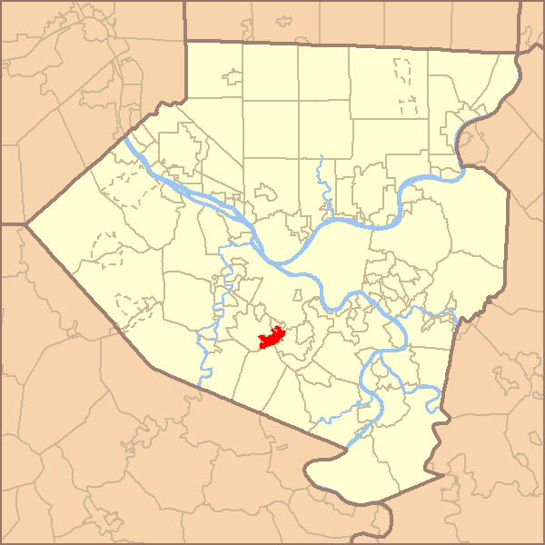
map_caption = Location of Castle Shannon Borough in Allegheny County
map1 = Pennsylvania Locator Map.png
map1_locator = Pennsylvania
map2 = Map of USA PA.svg
map2_caption = Location of Pennsylvania in the United States
website = http://borough.castle-shannon.pa.usCastle Shannon is a borough in Allegheny County,
Pennsylvania ,United States and is part of thePittsburgh Metro Area . The population was 8,556 at the 2000 census.Geography
According to the
United States Census Bureau , the borough has a total area of convert|1.6|sqmi|km2, all of it land. Its average elevation is convert|1040|ft|m above sea level GR|3.urrounding communities
*Baldwin Township
*Bethel Park
*Mt. Lebanon
*Overbrook (Pittsburgh neighborhood)
*WhitehallHistory
The first families settled Castle Shannon in 1786 in pursuit of farmland and timber. The most prominent farm was owned by David Strawbridge, which he named Castle Shanahan. Over time, the farm would lend its name to the area, as "Shanahan" would evolve into "Shannon."
In 1872, The Pittsburgh and Castle Shannon Railroad line was completed, providing a direct link from Pittsburgh to what was then known as the Village of Castle Shannon. Development was stimulated by two years of free transportation and lumber transport given to anybody building a home. [ [http://www.post-gazette.com/pg/04221/352632.stm Allegheny County Municipalities]
Pittsburgh Post-Gazette . 2004-08-08. Retrieved on 2008-06-08.] . In 1877, a second railroad was built fromFinleyville through Castle Shannon to the West End of Pittsburgh. In 1909, the right of way through the valley containing Castle Shannon was purchased by Pittsburgh Railroad. This helped lead to Castle Shannon becoming a center for coal mining, with 8 mines in operation in 1904. The Pittsburgh and West Virginia Railroad, still active today, came shortly after.The First National Bank in Castle Shannon was the site of a much publicized bank robbery in 1917. $18,500 was taken in the robbery, of which $10,500 was immediately recovered from one man shot during the escape. The full sum was never recovered.
Castle Shannon was incorporated as a borough in 1919, formed from parts of Baldwin Township, Mt. Lebanon, and Bethel Township.
Demographics
As of the
census GR|2 of 2000, there were 8,556 people, 3,859 households, and 2,288 families residing in the borough. Thepopulation density was 5,259.8 people per square mile (2,026.7/km²). There were 4,037 housing units at an average density of 2,481.8/sq mi (956.3/km²). The racial makeup of the borough was 96.91% White, 1.34% African American, 0.06% Native American, 0.78% Asian, 0.01% Pacific Islander, 0.39% from other races, and 0.50% from two or more races. Hispanic or Latino of any race were 0.98% of the population.There were 3,859 households out of which 23.2% had children under the age of 18 living with them, 45.3% were married couples living together, 10.7% had a female householder with no husband present, and 40.7% were non-families. 35.1% of all households were made up of individuals and 12.5% had someone living alone who was 65 years of age or older. The average household size was 2.20 and the average family size was 2.88.
In the borough the population was spread out with 19.7% under the age of 18, 7.3% from 18 to 24, 32.9% from 25 to 44, 21.4% from 45 to 64, and 18.7% who were 65 years of age or older. The median age was 39 years. For every 100 females there were 90.0 males. For every 100 females age 18 and over, there were 85.5 males.
The median income for a household in the borough was $38,040, and the median income for a family was $48,586. Males had a median income of $33,013 versus $27,907 for females. The
per capita income for the borough was $20,518. About 5.0% of families and 7.7% of the population were below thepoverty line , including 9.4% of those under age 18 and 7.8% of those age 65 or over.chools
Castle Shannon’s school system, Keystone Oaks School District, is a jointure with the boroughs of Dormont and Green Tree, comprising Dormont Elementary School, Keystone Oaks Middle School and
Keystone Oaks High School . Oddly enough, none of the three communities which make up theKeystone Oaks School District share a common border and the high school/middle school campus is located outside the district, being situated in themunicipality of Mount Lebanon. Also, a small part of Castle Shannon is actually part of theBethel Park School District .Notable residents
*
Dennis Miller - comedian, grew up in Castle Shannon, and attended St. Anne's Elementary School and Keystone Oaks High School
* Paul J. Wilhelm - former president ofU.S. Steel , attended St. Anne School, class of 1956References
External links
* [http://borough.castle-shannon.pa.us/findex.htm Castle Shannon Borough]

Wikimedia Foundation. 2010.