- Coraopolis, Pennsylvania
-
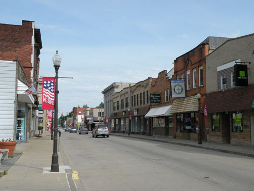
Coraopolis, Pennsylvania Borough 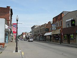 5th Avenue, Coraopolis, PA
 Coat of arms
Official name: Borough of Coraopolis Origin of name: Koreopolis, Greek for "Maiden city" Nickname: Cory Country United States State Pennsylvania County Allegheny Coordinates 40°30′56.94″N 80°9′46.05″W / 40.5158167°N 80.1627917°W Population 5,677 (2010) Settled in 1773 Incorporated in 1886 Mayor John Haberland Timezone EST (UTC-5) - summer (DST) EDT (UTC-4) ZIP code 15108 Area code 412 School District Cornell 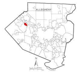 Location of Coraopolis in Allegheny County
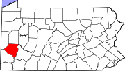
 Location of Coraopolis in Pennsylvania
 Location of Pennsylvania in the United States
Website: Coraopolis Coraopolis (
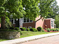
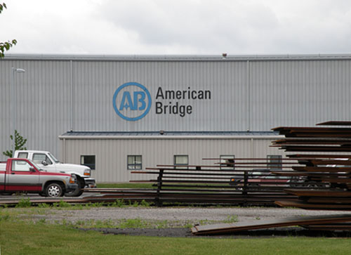
 /kɔərɪˈɒplɨs/) is a borough in Allegheny County, Pennsylvania, USA. The population was 5,677 at the 2010 census.[1] In 1940 the population peaked at 11,086. It is a small community located to the west of Pittsburgh, along the Ohio River and to the east of the Pittsburgh International Airport. The borough is noted for its steep topography, numerous brick streets and many large, old and exquisite homes. The American Bridge Company is headquartered in Coraopolis.
Contents
History
Coraopolis has a history replete with the names found on the borough's street signs; names like Montour, Vance, Ferree, McCabe, Neely and Watson.
On April 3, 1769, Andrew Montour, an Indian interpreter who had provided service to English settlers during the French and Indian War, was granted a land patent for approximately 350 acres (1.4 km2) of what would later become the borough of Coraopolis and Neville Island. It is a matter of uncertainty whether he ever lived upon this tract, and highly probable that his residence was not long. The first permanent white settler in Coraopolis was Capt. Robert Vance, who settled in the vicinity of Montour's tract around 1773, just prior to the beginning of the American Revolution. Vance, a Virginian, had been a member of the regiment commanded by George Washington at the Braddock expedition during the French and Indian War. For the protection of himself and his neighbors, of whom several arrived within a few years, Vance had a log stockade built with a stone blockhouse to protect the area against Indian raids. This was known as Vance Fort (or Fort Vance). The site of the fort was around present-day Broadway and Chestnut streets, near Second Avenue. Over time the community grew and developed, and it became known as Middletown in the 1800s, because it was situated midway between Pittsburgh and Beaver, Pennsylvania.
One of the most important early industries in the area was begun by the Watson family, English immigrants who arrived in America in 1830. The Watsons built a sawmill on the site of the present municipal building on Fifth Avenue. Later, they operated a much larger grist mill on the river bank at Mill Street, until 1887.
The borough was incorporated on June 7, 1886. It was previously known as a village under the name of Middletown, while the post office name was Vancefort. It was established in August 1861, and changed to Coraopolis in March 1886. Legend has it that the borough was named for a member of the Watson family, Cora Watson, who was born on February 2, 1870. However, an old newspaper uncovered by longtime resident and local historian Dr. Frank Braden, Jr. suggests it more likely took the appellation from a Greek word for "maiden city". According to page 7 of the book Coraopolis, by Gia Tatone, Coraopolis Historical Society (2007), "The newspaper [Dr. Frank Braden, Jr. uncovered] was simply called the News and was published in Coraopolis, Pennsylvania, on June 5, 1897. The newspaper discusses the confusion that was occurring with the post offices in regard to the name Middletown. Several other areas in the state of Pennsylvania shared the same name. With a borough now being established, the Reverend Josiah Dillon, a pioneer clergyman, suggested the name to be changed to Coraopolis. Dillon knew Greek and was also the first burgess (mayor) at the time. So he suggested combining Kore meaning 'maiden' and opolis meaning 'city' ('maiden city') to achieve Koreopolis. However, when Greek letters and pronunciation were turned to English, it is said the spelling therefore accidentally got changed."[1]
Community development in Coraopolis moved along gradually with the building of the Pittsburgh and Lake Erie Railroad in 1877. Several Coraopolis residents were stockholders in this enterprise. In 1890, oil was discovered at both ends of the borough, which briefly stimulated a population boom. The effects did not last long, however, as the oil supplies were found to be rather modest.
In 1892, community development took off with the construction of the first high-speed electric street railway in the United States. The railway was scheduled to run up to 40 mph, going from Coraopolis, over Neville Island and to McKees Rocks. Along with the railway came Consolidated Lamp and Glass Company to Coraopolis, moving from its location in Fostoria, Ohio. Consolidated Glass employed up to 350 people. Other Coraopolis residents worked for the new industries established on Neville Island.
Coraopolis' first municipal building was built in 1897 on State Avenue and was used until 1929, when the current building was constructed.
Two significant contributions to modern educational practice took place in the area. In 1955, Dr. Harry Houtz published a six year study in the National Education Journal demonstrating that phonics was a more effective way of teaching reading, and in 1957, Herbert Snell published his study of performance-based academic tracking in junior high, which became widely adopted. Coraopolis and Neville Township merged to form Cornell School District in 1971, and all students reported to the new Cornell Educational Center in 1976.
Coraopolis is the birthplace of actors Michael Keaton and S. William Hinzman.
Geography
Coraopolis is located at 40°30′57″N 80°9′46″W / 40.51583°N 80.16278°W (40.515818, -80.162791).[2]
According to the United States Census Bureau, the borough has a total area of 1.5 square miles (3.9 km2), of which 1.3 square miles (3.4 km2) is land and 0.1 square miles (0.26 km2), or 9.46%, is water.
Surrounding communities
Coraopolis is situated along the southern bank of the Ohio River in western Pennsylvania. The borough is bordered on the west and south by Moon Township and on the southeast by Robinson Township. Coraopolis is connected to Neville Island (Neville Township) via the Coraopolis Bridge. The borough sits across the river from Haysville and Osborne.
Demographics
As of the census[3] of 2000, there were 6,131 people, 2,880 households, and 1,552 families residing in the borough. The population density was 4,582.3 people per square mile (1,766.6/km²). There were 3,119 housing units at an average density of 2,331.1 per square mile (898.7/km²). The racial makeup of the borough was 84.96% White, 12.43% Black or African American, 0.08% Native American, 0.28% Asian, 0.02% Pacific Islander, 0.57% from other races, and 1.66% from two or more races. 0.98% of the population were Hispanic or Latino of any race.
There were 2,880 households out of which 21.4% had children under the age of 18 living with them, 38.0% were married couples living together, 11.8% had a female householder with no husband present, and 46.1% were non-families. 40.3% of all households were made up of individuals and 19.2% had someone living alone who was 65 years of age or older. The average household size was 2.10 and the average family size was 2.85.
In the borough the population was spread out with 19.4% under the age of 18, 7.2% from 18 to 24, 30.3% from 25 to 44, 21.6% from 45 to 64, and 21.5% who were 65 years of age or older. The median age was 41 years. For every 100 females there were 84.1 males. For every 100 females age 18 and over, there were 81.7 males.
The median income for a household in the borough was $32,321, and the median income for a family was $41,081. Males had a median income of $31,374 versus $25,269 for females. The per capita income for the borough was $17,595. About 6.4% of families and 9.7% of the population were below the poverty line, including 10.9% of those under age 18 and 11.8% of those age 65 or over.
Borough government
- Mayor - John Haberland
- Borough Council:
- Council President - John Pessy
- Dan LaRocco
- Ettore Pitassi
- Anthony Celeste
- Shelly Jones
- Ray McCutcheon
- Paul Pollastro
- Gerard Thompson
- Borough Manager - Tom Cellante, Jr.
- Borough Engineers - Lennon, Smith and Souleret (Ned Metrovich)
- Borough Solicitor - Richard Start
- Water Superintendent - Rich Deems
See also
Gallery
-
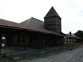
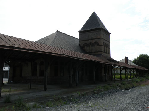
The old Coraopolis Railroad Station
-
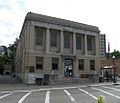
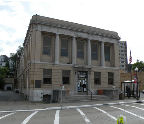
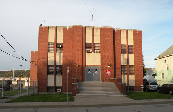
Coraopolis municipal building
-
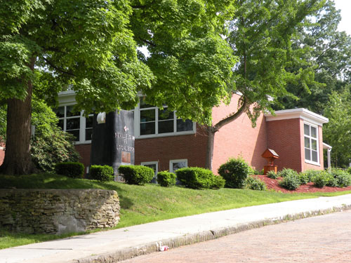
Coraopolis library
-
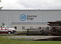
A building that is part of the American Bridge Company's headquarters in Coraopolis
-
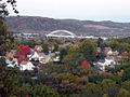
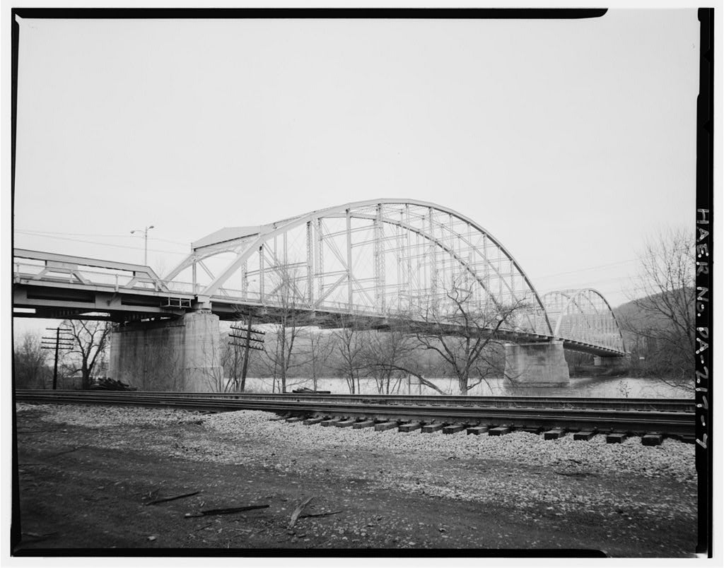
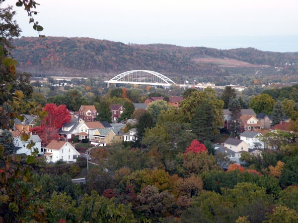
The Neville Island Bridge as viewed from a hill in Coraopolis
References
- ^ "Race, Hispanic or Latino, Age, and Housing Occupancy: 2010 Census Redistricting Data (Public Law 94-171) Summary File (QT-PL), Coraopolis borough, Pennsylvania". U.S. Census Bureau, American FactFinder 2. http://factfinder2.census.gov. Retrieved September 19, 2011.
- ^ "US Gazetteer files: 2010, 2000, and 1990". United States Census Bureau. 2011-02-12. http://www.census.gov/geo/www/gazetteer/gazette.html. Retrieved 2011-04-23.
- ^ "American FactFinder". United States Census Bureau. http://factfinder.census.gov. Retrieved 2008-01-31.
External links
Municipalities and communities of Allegheny County, Pennsylvania County seat: Pittsburgh Cities Clairton | Duquesne | McKeesport | Pittsburgh
Boroughs Aspinwall | Avalon | Baldwin | Bell Acres | Bellevue | Ben Avon | Ben Avon Heights | Bethel Park | Blawnox | Brackenridge | Braddock | Braddock Hills | Bradford Woods | Brentwood | Bridgeville | Carnegie | Castle Shannon | Chalfant | Cheswick | Churchill | Coraopolis | Crafton | Dormont | Dravosburg | East McKeesport | East Pittsburgh | Edgewood | Edgeworth | Elizabeth | Emsworth | Etna | Forest Hills | Fox Chapel | Franklin Park | Glassport | Glen Osborne | Glenfield | Green Tree | Haysville | Heidelberg | Homestead | Ingram | Jefferson Hills | Leetsdale | Liberty | Lincoln | McDonald‡ | McKees Rocks | Millvale | Monroeville | Mount Oliver | Munhall | North Braddock | Oakdale | Oakmont | Pennsbury Village | Pitcairn | Pleasant Hills | Plum | Port Vue | Rankin | Rosslyn Farms | Sewickley | Sewickley Heights | Sewickley Hills | Sharpsburg | Springdale | Swissvale | Tarentum | Thornburg | Trafford‡ | Turtle Creek | Verona | Versailles | Wall | West Elizabeth | West Homestead | West Mifflin | West View | Whitaker | White Oak | Whitehall | Wilkinsburg | Wilmerding
Townships Aleppo | Baldwin | Collier | Crescent | East Deer | Elizabeth | Fawn | Findlay | Forward | Frazer | Hampton | Harmar | Harrison | Indiana | Kennedy | Kilbuck | Leet | Marshall | McCandless | Moon | Mt. Lebanon | Neville | North Fayette | North Versailles | O'Hara | Ohio | Penn Hills | Pine | Reserve | Richland | Robinson | Ross | Scott | Shaler | South Fayette | South Park | South Versailles | Springdale | Stowe | Upper St. Clair | West Deer | Wilkins
CDPs Allison Park | Bairdford | Bakerstown | Carnot-Moon | Clinton | Curtisville | Enlow | Gibsonia | Glenshaw | Harwick | Imperial | Noblestown | Rennerdale | Russellton | Sturgeon
Unincorporated
communitiesAcmetonia | Blackridge | Blanchard | Broughton | Bruceton | Buena Vista | Creighton | Dorseyville | Elfinwild | Harmarville | Hickory Heights | Karns | Keown Station | Natrona | Natrona Heights | Warrendale | Wexford | Wildwood
Footnotes ‡This populated place also has portions in an adjacent county or counties
Categories:- Pennsylvania populated places on the Ohio River
- Populated places established in 1773
- Pittsburgh metropolitan area
- Boroughs in Allegheny County, Pennsylvania


Wikimedia Foundation. 2010.