- National Register of Historic Places listings in Whatcom County, Washington
-
List of entries on the National Register of Historic Places in Whatcom County, Washington
-
- This National Park Service list is complete through NPS recent listings posted November 10, 2011.[1]
[2] Landmark name [3] Image Date listed Location City or town Summary 1 Aftermath Clubhouse 
December 14, 1978 1300 Broadway
48°45′28″N 122°29′24″W / 48.757778°N 122.49°WBellingham Some guess Aftermath Clubhouse to be the first women's clubhouse built in Washington.[4] 2 Austin Pass Warming Hut 
December 21, 1990 Southeast of Bagley Lakes, Mt. Baker-Snoqualmie NF
48°51′18″N 121°40′59″W / 48.855°N 121.683056°WGlacier 3 B. P. O. E. Building 
March 26, 1992 1412-1414 Cornwall Ave.
48°45′05″N 122°28′31″W / 48.751389°N 122.475278°WBellingham Also known as the Elk's Club. 4 George H. Bacon House 
November 21, 1974 2001 Eldridge Ave.
48°45′33″N 122°29′43″W / 48.759167°N 122.495278°WBellingham Built by Henry Bacon, first cousin of George. 5 Barlow Building 
December 15, 2004 211 W. Holly St.
48°45′09″N 122°28′50″W / 48.7525°N 122.480556°WBellingham The Barlow Building currently houses Film is Truth. 6 Beaver Pass Shelter February 10, 1989 Beaver Pass, 14 mi (23 km). W of Ross Lake
48°52′20″N 121°14′56″W / 48.872222°N 121.248889°WDiablo 7 Bellingham National Bank Building 
October 13, 1983 101-111 E. Holly St.
48°45′00″N 122°28′38″W / 48.75°N 122.477222°WBellingham 8 Berthusen Barn and Privy April 22, 2003 8837 Bethusen Rd.
48°57′43″N 122°30′25″W / 48.961944°N 122.506944°WLynden 9 Alfred L. Black House December 4, 1980 158 S. Forest St.
48°44′07″N 122°29′38″W / 48.735278°N 122.493889°WBellingham Also known as Wahl House. 10 Boundary Marker No. 1 
May 30, 1975 Marine Dr. at U.S./Canada border
49°00′08″N 123°05′17″W / 49.002222°N 123.088056°WPoint Roberts 11 Cissna Cottages Historic District January 11, 2010 Area roughly bounded by H., Halleck, G., and Girard Sts.
48°45′35.14″N 122°29′01.64″W / 48.7597611°N 122.4837889°W (approx.)[5]Bellingham 12 Copper Mountain Fire Lookout 
February 10, 1989 On Copper Mountain, 10 mi (16 km). E of Hannegan Campground
48°54′33″N 121°27′41″W / 48.909167°N 121.461389°WNewhalem 13 Daylight Building 
December 15, 2004 1201-1213 N. State St.
48°44′59″N 122°28′43″W / 48.749722°N 122.478611°WBellingham 14 Deer Lick Cabin 
February 10, 1989 E of Ross Lake on Lightening Creek Trail, S of Three Fools Trail
48°54′00″N 120°58′46″W / 48.9°N 120.979444°WHozomeen 15 Desolation Peak Lookout 
February 10, 1989 On Desolation Peak E of Ross Lake, 6 mi (9.7 km). S of Canadian border
48°54′42″N 121°00′54″W / 48.911667°N 121.015°WHozomeen 16 Devil's Corner Cliff Walk 
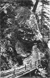
June 7, 1974 N of Newhalem in Ross Lake National Recreation Area
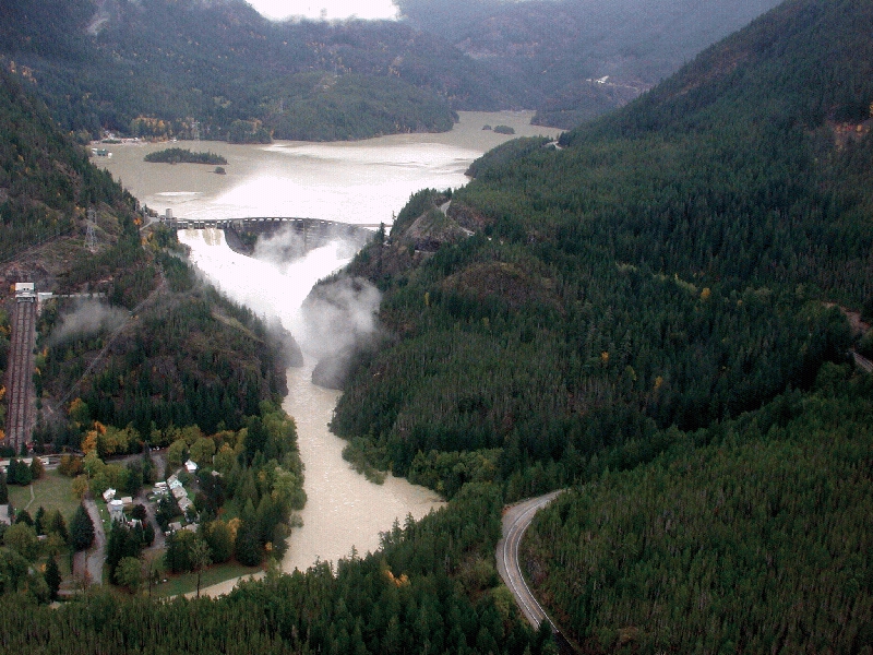
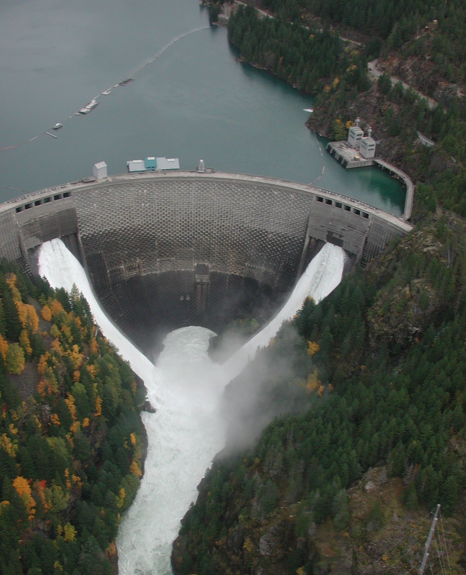
48°41′28″N 121°13′23″W / 48.691111°N 121.223056°WNewhalem 17 Diablo Hydroelectric Power Plant 
June 30, 1989 Off WA 20 at W end of Diablo Lake
48°42′52″N 121°08′04″W / 48.714444°N 121.134444°WNewhalem Consists of 520 acres (2.1 km2), 1 building, and 8 structures. 18 J. J. Donovan House 
January 27, 1983 1201 Garden St.
48°44′47″N 122°28′31″W / 48.746389°N 122.475278°WBellingham Was used as a women's dormitory by Western Washington University for roughly 25 years. 19 Eldridge Avenue Historic District July 27, 1979 Eldridge Ave. and environs
48°45′43″N 122°29′48″W / 48.761944°N 122.496667°WBellingham Encompasses 1,500 acres (6.1 km2), 683 buildings, and 1 structure. 20 Eldridge Homesite and Mansion 
January 27, 1983 2915 Eldridge Ave.
48°45′46″N 122°30′29″W / 48.762778°N 122.508056°WBellingham The home currently occupying the site, is the fourth, being built after three others burned. 21 Fairhaven Historic District 
August 19, 1977 Roughly bounded by 10th and 13th Sts., Columbia and Larrabee Aves.
48°43′13″N 122°30′07″W / 48.720278°N 122.501944°WBellingham Roughly bounded by 10th and 13th Sts., Columbia and Larrabee Aves., (85 acres, 16 buildings) 22 Fairhaven Library 
August 3, 1982 1105 12th St.
48°43′17″N 122°30′05″W / 48.721389°N 122.501389°WBellingham Carnegie Libraries of Washington TR 23 Fish and Game-Hozomeen Cabin 
February 10, 1989 Hozomeen Lake-Lightening Creek trailhead on E side of Ross Lake
48°59′08″N 121°04′07″W / 48.985556°N 121.068611°WHozomeen 24 Flatiron Building 
January 27, 1983 1311-1319 Bay St.
48°45′07″N 122°28′47″W / 48.751944°N 122.479722°WBellingham Bellingham's first "Skyscraper". It was originally built for the Bellingham Bay (B.B.) Furniture Co. 25 Gamwell House 
March 16, 1972 1001 16th St.
48°43′26″N 122°29′44″W / 48.723889°N 122.495556°WBellingham 26 Glacier Ranger Station 
September 17, 1980 Mount Baker Hwy.
48°53′16″N 121°56′07″W / 48.887778°N 121.935278°WGlacier 27 Gorge Hydroelectric Power Plants 
June 30, 1989 Off WA 20 at W end of Gorge Lake
48°41′18″N 121°13′14″W / 48.688333°N 121.220556°WNewhalem 820 acres (3.3 km2), 1 building, and 6 structures 28 Great Northern Passenger Station 
May 30, 1975 S end of D St.
48°45′14″N 122°29′07″W / 48.753889°N 122.485278°WBellingham Building is currently utilized by Burlington Northern-Santa Fe. 29 Hotel Laube 
August 29, 2003 1226 N. State St.
48°44′52″N 122°28′35″W / 48.747778°N 122.476389°WBellingham Currently being remodeled. 30 Hovander Homestead October 16, 1974 5299 Neilson Rd.
48°49′46″N 122°35′24″W / 48.829444°N 122.59°WFerndale 31 Immanuel School of Industries-Department of Public Welfare 
November 7, 2003 1303 Astor St.
48°53′10″N 122°39′39″W / 48.886111°N 122.660833°WBellingham 32 International Boundary US-Canada February 10, 1989 Along US-Canada border between eastern boundary of Ross Lake NRA and western boundary of North Cascades National Park
49°00′04″N 121°31′19″W / 49.001111°N 121.521944°WHozomeen 33 Koma Kulshan Ranger Station June 10, 1991 Forest Rd. 11, W of Baker Lake, Mt. Baker National Forest
48°39′42″N 121°42′49″W / 48.661667°N 121.713611°WConcrete 34 Larrabee House May 30, 1975 405 Fieldstone Rd.
48°42′43″N 122°30′26″W / 48.711944°N 122.507222°WBellingham Commissioned by Charles Xavier Larrabee, he did not live to see it built. Also known as Lairmont Manor and Mt. St. Mary's Novitiate. 35 Leopold Hotel 
February 19, 1982 1224 Cornwall Ave.
48°44′57″N 122°28′43″W / 48.749167°N 122.478611°WBellingham The Leopold Hotel currently houses a retirement home. 36 Lynden Department Store 
July 20, 2011 444 Front St.
48°56′35″N 122°27′10″W / 48.943056°N 122.452778°WLynden Also known as the Waples Building / Delft Square. Heavily damaged by fire in 2008. 37 Middle Fork Nooksack River Bridge July 16, 1982 Mosquito Lake Rd.
48°47′05″N 122°06′40″W / 48.784722°N 122.111111°WAcme Historic Bridges and Tunnels in Washington TR 38 Montague and McHugh Building 
April 29, 1993 114 W. Magnolia St.
48°45′05″N 122°28′41″W / 48.751378°N 122.478075°WBellingham Designed by John Graham Sr. 39 Morse Hardware Company Building 
February 2, 2005 1023-1025 N. State St.
48°44′52″N 122°28′52″W / 48.747778°N 122.481111°WBellingham 40 Robert I. Morse House 
November 7, 1977 1014 N. Garden St.
48°44′41″N 122°28′38″W / 48.744722°N 122.477222°WBellingham 41 Mount Baker Theatre 
December 14, 1978 106 N. Commercial St.
48°45′08″N 122°28′36″W / 48.752222°N 122.476667°WBellingham Designed by Robert Reamer, designer of the Old Faithful Inn. 42 MV PLOVER (ferry) June 4, 1997 245 Marine Dr.;Blaine Harbor Berth A-11
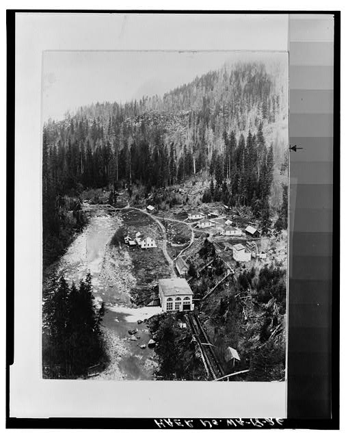
48°59′37″N 122°45′31″W / 48.993611°N 122.758611°WBlaine 43 Nooksack Falls Hydroelectric Power Plant 
December 15, 1988 Rt. 542 on Nooksack River
48°54′33″N 121°49′31″W / 48.909167°N 121.825278°WGlacier 44 Oakland Block 
March 25, 1999 310-318 W. Holly St. and 419 Champion St.
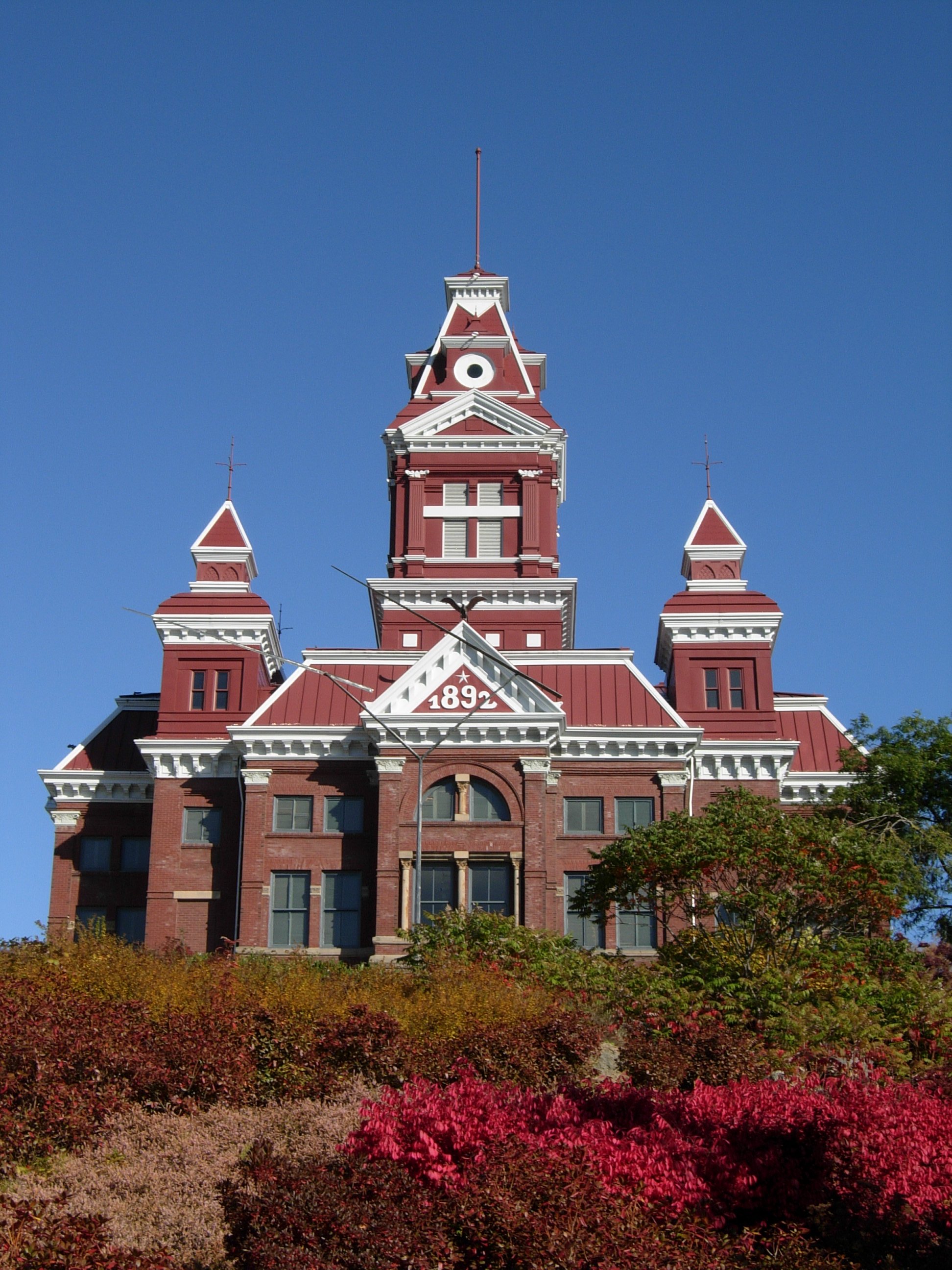
48°45′13″N 122°28′54″W / 48.753611°N 122.481667°WBellingham The Oakland Block was recently remodeled to provide low-income housing. 45 Old Main, Western Washington State College 
November 7, 1977 516 High St.
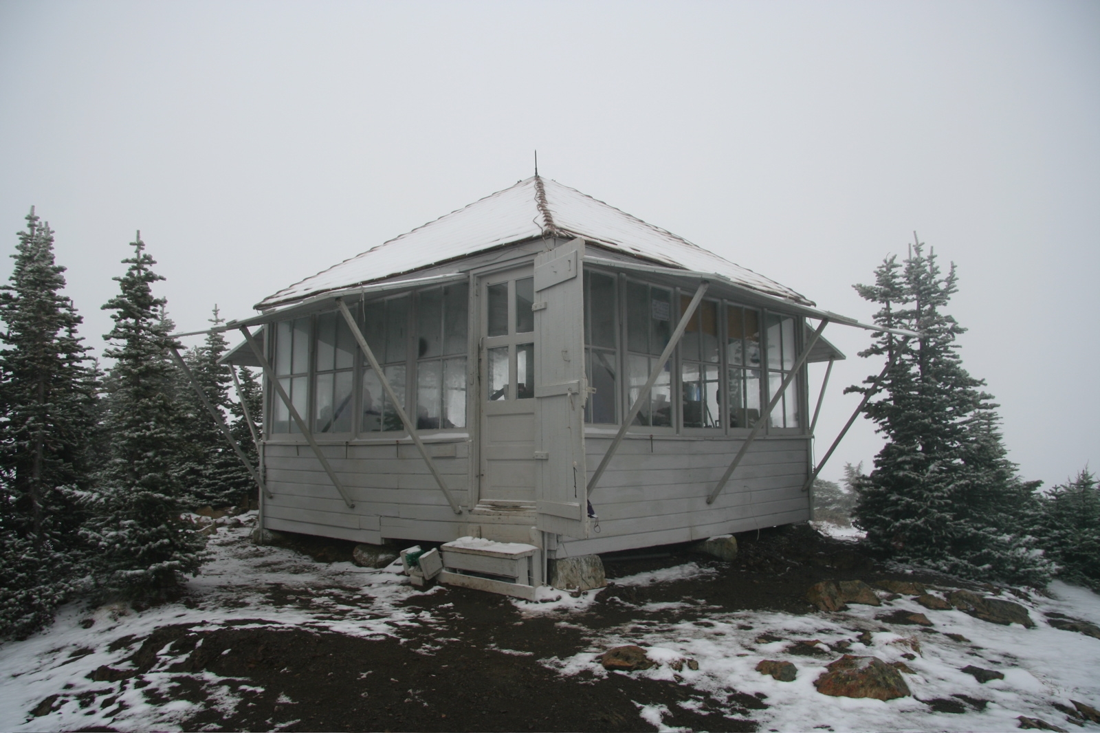
48°44′17″N 122°28′58″W / 48.738056°N 122.482778°WBellingham 46 Park Butte Lookout 
July 14, 1987 Mt. Baker Ranger District, SW of the Easton Glacier of Mt. Baker
48°42′59″N 121°51′18″W / 48.716389°N 121.855°WSedro-Woolley vicinity 47 Peace Arch 
December 13, 1996 Peace Arch State Park, US 5 at the US-Canadian border
48°59′59″N 122°45′10″W / 48.999722°N 122.752778°WBlaine 48 Perry Creek Shelter February 10, 1989 On Little Beaver Trail, 5 mi (8.0 km). W of Ross Lake
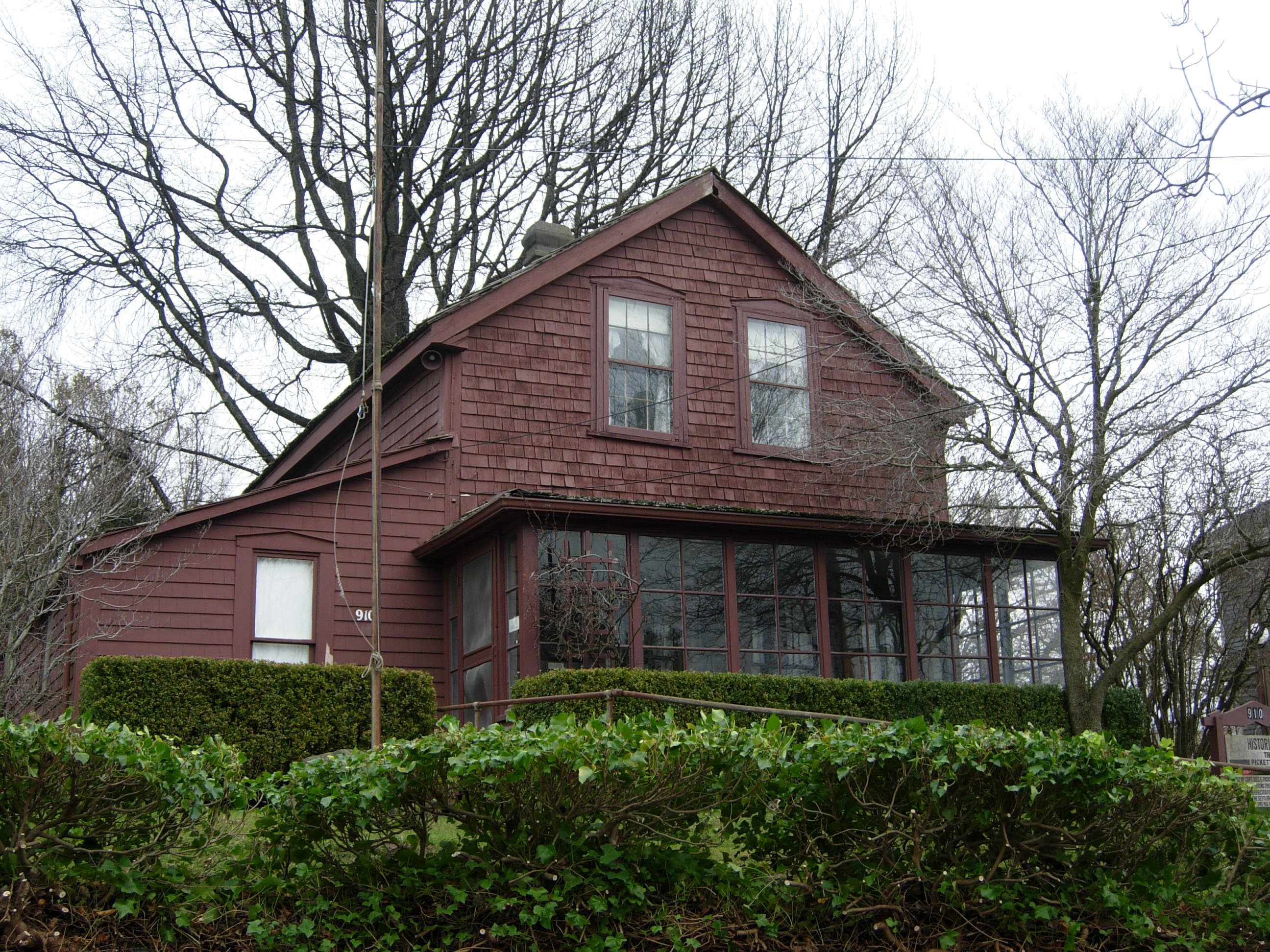
48°55′16″N 121°09′21″W / 48.921111°N 121.155833°WHozomeen 49 Pickett House 
December 13, 1971 910 Bancroft St.
48°45′23″N 122°29′04″W / 48.756389°N 122.484444°WBellingham The former home of George Pickett is the oldest building in Bellingham. 50 T. G. Richards and Company Store 
August 28, 2003 1308 E St.
48°45′17″N 122°29′10″W / 48.754786°N 122.486208°WBellingham Later became the Washington Territorial Courthouse. The oldest brick building in Washington. 51 Victor A. Roeder House 
November 7, 1977 2600 Sunset Dr.
48°45′56″N 122°28′41″W / 48.765556°N 122.478056°WBellingham The home currently provides space for different educational activities. 52 Lottie Roth Block 
December 12, 1978 1106 W. Holly St.
48°45′22″N 122°29′14″W / 48.756111°N 122.487222°WBellingham 53 Sanitary Meat Market 
February 2, 2005 1015-1019 N. State St.
48°44′52″N 122°28′53″W / 48.747778°N 122.481389°WBellingham The Sanitary Meat Market originally occupied 1015-1019 N. State St., now only 1017. 54 Sehome Hill Historic District February 13, 2001 Portions of Jersey, Key, Liberty, Mason, Newell, E. Myrtle, E. Laurel, and E. Maple Sts.
48°44′23″N 122°28′32″W / 48.739608°N 122.475472°WBellingham Includes portions of Jersey, Key, Liberty, Mason, Newell, E. Myrtle, E. Laurel, and E. Maple Streets, with 153 buildings. 55 Si'ke village with historic area called Tsi'lich June 30, 2000 Address Restricted Blaine 56 Skagit River and Newhalem Creek Hydroelectric Projects 
April 26, 1996 At Newhalem on the Skagit River and at Ross Dam
48°41′50″N 121°11′14″W / 48.697222°N 121.187222°WNewhalem 420 acres (1.7 km2), 21 buildings, 5 structures, and 1 object 57 Sourdough Mountain Lookout 
February 10, 1989 On Sourdough Mountain, 5 mi (8.0 km). NE of Diablo
48°44′34″N 121°06′29″W / 48.742778°N 121.108056°WDiablo 58 South Hill Historic District February 24, 2010 Bounded by Knox, 11th, State, Cedar, 17th, and Highland
48°43′42″N 122°29′52″W / 48.728372°N 122.497747°WBellingham 59 U.S. Post Office and Courthouse 
April 30, 1979 104 W. Magnolia St.
48°45′05″N 122°28′35″W / 48.751389°N 122.476389°WBellingham Formerly the Bellingham Federal Building, the building is now owned by the city. 60 US Post Office-Lynden Main 
August 7, 1991 600 Front St.
48°56′34″N 122°27′13″W / 48.942778°N 122.453611°WLynden 61 James F. Wardner House 
December 1, 1988 1103 15th St.
48°43′21″N 122°29′49″W / 48.7225°N 122.496944°WBellingham Also known as Wardner Castle, James Wardner only lived in the home for one year. 62 Washington Grocery Company Warehouse 
December 13, 1996 1125 Railroad Ave.
48°44′54″N 122°29′33″W / 48.748333°N 122.4925°WBellingham 63 Whatcom Museum of History and Art 
April 3, 1970 121 Prospect St.
48°45′10″N 122°28′48″W / 48.752778°N 122.48°WBellingham Formerly the Bellingham City Hall. 64 Wild Goose Pass Tree June 7, 1991 Address Restricted Glacier 65 Winchester Mountain Lookout 
July 14, 1987 Mt. Baker Wilderness Area overlooking the N fork of Nooksack River and W fork of Silesia Creek
48°57′25″N 121°38′31″W / 48.956944°N 121.641944°WSedro-Woolley vicinity 66 York Historic District February 1, 2010 Bounded roughly by Ellis St., Meador Ave., I-5, and Lakeway Dr.
48°44′57″N 122°28′05″W / 48.7493°N 122.468033°WBellingham 67 Young Women's Christian Association 
April 21, 1977 1026 N. Forest St.
48°44′44″N 122°28′41″W / 48.745556°N 122.478056°WBellingham See also
References
- ^ "National Register of Historic Places: Weekly List Actions". National Park Service, United States Department of the Interior. Retrieved on November 10, 2011.
- ^ Numbers represent an ordering by significant words. Various colorings, defined here, differentiate National Historic Landmark sites and National Register of Historic Places Districts from other NRHP buildings, structures, sites or objects.
- ^ "National Register Information System". National Register of Historic Places. National Park Service. . http://nrhp.focus.nps.gov/natreg/docs/All_Data.html.
- ^ Aftermath Clubhouse (1904) 1412 West Holly Street - City of Belligham, WA
- ^ Coordinates given are for the intersection of H Street and Girard Street, as resulting from a corresponding search in Google Earth.
U.S. National Register of Historic Places Topics Lists by states Alabama • Alaska • Arizona • Arkansas • California • Colorado • Connecticut • Delaware • Florida • Georgia • Hawaii • Idaho • Illinois • Indiana • Iowa • Kansas • Kentucky • Louisiana • Maine • Maryland • Massachusetts • Michigan • Minnesota • Mississippi • Missouri • Montana • Nebraska • Nevada • New Hampshire • New Jersey • New Mexico • New York • North Carolina • North Dakota • Ohio • Oklahoma • Oregon • Pennsylvania • Rhode Island • South Carolina • South Dakota • Tennessee • Texas • Utah • Vermont • Virginia • Washington • West Virginia • Wisconsin • WyomingLists by territories Lists by associated states Other Municipalities and communities of Whatcom County, Washington Cities 
CDPs Acme | Birch Bay | Custer | Deming | Geneva | Glacier | Kendall | Maple Falls | Marietta-Alderwood | Peaceful Valley | Sudden Valley
Unincorporated
communitiesFairhaven | Laurel | Lummi Island | Maple Beach | Newhalem | Point Roberts
Ghost town Categories:- National Register of Historic Places in Washington (state) by county
- Whatcom County, Washington
- History of Bellingham, Washington
- Bellingham, Washington
-


Wikimedia Foundation. 2010.