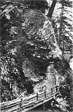
- Devil's Corner Cliff Walk
-
Devil's Corner Cliff WalkInvalid designation

Location: Ross Lake National Recreation Area Nearest city: Anacortes, Washington Coordinates: 48°41′28″N 121°13′23″W / 48.69111°N 121.22306°W Built: 1875? Governing body: State, Federal NRHP Reference#: - 74000909
Added to NRHP: 1974 The Devil's Corner Cliff Walk is a National Recreation Area in the Ross Lake area.
Built in 1875[clarification needed], it functioned as pedestrian transportation until the turn of the century, and now functions as a park. It was added to the National Register of Historic Places in 1974.
External links
- "Freebase". August 8, 2009. http://www.freebase.com/view/guid/9202a8c04000641f800000000df7e322/-/base/usnris. Retrieved December 29, 2009.
- http://www.hpdb.org/historic_places/44587?tab=description
- http://www.nationalregisterofhistoricplaces.com/WA/Whatcom/state.html
Lists by county Adams • Asotin • Benton • Chelan • Clallam • Clark • Columbia • Cowlitz • Douglas • Ferry • Franklin • Garfield • Grant • Grays Harbor • Island • Jefferson • King • Kitsap • Kittitas • Lewis • Lincoln • Mason • Okanogan • Pacific • Pend Oreille • Pierce • San Juan • Skagit • Skamania • Snohomish • Spokane • Stevens • Thurston • Wahkiakum • Walla Walla • Whatcom • Whitman • Yakima

Other lists Keeper of the Register • History of the National Register of Historic Places • Property types • Historic district • Contributing property Categories:- National Recreation Areas of the United States
- Parks in Washington (state)
- Bridges on the National Register of Historic Places in Washington (state)
- Buildings and structures in Skagit County, Washington
- Geography of Skagit County, Washington
Wikimedia Foundation. 2010.
