- National Register of Historic Places listings in Stevens County, Washington
-
List of entries on the National Register of Historic Places in Stevens County, Washington
-
- This National Park Service list is complete through NPS recent listings posted November 10, 2011.[1]
Contents
[2] Landmark name Image Date listed Location City or town Summary 1 Clayton School August 28, 2003 Corner of Park Ave. and Swenson Rd.
47°59′45″N 117°33′53″W / 47.995833°N 117.564722°WClayton Rural Public Schools of Washington State MPS 2 Collins Building November 19, 1998 S 202 Main
48°32′37″N 117°54′18″W / 48.543611°N 117.905°WColville 3 Columbia River Bridge at Northport May 24, 1995 WA 25 over the Columbia R.
48°55′21″N 117°46′32″W / 48.9225°N 117.775556°WNorthport Bridges of Washington State MPS 4 Colville Flour Mill June 29, 1995 466 W. First St.
48°32′39″N 117°54′40″W / 48.544167°N 117.911111°WColville 5 Hudsons Bay Gristmill Site on Colville River April 12, 1982 Address Restricted Kettle Falls 6 Keller House April 18, 1979 700 N. Wynne St.
48°33′05″N 117°54′25″W / 48.551389°N 117.906944°WColville 7 Kettle Falls District November 20, 1974 Address Restricted Kettle Falls 8 Little Falls Hydroelectric Power Plant December 15, 1988 Spokane River
47°49′53″N 117°55′00″W / 47.831389°N 117.916667°WReardan 9 Long Lake Hydroelectric Power Plant 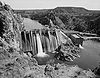
December 15, 1988 Spokane River
47°50′10″N 117°50′19″W / 47.836111°N 117.838611°WFord 10 Long Lake Pictographs May 24, 1976 Address Restricted Ford 11 Loon Lake School November 19, 1992 4000 Colville Rd.
48°03′48″N 117°37′49″W / 48.063333°N 117.630278°WLoon Lake Rural Public Schools of Washington State MPS 12 H. M. McCauley House April 18, 1979 285 Oak St.
48°32′42″N 117°54′13″W / 48.545°N 117.903611°WColville 13 Meyers Falls Power Plant Historic District June 29, 1995 0.5 mi. S of Kettle Falls at Colville R., on either side of Juniper St.
48°35′46″N 118°03′21″W / 48.596111°N 118.055833°WKettle Falls 14 Northport School October 4, 1979 South and 7th Sts.
48°54′49″N 117°46′59″W / 48.913611°N 117.783056°WNorthport 15 Old Indian Agency May 17, 1974 3rd St.
48°16′44″N 117°42′46″W / 48.278889°N 117.712778°WChewelah 16 Opera House and IOOF Lodge April 18, 1997 151 W. 1st Ave.
48°32′40″N 117°54′18″W / 48.544444°N 117.905°WColville 17 Orient Bridge 
July 16, 1982 Richardson Rd., Spans Kettle River
48°51′59″N 118°11′52″W / 48.866389°N 118.197778°WOrient Historic Bridges and Tunnels in Washington TR 18 Red Mountain Railroad Bridge July 16, 1982 Spans Little Sheep Creek
48°58′03″N 117°48′53″W / 48.9675°N 117.814722°WNorthport Historic Bridges and Tunnels in Washington TR 19 Rickey Block June 30, 1995 230 S. Main St.
48°32′35″N 117°54′18″W / 48.543056°N 117.905°WColville 20 Spokane River Bridge at Long Lake Dam May 24, 1995 WA 231 over the Spokane R.
47°50′19″N 117°51′05″W / 47.838611°N 117.851389°WRearden 21 US Post Office-Colville Main August 7, 1991 204 S. Oak
48°32′35″N 117°54′13″W / 48.543056°N 117.903611°WColville 22 Colburn T. Winslow House April 26, 1990 458 E. 2nd St.
48°32′43″N 117°53′57″W / 48.545278°N 117.899167°WColville References
- ^ "National Register of Historic Places: Weekly List Actions". National Park Service, United States Department of the Interior. Retrieved on November 10, 2011.
- ^ Numbers represent an ordering by significant words. Various colorings, defined here, differentiate National Historic Landmark sites and National Register of Historic Places Districts from other NRHP buildings, structures, sites or objects.
U.S. National Register of Historic Places Topics Lists by states Alabama • Alaska • Arizona • Arkansas • California • Colorado • Connecticut • Delaware • Florida • Georgia • Hawaii • Idaho • Illinois • Indiana • Iowa • Kansas • Kentucky • Louisiana • Maine • Maryland • Massachusetts • Michigan • Minnesota • Mississippi • Missouri • Montana • Nebraska • Nevada • New Hampshire • New Jersey • New Mexico • New York • North Carolina • North Dakota • Ohio • Oklahoma • Oregon • Pennsylvania • Rhode Island • South Carolina • South Dakota • Tennessee • Texas • Utah • Vermont • Virginia • Washington • West Virginia • Wisconsin • WyomingLists by territories Lists by associated states Other Categories:- National Register of Historic Places in Washington (state) by county
- Stevens County, Washington
-


Wikimedia Foundation. 2010.