- National Register of Historic Places listings in Chelan County, Washington
-
List of entries on the National Register of Historic Places in Chelan County, Washington
-
- This National Park Service list is complete through NPS recent listings posted November 10, 2011.[1]
Contents
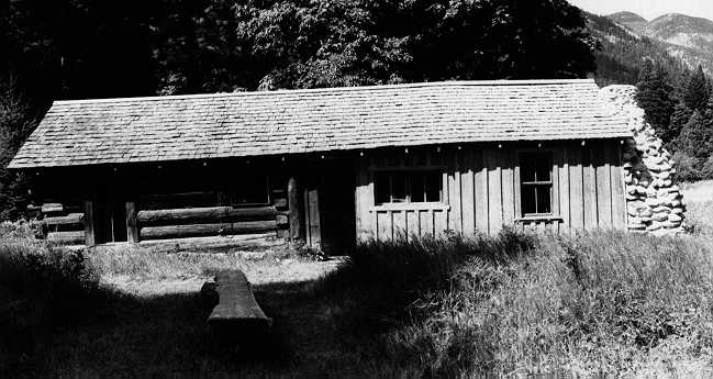
[2] Landmark name [3] Image Date listed Location City or town Summary 1 Black Warrior Mine October 15, 1974 N of Stehekin in North Cascades National Park
48°28′48″N 121°01′27″W / 48.48°N 121.024167°WStehekin 2 Blewett Arrastra September 17, 1974 S of Cashmere on U.S. 97
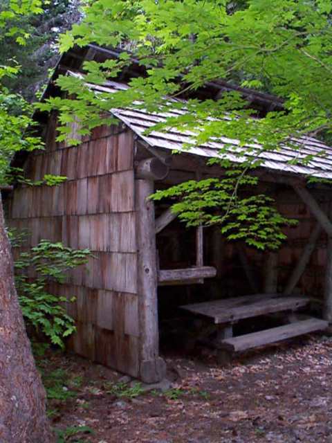
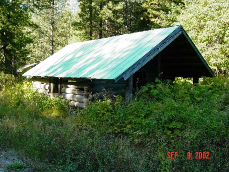
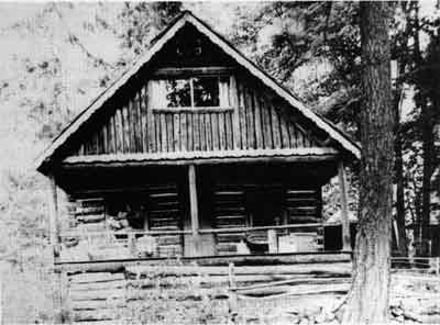
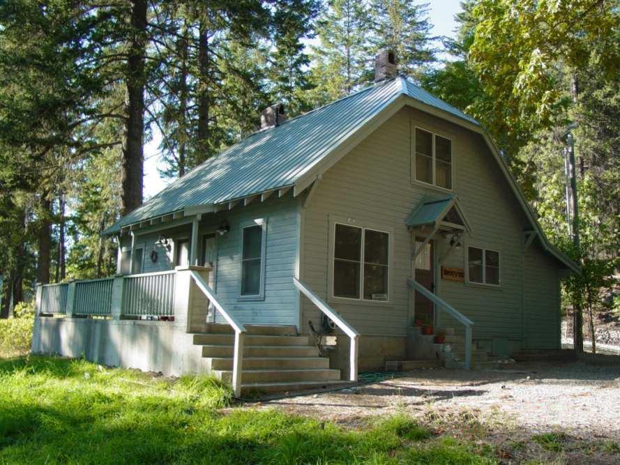
47°25′37″N 120°39′25″W / 47.426944°N 120.656944°WCashmere 3 Bridge Creek Cabin-Ranger Station February 10, 1989 Bridge Creek Campground off Stehekin Valley Rd.
48°25′50″N 120°52′15″W / 48.430556°N 120.870833°WStehekin 4 Bridge Creek Shelter 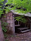
February 10, 1989 Bridge Creek Campground off Stehekin Valley Rd.
48°25′52″N 120°51′55″W / 48.431111°N 120.865278°WStehekin 5 Buckner Cabin 
May 17, 1974 Lake Chelan National Recreation Area
48°20′06″N 120°41′56″W / 48.335°N 120.698889°WStehekin 6 Buckner Homestead Historic District 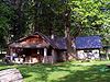
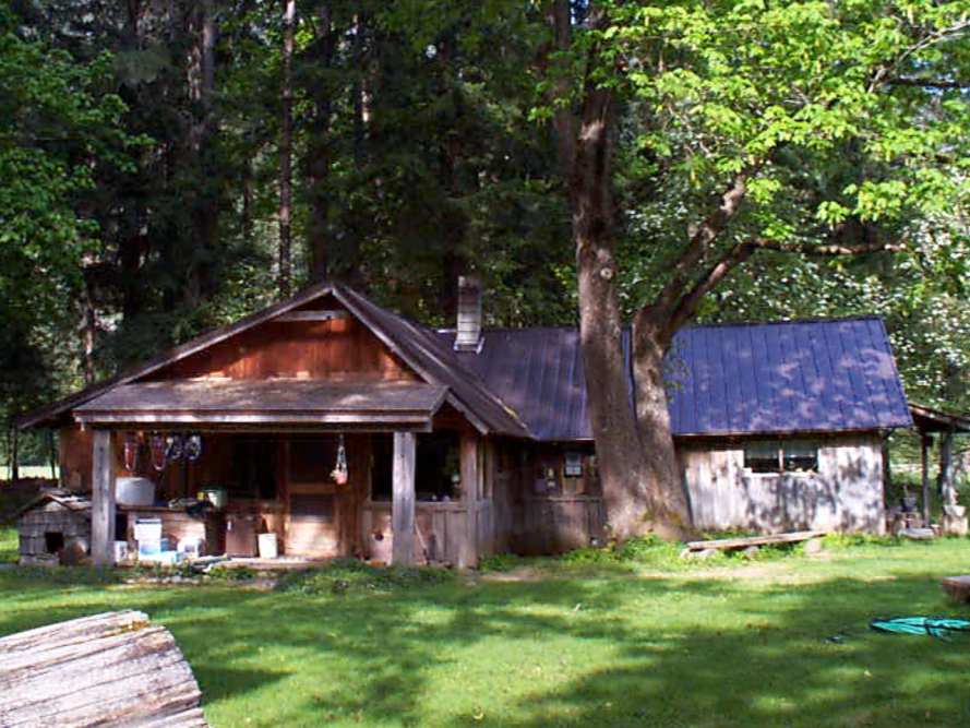
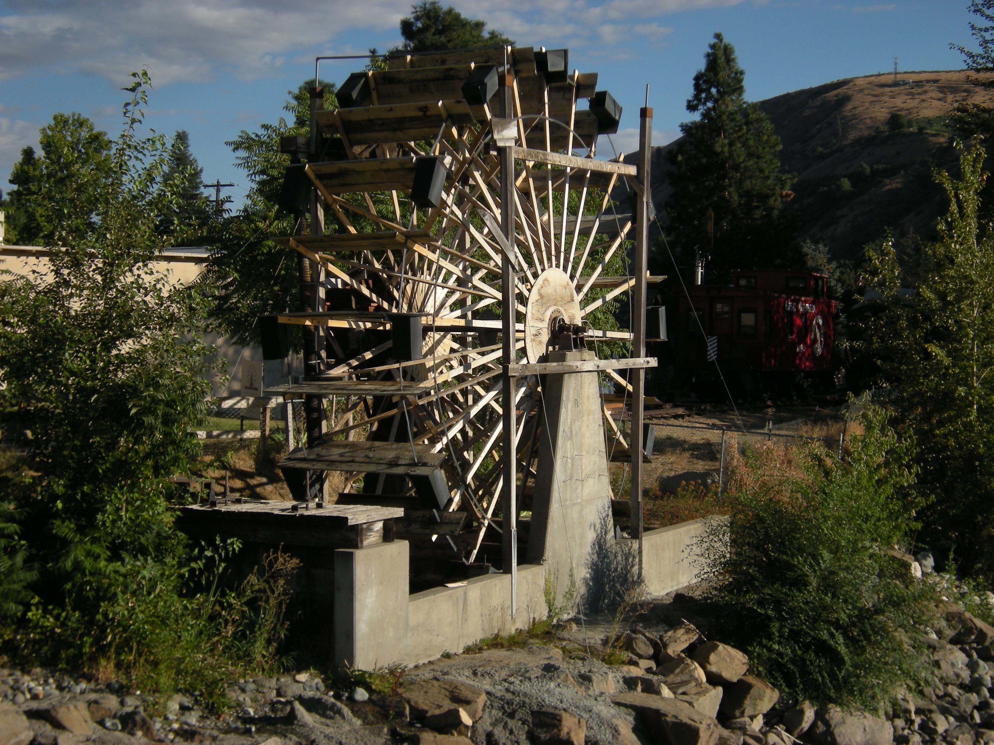
February 10, 1989 Address Restricted Stehekin 7 Burbank Homestead Waterwheel 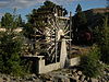
June 19, 1973 600 Cotlets Way
47°31′13″N 120°27′21″W / 47.520278°N 120.455833°WCashmere 8 Chatter Creek Guard Station April 8, 1986 Wenatchee National Forest
47°36′27″N 120°53′00″W / 47.6075°N 120.883333°WLeavenworth 9 Chelan Butte Lookout 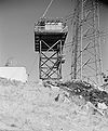
December 27, 1990 Summit of Chelan Butte
47°48′25″N 120°01′58″W / 47.806944°N 120.032778°WChelan 10 Columbia River Bridge July 16, 1982 Spans Columbia River between Wenatchee and East Wenatchee
47°24′51″N 120°17′54″W / 47.414167°N 120.298333°WWenatchee Historic Bridges and Tunnels in Washington TR 11 Columbia River Bridge at Wenatchee 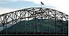
May 24, 1995 US 2 over the Columbia R.
47°24′36″N 120°17′41″W / 47.41°N 120.294722°WWenatchee Also known as WSDOT 285/10 and the George Sellars Bridge.
Bridges of Washington State MPS12 Cottage Avenue Historic District 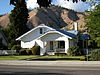
December 26, 2002 208-509 Cottage Ave., 103 Maple St., 107 Parkhill St.
47°31′14″N 120°27′43″W / 47.520556°N 120.461944°WCashmere 208-509 Cottage Ave., 103 Maple St., 107 Parkhill St., Cashmere 13 Courtney Cabin 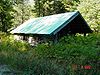
May 31, 1974 Lake Chelan National Recreation Area
48°21′55″N 120°44′58″W / 48.365278°N 120.749444°WStehekin 14 Downtown Wenatchee Historic District 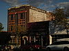
December 17, 2008 Roughly bounded by Columbia St., Mission St., N. 1st St., and Kittitas St. Wenatchee 15 Flick Creek Shelter February 10, 1989 E side of Lake Chelan S of Flick Creek
48°16′31″N 120°37′42″W / 48.275278°N 120.628333°WStehekin 16 Golden West Lodge Historic District 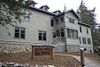
February 10, 1989 Stehekin Landing
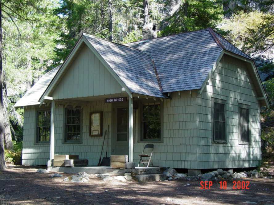
48°18′31″N 120°39′16″W / 48.308611°N 120.654444°WStehekin 17 High Bridge Ranger Station Historic District 
February 10, 1989 Stehekin Valley Rd.
48°22′48″N 120°50′11″W / 48.38°N 120.836389°WStehekin 18 High Bridge Shelter 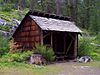
February 10, 1989 High Bridge Campground off Stehekin Valley Rd.
48°22′52″N 120°50′16″W / 48.381111°N 120.837778°WStehekin 19 Michael Horan House 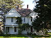
March 31, 1992 2 Horan Rd.
47°27′34″N 120°20′00″W / 47.459444°N 120.333333°WWenatchee 20 Lake Chelan Hydroelectric Power Plant December 15, 1988 Lake Chelan
47°49′18″N 119°59′56″W / 47.821667°N 119.998889°WChelan 21 Lake Wenatchee Residence No. 1200 March 6, 1991 WA 207, N shore of Lake Wenatchee, Wenatchee NF
47°50′12″N 120°47′45″W / 47.836667°N 120.795833°WLeavenworth 22 Leavenworth National Fish Hatchery July 27, 1998 12790 Fish Hatchery Rd.
47°31′58″N 120°41′42″W / 47.532778°N 120.695°WLeavenworth 23 Leavenworth Ranger Station 
April 11, 1986 Wenatchee National Forest
47°35′58″N 120°39′20″W / 47.599444°N 120.655556°WLeavenworth 24 Richard Hinton Lord House March 25, 1999 121 E. Highland Ave.
47°50′45″N 120°00′58″W / 47.845833°N 120.016111°WChelan 25 Lucas Homestead December 14, 1978 SW of Chelan
47°48′14″N 120°06′17″W / 47.803889°N 120.104722°WChelan 26 Lucerne Guard Station March 6, 1991 S shore of Lake Chelan, Wenatchee NF
48°12′09″N 120°35′21″W / 48.2025°N 120.589167°WLucerne 27 George Miller House 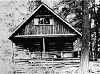
February 10, 1989 E side Lake Chelan on Stehekin Valley Rd.
48°18′49″N 120°39′19″W / 48.313611°N 120.655278°WStehekin 28 Penstock Bridge July 16, 1982 Spans Wenatchee River, N of Leavenworth on US 2
47°35′17″N 120°42′28″W / 47.588056°N 120.707778°WLeavenworth Historic Bridges and Tunnels in Washington TR 29 Purple Point-Stehekin Ranger Station House 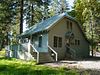
February 10, 1989 E side of Lake Chelan
48°18′27″N 120°39′15″W / 48.3075°N 120.654167°WStehekin 30 Rock Island Railroad Bridge July 30, 1975 SW of Rock Island over the Columbia River
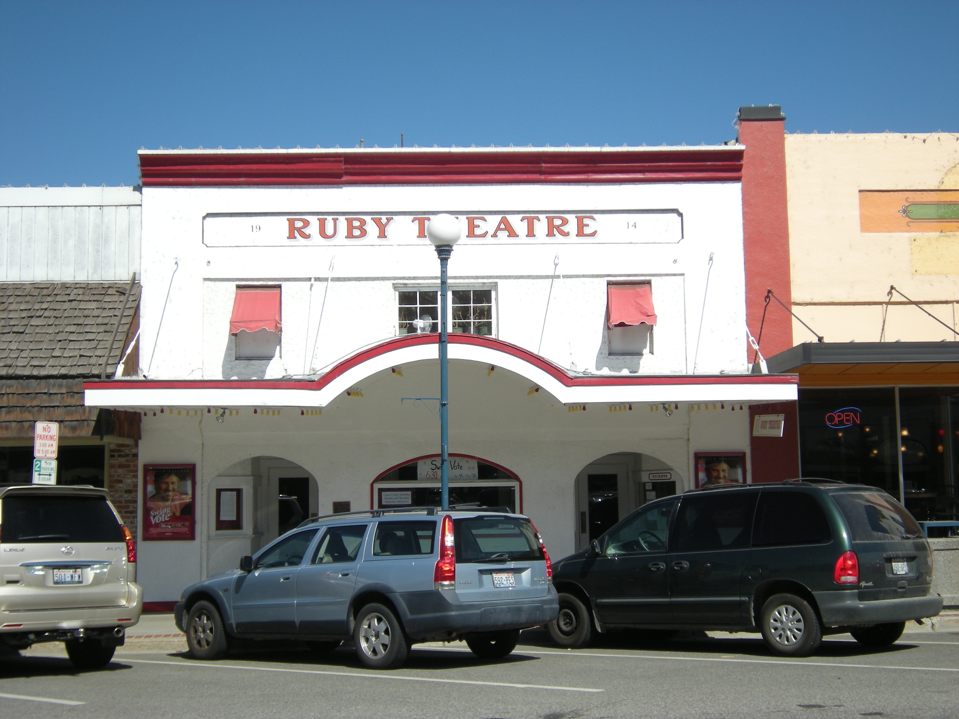
47°22′02″N 120°09′09″W / 47.367222°N 120.1525°WRock Island Historic Bridges and Tunnels in Washington TR 31 Ruby Theatre 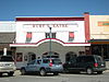
October 7, 1991 135 E. Woodin Ave.
47°50′26″N 120°00′57″W / 47.840556°N 120.015833°WChelan 32 St. Andrews Episcopal Church 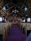
March 31, 1992 120 E. Woodin Ave.
47°50′24″N 120°01′03″W / 47.84°N 120.0175°WChelan 33 Stehekin School 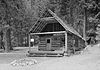
May 31, 1974 Lake Chelan National Recreation Area
48°20′28″N 120°41′48″W / 48.341111°N 120.696667°WStehekin 34 Steliko Ranger Station March 6, 1991 E of Entiat R., Wenatchee NF
47°44′38″N 120°21′33″W / 47.743889°N 120.359167°WArdenvoir 35 Stevens Pass Guard Station March 6, 1991 I-2 at Stevens Pass
47°44′45″N 121°05′14″W / 47.745833°N 121.087222°WSkykomish 36 Stevens Pass Historic District October 22, 1976 W of Berne on U.S. 2
47°44′40″N 121°06′03″W / 47.744444°N 121.100833°WBerne 37 Sugarloaf Peak Lookout December 27, 1990 Summit of Sugarloaf Peak
47°45′26″N 120°31′36″W / 47.757222°N 120.526667°WLeavenworth 38 Sulphide-Frisco Cabin February 10, 1989 Bridge Creek Trail, 9 mi. N of Stehekin Valley Rd.
48°28′34″N 120°42′31″W / 48.476111°N 120.708611°WStehekin 39 Tyee Mountain Lookout December 27, 1990 Summit of Tyee Mountain
47°51′51″N 120°28′12″W / 47.864167°N 120.47°WEntait 40 U.S. Post Office and Annex 
May 27, 1977 Mission and Yakima Sts.
47°25′20″N 120°18′35″W / 47.422222°N 120.309722°WWenatchee 41 Wells House 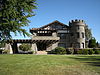
June 4, 1973 1300 5th St.
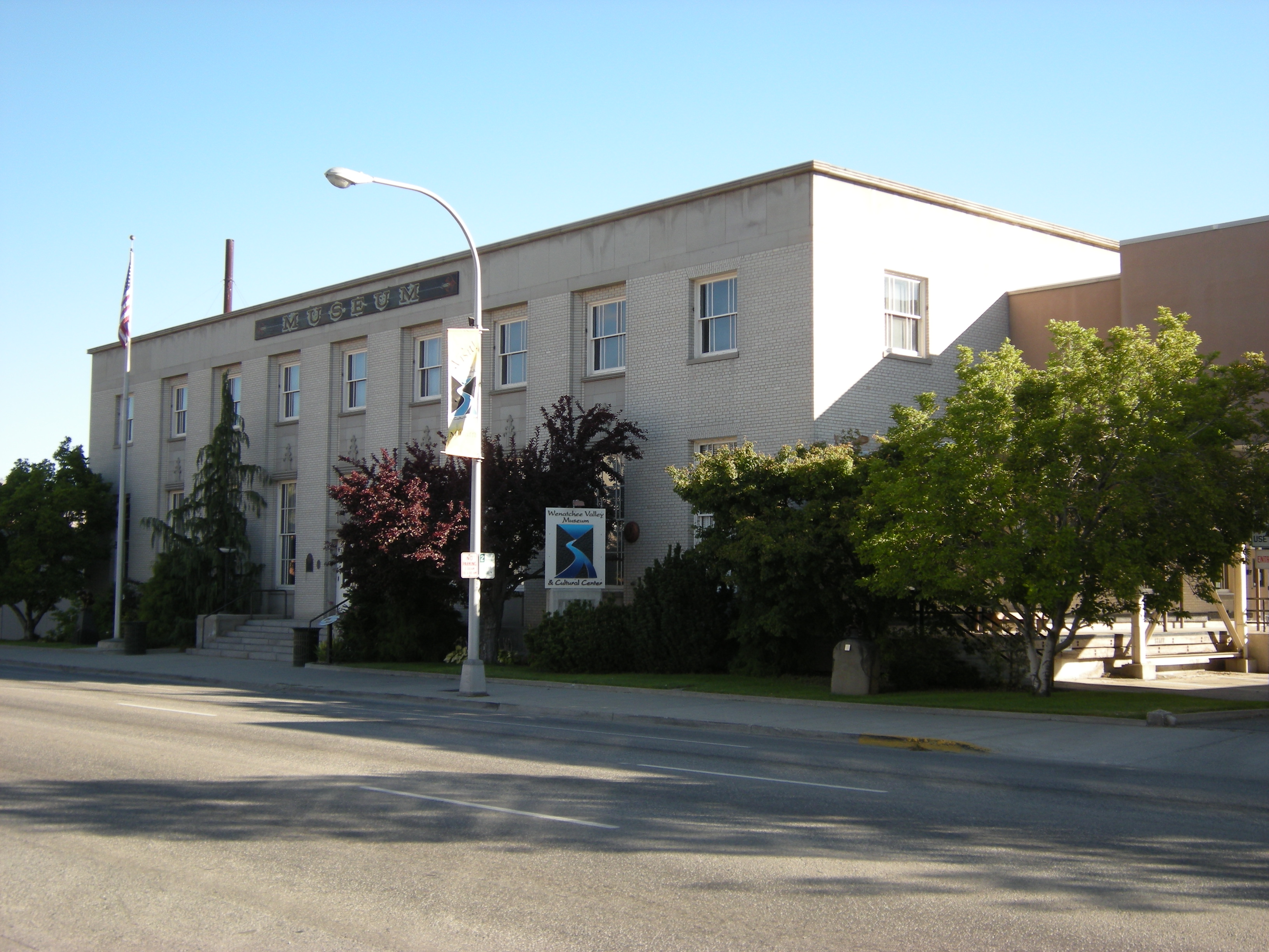
47°25′53″N 120°19′55″W / 47.431389°N 120.331944°WWenatchee 42 Wenatchee Carnegie Library 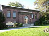
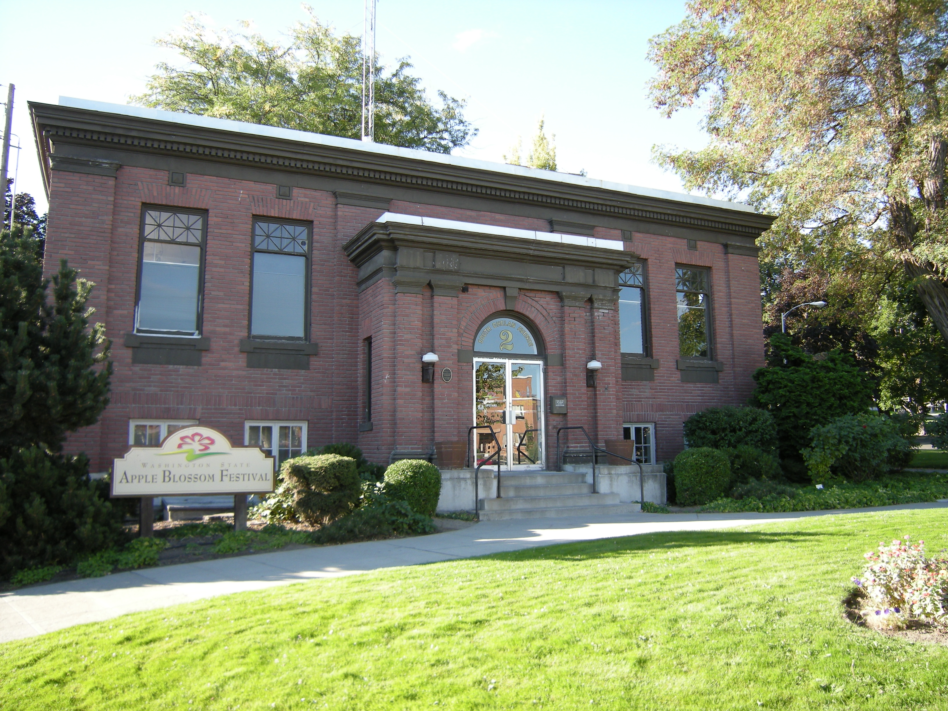
August 3, 1982 2 S. Chelan St.
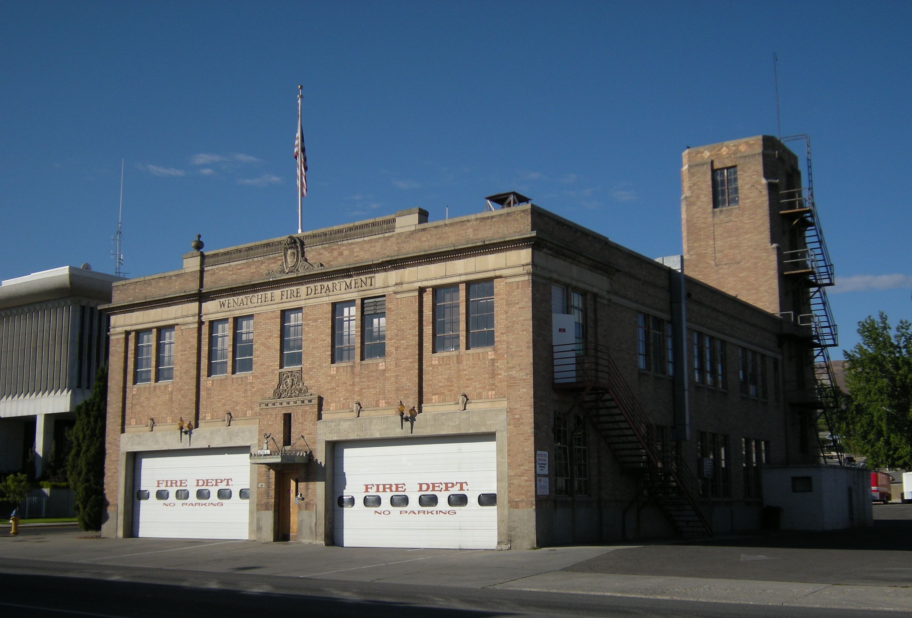
47°25′24″N 120°18′45″W / 47.423333°N 120.3125°WWenatchee Carnegie Libraries of Washington TR 43 Wenatchee Fire Station #1 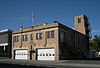
September 10, 2004 136 S. Chelan Ave.
47°25′18″N 120°18′38″W / 47.421667°N 120.310556°WWenatchee 44 Wenatchee Flat Site 
August 14, 1973 Address Restricted Wenatchee 45 West Monitor Bridge July 16, 1982 Spans Wenatchee River
47°30′04″N 120°25′28″W / 47.501111°N 120.424444°WMonitor Historic Bridges and Tunnels in Washington TR References
- ^ "National Register of Historic Places: Weekly List Actions". National Park Service, United States Department of the Interior. Retrieved on November 10, 2011.
- ^ Numbers represent an ordering by significant words. Various colorings, defined here, differentiate National Historic Landmark sites and National Register of Historic Places Districts from other NRHP buildings, structures, sites or objects.
- ^ "National Register Information System". National Register of Historic Places. National Park Service. . http://nrhp.focus.nps.gov/natreg/docs/All_Data.html.
U.S. National Register of Historic Places Topics Lists by states Alabama • Alaska • Arizona • Arkansas • California • Colorado • Connecticut • Delaware • Florida • Georgia • Hawaii • Idaho • Illinois • Indiana • Iowa • Kansas • Kentucky • Louisiana • Maine • Maryland • Massachusetts • Michigan • Minnesota • Mississippi • Missouri • Montana • Nebraska • Nevada • New Hampshire • New Jersey • New Mexico • New York • North Carolina • North Dakota • Ohio • Oklahoma • Oregon • Pennsylvania • Rhode Island • South Carolina • South Dakota • Tennessee • Texas • Utah • Vermont • Virginia • Washington • West Virginia • Wisconsin • WyomingLists by territories Lists by associated states Other Categories:- National Register of Historic Places in Washington (state) by county
- Chelan County, Washington
-


Wikimedia Foundation. 2010.